michsnowfreak
-
Posts
17,982 -
Joined
-
Last visited
Content Type
Profiles
Blogs
Forums
American Weather
Media Demo
Store
Gallery
Everything posted by michsnowfreak
-
I was going to mention 1874-75 in my original post but didnt. So it's weird. Snowfall records technically date to the beginning of the climate record, which is November 1, 1870. (Happy 153rd birthday of weather records, Detroit ). However, due to some inconsistencies, including some missing data as well as some erroneous snow listed, even though MOST of the 1870-79 record is complete, since there are multiple missing data & errors scattered throughout the 1870s, DTX elects to consider snowfall officially as starting in 1880. It's kind of annoying since so much of the data is there and seems reliable, especially when you compare it to newspapers of the time, but have to stay consistent for records purposes so I quote snow data as starting in 1880.
-

Winter 2023-24 Longrange Discussion
michsnowfreak replied to michsnowfreak's topic in Lakes/Ohio Valley
A lot of it is weather superstition, of which we have plenty of lol. It doesnt help that we had a stretch of snowy, cold Novembers followed by mild Decembers the past decade. But in reality, it is no predicator of what winter will bring. Detroit Halloween-Winter Snowfall: 2023: 0.2" - Winter 2023-24: ? 2019: T - Winter 2019-20: 43.7" (mild) 2017: T - Winter 2017-18: 61.0" (avg/slightly cold) 2014: T - Winter 2014-15: 47.5" (cold) 1993: 0.1" - Winter 1993-94: 45.8" (cold) 1955: T - Winter 1955-56: 45.2" (avg/slightly cold) 1917: T - Winter 1917-18: 38.4" (cold) -
26° and a dusting of snow opens November. Plenty of leaves yet to rake. But nevertheless I turned on Christmas music!
-
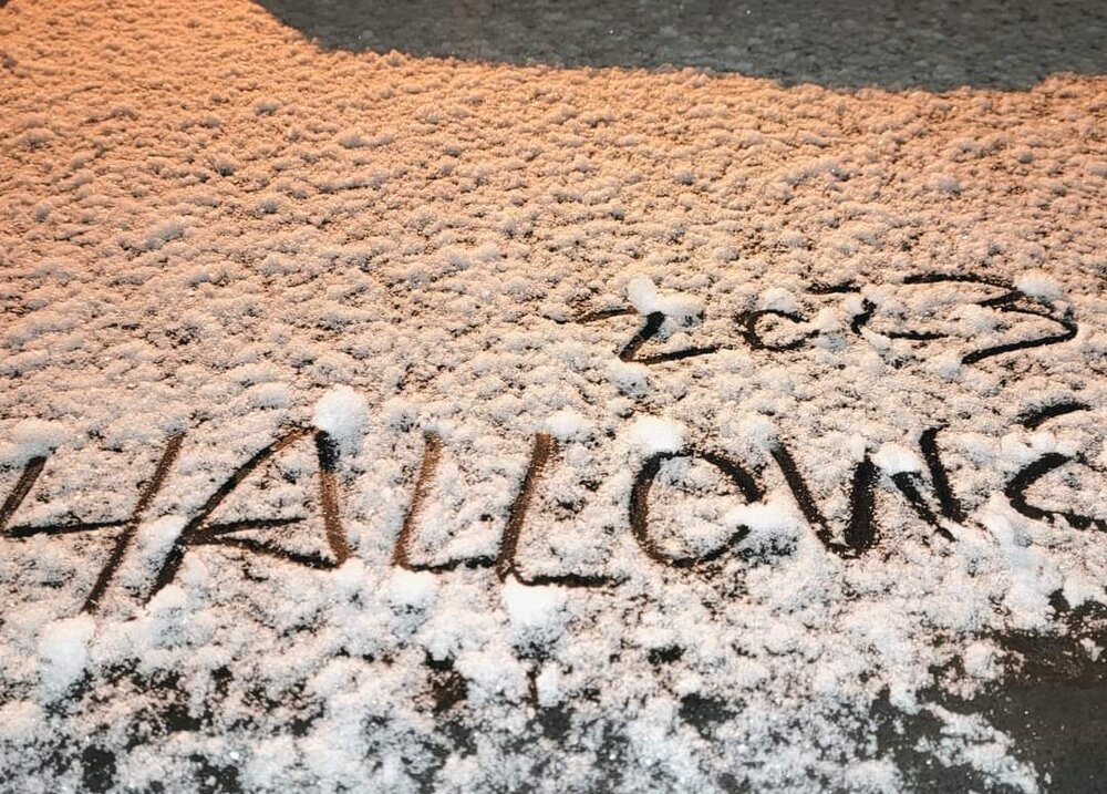
Had light snow falling during most of trick or treating hours, and it was fun passing out candy in a winter coat with flakes floating down. But at the time heavy snow squalls were splitting me from Flint to Toledo. I thought, did I REALLY just go from Fall-mode to "jealous bc a nearby city got more snow" mode in like 2 days, in October? But later in the evening a nice beautiful burst of snow coated the ground in white...winter is coming fast! Snow totals for Oct 31 were: DTW 0.2", FNT 1.1", MBS 0.5", TOL 0.7", all daily records for Oct 31. The high/low of 41°/27° (mean temp 34°) made it the 5th coldest Halloween on record at Detroit, but coldest since 1923. The real interesting stat tho, since snow records began in 1880, this was only the 7th Halloween to see snow, but 4 of the 7 years have been the last decade (1917, 1955, 1993, 2014, 2017, 2019, 2023)! With the last flakes of last season May 2nd and the first flakes Oct 31, in 2023 (barring something unprecedented in Nov-Dec), only 4 calendar months (JJAS) will have had no snow.
-
Everything's relative. A terrible winter in Detroit is colder/snowier than a great winter in Albuquerque. Most people do tend to have biases but I'll still read any outlook with reasoning over NOAAs cookie cutter nino climo "forecast" maps with zero explanation. You are correct about the above mentioned winters being good. 2013-14 was the most severe winter on record here, & those other winters were all good as well. There have also been some impressive record cold snaps even in winters where the overall departure ends up average to somewhat above average. No winter is without ups and downs and surprises (good and bad).
-
The colors are just stunning and still peak but the leaves will be raining down quickly I'd imagine.
-
Winter 2023-24 Longrange Discussion
michsnowfreak replied to michsnowfreak's topic in Lakes/Ohio Valley
Agree 100%. -
Winter 2023-24 Longrange Discussion
michsnowfreak replied to michsnowfreak's topic in Lakes/Ohio Valley
I kind of agree that its dumb to change the warnings, but i also think warnings are VERY prone to conditions moreso than inches. A 3-4" snowfall can absolutely be more treacherous than a 7" snowfall depending on conditions. But again, this is for the public only, as I never care what warnings/advisories are or are not in place, its all about the actual snow for me. Speaking of snow, the beginning of November begins the annual "lose-lose" pre-winter jitters for winter lovers. If its mild & sunny with little in the way of cold/snow, we hear "where is winter? so much for snow. Feels like mid-Fall. etc". If it is cold with snow we here "you dont want to see snow in Nov. Bad sign for winter. Dont waste this pattern now. etc". -
Thick frost today. 33 at DTW but 25 in Ann Arbor, 27 White Lake. So yesterday we in southeast michigan found out the sky actually IS blue, and it was the perfect crisp day for a walk in the park. Colors are peak and absolutely stunning.
-
The same phenomenon is seen in MI. Most falls Detroit will peak before Traverse City. And likewise, it's a later bloom in spring along the lakeshore.
-
Winter 2023-24 Longrange Discussion
michsnowfreak replied to michsnowfreak's topic in Lakes/Ohio Valley
Agree. It's so dumb. And warnings should not be based solely on inches. -
The gray continues here but trees are nearing peak. Took these yesterday
-
Winter 2023-24 Longrange Discussion
michsnowfreak replied to michsnowfreak's topic in Lakes/Ohio Valley
I mean again. It did suck for us hardy WINTER lovers because it was a very mild winter, but snowfall managed to be around average. -
Winter 2023-24 Longrange Discussion
michsnowfreak replied to michsnowfreak's topic in Lakes/Ohio Valley
Wow props to you. Of course I had Detroit but couldn't find Ft Meyers lol. -
Winter 2023-24 Longrange Discussion
michsnowfreak replied to michsnowfreak's topic in Lakes/Ohio Valley
It's a hard comparison. It definitely will rain/snow on more days in Detroit, but total amounts are probably relatively close on average. -
Once we hit November I love overcast skies. It can be gray every day from November through the entire winter for all I care. But in October when we have a color show to enjoy...I do NOT care for it!
-
Definitely the cloudiest October I can remember. High temps have been colder than average for 11 straight days and counting but no frost/freeze yet (should change early next week).
-
Winter 2023-24 Longrange Discussion
michsnowfreak replied to michsnowfreak's topic in Lakes/Ohio Valley
Yes. It got down to 7° on Nov 13, 2019 which is the earliest single digits on record for Detroit. The bitter cold and deep snowcover before hitting mid November was surreal and clearly not a sign of the winter that was on the way (although we did get some other good snows, it was mild). -
Winter 2023-24 Longrange Discussion
michsnowfreak replied to michsnowfreak's topic in Lakes/Ohio Valley
What IS a realistic hope is for a good stretch of deep Winter in any given season. A snow season often spans six months between first and last flakes, so not unreasonable to get some deep Winter stretches. -
Winter 2023-24 Longrange Discussion
michsnowfreak replied to michsnowfreak's topic in Lakes/Ohio Valley
Agree on too much climo in the models these days, but thats why Im not leaning towards a warm winter (not saying its going to be cold). The seasonal model consensus is surprisingly tame (less than 1 degree F warmer than average), so imo with a nino in place, if I dont see the models torching thats a good sign. I disagree on the "we are becoming less of a snowcover region". Its always been variable and we have never been the type of region to be snowcovered all winter, regardless of what the old fabled wives tales say about going uphill. Some winters are whiter than others, but when you average out every 10 years it stays relatively steady. Im a snowcover guy, but I know hoping for a 2013-14 or 1977-78 is unrealistic. Just can always hope lol. Thats why I laugh when people who DONT care about snowcover get so worried about temps. If all you care about is snowstorms and not their lasting impact, then it shouldnt matter whether the winter is forecast warm or cold at this latitude, it all depends on storm tracks. Average Annual number of days with 1"+ snowcover per decade at Detroit 1920s- 51 days 1930s- 42 days 1940s- 49 days 1950s- 47 days 1960s- 57 days 1970s- 57 days 1980s- 47 days 1990s- 37 days 2000s- 51 days 2010s- 53 days 2020s- 46 days (thru 2022) 1920-2022 avg: 49 days -
Winter 2023-24 Longrange Discussion
michsnowfreak replied to michsnowfreak's topic in Lakes/Ohio Valley
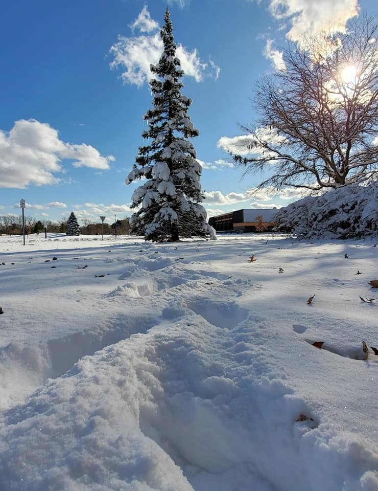
It was quite a sight for so early in the season. The 9.2" at DTW is actually the largest November snowstorm on record, edging out 9.0" on Nov 15/16, 1932. Also, the snow stayed on the ground 10 days. Also, that was a very late leaf drop so some trees still had colorful leaves on them and it made beautiful scenes. Photos from Nov 12, 2019.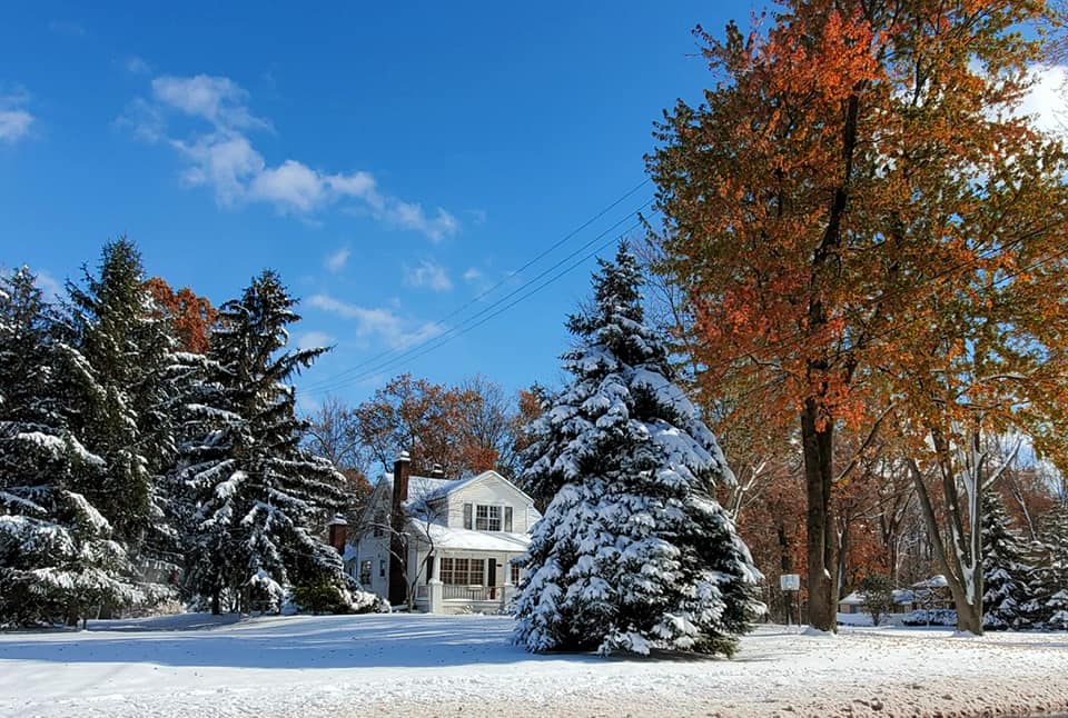

-
Winter 2023-24 Longrange Discussion
michsnowfreak replied to michsnowfreak's topic in Lakes/Ohio Valley
Cfs is run 4 times a day. Plenty of cold looks too. It changes like the gfs lol. -
Another gray autumn day today. Hoping after this system we get some sun for the peak color show.
-
Winter 2023-24 Longrange Discussion
michsnowfreak replied to michsnowfreak's topic in Lakes/Ohio Valley
With 150 years of weather data, good luck finding ANYTHING that matches a "slam dunk" scenario. But I always think its funny that the old "the weather in November the winter will remember" saying is often SO wrong. It goes both ways. -
Winter 2023-24 Longrange Discussion
michsnowfreak replied to michsnowfreak's topic in Lakes/Ohio Valley
2015-16 definitely had a big north-south gradient, although it wasnt a terrible winter outside of December. The Nov 21 snowstorm was gorgeous, but the Nov 11, 2019 snowstorm takes the cake here. It was incredible. In both cases, those would be the biggest storms of the winter (altho each winter had some more decent snows). As we have seen time and time again, in the end, temp departures dont necessarily matter for total snowfall. You can have more snow in a winter with a +6F departure than you do with a -3F departure. Its all a crapshoot. Colder winters matter for us snowcover folks. Of course some years the cold winters match the cold/snowy narrative (hello severest winter on record, 2013-14) and the warm winters match the low snow (2011-12, yuck), but sometimes they dont. I am not feeling a warm winter this year. The latest model consensus of the 8 seasonal models (NMME) is a DJF departure of less than a degree warmer than avg. If it was going to be a really mild winter there would be more of a signal. A lot of models seem to be in consensus that the early part of winter will be milder than the latter part. Im more worried about what the precip patterns will be than what the temps will be. Regardless, lets enjoy Fall and winter is almost here!