nrgjeff
-
Posts
4,253 -
Joined
-
Last visited
Content Type
Profiles
Blogs
Forums
American Weather
Media Demo
Store
Gallery
Everything posted by nrgjeff
-
Yes I'm working on an inch plus of rain already. Might get nearly that much more, but probably another half. Then more later this week. Lawn is happy. I am happy. No more watering!
-

Fall/Winter Banter - Football, Basketball, Snowball?
nrgjeff replied to John1122's topic in Tennessee Valley
Weenie Warning! Can we do this again in January? That'd be money for anyone I-65 east. Mid-South usually scores off a different pattern. Oh wait, in winter the last slug of moisture in Alabama would fall apart on the way in here. Actually it usually does not, but I'm being cynical here. Bama delivers. From the northwest snow dies in downslope off the Plateau into KCHA.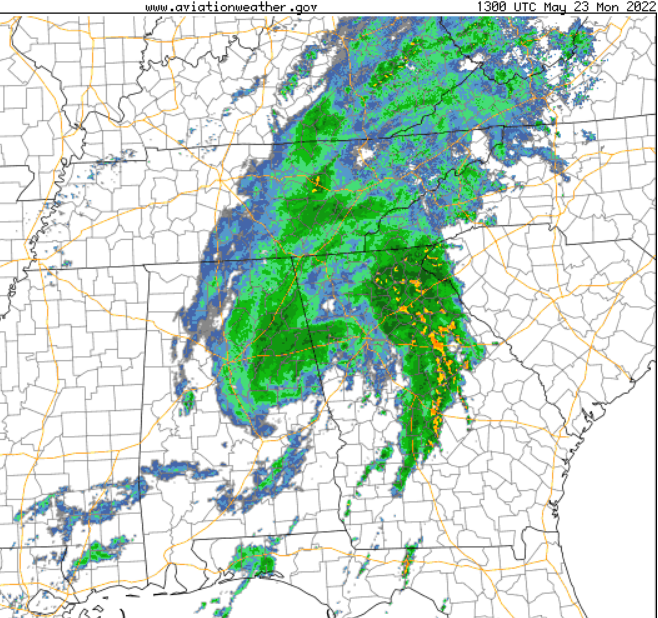
-
Sat. May 21: Boundary intersection forecast WSW of MEM this afternoon in the flat Ark. Delta. Technically not our Region, but I'm thinking about chasing it. Boundary intersection is outflow / quasi-cold front, not preferred. Rather have a pre-frontal trough away from the CF. However instability is robust. Also modest LLJ flow is forecast. Upper levels are modest too. In late May that is great with high CAPE. Just the boundary pair is not my preferred combo. CF and WF drawn IL/IN. Yellow is outflow. Magenta is possible boundary intersection forecasts. Idea is just get toward MEM. Normally I go through HSV (few trucks) but probably BNA to offer flexibility if Kentucky pops. Still the best shear looks Ark/Tenn/Miss. General Public notes: This is a low probability event. Bored on a Saturday. Awaiting Gam 4s in NHL and NBA and USFL Sunday.
-
2022 Short/Medium Range Severe Weather Discussion
nrgjeff replied to Chicago Storm's topic in Lakes/Ohio Valley
Gaylord Maps pic makes me sick. Looks like Chattanooga after our tornado. Ditto Scanner. Alas, we are still interested in severe and that is OK. We cannot control it. Anyway I am looking at Illinois and Indiana for meso-scale accidents on Saturday. Doubt anything will be learned from 00Z data. It is wake up in the morning and decide if I want to drive 5-6 hours for a low-probability event. Probably not, but I'll check. One scenario is stable rain-out. Other is quick end to morning rain. Leaves boundary south of synoptic front. I'm a fool for outflow boundaries. However the south part creates terrain issues. We'll see. -
Global models point to a late season Mid South setup Tuesday 5/24 and perhaps Tenn. Valley Wednesday 5/25; however, I doubt the latter as low level winds will tend to veer off. Tuesday we have a system with vort max dug into Texas coming out into the Mid South. While it feels late in the season, long-term climo May is still severe weather season. Recent years the South shut down by mid-May. It has not always been that way. Keep in mind Hoosier Alley (not far) gets slammed in mid-May even recent years. Pattern recognition is a little shaky vs recent years with a bowling ball vs open wave; however again, this used to happen. LLJ responds Tuesday, and not veered off trash. We'll see. Late May we don't even have to worry about instability or dewpoints. Anyone step outside? If low level winds respond next week, it's game on!
-
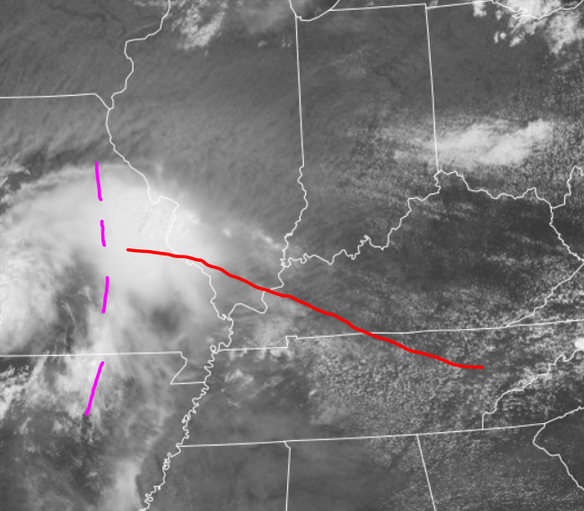
Boundary is sharpening up on the TN/KY border and drifting north into KY. ARWs were a disaster with the false washout in East Tenn. HRRR and NAM sniffed out the north bias. FV3 was in between - but still wrong! At any rate, action might start from MO to IL before rolling into Kentucky (our Region). Could get going as a nice QLCS. Any sups ahead would offer more rotation risk - esp riding the boundary. Purple dots is MCV aloft. Red line is surface WF / wind shift boundary. Higher dews south are marked by deeper Cu field. However I expect the severe weather mainly Kentucky. Maybe drop into TRI later, but weaker by evening.
-
Spring/Summer 2022 Medium/Long Range Forecast Discussion.
nrgjeff replied to John1122's topic in Tennessee Valley
After three wet years in a row.. We are kind of due for a summer of making the water utility more profitable. Already in May! -
Worked out well for naked eye viewing through the high clouds. Orange effect was quite muted; so, did not attempt photography. Partial phases were pretty classic even with high clouds. Glad I woke up for the last one (4am) since this was less than ideal. Last two were visible from windows, easy haha! Three ago (cold January) is most memorable because it was the first time weather worked out in literally decades for me. However directly overhead it required going outside in ski clothes. At any rate, the total solar remains the granddaddy of them all. Little less than two years I'll visit Texas or Ohio or somewhere.
-
High clouds are encroaching East Tennessee / east Regional Forum area this evening. Lunar eclipse looks clouded out Middle and West. Hoping thin high clouds won't make much of a difference in East Tenn. In contrast to solar, a lunar eclipse does not require perfect weather. Just not overcast. Can't justify a thread this late, so going with increasing high clouds observation. Hopefully a good show later.
-
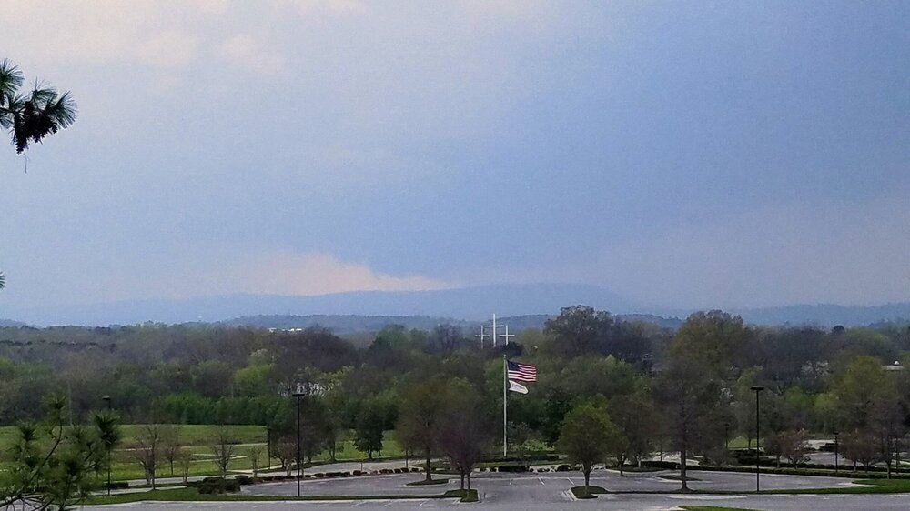
Late spring La Nina things... KCHA airport reported wind gusts to the 50s but I forgot the exact reading. Twas a good storm. Chattanooga had established an inverted V sounding, as dews mixed out, which promoted the strong straight line winds.
-
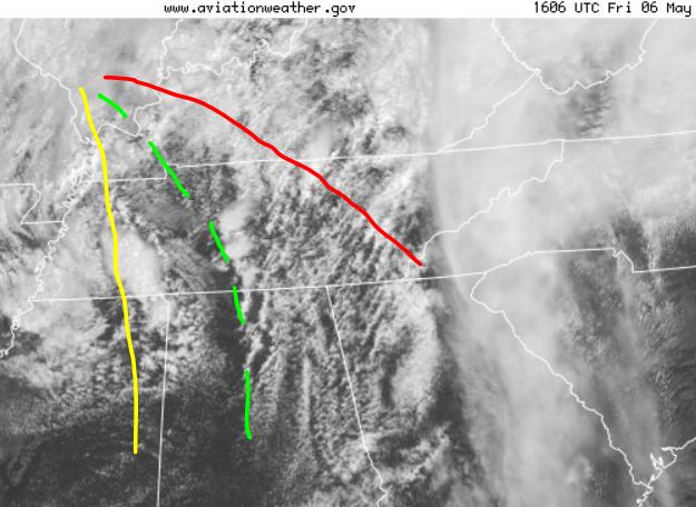
Good point Dusty. Actually the morning (or just earlier) rain likely laid down an outflow boundary which enhanced local storm relative shear SRH. Absolute instability is not always as important as the rate of destabilization - which is fast going from rain back to sun. Speaking of all that, East Tennessee had morning rain today (Friday May 6). Surface low in IL about to track into IN. Cold front in Missouri is not drawn. Quasi dry line DL in yellow, hailers probably on it under colder mid-levels. Warm front WF in red should host some hailers with some wind. Prefrontal trough dotted green is most interesting. Should have a blend of instability and some wind shear. Low level shear is a little better on the WF, but instability is just-in-time. DL is a little veered off both sides for tor. Prefrontal trough PFT might have that low top arc. We'll see. PFT could also accelerate (actually mix east faster with background wind) and/or merge with WF. Faster would put the area of interest east of Chattanooga later. Knoxville depends on instability and storm interaction. Just in 16:30 SPC shows that arc shape with the ENH part. Flexible forecast for either WF or trough East Tenn. Arc into Georgia.
-
Wednesday afternoon the SPC updated Day 2 (for Thursday) pushing Slight into Nashville and adding 5% tornado from West Kentucky through Clarksville TN into the Nashville metro. That is along the Wednesday cool front, retreating as warm front and/or outflow boundary Thursday. See if any morning rain, which would actually enhance local SRH if rain departs by Noon. I'm not really expecting anything big. Just need to give our region some attention. I can't get to the Plains yet, ha. Most likely Thursday Tenn / KY is just clusters and straight wind.
-
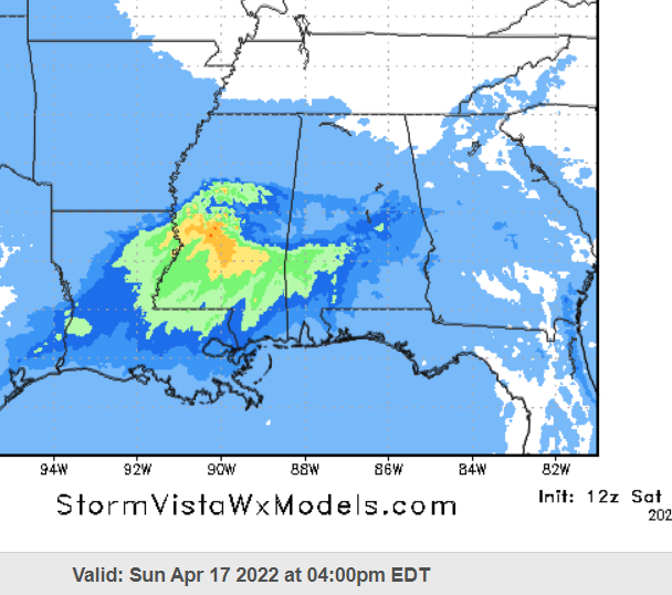
Happy Easter forecast. SPC has a slight risk Deep South. Lean South is prudent since outflow boundaries tend to reinforce south with repeating waves of convection, as has happened and is forecast Friday night through Sunday. ARWs (NSSL) and HRRR are in line south. NAM version opens the door a little farther north into central Mississippi on Sunday, with a little less morning rain and/or it departing sooner. FV3 also has less morning rain and some storms North Mississippi later, but that should be elevated given the boundary position. 12Z Sat. NAM low-level EHI (blend of SRH and CAPE) valid Sunday afternoon is below. Boundary tries to lift north (green central Miss.) however, best CAPE (orange) is south. NAM is struggling to juxtapose CAPE and shear, but it's close. Sunday will all depend on morning rain (shocker I know) but even more than usual. LLJ cranks in the afternoon; however, it does not line up with far south boundary (LLJ veered south). If the said boundary lifts north enough it'll line up (LLJ backed north). Mississippi and Alabama issue only.
-
Thanks Yoda. Also I think the warm sector never fully recharged from the morning MCS despite many hours. Dews did not recover as well as temps. A little veer-back could be overcome if the low-level CAPE was not so low (narrow on sounding). Dews below 65 made it harder for rising air parcels to overcome a warm layer about 800 mb. Said layer was also dry enough to promote the evaporative cooling SPC mentions. Rain falling through it exacerbated the situation (for the storm) but it was a blessing for the Public. Not a tornado day after all. Plenty of straight line wind though. As one would expect if evaporative cooling gets a cool pool going with a big squall line. Convective models got the QLCS. Separately @Matthew70 that picture is incredible. Were they OK in the car? Faraday cage hopefully protected the people, even if all the electronics are shot. What to tell the insurance company? Struck by lightning NOT storm chasing - just going to the store in a non-severe thundershower, ha!
-
There is the MD for which I'm waiting. If the SPC and I draw the same boundary and forecast, is that a good sign or a bad sign? At any rate instability and low level turning with height will increase markedly when it all comes together West Kentucky and northwest Tenn. Any discrete cell(s) will ingest it all. However that whole MD may get whacked by wind too. MEM south is at risk for QLCS tornadoes.
-
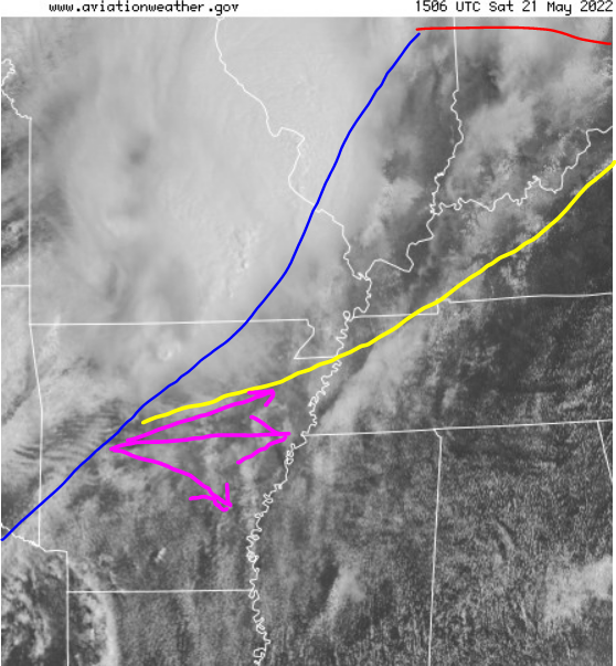
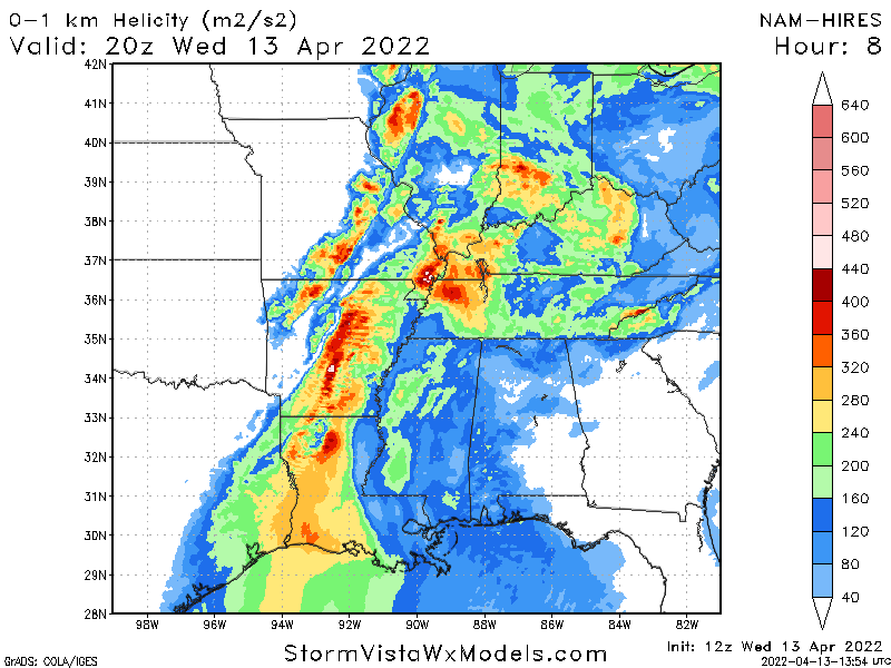
Wednesday April 13: My target area has shifted, though I do not plan a real chase. Virtual target is north of my previous post last night. Dyersburg, esp the flatter area west of is my target. Lunch in Dyersburg would have been nice! Mississippi dewpoints are under-achieving, not a shock given MCS. Also 800mb is warm on most soundings and fcst soundings (between standard constant press level charts). That means Miss has to work even harder to recover surface T/Td. Yes it'll hit 80 deg. However it might not be enough. Meanwhile outflow boundary OFB lifts north into northwest Tenn. 800mb will cool sooner there. Temps and Dews will almost match Mississippi. In fact dews could recover better, circumnavigating the mixed air over Miss. Dotted green is edge of the more pronounced lower T/Td. Yellow line is the chaser's OFB. It is forecast to lift into the red position by late afternoon. Prefrontal trough is not drawn, but I expect the red OFB to intersect it in northwest Tenn. Hence chase target. 1KM SHR below satellite, numerical models NWP shows my conceptual model. However NWP could misplace the OFB. NWP has robust cells on its intersection with the pre-frontal trough. Chaser would follow the boundary, not the NWP. Just good to see the conceptual model confirmed.

-
Fall/Winter Banter - Football, Basketball, Snowball?
nrgjeff replied to John1122's topic in Tennessee Valley
Oh wow! Aluminum bats carry the ball better than wood. Odd decision making. Kind of like chasing the South, haha! -
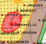
Most of that Moderate is wind driven. However the southern quarter of the MDT is 15% tornado, which straddles the Arkansas and Mississippi border. Pre-frontal trough is quite likely along that AR/MS state line, and eventually moving into Mississippi. Outflow from morning rain and/or the usual Alabama boundary will intersect the prefrontal trough. That intersection is ahead of (southeast of) the synoptic triple point (TP). Synoptic cold front may have a line of storms as SPC says, and the TP a cluster near the warm front. However the pre-frontal trough and OFB intersection farther south could feature discrete supercells if enough local SRH storm relative helicity. Chart looks like a reasonable initiation of any tornadic cells. Could lumber farther east into Mississippi later. Alabama has lower forecast CAPE - but could get some straight winds Wed. night. Wed. Apr. 13 TOR probs.
-
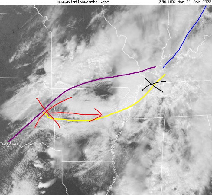
Now for today Monday April 11, I have to post this. (See my April 6 follow-up previous page.) Little outside of our Region, but today so classic. Mon. April 11 boundaries for the win! First the black X is probably not severe though near boundaries, where they kind of merge in with a synoptic front. Not a classic intersection though. See MD 446. However some strong storms. Red X is classic outflow intersection with front, aligned right for severe. HRRR goes bonkers with supercells in Arkansas. We'll see. Probably something more in between like ARW / NSSL. NAM seemed underdone. FV3 looks good, more bullish than ARW but not HRRR fest. Despite rising heights, it's gonna go. Very much looks late spring like. Setup is May Plains. Terrain is.. Virtual chase from home, haha!
-
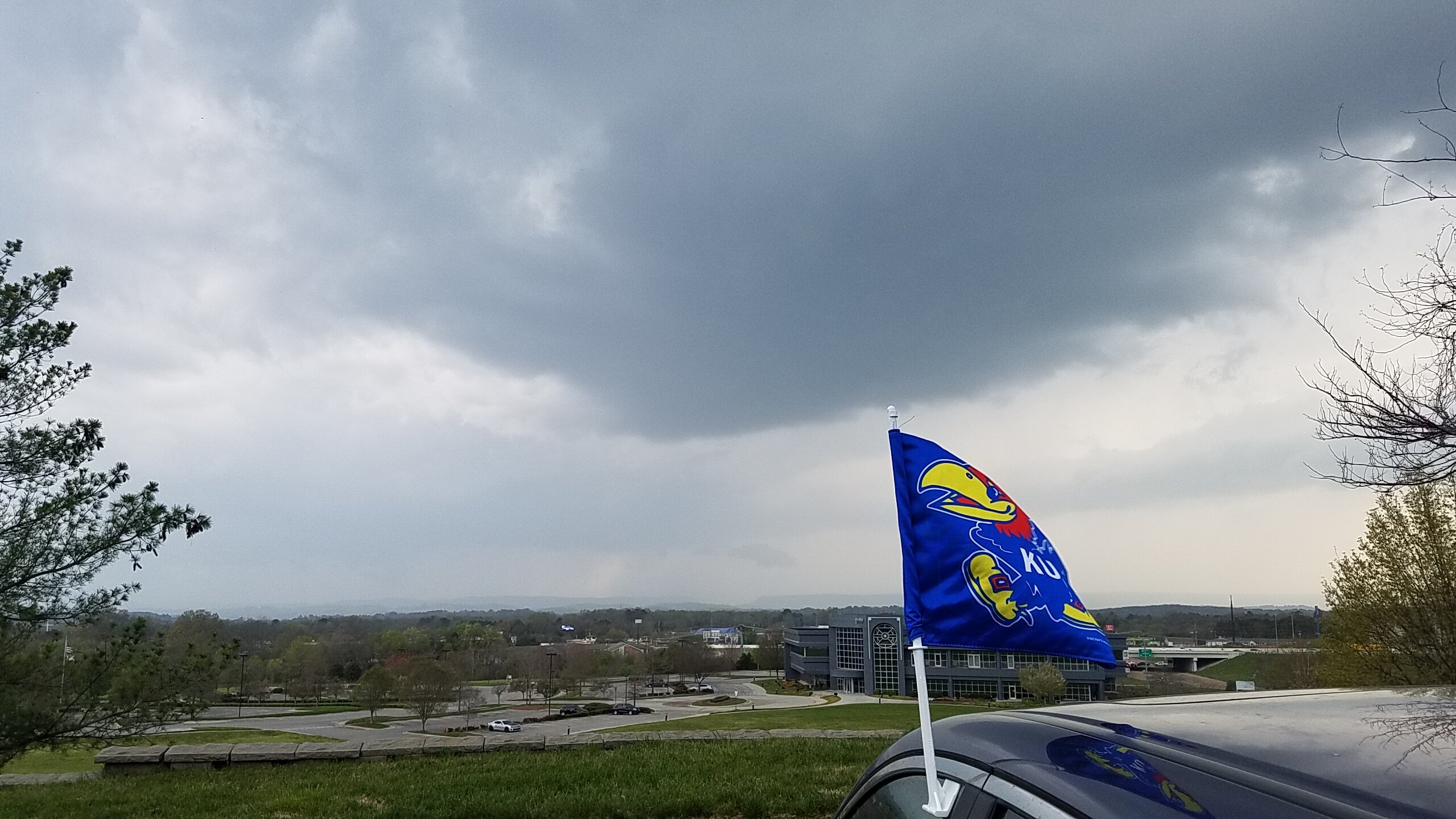
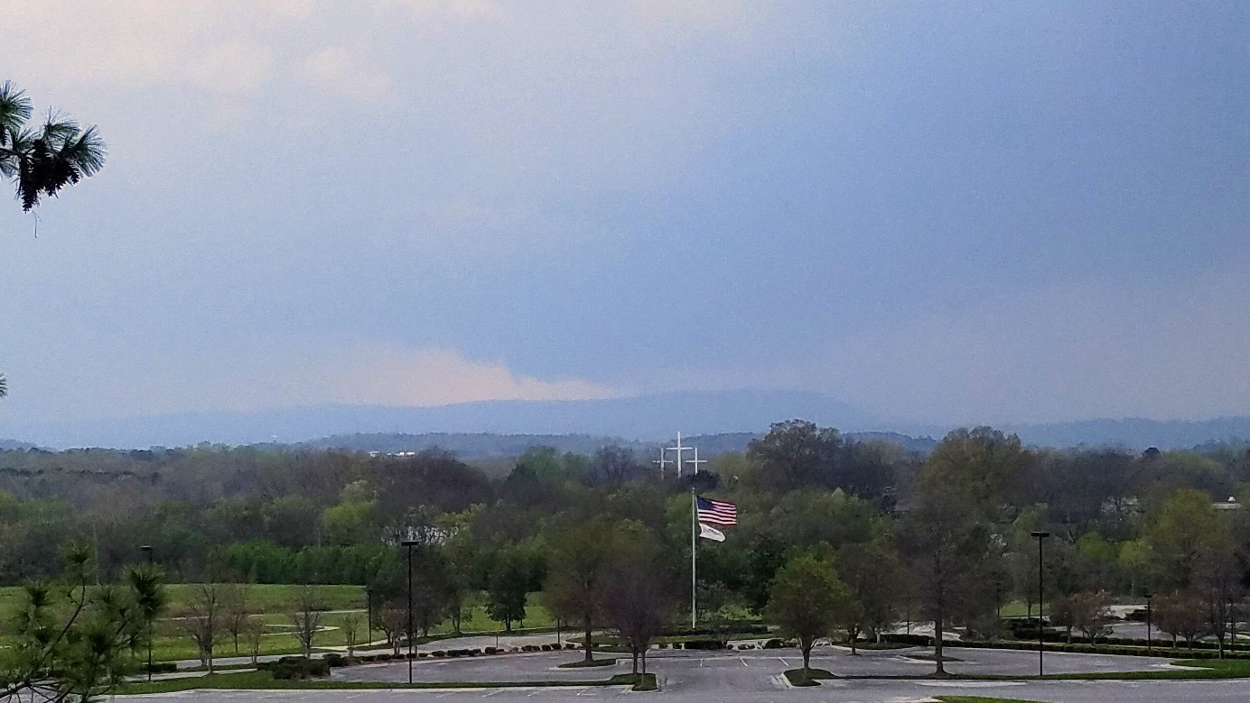
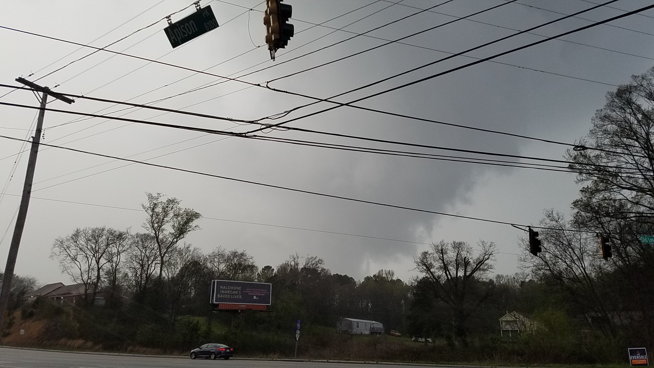
Wednesday April 6 follow up. Yes @PowellVolz that's my intended message back on Wed. At any rate the northern boundary intersection passed over Chattanooga. As expected, we just got some wind. However it was a little more interesting than I'd expected. First of all, going with a Kansas flag is the only way to go last week! Found my little perch in Chattanooga at US Express, a high spot with a good view. Also where I 1st saw Comet NEOWISE with binoculars. In town, but just doing recon before the dark skies. US Express is a sweet spot, both literally and figuratively in my heart. OK back to Wed. April 6. Then this gets going to my southwest over Lookout Mtn. Thankfully it dissipated without incident, because that's Downtown and other densely populated areas. Look back at radar archive and it had weak rotation. Then to my north a horseshoe cloud forms, sometimes an indicator of rear-flank and possible rotation, but I ignored it for a few minutes. Alas the check of radar archive and it was the better rotation. Not pictured. Think common bow horse shoe. Finally this happens! I gave chase to the horseshoe a little late for proper (aggressive) viewing position. I'm SAFE position with it to my north, but I can't see anything. Wind damage is later reported with the feature between Colledgedale and Ooltewah. I can confirm strong wind from west and small hail. Wed. April 6.


-
Fall/Winter Banter - Football, Basketball, Snowball?
nrgjeff replied to John1122's topic in Tennessee Valley
Rock Chalk Jayhawk! Thank you all for the congratulations. It is always special. Setting the record for come-back during the Championship is incredible too. I was out of town last week for kids spring break. Tuesday I was recovering from staying up so late Monday. Hard to sleep after all that excitement, and social media with friends back home. Kansas has been hungry since 2020 was cancelled. Some players remain from 2020. Team dedicated the Championship to players from the 2020 team who graduated. Coach Self also has the personal story. Team rallied around Coach after his dad passed away. Now it's baseball season. NBA and NHL playoffs are soon. Most importantly, it's the heart of Southern chase season. April tends to have better visibility than March. Rock Chalk Jayhawk everywhere! -
Wow, I love the enthusiasm in here! Relative to past years this is actually hype. Might yet get some severe wx enthusiasts on the board, haha. Temps have over achieve; so, CAPE is higher than forecast. Dews are as forecast, with the higher temps, which means the LCLs are not particularly low and grungy. MRX may be right that LCLs are favorable.. for chasing. Deep layer shear is there, and the upper levels are stout along I-40. However the LLJ did not report for duty. Probably not a big tornado day.
-
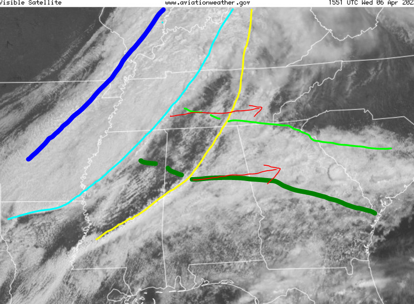
I'm way behind. Drew up this when Mesoscale Discussion 422 came out. Then got sidetracked. Still worth comparing MD #422 with the old image. More notes below image, but first... However now MD #424 is more relevant to us. Feels like they'll go severe, not tornado watch. SPC put out a tornado watch for that southern boundary intersection. As expected went on gravity wave (yellow) intersection with maritime / yesterday outflow (dark green). Local enhanced SRH is almost Plains like. Our MD 424 is for the intersection of the traditional cool wedge (light green) and pre-frontal trough (light blue). It is more what I look for in the South. However, no LLJ saves Tennessee from much tornado action. I draw the cold front in dark blue, but it's less of a factor. Synoptic warm front is north of Kentucky. All boundaries were cross checked visible satellite and surface chart at the time.
-
True. Even summer could be tempered for yet another year - in contrast to 1st year Nina. Could we be that lucky? Also a third winter in a row with mild Tropical Pacific SSTs does create a cooler background in the broad Northern Hemisphere Atmo, regardless of MJO behavior. Let's do it! First of all for spring @jaxjagman let's try to hold that +TNI. Should we be careful what we wish for? Or just game on!
-
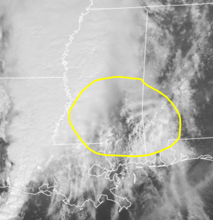
Showers percolating in southeast Mississippi are on and south of the Gulf Coast front lifting north, out ahead of the main surface trough and line of storms. Cells could be of interest. Gulf front will continue to lift north into east-central Miss. Main line of storms goes from West Miss into Louisiana. It's linear with QLCS tornadoes probable, and likely poor visibility. The new cells out ahead would perhaps provide better visibility; however, typical South challenges of terrain and trees exist. Also even the cells ahead could get into messy groups or clusters. HRRR is keying in on those southeast Miss cells 15-16Z runs. 12Z NAM missed them. 12Z FV3 was meh small cells. However one of the 12Z ARWs (NSSL research) hinted at the cells becoming rooted southeast Miss. Then going into Bama like the FV3. Latest HRRR runs have some ARW support. One could say the ARW is with HRRR (her). Satellite as of 12:30 Central shows vertical development, and turning with height as the baby anvils shear properly.