-
Posts
6,649 -
Joined
-
Last visited
Content Type
Profiles
Blogs
Forums
American Weather
Media Demo
Store
Gallery
Everything posted by Terpeast
-

Feb 22nd/23rd "There's no way..." Storm Thread
Terpeast replied to Maestrobjwa's topic in Mid Atlantic
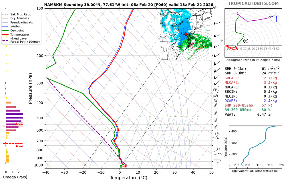
No I mean the thermals part. It was correct about the warm nose on Jan 25 -

Feb 22nd/23rd "There's no way..." Storm Thread
Terpeast replied to Maestrobjwa's topic in Mid Atlantic
-

Feb 22nd/23rd "There's no way..." Storm Thread
Terpeast replied to Maestrobjwa's topic in Mid Atlantic
High end updated from LWX (low end is 0-T of course haha) -

Feb 22nd/23rd "There's no way..." Storm Thread
Terpeast replied to Maestrobjwa's topic in Mid Atlantic
I think we should be rooting for a later start time either way. Get the clouds here during the day to hold off the sun angle, and then thump overnight for best snow-maxing -

Feb 22nd/23rd "There's no way..." Storm Thread
Terpeast replied to Maestrobjwa's topic in Mid Atlantic
Split them down the middle, and account for temps, perhaps 3-5" for us and 4-8"+ DC and northeast -

Feb 22nd/23rd "There's no way..." Storm Thread
Terpeast replied to Maestrobjwa's topic in Mid Atlantic
Yeah the ratios probably won't be 10:1. I'd probably go with 70% of that -

Feb 22nd/23rd "There's no way..." Storm Thread
Terpeast replied to Maestrobjwa's topic in Mid Atlantic
qpf/snow ticked up (or west) with 6z gefs -

Feb 22nd/23rd "There's no way..." Storm Thread
Terpeast replied to Maestrobjwa's topic in Mid Atlantic
Well this is Maestro's storm, so maybe it is really happening! -

Feb 22nd/23rd "There's no way..." Storm Thread
Terpeast replied to Maestrobjwa's topic in Mid Atlantic
GEFS more interaction in the mean between ns and ss out west at 30 -

Feb 22nd/23rd "There's no way..." Storm Thread
Terpeast replied to Maestrobjwa's topic in Mid Atlantic
I think gfs and euro camps are starting to meet in the middle. Hopefully the middle is as beefy in qpf as this -

Feb 22nd/23rd "There's no way..." Storm Thread
Terpeast replied to Maestrobjwa's topic in Mid Atlantic
foot plus for dc metro, more towards the bay and delmarva (2 feet) I'd mentally cut those amounts by 20-30% considering daytime snow and temps. -

Feb 22nd/23rd "There's no way..." Storm Thread
Terpeast replied to Maestrobjwa's topic in Mid Atlantic
Very nick tuck. northern Delmarva gets the goods -

Feb 22nd/23rd "There's no way..." Storm Thread
Terpeast replied to Maestrobjwa's topic in Mid Atlantic
Looks maybe a few hours faster -

Feb 22nd/23rd "There's no way..." Storm Thread
Terpeast replied to Maestrobjwa's topic in Mid Atlantic
Just reviewed the overnight runs, looks like mostly a hold, or at least similar to 12z yesterday. 18z was the high bar. Hoping to see more of a consensus today... -

Feb 22nd/23rd "There's no way..." Storm Thread
Terpeast replied to Maestrobjwa's topic in Mid Atlantic
If it were up to me, tomorrow midday after 12z runs come in would probably be a good time to issue watches (if they’re still showing what they are now). One thing going for NWS is that this storm doesn’t happen during commute, at least until it’s over New England -

Feb 22nd/23rd "There's no way..." Storm Thread
Terpeast replied to Maestrobjwa's topic in Mid Atlantic
Gefs basically a hold at 72, looks good -

Feb 22nd/23rd "There's no way..." Storm Thread
Terpeast replied to Maestrobjwa's topic in Mid Atlantic
My sister is flying in the next day to visit me and my kids. So… -

Feb 22nd/23rd "There's no way..." Storm Thread
Terpeast replied to Maestrobjwa's topic in Mid Atlantic
Gefs 66 neg tilt, sfc looks the same, ass hair west -

Feb 22nd/23rd "There's no way..." Storm Thread
Terpeast replied to Maestrobjwa's topic in Mid Atlantic
Gefs to 60, ss vort sharper -

Feb 22nd/23rd "There's no way..." Storm Thread
Terpeast replied to Maestrobjwa's topic in Mid Atlantic
0z gefs NS vort separates a bit by backing off, while southern vort amps a bit. Let’s see -

Feb 22nd/23rd "There's no way..." Storm Thread
Terpeast replied to Maestrobjwa's topic in Mid Atlantic
I don’t envy their jobs right now that’s for sure -

Feb 22nd/23rd "There's no way..." Storm Thread
Terpeast replied to Maestrobjwa's topic in Mid Atlantic
Not sure how others are seeing a tick east. Noise level changes in SLP position and precip shield (the extent, not amounts) has actually expanded west i’m more worried about bigger changes at h5 before storm formation -

Feb 22nd/23rd "There's no way..." Storm Thread
Terpeast replied to Maestrobjwa's topic in Mid Atlantic
Definitely a different path to the promised land. It almost looked like it was gonna miss the phase and cave spectacularly, but it still somehow spun up a more miller A like coastal (or miller a/b hybrid) -

Feb 22nd/23rd "There's no way..." Storm Thread
Terpeast replied to Maestrobjwa's topic in Mid Atlantic
Just need a better phase. It’s close -

Feb 22nd/23rd "There's no way..." Storm Thread
Terpeast replied to Maestrobjwa's topic in Mid Atlantic
As you probably know, hrrr isn’t comparable with the globals because it isn’t a global model. But same goes for the nam, which we do pbp on anyway


