Terpeast
-
Posts
6,687 -
Joined
-
Last visited
Content Type
Profiles
Blogs
Forums
American Weather
Media Demo
Store
Gallery
Everything posted by Terpeast
-
That was awful. Mountains from SC north got buried
-
Outta gas and Outta Time: Early March Winter Storm finale
Terpeast replied to Ji's topic in Mid Atlantic
Every month from dec-mar yielded more than 2” imby -
Outta gas and Outta Time: Early March Winter Storm finale
Terpeast replied to Ji's topic in Mid Atlantic
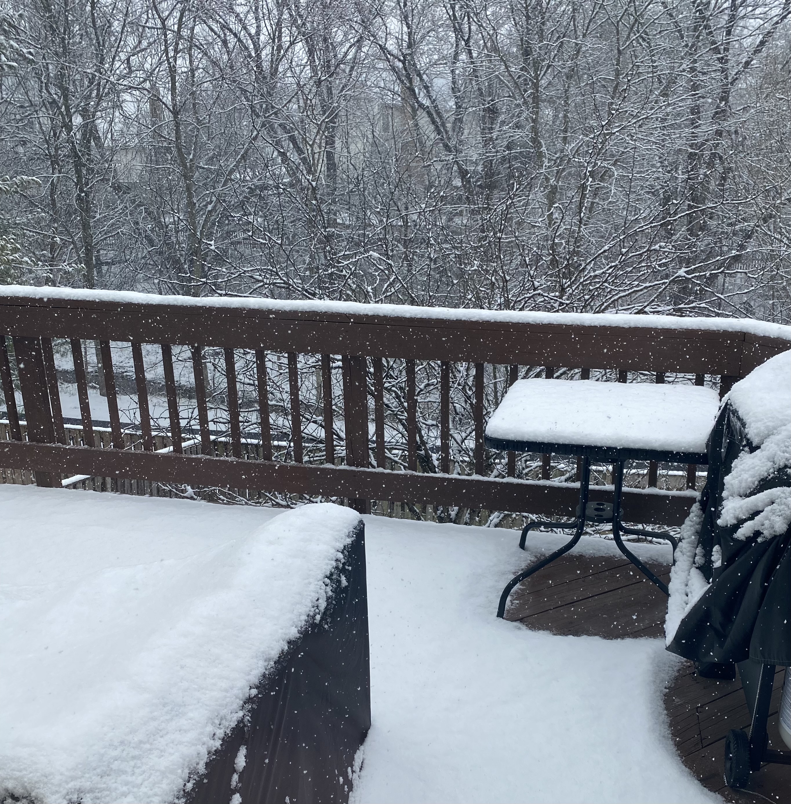
2.0”, still snowing lightly. Above freezing now so some melting and compaction. Just got back from sledding with daughter!- 959 replies
-
- 11
-

-
Outta gas and Outta Time: Early March Winter Storm finale
Terpeast replied to Ji's topic in Mid Atlantic
Looks more like a winter wonderland than feb 22 ever did -
Outta gas and Outta Time: Early March Winter Storm finale
Terpeast replied to Ji's topic in Mid Atlantic
Haven’t officially measured, but eyeballing close to 1.5”, finer flakes falling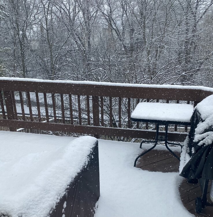
- 959 replies
-
- 22
-

-
-
Outta gas and Outta Time: Early March Winter Storm finale
Terpeast replied to Ji's topic in Mid Atlantic
Moderate snow, looks like radar backfilling to the west, not as heavy as initial band. Close to 1" at 30.6- 959 replies
-
- 12
-
-

-
Outta gas and Outta Time: Early March Winter Storm finale
Terpeast replied to Ji's topic in Mid Atlantic
Half inch already. I may break 16" on the season if this continues for another 30 min -
Outta gas and Outta Time: Early March Winter Storm finale
Terpeast replied to Ji's topic in Mid Atlantic
Now it is coming down heavy, big fatties! -
Outta gas and Outta Time: Early March Winter Storm finale
Terpeast replied to Ji's topic in Mid Atlantic
Now below freezing at 31.8, mulch and car tops caving. Grass getting dusted too -
Outta gas and Outta Time: Early March Winter Storm finale
Terpeast replied to Ji's topic in Mid Atlantic
Snow coming down nicely -
Outta gas and Outta Time: Early March Winter Storm finale
Terpeast replied to Ji's topic in Mid Atlantic
Light snow, good flakes. 33.8 and falling -
Outta gas and Outta Time: Early March Winter Storm finale
Terpeast replied to Ji's topic in Mid Atlantic
I'm at 35, but dews at 19. Wet bulb temp is still below freezing -
Outta gas and Outta Time: Early March Winter Storm finale
Terpeast replied to Ji's topic in Mid Atlantic
28.8/17. Guess this time we’re not chasing moisture with cold air -
2026-2027 Super El Nino
Terpeast replied to Stormchaserchuck1's topic in Weather Forecasting and Discussion
I’d say that Jan 26 forecast verified well overall, except it was too warm for the SE. -
Didn’t check dca, but iad was about -3 for the 3 months (relative to 1991-2020 climo I believe)
-
Amazing for you guys up there. While luck wasn’t on our side in the mid-atlantic, NYC’s winter and the NC HECS gives me even more conviction that the MA is not yet done with HECS potential and blockbuster winters like 95-96 and 09-10, etc.
-
2026-2027 Super El Nino
Terpeast replied to Stormchaserchuck1's topic in Weather Forecasting and Discussion
I have a hard time envisioning the physics that link a SSW to a subsequent el nino (or la nina). I imagine the top-down effects would be confined mainly to the polar domain or mid latitudes, but not tropics. Conversely, enso is driven mainly by tropical ocean-atmosphere (KWs and WWBs mostly) and then those forcing effects propagate to mid- and polar-latitudes via rossby waves, and then bottom-up into the stratosphere. But the other way around? I dunno. -
I think we enjoyed last year more. More powdery and lots more sledding. This time it was tough, hard/fast sledding and my daughter got a bit scared. We did make a killer igloo though!
-
Yeah, we had cold and no real torch this winter. Snowcover was great. And the atmosphere threw some HECS, but they both missed. We only needed one direct hit, and it would have changed the entire picture.
-
Wow, the color scheme really brings out our luck (or lack thereof) this winter. It could have been one for the ages, but we did not have luck on our side. That won’t last forever though. It’ll flip at some point.
-
2026-2027 Super El Nino
Terpeast replied to Stormchaserchuck1's topic in Weather Forecasting and Discussion
Why would it? -
Bring it. Good time to put netting over my fig tree so the squirrels don't steal all my figs like they did last fall.
-
Outta gas and Outta Time: Early March Winter Storm finale
Terpeast replied to Ji's topic in Mid Atlantic
On a CWG post on facebook I saw a quote from Wes Junker saying that the atmosphere doesn't really support a storm here, the models are "overcooking" it rn. Upside is only a dusting and maybe a few lucky inches. He's one I respect and knows what he's talking about, so that dampened any remaining enthusiasm for tracking this (not that I had much to begin with). -
At least maybe we go straight into severe wx tracking

-
Outta gas and Outta Time: Early March Winter Storm finale
Terpeast replied to Ji's topic in Mid Atlantic
Probably the last trackable event of the year. If it comes to fruition, it may get me to my median climo. Once again, I’m waiting until lead times of 84-96 hours or less to really buy in.