Terpeast
-
Posts
6,687 -
Joined
-
Last visited
Content Type
Profiles
Blogs
Forums
American Weather
Media Demo
Store
Gallery
Everything posted by Terpeast
-
0.5”, coming down good but temp still at 33. Maybe I was wrong about temps not being an issue
-
Snowing, 0.1-0.2” so far. 33
-
Few drops, 36. Precip band just to the NW should move SE with the cold air push. Patience is needed.
-
Nothing falling atm imby, 37. Didn’t think it was supposed to start this early though
-
Based on radar, expecting precip to start within the hour.
-
34.7
-
35 here too. Dew at 29. Don’t think temps will be an issue
-
Yeah i gotcha, I don’t like changing my forecasts too much. Maybe once after an initial call, but that’s it
-
This will be my last one
-
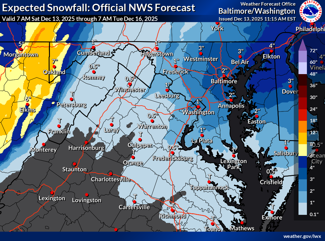
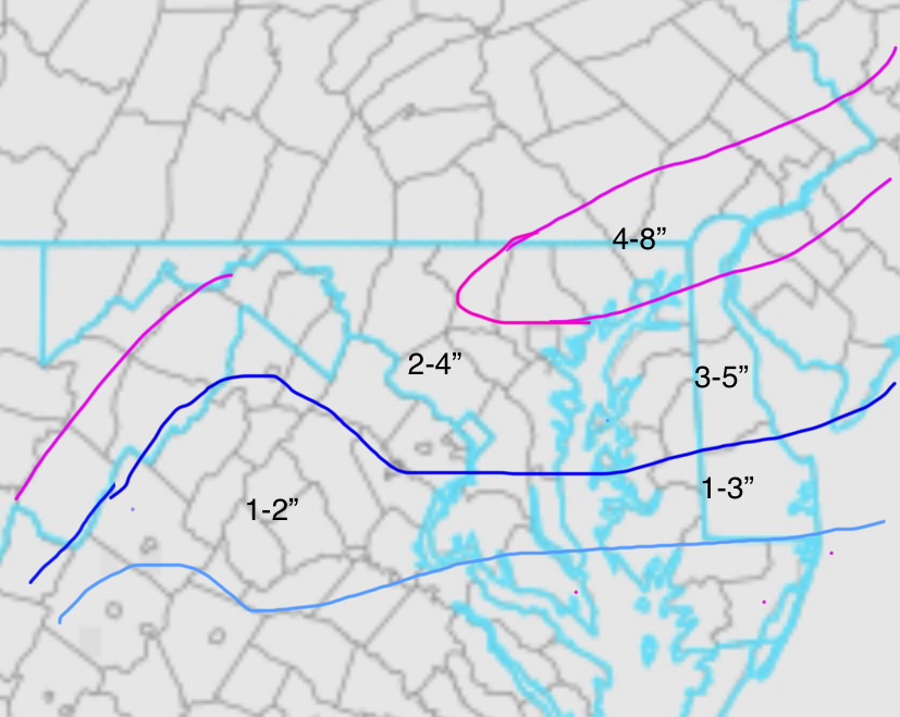
My updated forecast and final call (Note BR and cacotins can be double my numbers)
-
36.9 as of 5:15p in ashburn
-
I think this is the best hrrr run for loudoun, and its been more conservative than other models with the SW tail end.
-
If 0.4” qpf is correct for mby, thats a solid 3”+ which I think is the boom scenario. Very achievable though
-
Just now there is. Eastern Loudoun as well
-
Yeah anyone east of the BR is in the game, just the vibe changed when the models shifted main band NW, which isn’t surprising to see.
-
39 here, underperforming temp forecast (it was supposed to be 45)
-
Euro reflects my thinking on where the best banding may set up just NW of 95 rather than right along it or SE (except extreme NE MD through DE and S NJ.
-
Yeah with 1”/hr rates it won’t take long to clear 4” NE of balt
-
Initial call. A lot could change as this is really a nowcast event, so I feel like I’m really sticking my neck out on this one. I’d also add an inch over the delmarva east of the bay north of 50
-
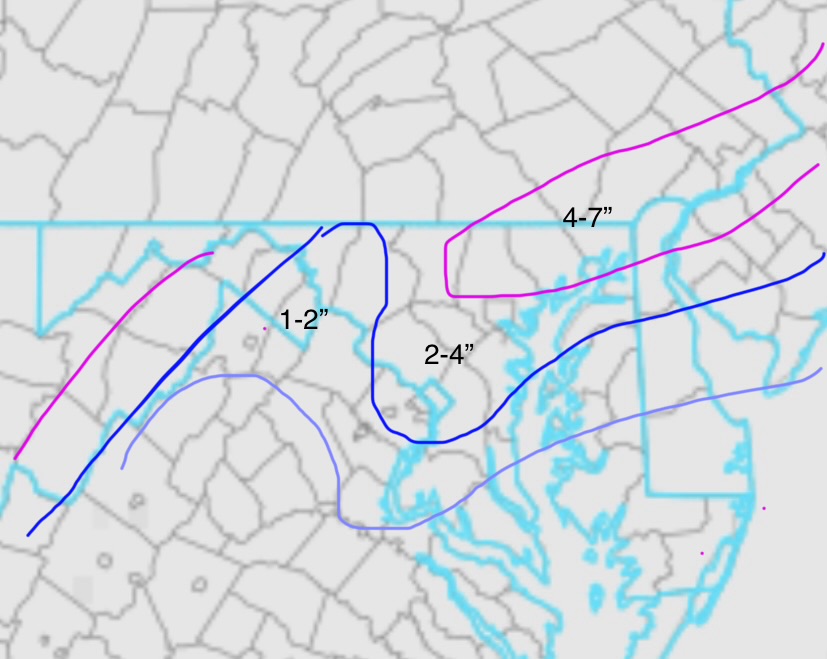
Updated. 1” line moved significantly NW

-
I noticed that over greenland/scandinavia. While that hasn’t yet translated to an eastern trough, I see BN temp anomalies NYC north and less “torchy” conditions down here in the MA. Tells me CAD events may be a possibility, something we haven’t seen in ages. And perhaps the E trough will pop in if/when the-nao persists at least a week.
-
It still gives me about 1.5” imby, so if that’s the “worst” model, I’ll take. Happy to see balt corridor get the jack this time though
-
Watching for an expansion of wwa west to cover Loudoun and Frederick counties
-
Nws reduced expected amt to less than 1” for mby and no WWA (eastern loudoun) but increased high-end potential to 4-5”. Low expectations but high upside.
-
Down to 20.5