Terpeast
-
Posts
6,687 -
Joined
-
Last visited
Content Type
Profiles
Blogs
Forums
American Weather
Media Demo
Store
Gallery
Everything posted by Terpeast
-
Haha that’s funny about them asking if you needed help. Did you stay in one place the whole time, or did you move to wherever the band was setting up for the day? I’d love to do this when my second kid is old enough to understand what snow is and how to have fun with it.
-
Gefs showing a signal on Jan 11-12 for a post-cutter wave that could work for us. Spacing needs some work though
-
Congrats!
-
I apologize if I came off as model bashing in the general sense, that wasn't my intention and I can see that my statement was a bit unfair. We've seen incredible advances in modeling both physical and AI, and seeing 0.6-0.8 correlations in 500mb anomalies from 10+ days out is an incredible feat. I only meant that their performance have collectively taken a hit lately in the 11-15 day range especially in the past 5-6 months. In the grand scheme of things, on a global scale, they still perform better than 10+ years ago. But regionally, they have been struggling with the trough/ridge placements such that we're seeing wild swings in our forecasted sensible weather in our back yards. Again, sorry about that.
-
Wow. 11-15 day model forecasts have been terrible this fall/winter. Terrible.
-
That would shorten the torch to just 5 days instead of 7-10+ like previous runs were showing.
-
More than that.
-
Maybe I wouldn’t say “the best” but it did very well. Top 3
-
KIAD had 26.6” in 18-19, pretty solid winter
-
Vaguely recall PSU mentioned going skiing somewhere around this time or something
-
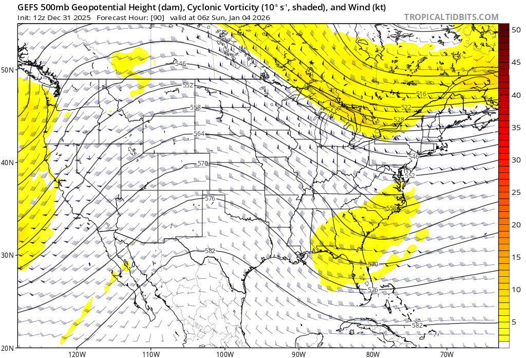
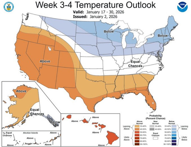
Looking ahead to the second half of the month - with a map like this after the ~5 day torch in the near-medium term, Jan might finish a couple degrees AN. But if those last two weeks come to fruition like this, we could have some interesting events to track without the suppression risks. Not the time to bail on this winter just yet.
-
Yes, the pattern is very progressive and volatile. Anything could happen. Before, we’ve seen these 60 degree days turn into snowfalls the next day or two. This could happen here.
-
EPS shows NN temps (at least at 850mb) starting Jan 11 onwards. As a reminder, our Jan climo 850s are at -3 to -4, so it can still snow (or mix) if 850s are slightly AN. GEFS/GEPS is warmer and more borderline, and delays the cold by a day or two. We want to root for Euro to be right.
-
As would I
-
Don’t encourage him…
-
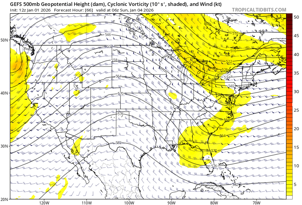
New 12z gefs trending for more NS interaction on the 4th. New run Old 12z run yesterday

-
12/5: 1.5” 12/14: 1.0” 1/1: 0.2” Total: 2.7”
-
12/31-1/1 Possible Snow Showers/Squalls to Start 2026
Terpeast replied to bncho's topic in Mid Atlantic
Woke up to a surprise dusting! Yes i slept through it not expecting anything (stayed up late watching stranger things). been a long time to see a surprise snow. -
Happy new year!
-
12/31-1/1 Possible Snow Showers/Squalls to Start 2026
Terpeast replied to bncho's topic in Mid Atlantic
Happy birthday! -
Nam may have ticked south, but based on 500mb vort it took one step closer to the euro. Northern stream vort is sharper and more south. The ss vort shifted south too, but if it stays north like 18z, then there will be more interaction.
-
Actually I agree with you. The NYC event trended north in the last day or so, putting the max just NE of the city instead of directly over and south of it.
-
When the models were showing a great pattern over the next 10 days and beyond a few days back, it was showing this system but it was way suppressed to the south because of the cold press. Now that the block is falling apart, the cold press isn't as much, allowing this system to come up north. Hopefully we still have enough cold air to snow if the precip comes up that far.
-
Seems everything has shifted 10 days later. I have a feeling models will turn colder at day 10+ by friday.
-
I’ve experienced one just SE of dunkirk where we got 3 ft, it was great. But that was a long time ago and memories are fading. I want more haha