Terpeast
-
Posts
6,591 -
Joined
-
Last visited
Content Type
Profiles
Blogs
Forums
American Weather
Media Demo
Store
Gallery
Everything posted by Terpeast
-
You could be right, it was dark and hard to tell. Just saw those things bounce off my hand
-
Must have been temporary warm pocket upstairs. But my hours (minutes?) are numbered I also hope we stay sleet and then dryslot before zr
-
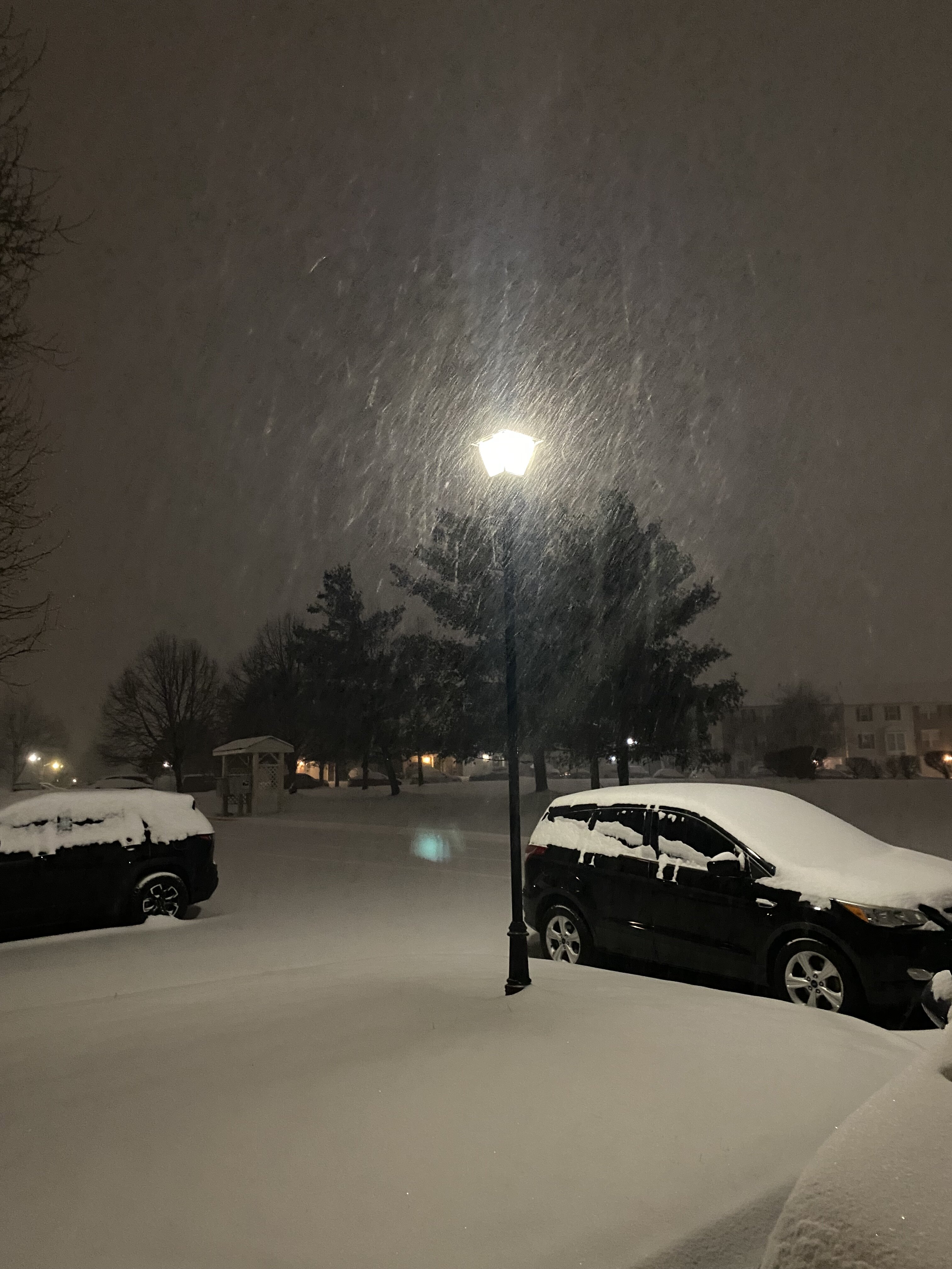
Changed back to all sn, still accumulating. 4.5”
-
Pingers starting to mix in Ashburn
-
Cleared 4” and coming down heaviest so far
-
Think we have 2-3 hours till we flip here. Line is moving north but cold is fighting back
-
Closing in on 4”, should be able to clear that with the yellows incoming dropped slightly to 14.2
-
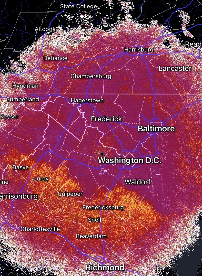
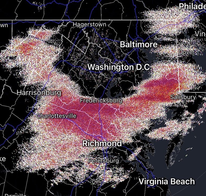
If we set it to tilt 3, can better see where the sleet line actually is

-
Yeah totally. Even with the more compactness of this dmv powder I can’t make a snowball with it to save my life. But the lake effect powder is a whole another level. Makes it much easier to clear the roads up there.
-
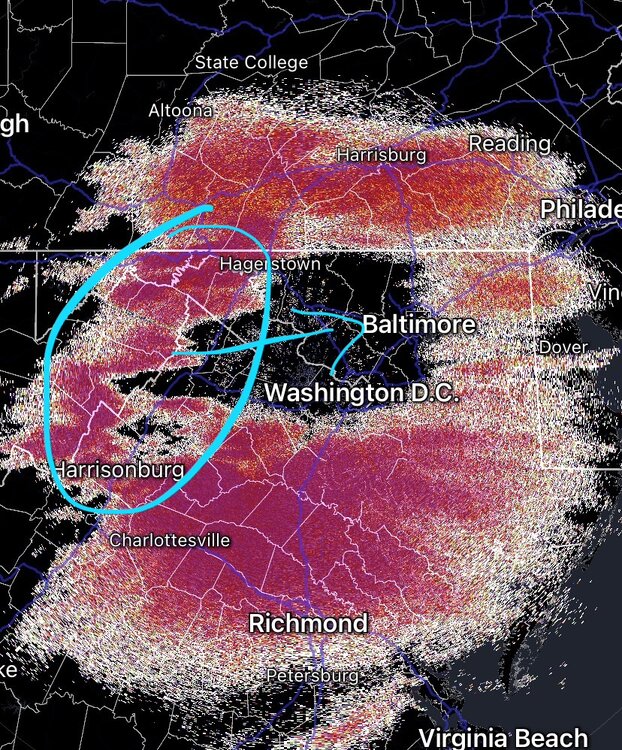
If the radar is correct, maybe this heavy batch is cooling the column as psu said would happen
-
-
Yes, got 0.5” in 20 min
-
Just measured 3” in Ashburn, pure powder
-
rates increasing now
-
Sleet line looks like its slow to come up. In 25 min, it seemed to move only a few miles
-
Eyeballing around 2.5” at 14.4 degrees. Pure powder
-
Radar looks like things will get started at around 11, an hour later than LWX but still at least 2-3 hours earlier than the CAMs. Going to sleep now, it’ll be light stuff to begin with… the best part will be early morning. Get some rest folks!
-
Thats my bar. An hour or two extra of all snow during heavy precip before the flip is how we hit our high ends 18/-3
-
It’s coming. Within the hour or less. anything to the N or NE of is virga
-
January 24-26: Miracle or Mirage JV/Banter Thread!
Terpeast replied to SnowenOutThere's topic in Mid Atlantic
If the NAM busts, let’s decommission it early -
Judging from radar and CC, may take another couple of hours for the column to saturate for dc metro and north.
-
@psuhoffman I mostly went toward the cams for the usual fall line, but leaned towards the euro for well N and W. *on baby duty rn, can’t explain my reasoning in detail. Sorry
-
Another 3 hours perhaps? Then pixie dust first hour or so, and the rates increase. At least that’s the plan…
-
Gefs look good on this threat. Nice signal. Next event to track. (Also that clipper in between)
-
Jan 24-26 Weekend Snow and Sleetfest Model Thread Part Tres
Terpeast replied to H2O's topic in Mid Atlantic
Doubt it. I’ll go with what LWX is saying, if not an hour later. Next hrrr run may show something different