

Terpeast
-
Posts
6,687 -
Joined
-
Last visited
Content Type
Profiles
Blogs
Forums
American Weather
Media Demo
Store
Gallery
Everything posted by Terpeast
-
A degree or so in F is noise. Nothing has changed today. Still time to bleed colder and the mesos can catch that better than the globals. Also, higher thumpy qpf will help, not hurt. 18z is a bit lighter than 12z
-
Jan Medium/Long Range Disco: Winter is coming
Terpeast replied to stormtracker's topic in Mid Atlantic
Best if we scoot through 4-6 as a weak wave or inside COD and reemerge at 7, then we can hunt for big dogs. Most biggies start as a wave in the N Pac while the mjo is at 7. Could be early Feb -
I think they’re hedging on either 5” snow or 0.25” ice. The latter more likely further south. But this doesn’t scream ice storm to me
-
Check LWX. Hoisted watch for west of 15 I’m just a few miles east. Likely going to get an advisory closer in
-
Just checked, its a smidge better. Probably noise
-
Jan Medium/Long Range Disco: Winter is coming
Terpeast replied to stormtracker's topic in Mid Atlantic
Mild just 3 days then cold, if going by that op run This is the kind of warminista cherry picking that really grinds my gears. A lot of that goes on in the NYC forum (not naming names) -
Other than the euro, the bleeding has stopped. For now…
-
Both sides of the same coin. No blocking and too fast pacific
-
Jan Medium/Long Range Disco: Winter is coming
Terpeast replied to stormtracker's topic in Mid Atlantic
Why are we even looking at op runs 10 days out? They couldn’t even get it right at 5 days for this Saturday’s storm -
Mid-Atlantic Snow Totals Thread - Winter 2023-2024
Terpeast replied to mattie g's topic in Mid Atlantic
12/11: 0.5” 1/1: T 1/6: 0.2" (sleet/snow mix) -
12Z nam gives me 3-4", which I think is the boom scenario for mby. Bust would obviously be a mix to rain scenario.
-
Jan Medium/Long Range Disco: Winter is coming
Terpeast replied to stormtracker's topic in Mid Atlantic
LR looks good, but I’m worried about the MJO trending stronger in the warm phases. I hope that’s wrong, but if it isn’t it might interfere with The Look. We want it to stay weak enough. -
Low of 32, now 38. Nothing falling
-
It drew a line right over us 5 days ago. We want that line to be 50-100 miles south of us so we’re still good even if it trended north even a little
-
I think 1-3” before the flip is a reasonable call Loudoun-MoCo and west. Fairfax county might struggle to reach an inch. Higher elevations or west of 81 may see 2-4” locally 5” Best we can hope for is that thermals tick a bit colder and we hold the flip off an extra hour or two
-
Yeah we should start looking at mesos now, its 60 hours till game time. CMC - careful what you wish for. Brutal cutoff in snow amounts. I’d prefer a more uniform thump for most of us even if the jack is less snow. Lets save the biggie for the better pattern up ahead
-
Not sure why this run sucks. Synoptically it looks the same to me. Slp and sfc high placements shuffle a bit, thermals fluctuate a tiny bit. It’s noise. Nothing really changed Both 0z nam and gfs are finally in agreement. Well, for this run at least
-
Looking at the 0z nam and 18z gfs just now… I feel that trailing vort might do some weird things if it gets closer to the backside
-
Best spot for snow vacation home within 4 hours of NOVA
Terpeast replied to SnowenOutThere's topic in Mid Atlantic
Good elevation? If not, don’t buy. Just kidding! -
Jan Medium/Long Range Disco: Winter is coming
Terpeast replied to stormtracker's topic in Mid Atlantic
Edited my post to say i was being sarcastic, but I’ll wait until after 1/7-1/9 to update my forecast if need be -
And one of them will be wrong. Or both.
-
Jan Medium/Long Range Disco: Winter is coming
Terpeast replied to stormtracker's topic in Mid Atlantic
MJO gonna go ape in the warm phases Nino isn’t enough to overpower the nina base state 11th straight warmest winter for NE, bad juju there It’s never going to snow again, so we’re f’ed /sarcasm -
Happy to see the HH GFS, but kinda hard to get too invested when models can't even agree on what kind of storm this is going to be... or if there is even going to be one.
-
Best spot for snow vacation home within 4 hours of NOVA
Terpeast replied to SnowenOutThere's topic in Mid Atlantic
For a modest 3BR/3BA house at Wisp/McHenry.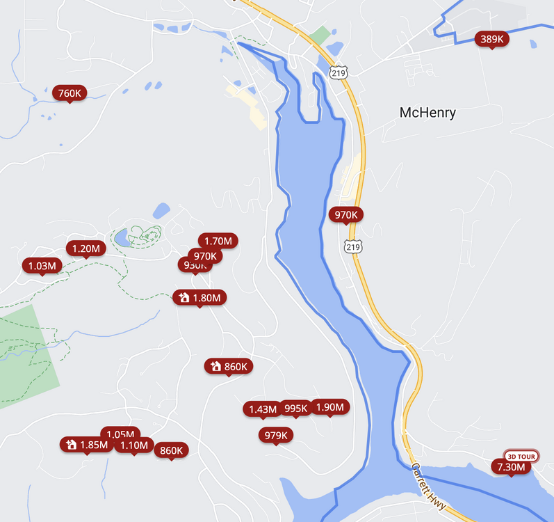
-
Jan Medium/Long Range Disco: Winter is coming
Terpeast replied to stormtracker's topic in Mid Atlantic
Fall line again


