
bncho
-
Posts
3,734 -
Joined
-
Last visited
Content Type
Profiles
Blogs
Forums
American Weather
Media Demo
Store
Gallery
Everything posted by bncho
-
Lots of thunder.
-
It's still great.

-
GFS!
- 680 replies
-
- 21
-

-

-

-

-

-

-
HRRR is cool. But I feel like every HRRR run with snow ALWAYS favors my backyard. I'm sitting in a 2.5" Kuchie jack
-
This feels like a bncho thread
-
My school just issued a tornado drill. Coincidence?
-
@bncho was about to sleep, but then he saw the 0z GFS.
-
we're back?
-
August was a great month, probably the most underrated month of 2025. We had many nice and cool days in the upper 70s.
-
You can see that there will be impeccable dendrite growth that will fall onto incredibly cold ground.
-
We won't even be partly sunny, though! We'll 42 and drizzle while CAPE enjoys his 34 and heavy snow
-
My allergies just suddenly popped up today. I am miserable right now.
-
I'm going to absolutely LOSE IT if RIC gets more snow while we suck ass
-
could be from +TNH bc of the SSW?
-
Chuck is starting to cave yall, big news for the unemployed weenie
-
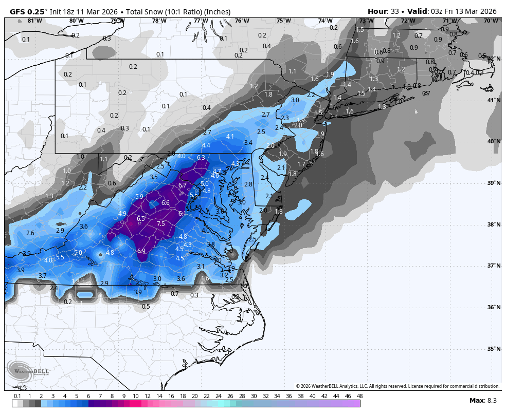
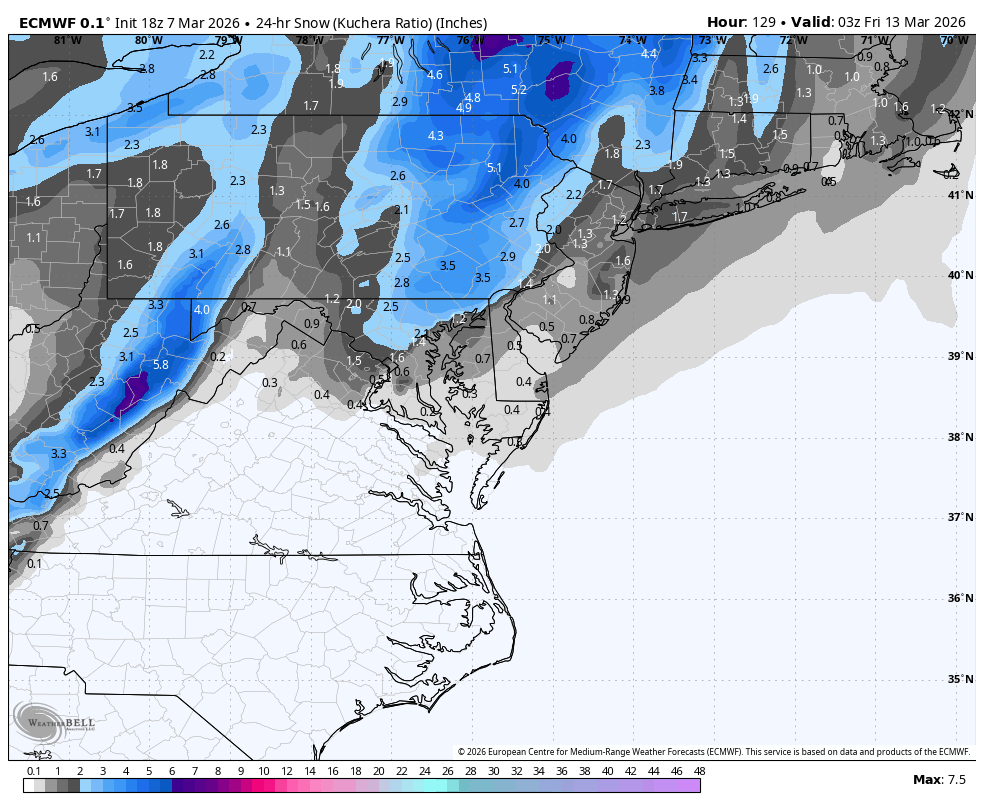
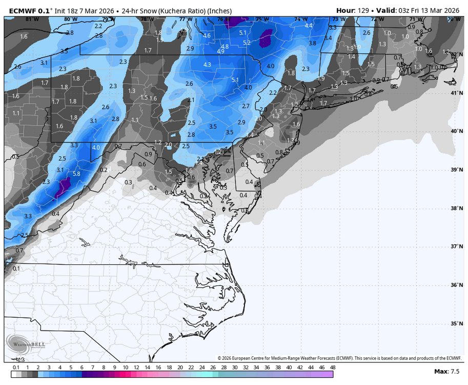
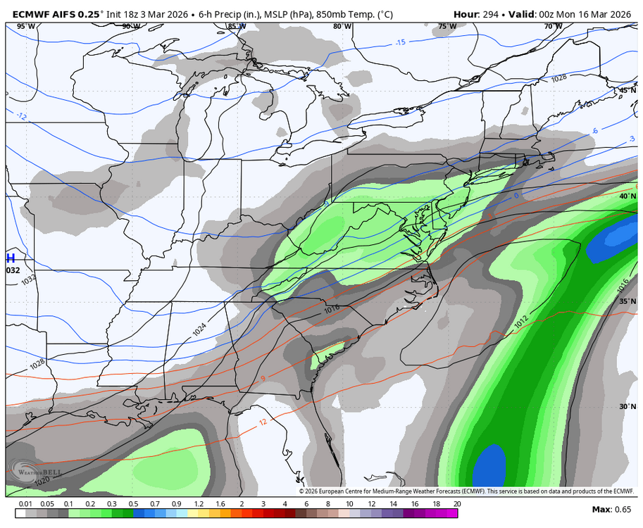
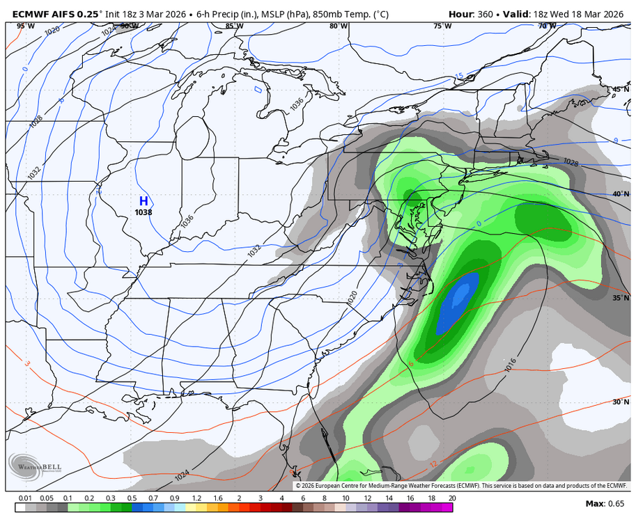
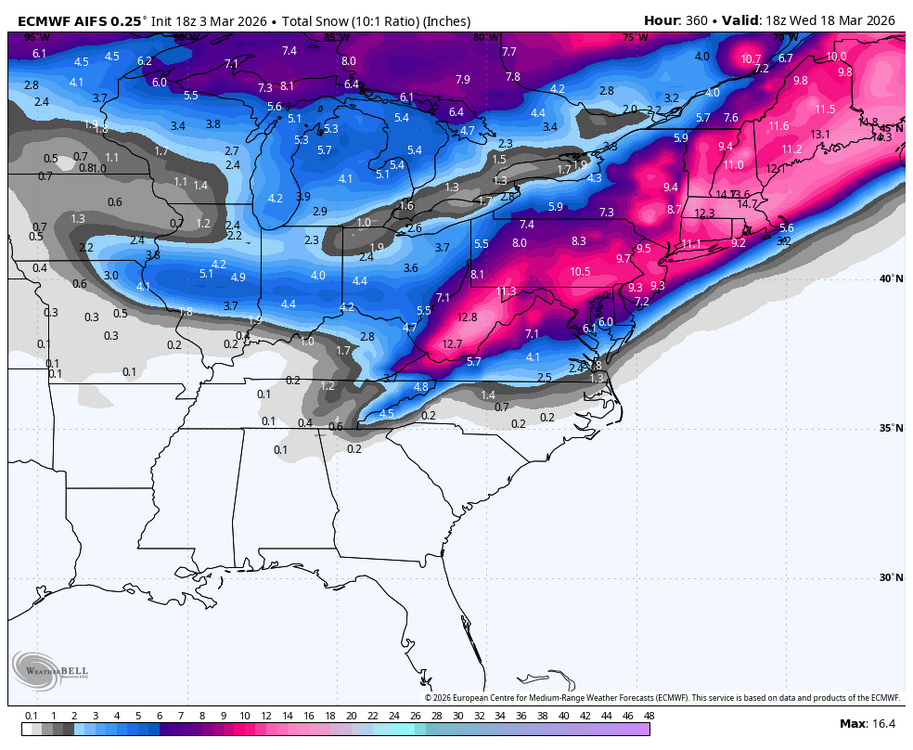
back end snow action on the euro for march 12
-
just miss to the north, but mitch and TSSN get hit pretty solidly

-
McLean, VA Winter Rating: B- Reasoning: ~18" of snow is still just below my average of 20". The snow/sleetfall from late-January stayed for a long, long time due to the severe cold in late-Jan to early-Feb, really helping this winter's case. There were lots of late nights just to see potential wasted for my area.
-
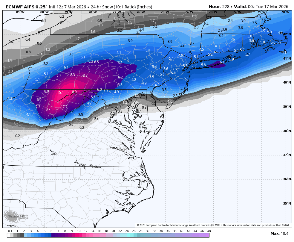
Mid March slop storm for DC and points north on the Euro AI
-
Quite an awful showing for my first snowfall contest entry. Will try again next year.
-
Euro AI has back to back hits. (wow i feel like will, not a bad thing)
- 408 replies
-
- 15
-
-
-
-
-
-

Outta gas and Outta Time: Early March Winter Storm finale
bncho replied to Ji's topic in Mid Atlantic
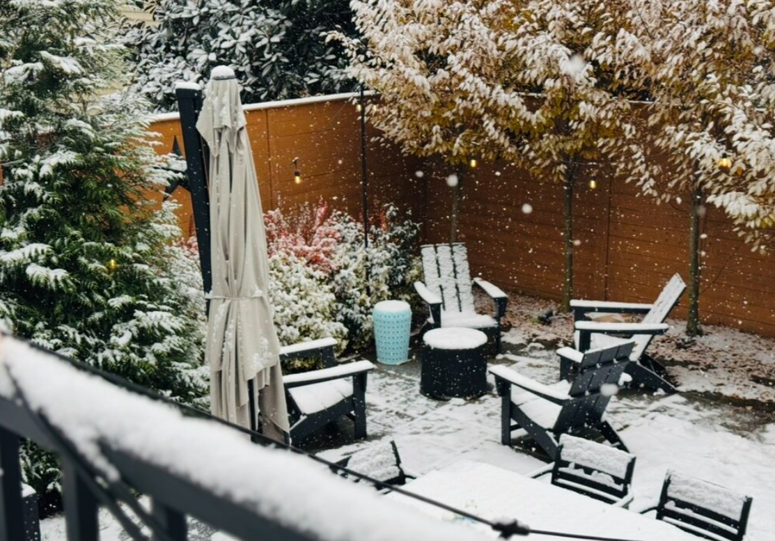
nice little report just north of DC.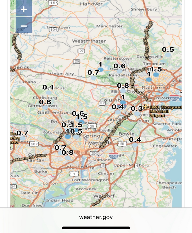
-
Outta gas and Outta Time: Early March Winter Storm finale
bncho replied to Ji's topic in Mid Atlantic
If I slant stick and measure on the grass I might be able to eek out 0.7" -
Outta gas and Outta Time: Early March Winter Storm finale
bncho replied to Ji's topic in Mid Atlantic
-
Outta gas and Outta Time: Early March Winter Storm finale
bncho replied to Ji's topic in Mid Atlantic
McLean's at 29.8/25 right now. It's snowing there too.