.jpg.b9a795a9fe89b3aa2ead015665ae36fe.jpg)
nvck
-
Posts
393 -
Joined
-
Last visited
Content Type
Profiles
Blogs
Forums
American Weather
Media Demo
Store
Gallery
Everything posted by nvck
-
hrrr finally got on board with the earlier/afternoon CI that other cams have had. probably targeting bloomington initially? maybe a bit north (like pontiac) as that seems to be the trend
-
looking good for a chase tomorrow, HRRR has 4.2k surface CAPE in IL which is just unreal... agreed that the biggest question is just whether storms pop or not before 00/01z, to actually be able to see something while chasing
-
The CSUMLP giveth, and the CSUMLP taketh
-
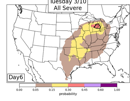
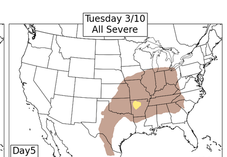
southwest michigan tomorrow looks pretty interesting, i can't lie
-
-
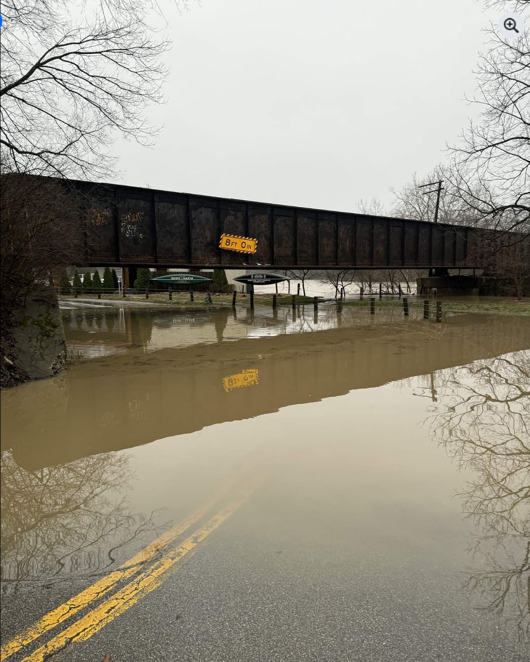
dealing with some flooding back home; don't think this bridge has an 8' clearance anymore!

-
looks like tonights event will be too far south for us to get anything more than an inch or 2 up here, but will be nice to see flakes fly (for what may be the last/2nd to last time?)
-
.thumb.jpg.ad3a2e31d30aff035044689b311a0540.jpg)
Winter 2025-26 Medium/Long Range Discussion
nvck replied to michsnowfreak's topic in Lakes/Ohio Valley
next sun/mon/tues period is looking interesting? recent ensembles seem to have trended south some, maybe one last gasp of winter back home before a week in the 60s -
worst weather. rain this morning melted all the remaining snow, and now we're stuck in the upper 30s while GRR hits 60...
-
Winter 2025-26 Medium/Long Range Discussion
nvck replied to michsnowfreak's topic in Lakes/Ohio Valley
d4 15% : could be interesting for some in the southern sub? -
Winter 2025-26 Medium/Long Range Discussion
nvck replied to michsnowfreak's topic in Lakes/Ohio Valley
midweek system looks interesting. probably not a big snowmaker for anyone but some fzra/mix and even thunderstorms possible for the mitten -
Winter 2025-26 Medium/Long Range Discussion
nvck replied to michsnowfreak's topic in Lakes/Ohio Valley
<next month> will be rockin! -
Dude needs to be shot into the sun, 276hour op gfs with kuchera ratios is an insane way to clickbait
-
Winter 2025-26 Short Range Discussion
nvck replied to SchaumburgStormer's topic in Lakes/Ohio Valley
i wonder which halftime show you're going to watch? -
Winter 2025-26 Medium/Long Range Discussion
nvck replied to michsnowfreak's topic in Lakes/Ohio Valley
Dismal near-term look, and that valentine's day storm that was looking promising for a few runs has trended away. let's fast forward to the 19th
-
can't speak much to the Linux aspect of ur question, but I think grlevel3 could be run through "Wine", which lets you run windows applications on linux. not sure how technically involved it is to set up. I think radarscope (should?) be linked to an account with user/pass, so I'd think you could download on a new windows machine and sign in that way. For the display, Hz is basically the refresh rate, so how many times per second the display updates. 60hz is pretty standard, if a bit on the low end. lots of new displays have a refresh rate of 120 or 144hz, which looks much smoother, especially if you're gaming. this probably won't be super noticeable unless you're playing a lot of games. for the rest of the specs, what are you planning on using the laptop for? the "copilot" thing just is microsoft pushing generative ai in everything they sell. copilot is basically their version of chatgpt. a laptop advertised like that probably has a dedicated "copilot key" on the keyboard, and a bunch of gen-ai features in the software you probably don't want. that would turn me off of buying the laptop, personally.
-
Winter 2025-26 Medium/Long Range Discussion
nvck replied to michsnowfreak's topic in Lakes/Ohio Valley
yeah, was gonna say, thurs/fri looks like the most interesting thing in the next week. potential for a few inches up here, especially if the gfs gives way to the euro -
-15 this am at KILN, -9 at Lunken. coldest air of the season afaik
-
really need another inch or two up here, existing snow is getting pretty slushy and gray
-
Probably a good way to communicate probability as well as intensity, but what about areas w/o the shading, in, say the 5% tor? is the shading just different "levels" of the previous sig shading? so 1 would be equivalent to the existing sig dashed lines, and then 2 and 3 are "levels" on top of that?
-
cannot stand him or any of these other grifting hypercasters
-
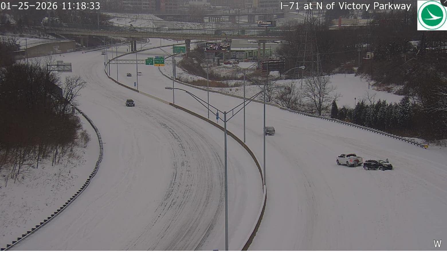
1/24-1/25 Major Winter Storm - S. IL, IN, and OH
nvck replied to A-L-E-K's topic in Lakes/Ohio Valley
first traffic cam i clicked on lol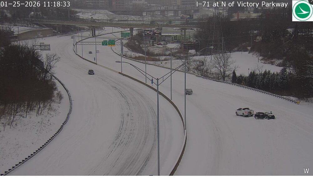
-
1/24-1/25 Major Winter Storm - S. IL, IN, and OH
nvck replied to A-L-E-K's topic in Lakes/Ohio Valley
Report of 11" in Middletown from 9:30 this am. expect another 6" at least for them -
1/24-1/25 Major Winter Storm - S. IL, IN, and OH
nvck replied to A-L-E-K's topic in Lakes/Ohio Valley
snow starting to reach the ground in evansville area -
1/24-1/25 Major Winter Storm - S. IL, IN, and OH
nvck replied to A-L-E-K's topic in Lakes/Ohio Valley
looking at traffic cams in s indiana, nothing really seems to be making it to the ground yet, despite the radar presentation. Still pretty large dew point depressions