.jpg.b9a795a9fe89b3aa2ead015665ae36fe.jpg)
nvck
-
Posts
462 -
Joined
-
Last visited
Content Type
Profiles
Blogs
Forums
American Weather
Media Demo
Store
Gallery
Everything posted by nvck
-
don't disagree w/ the spc often, but not a single tor warning, let alone report, out of that line
-
Both HRRR & RRFS are too slow, and not far enough SW with the ongoing convection
-
Not sure if i get the EF4 tor threat mentioned on this MD for the morning convection
.jpg.3fc53ca8f3973ba586cd113f2e8c5cc4.jpg)
-
looks like a good hail core on that cell NE of grand rapids
-
Dayton/ points west in the afternoon look interesting for something semi-discrete in the daytime around here.
-
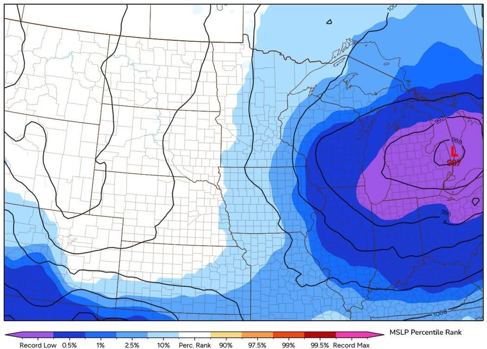
Record low slp
-
06z RRFS suggests that this may be more of a Thursday event for us, blowing up a cell right over the metro by midday. will be interesting to see what the 12z suite thinks, but I could see the d4 risk being shifted back west some
.thumb.jpg.9146b6d9aa092219118fa3de84d0e33c.jpg)
-
gonna go ahead and call a miss north/west here, and will hopefully be proven wrong
-
More of a march/april look here than anything else, but loving the shear profile
.thumb.jpg.db1464281a4b062a76df3b0f81742c74.jpg)
-
hoping we get some more of an east trend, am pretty tired of getting 2am weakening MCSs, would at least like to see some lightning in the daytime
-
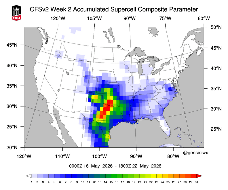
Looking like another impactful stretch of weather coming up, with Wednesday, as of now, having the highest ceiling. StormNet, CSU-MLP, and other ML products have all had very "hot" runs lately, pretty eyecatching stuff, especially as the northern bound of the highest prob area is over the same area that saw several tornadoes on Thursday. The GEFS has been consistent in showing an area of high P[SCP>1] over portions of Missouri and Illinois, even back into Kansas, for multiple runs now, while other models expand the risk further east towards Ohio. Regardless, very strong flow for this time of the year will overlap an area of ample moisture. Should be an interesting couple days.

-
Wednesday (Thursday to a lesser extent) looks thread-worthy, might get one going in a bit unless anyone else wants to jump on it
-
Eyeing next weds for a severe threat here in IL/IN/OH, longwave trough moving into the region, should be a great shear profile. funnily enough, biggest question IMO is how far east the best instability makes it.
-
2 tors likely otg SW of grand rapids
-
Tor for naperville
-
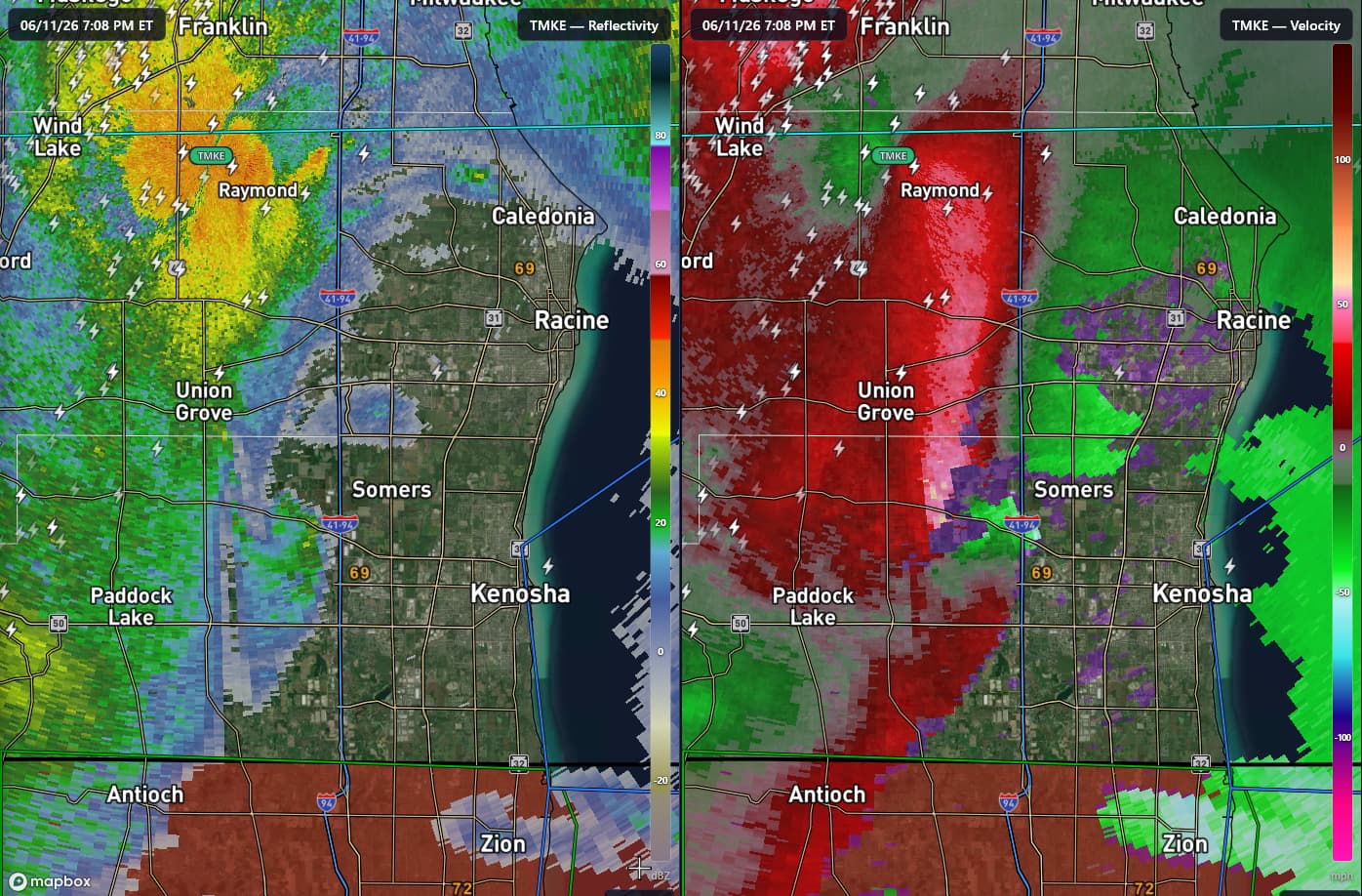
MKE terminal doppler looked pretty telling for a brief tor, will try and get a framegrab
-
https://x.com/Kentucky_WX/status/2065192083921543679?s=20
-
insane pics coming out of that cell... will be interesting to see how it reacts to these mergers
-
agreed, wish it wasn't in such a radar hole, but very impressive mid-level meso eta: warned now!
-
some MCV magic it looks like in eastern MI today, quite a few tor warnings
-
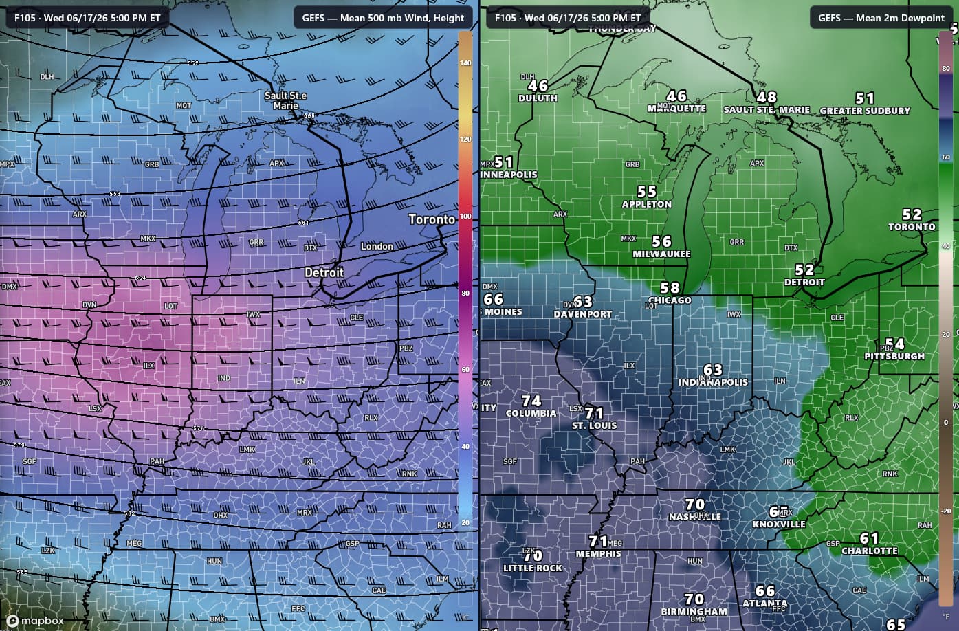
interested in the june 15-17 timeframe for a few days of highs potentially in the mid-70s. ensembles have been trending towards a nice respite from the heat/humidity
-
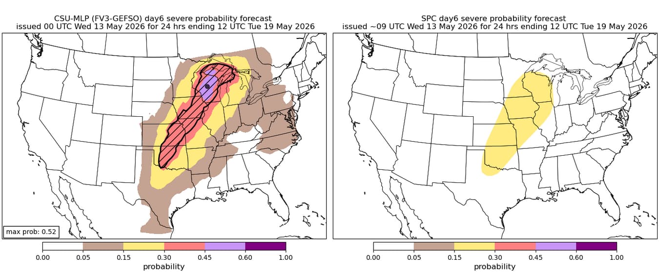
monday could be interesting, surprised to see the csu come in this hot, but multi-day svr wx possible from the plains up to the upper midwest

-
the current fv3 RRFS (which afaik is the one rolling out as operational on aug 31) is not great. word on the street (twitter) is that the mpas RRFS is much better, but won't be operational for a while longer
-
Heading out monday to try and chase tuesday in E KS/MO, looks like a dismal pattern if you're a tornado fan, but could be daily chances for ISO svrs with good hail, which is what we're after. will be out for ~2 weeks, so looks like the pattern should become a bit more favorable after next weekend
.thumb.jpg.ad3a2e31d30aff035044689b311a0540.jpg)


.jpg.f05bdd5bcc7794e75b3ee9d9df3fafb7.jpg)
.jpg.90743983ceb8a1b0c399121819faecd5.jpg)