.jpg.b9a795a9fe89b3aa2ead015665ae36fe.jpg)
nvck
-
Posts
445 -
Joined
-
Last visited
Content Type
Profiles
Blogs
Forums
American Weather
Media Demo
Store
Gallery
Everything posted by nvck
-
If you're in the western (ish) portion of the you've got a decent chance at seeing the northern lights tonight, sadly I think it'll be too cloudy here.
-
we don't need any more of this
-
some of you should like this:

-
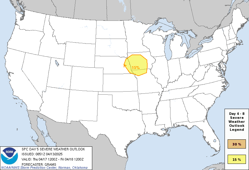
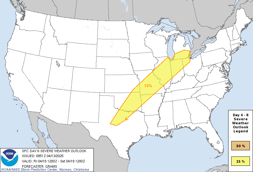
days 5 & 6 looking to get more active once again
-
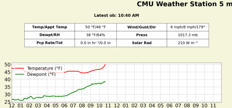
cloud cover overnight really limited the cool down, and we're looking at another day with a high in the upper 50s. absolutely incredible.
-
Same areas that saw snow last week?
-
lets come back to this in a couple months
-
no snow here last night, but a mid-30s, overcast, drizzly day, on par with most of spring so far. clouds did clear some a little bit ago and we're in the low 40s, but I can't wait for some 50s!
-
Yeah I'm super excited! was a fairly competitive selection process here, so i'm glad i got in, and it'll be cool to do legit fieldwork
-
may 15- the end of june. If the weather's looking dead then we might leave a week or so early, but the scheduled end date is june 28 i believe
-
not sure how many of you know about the ICECHIP hail research project this summer - a hail study led by CMU & NIU, with like 20 other orgs involved. I'll be going out to the front range/central plains for like 6 weeks this summer working on it. There's this website: http://icechip.niu.edu if you want to learn more, or feel free to ask me any questions, super excited about it
-
what a long night, insane wind gusts in IN/OH, with a 100mph report from the Muncie area. was posting warnings until like 2am for all the little 3 frame spin-ups in the wilmington area
-
lol yeah, I'm looking forward to some 50s and 60s later this month, before I head back south for the summer (I know, the wrong direction )
-
Heavy sleet with some thunder and gusty winds on my walk to class this morning. Why the hell did I come here?
-
tor-driven, and I was surprised that they didn't go 45% for wind.
-
Moderate issued for Evansville - Little Rock area along the Ohio & Mississippi Rivers
-
Would be exactly 1 year from this:
-
Big swath of 75kt+ winds at 850mb early thursday AM on the latest HRRR, over western ohio. I'm thinking a moderate is coming at 1:30, probably for both wind and tor potential.
-
Pretty sunny and 73 on the southwest side of lansing
-
Charlotte, mi, sorry, SW of Lansing. I think there is a Charlotte near circleville tho
-
Heading down to Charlotte area to chase
-
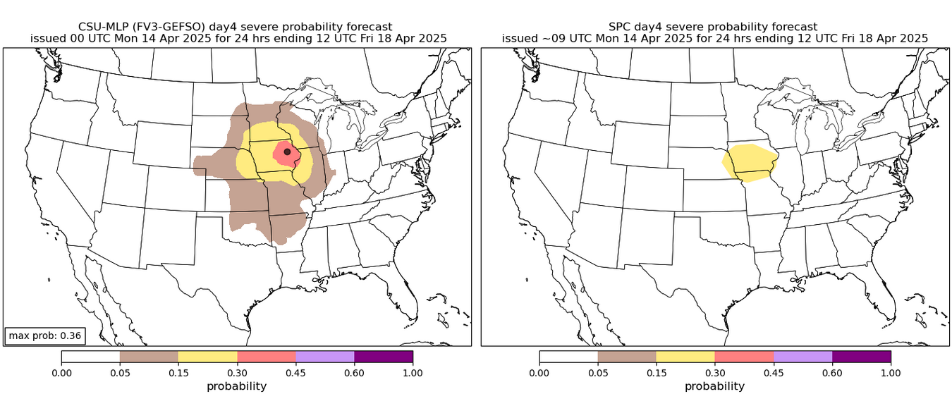
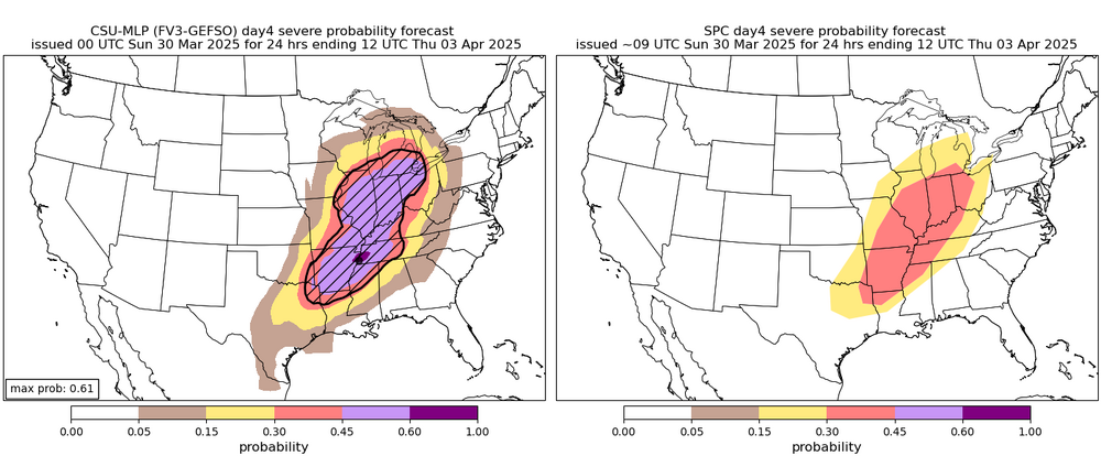
From the day4 portion of the days 4-8 outlook
-
keep in mind that this is a composite of all hazards but still, looking like another big day in the area.
-
Not so sure about this one...
-
At a glance, 00z hrrr looks like an uptrend in terms of morning convection decreasing around the IN/KY/OH area and a little bit more destabilization
.thumb.jpg.ad3a2e31d30aff035044689b311a0540.jpg)