.jpg.b9a795a9fe89b3aa2ead015665ae36fe.jpg)
nvck
-
Posts
445 -
Joined
-
Last visited
Content Type
Profiles
Blogs
Forums
American Weather
Media Demo
Store
Gallery
Everything posted by nvck
-
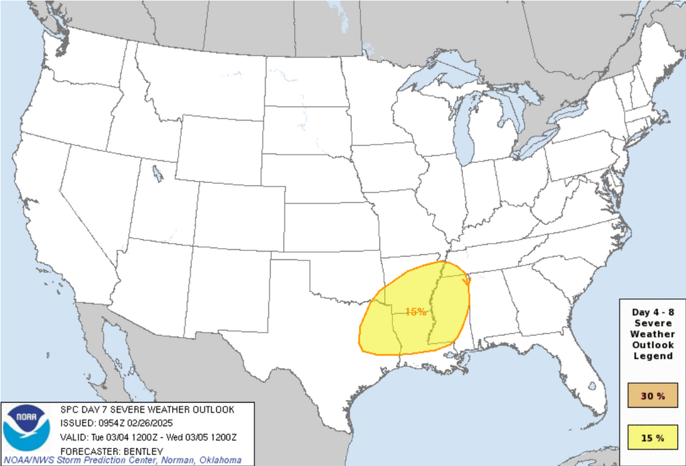
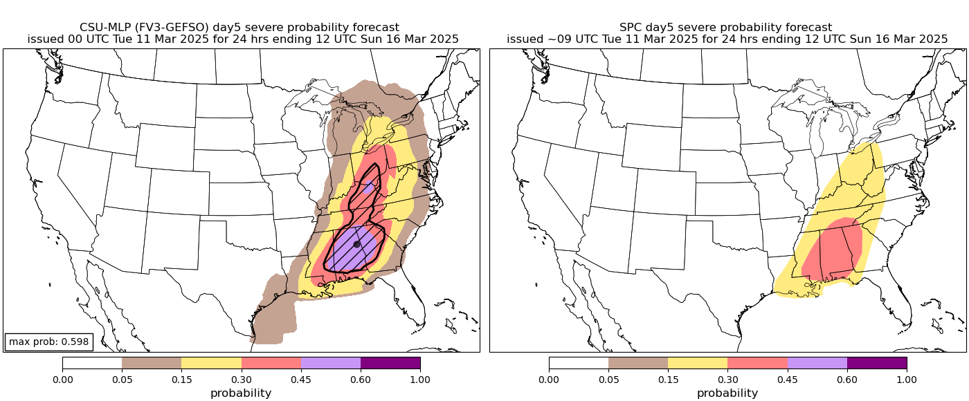
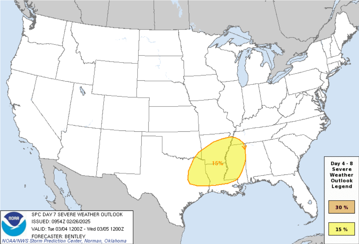
Probably thread worthy given the huge d3 enhanced covering a lot of the southern sub, and the slight risk all the way into MI. Interesting that the SPC keeps mentioning the significant hail probs as almost the primary risk with this event. Just rare to see this far east I feel.

-
.thumb.jpg.ad3a2e31d30aff035044689b311a0540.jpg)
2025 Short Range Severe Weather Discussion
nvck replied to Chicago Storm's topic in Lakes/Ohio Valley
I can start a thread for Sunday tomorrow if it looks to continue the uptrend around the area. Saw a gif of the GFS actually trending towards the ukmet solution which is concerning -
It's the chatbot on Twitter ("x"), https://x.com/i/grok. Not sure if it's accessible without an account, but in my experience it's pretty similar skillwise to deepseek/chatgpt, although I haven't used it to do analysis on data like that.
-
Something to watch for next weekend
-
Incredible amount of lightning with these storms as well
-
This is insane, and just the sheer number of pds warnings so far is wild
-
MDT got even bigger on the latest D1 outlook
-
Wow
-
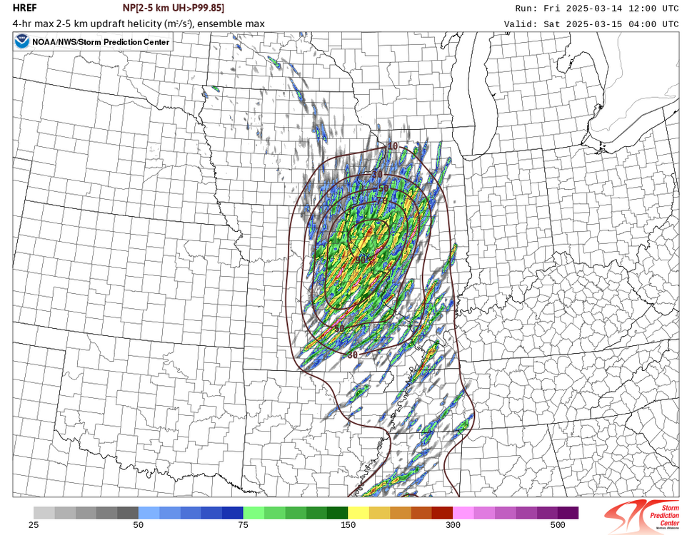
HREF with a UH bullseye around and north of STL tonight.
-
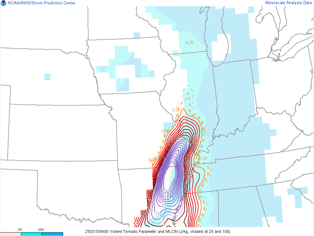
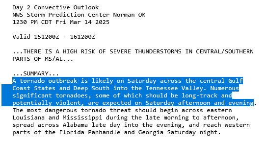
https://x.com/CameronJNixon/status/1900567103628857486 excellent thread by cameron nixon on why this storm mode may be more supportive of long-track tors than a purely supercellular one IMO, this could be cause enough for a high risk at 1630z
-
Looks as though the lead shortwave that was supposed to "scrub out" some moisture from south and limit northwards moisture advection for friday isn't as strong as forecast
-
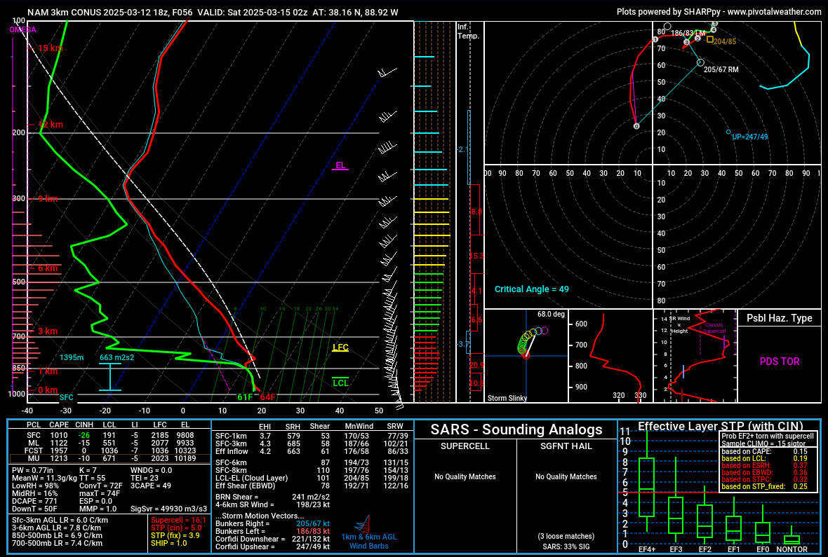
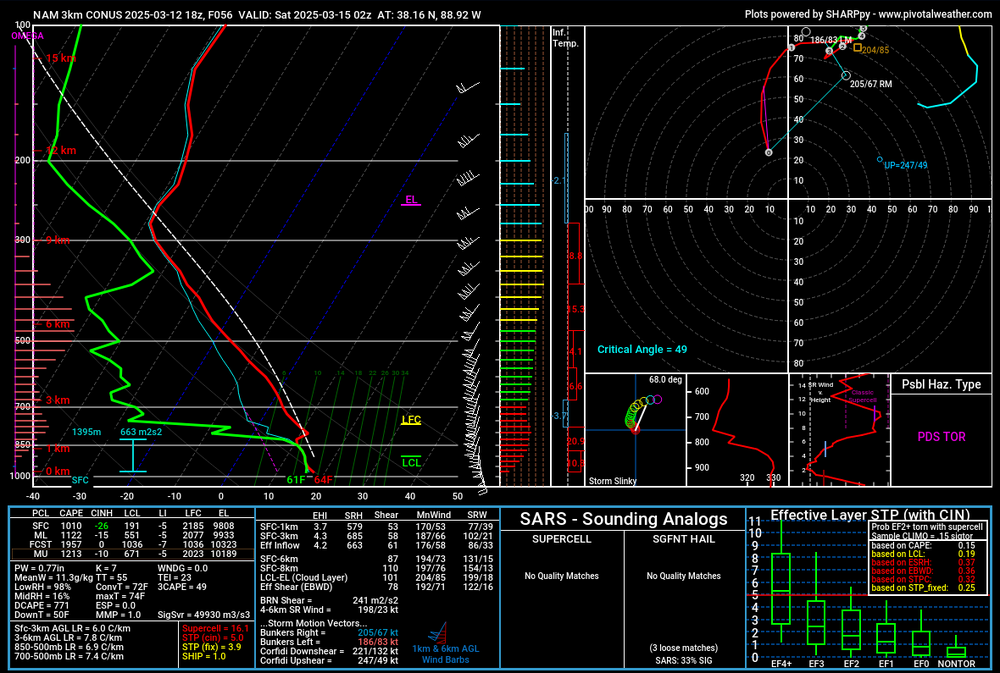
NAM3k sounding from SC IL (Mt. Vernon area) for late Friday night
-
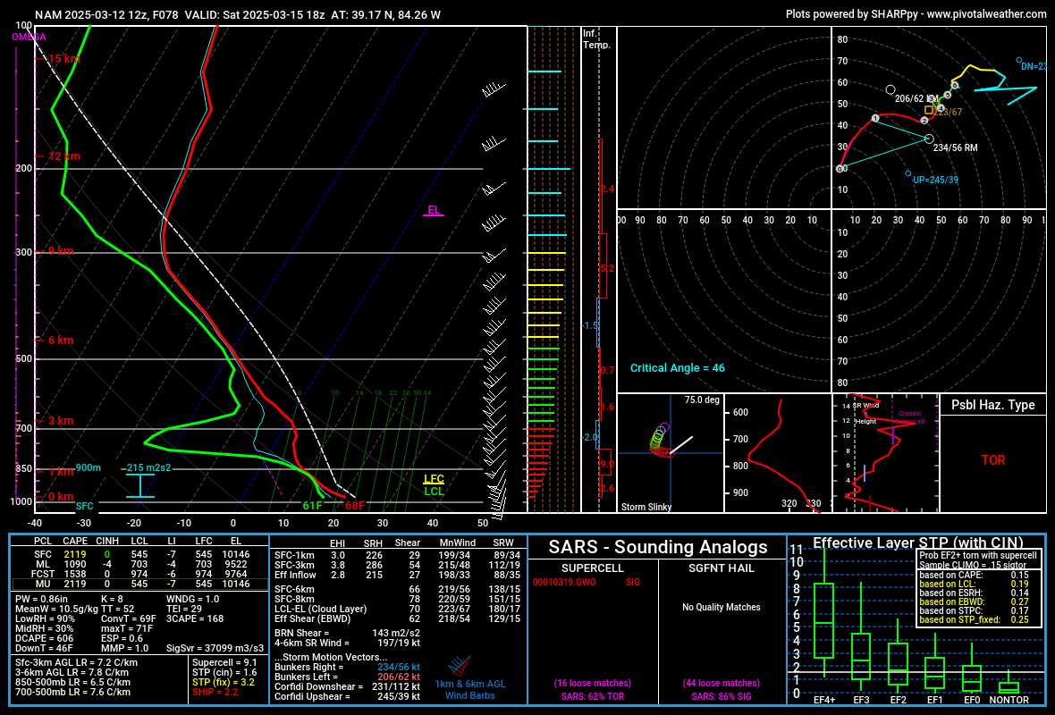
cincinnati area saturday afternoon

-
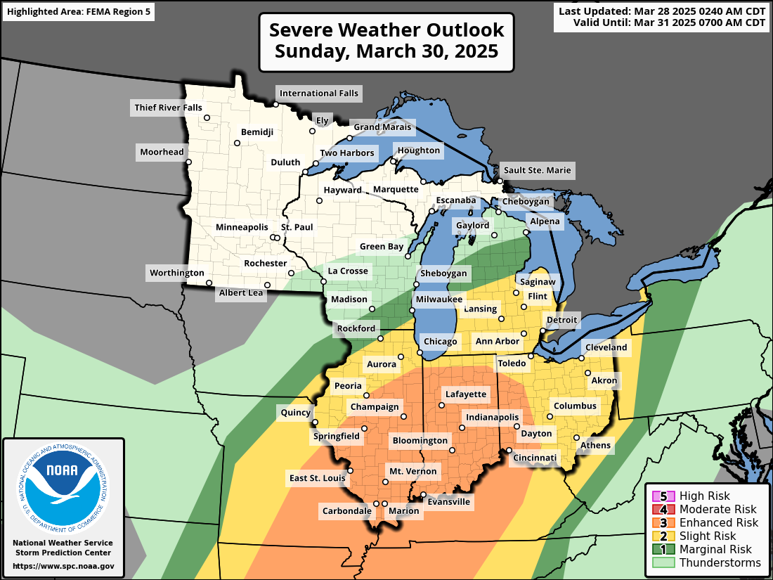
Saturday looking bigger than Friday for both the northern and southern modes

-
Is it worth starting another thread for what looks to be a 2day severe weather event? Expecting that both of these risks will be expanded northwards

-
Lock it in! I'm expecting 0.5" of rain on Saturday, with a few rumbles of thunder
-
Looks as though the first trough next week isn't going to be as strong as was thought earlier, and therefore the next (much more potent system) has more moisture to work with farther north. Also, depending on the timing the trough progression, I could see Saturday also being a decent severe wx day in the eastern bit of the sub, and into the midatlantic
-
https://x.com/ItzRoch11/status/1898430186380484745?t=k9tcfmbrBPZkv892UlEblg&s=19 Someone ran a WRF model on GFS initial conditions for Friday. Take with (many) grains of salt, but still interesting
-
Driving back home from MI, ground was basically completely bare the whole way, though there was a dusting just N of Ft Wayne, where a pretty strong band had been sitting for a little bit. Flurries from Lansing to there basically, but nothing was sticking really. Hoping to bag some 70s this week before a return to the frozen north.
-
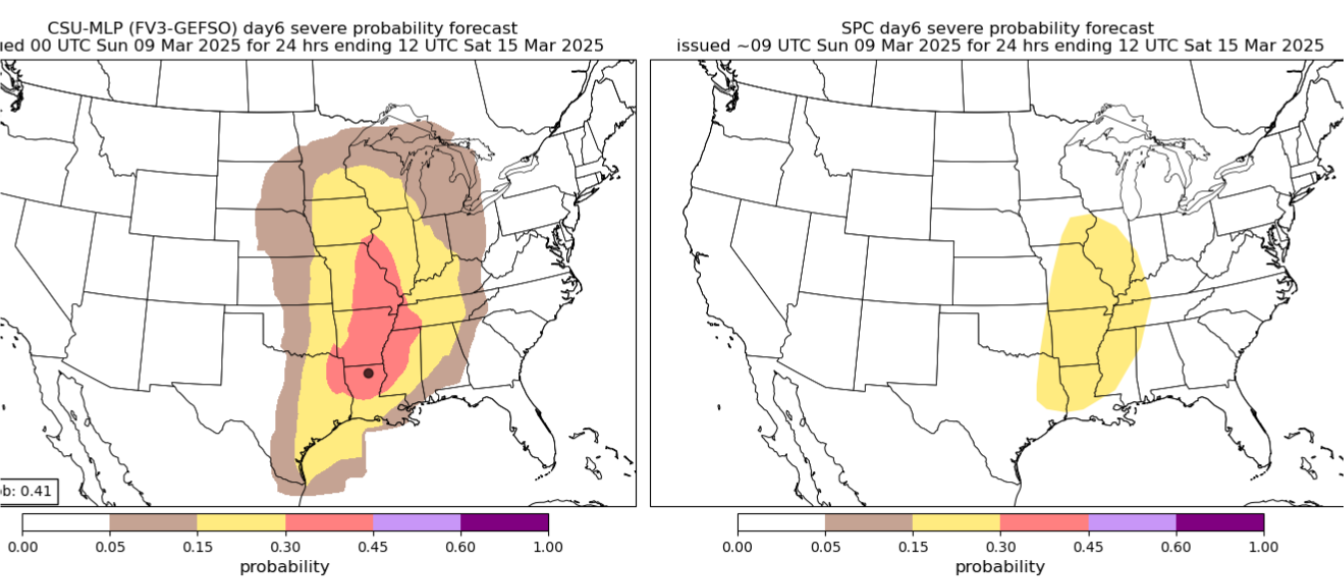
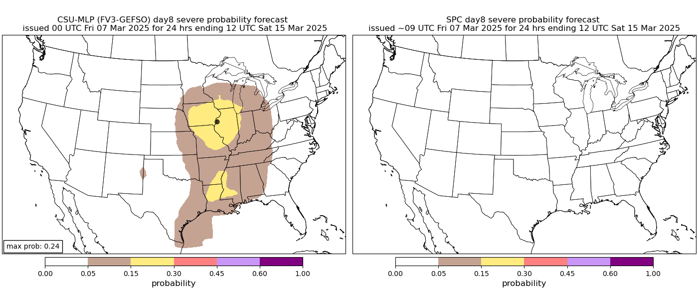
In the CSU d8 ML forecast we trust

-
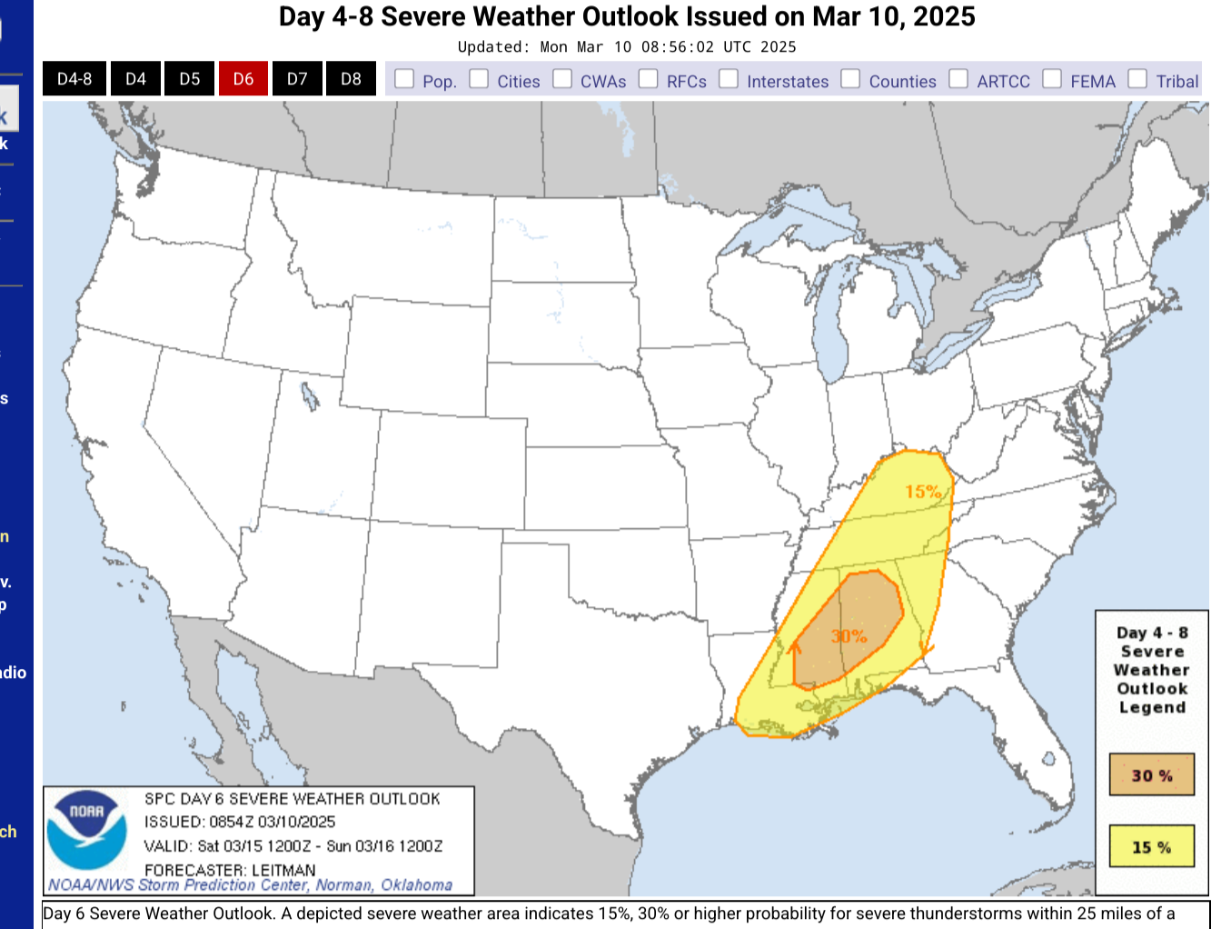
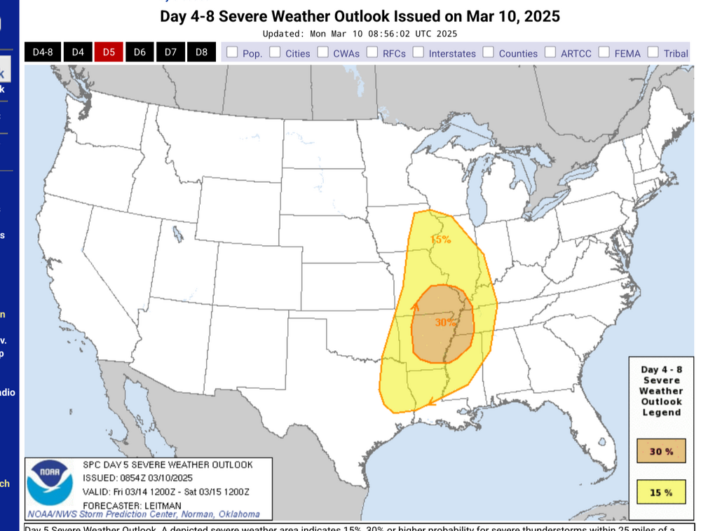
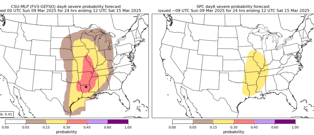
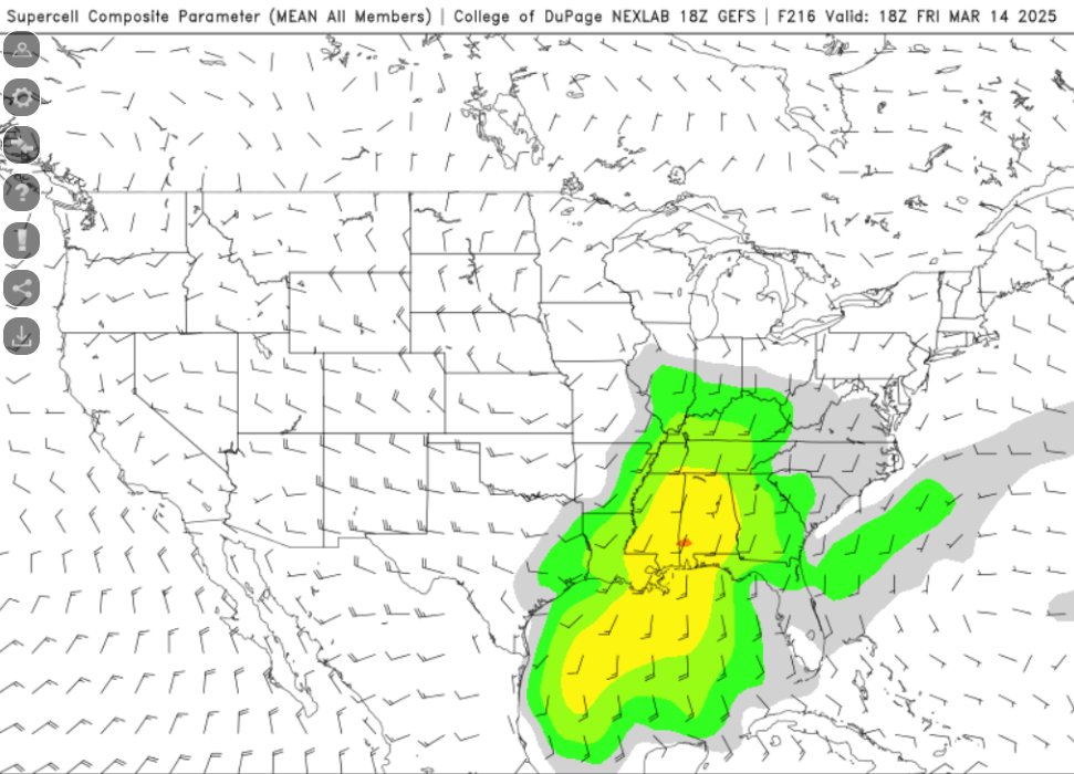
Ensemble support as well for a *potential* severe outbreak in the SE and S Ohio River Valley. Will obviously have to watch how this evolves, but seeing SCP values this high 200+ hours out on the gefs is surprising
-
Pressure bottomed out in the low 980s, after a pretty steep plunge this am. precip on the day around 3/4", and upper 40s feel incredible
-
6z gfs (and 00z euro) both want to run back another sub-980 low late next week, with more svr possible in the south
-
But I didn't think the leapords would eat *my* face!
-
Winter 2024-25 Medium/Long Range Discussion
nvck replied to michsnowfreak's topic in Lakes/Ohio Valley
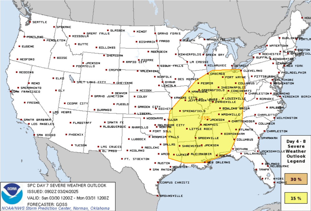
not in our bit of the country, but it's pretty wild that we can issue outlooks 7 days out, that have a decent chance of verifying.