SolidIcewx
-
Posts
1,526 -
Joined
-
Last visited
Content Type
Profiles
Blogs
Forums
American Weather
Media Demo
Store
Gallery
Everything posted by SolidIcewx
-
 Crazy i just did storm work in that town recently with the blizzard
- 1,093 replies
-
- 1
-

-
- severe
- thunderstorms
- (and 1 more)
-
Thats why it blows my mind the average person puts so much faith into social media. I had co workers all day say “well on facebook and twitter they said this” drives me nuts sometimes honestly.
- 1,093 replies
-
- 3
-

-
- severe
- thunderstorms
- (and 1 more)
-
Sun peeking through even with rain showers here in southern PG county
- 1,093 replies
-
- 1
-
-
- severe
- thunderstorms
- (and 1 more)
-
Obviously no one wants anyone hurt or damage to the things we worked hard for such as home and vehicles. Opinion varies widely. I know in my case i work Utility and welcome some overtime as long as there are not any injuries.
- 1,093 replies
-
- 1
-
-
- severe
- thunderstorms
- (and 1 more)
-
Sleet by Watkins Regional park in PG county
-
Off topic but i gotta go to southern Delaware and Maryland border for storm work. Any good things to see and spots to eat?
-
Feb 22nd/23rd "There's no way..." Obs Thread
SolidIcewx replied to Maestrobjwa's topic in Mid Atlantic
Flakes mixing in with the rain here in Alexandria at 220’ if that matters. -
As a Utility worker i dont look forward to Saturday at all lol
-
1/24-1/25 Major Winter Storm - S. IL, IN, and OH
SolidIcewx replied to A-L-E-K's topic in Lakes/Ohio Valley
Happy to see there was a nice spread the wealth event up there. Down where i am now people are freaking out a out prolonged 20’s lol. -
27 where i am in Alexandria. Temp rose fast. Almost can feel the warm layer above. ZR gonna be an issue i think.
-
Glazing here in Alexandria
-
Maybe my mind id playing tricks but seems i have a very thin glaze of ice on my handrails to my balcony
-
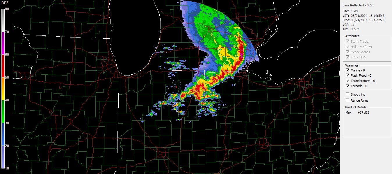
Some gravity waves on radar just south of Richmond
-
Went on my Jeb walk. The sleet is impressive. Coming from the Great Lakes area ive never seen sleet like this and at such low temps. Climo here is very intriguing to say the least.
-
Nice moderate rates here on the west side of Alexandria.
-
I work in Utility. Next week is gonna be a long one for me.
-
Nov 28-30th Post Turkey Day Winter Storm
SolidIcewx replied to Chicago Storm's topic in Lakes/Ohio Valley
Nice heavy band making its way into Adrian MI. The start of the heavier snow for SEMI -
Nov 28-30th Post Turkey Day Winter Storm
SolidIcewx replied to Chicago Storm's topic in Lakes/Ohio Valley
Gonna be interesting to see the variations in storm totals from west to east in the Detroit Metro. -
Major Hurricane Melissa - 892mb - 185mph Jamaica landfall
SolidIcewx replied to GaWx's topic in Tropical Headquarters
One hell of a blow up going on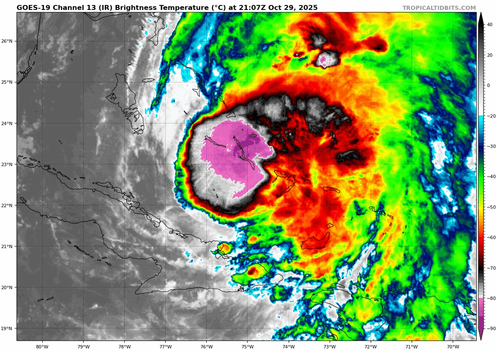
-
Major Hurricane Melissa - 892mb - 185mph Jamaica landfall
SolidIcewx replied to GaWx's topic in Tropical Headquarters
Takes time to catch up -
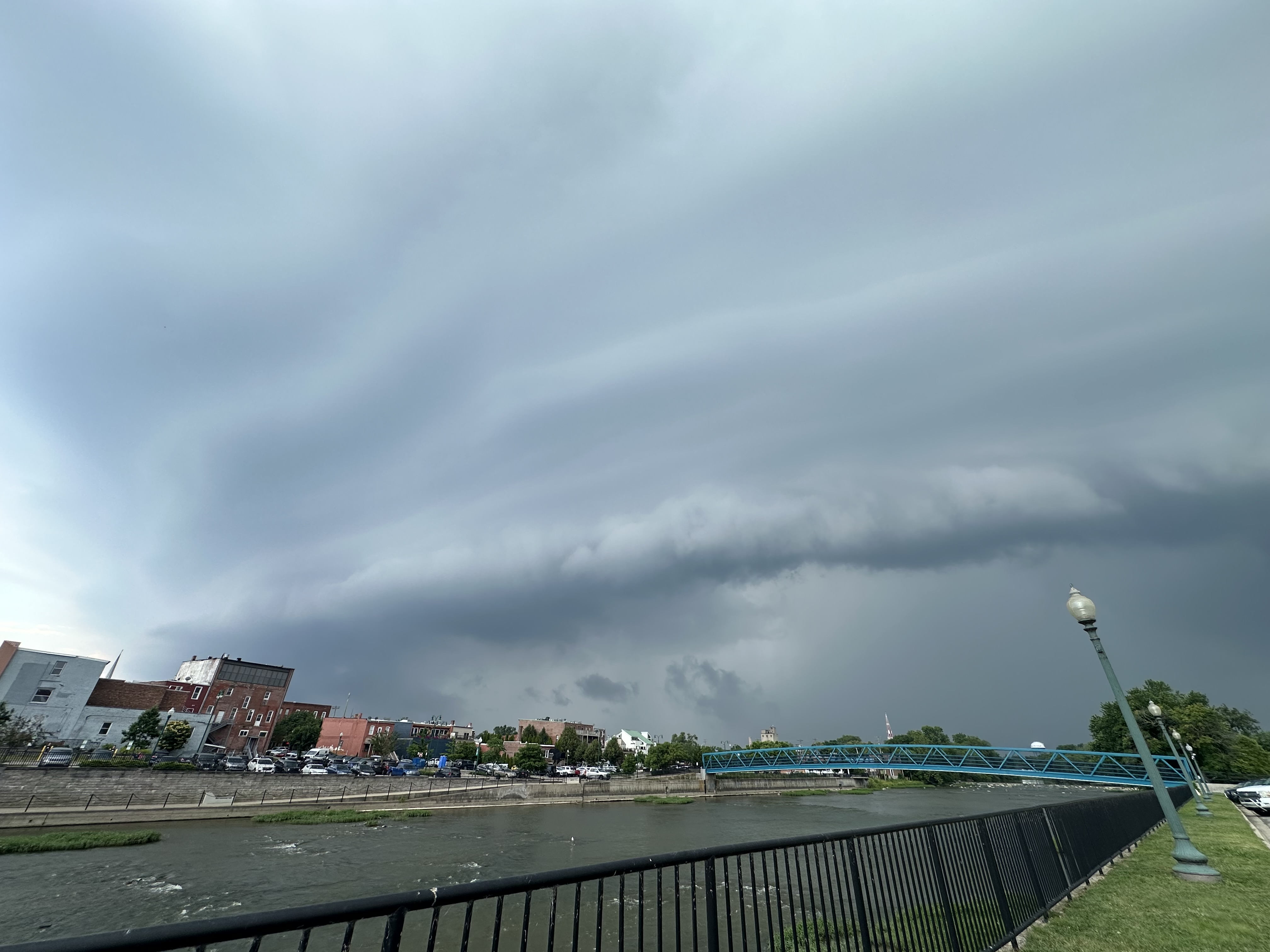
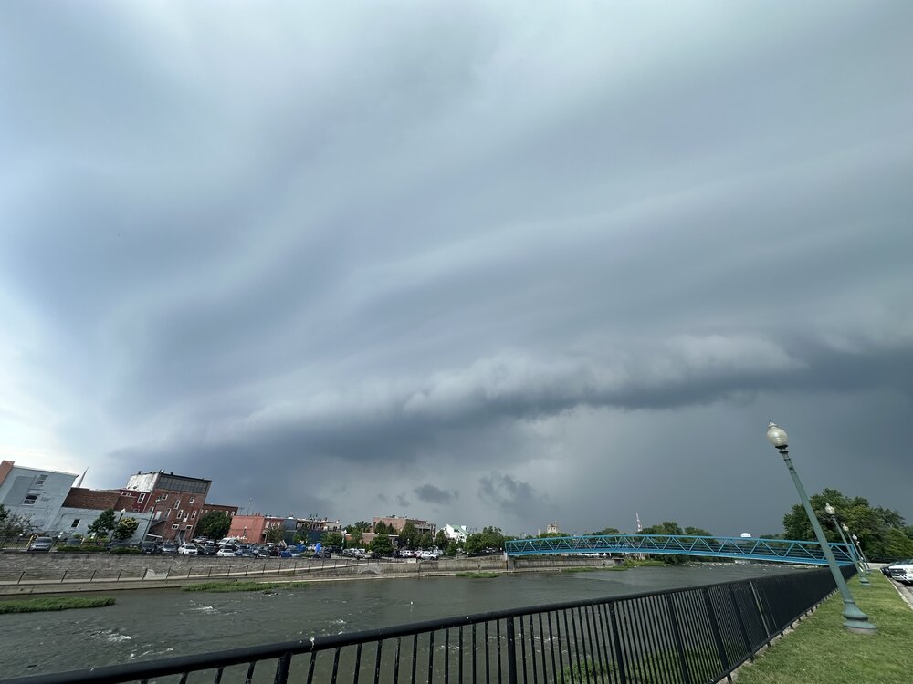
Nice Shelf here in Monroe MI
-
I had to explain to the lady at home on why the ac would stay on even if set higher. It was really toasty last night