SolidIcewx
-
Posts
1,647 -
Joined
-
Last visited
Content Type
Profiles
Blogs
Forums
American Weather
Media Demo
Store
Gallery
Everything posted by SolidIcewx
-
I see towers to my north and northwest. Was thinking the same thing on timing.
-
89/76/100 in Croom for work. At least i have a breeze under these transmission lines.
-

2026 Mid-Atlantic Severe Storm General Discussion
SolidIcewx replied to Kmlwx's topic in Mid Atlantic
Pepco stopped going out of their way to ask people. But if a tree is removed they do still offer a replacement tree or if a big one is taken down we sometimes will give out a second tree. BGE is an over complicated hot mess in short when it comes to their vegetation mgmt program. From what i know vegetation mgmt has a heavy focus on fast growing and or invasive species like chinese paulownia. -
Heavy thundershower out in Croom where I was for work. Snuck up on me. When it got dark in the forest I’m glad I know to B-line it right to the truck lol.
-
2026 Mid-Atlantic Severe Storm General Discussion
SolidIcewx replied to Kmlwx's topic in Mid Atlantic
I think im about to edge the tail end of this storm -
2026 Mid-Atlantic Severe Storm General Discussion
SolidIcewx replied to Kmlwx's topic in Mid Atlantic
Mesoscale Discussion 1783 NWS Storm Prediction Center Norman OK 0104 PM CDT Tue Jul 28 2026 Areas affected...portions of West Virginia...northern/central Virginia...and southern Delaware Concerning...Severe potential...Severe Thunderstorm Watch likely Valid 281804Z - 282000Z Probability of Watch Issuance...80 percent SUMMARY...Severe potential to increase through the afternoon. Damaging wind, large hail, and tornadoes will be possible. DISCUSSION...Ahead of an approaching cold front across West Virginia, mostly sunny skies across portions of northern/central Virginia has allowed for temperatures to rise into the low to mid 80s. Steepening low-level lapse rates and increasing MLCAPE are noted across the region as a result. Strong mid-level flow is supporting deep layer shear around 40-50 kts. Flow is generally perpendicular to the front, which may support a mix of clusters and supercell structures. Steepening low-level lapse rates will support potential for downward momentum transfer and damaging wind. With any supercell structures that can maintain, large hail and perhaps a tornado will be possible. More modest low-level shear may somewhat limit the tornado potential initially, though the low-level jet may increase into the late afternoon. A watch will be needed soon to cover this potential.- 2,562 replies
-
- 2
-

-
- severe
- thunderstorms
- (and 7 more)
-
2026 Mid-Atlantic Severe Storm General Discussion
SolidIcewx replied to Kmlwx's topic in Mid Atlantic
Richmond wins again? -
2026 Mid-Atlantic Severe Storm General Discussion
SolidIcewx replied to Kmlwx's topic in Mid Atlantic
Looks like the clouds are breaking up a bit to the west -
2026 Mid-Atlantic Severe Storm General Discussion
SolidIcewx replied to Kmlwx's topic in Mid Atlantic
The debris ball on that tornado was insane -
2026 Mid-Atlantic Severe Storm General Discussion
SolidIcewx replied to Kmlwx's topic in Mid Atlantic
A repeat of last tuesday would be nice -
As a utility worker i prefer Spring & Autumn over peak of winter and summer. Minus the storms in each though those are always awesome!
-
2026 Mid-Atlantic Severe Storm General Discussion
SolidIcewx replied to Kmlwx's topic in Mid Atlantic
At least this is a good widespread rain. Spreading the wealth. -
2026 Mid-Atlantic Severe Storm General Discussion
SolidIcewx replied to Kmlwx's topic in Mid Atlantic
Hopefully the WV complex starts developing and congealing to the NE to get more of the metro. -
2026 Mid-Atlantic Severe Storm General Discussion
SolidIcewx replied to Kmlwx's topic in Mid Atlantic
Unless the “storm cluster” is coming right at me and within 10 miles im not gonna get my hopes up. I understand the frustration when it comes to severe weather in this area since moving here last year -
Ive mowed only once in the last 5-6 weeks
-
92/79/108
-
Nova starting to clear out based on satellite
-
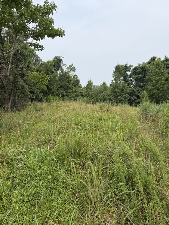
Out this morning myself on a hike
-
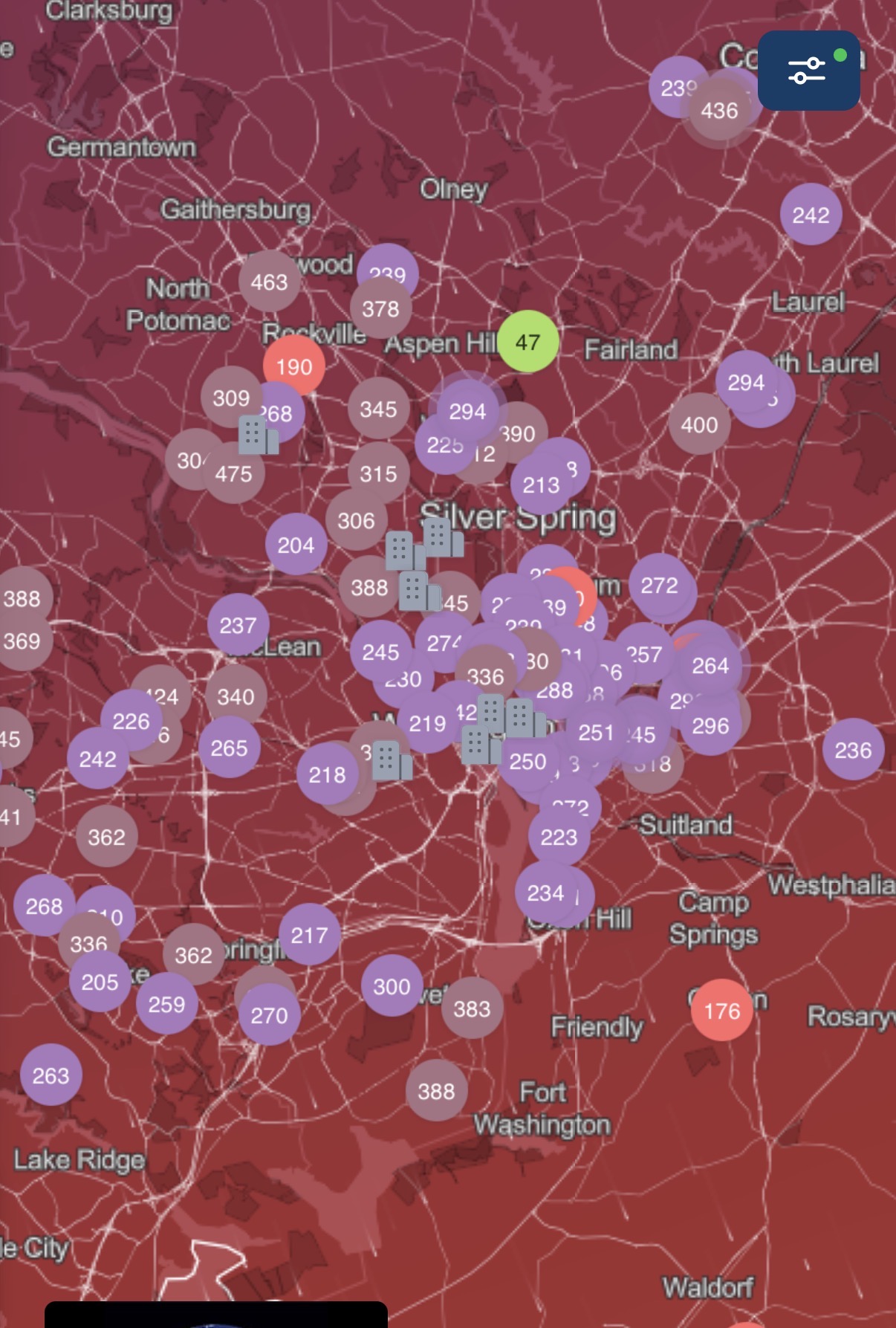
Really incredible smoke plume. Its made its way to the DC area. Readings similar to whats in the great lakes. And yeah no birds singing here either.
-
All we can do is hope its correct. Got a gathering tonight im probably going to cancel.
-
I seen that but i call bullshit personally
-
Northern edge on the GOES East did not budge much of a few frames. Would bot surprise me.
-
Luckily there has been some rain in the thunder bay region. Including a mcs going through the wildfire area currently. Hopefully this is the worst we get this summer.
-
-
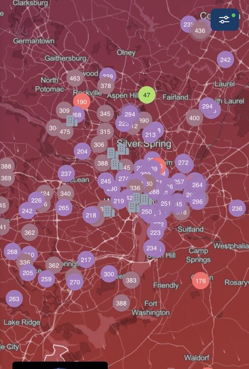
Looks like AQI ranges from 250-350 across the area. It smells horrible out. Not looking forward to working out in this today..