SnowenOutThere
-
Posts
5,666 -
Joined
-
Last visited
Content Type
Profiles
Blogs
Forums
American Weather
Media Demo
Store
Gallery
Everything posted by SnowenOutThere
-
 This is actual rage bait I’m impressed.
 -
Major Hurricane Melissa - 892mb - 185mph Jamaica landfall
SnowenOutThere replied to GaWx's topic in Tropical Headquarters
Imagine this turns out to be another Eta situation where recon gets in there and it’s hasn’t changed intensity. Not saying it will but would be really funny -
Major Hurricane Melissa - 892mb - 185mph Jamaica landfall
SnowenOutThere replied to GaWx's topic in Tropical Headquarters
The gravity waves are pretty cool -
GFS actually has snowfall all the way into Shenandoah this Friday. Personally I just hope WV gets something and it sticks around till Friday midday when my tests are over for the week.
-
Unfortunately I don’t think I’ll be able to get my hands on it. Though next semester when I’m in lab for the class I’ll have access to it and will use it to create a scew T diagram!
-
Launched a weather balloon today for my atmosphere and weather class!
-
Major Hurricane Melissa - 892mb - 185mph Jamaica landfall
SnowenOutThere replied to GaWx's topic in Tropical Headquarters
Wonder if tonight (or the next few hours at least) may be a case of arrested development where there are very high cloud tops and intense convection but the storm isn't quite stacked enough to take advantage of it. -
What do you think the best place is for upslope hiking wise? I’ve been at spruce knob before but I don’t know if I’d want to try that road when it’s snowing.
-
Wonder if the mountains could get their first accumulations out of that? Would love to go on a 3 hour jaunt if it meant seeing October snow.
-
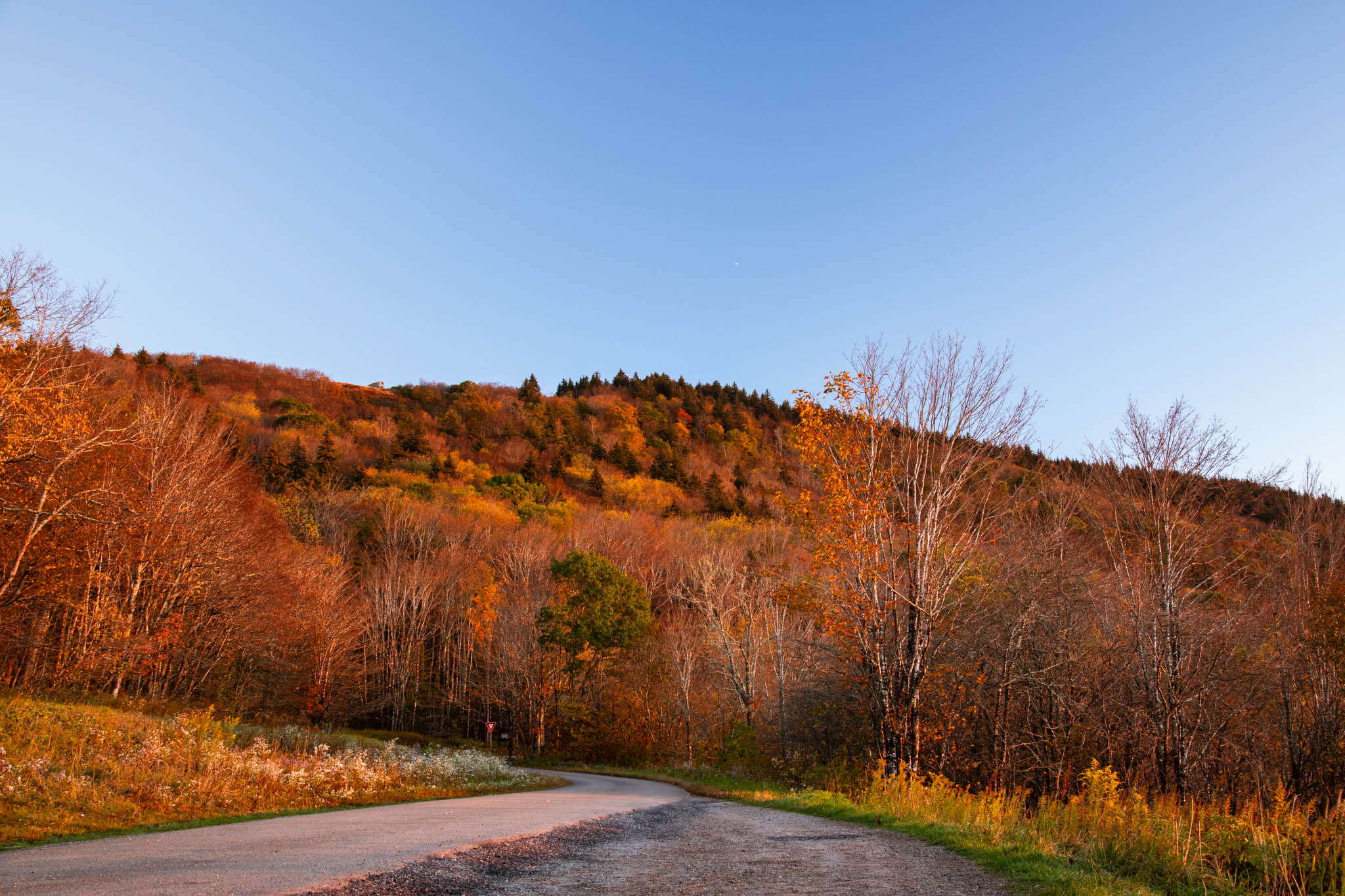
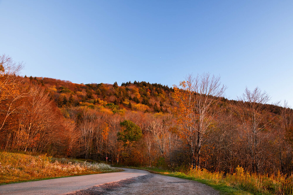
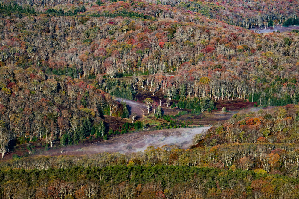
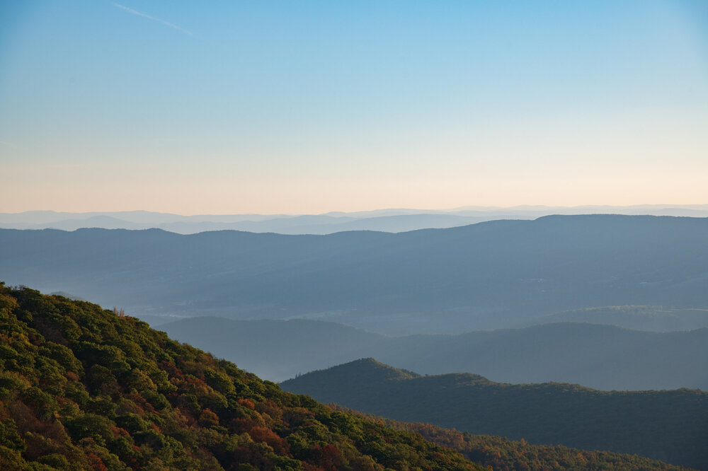
Went hiking from bottom of Ceder run to Hawksbill peak in Shenandoah (around 3000ft elevation gain) and got to walk through all the different levels of fall colors. Best leaves are from 2200-2700 ft on the mountain.
-
I don’t know about you but all of this should be solely based on hour 84 NAM extrapolations. From what I’m seeing expect a big snow January 18th
-
Gotta get mod permission for our idea first
-
On a side note I do think it would be hilarious to start a thread for some random day in the winter and hype it up the whole fall
-
Maybe we should start the thread preemptively. Have we ever tried that?
-
I'm okay having to snow chase to avoid mixing if its early November. Mid January is a different story...
-
If only you waited to start the thread by a day you could've had this one
-
Meh, doesn’t drop south enough I’m sure we can do better for our required .1 inches of October snow (as the average always occurs)
-
Of course, those aren't the only pictures I took

- 427 replies
-
- 15
-

-
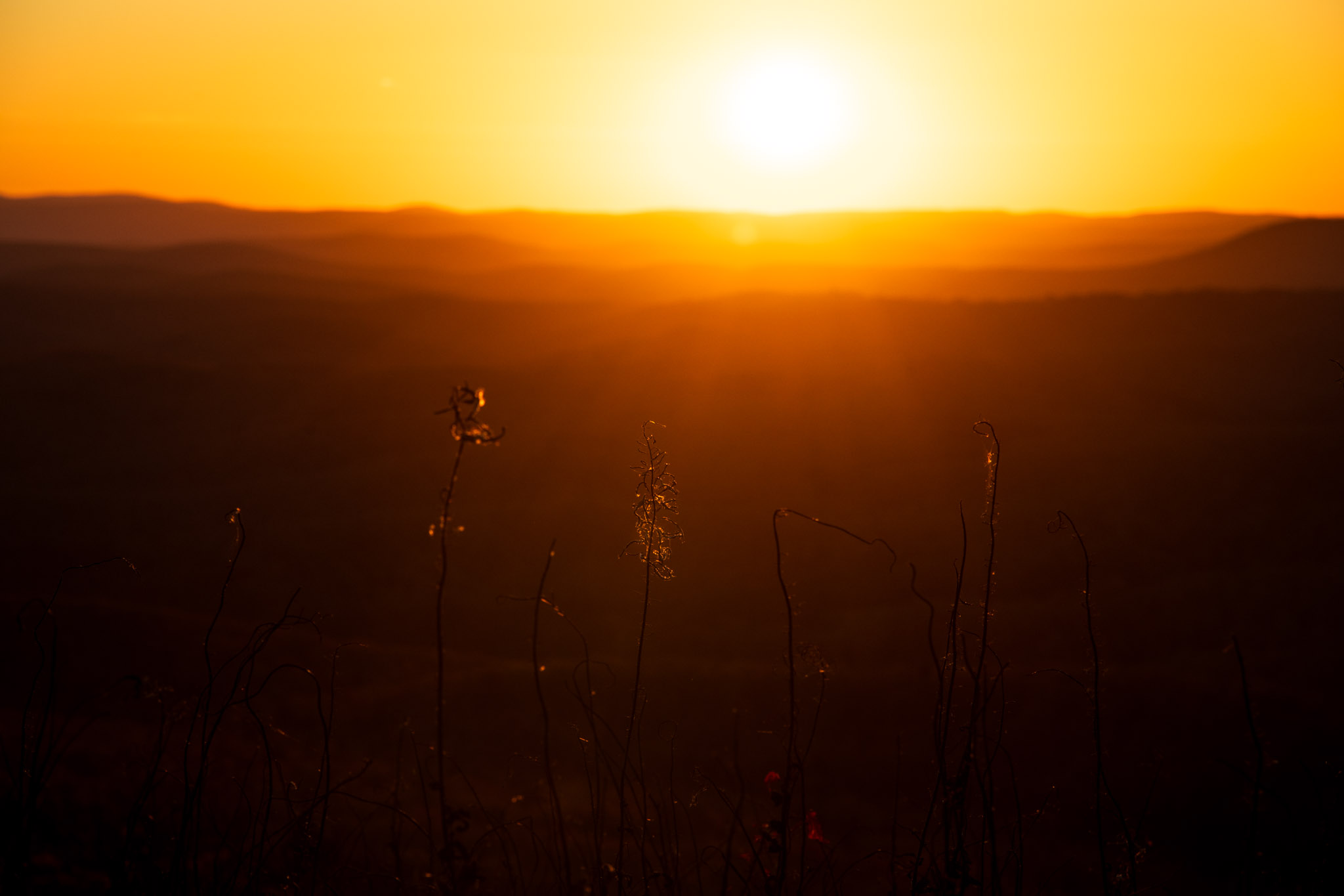
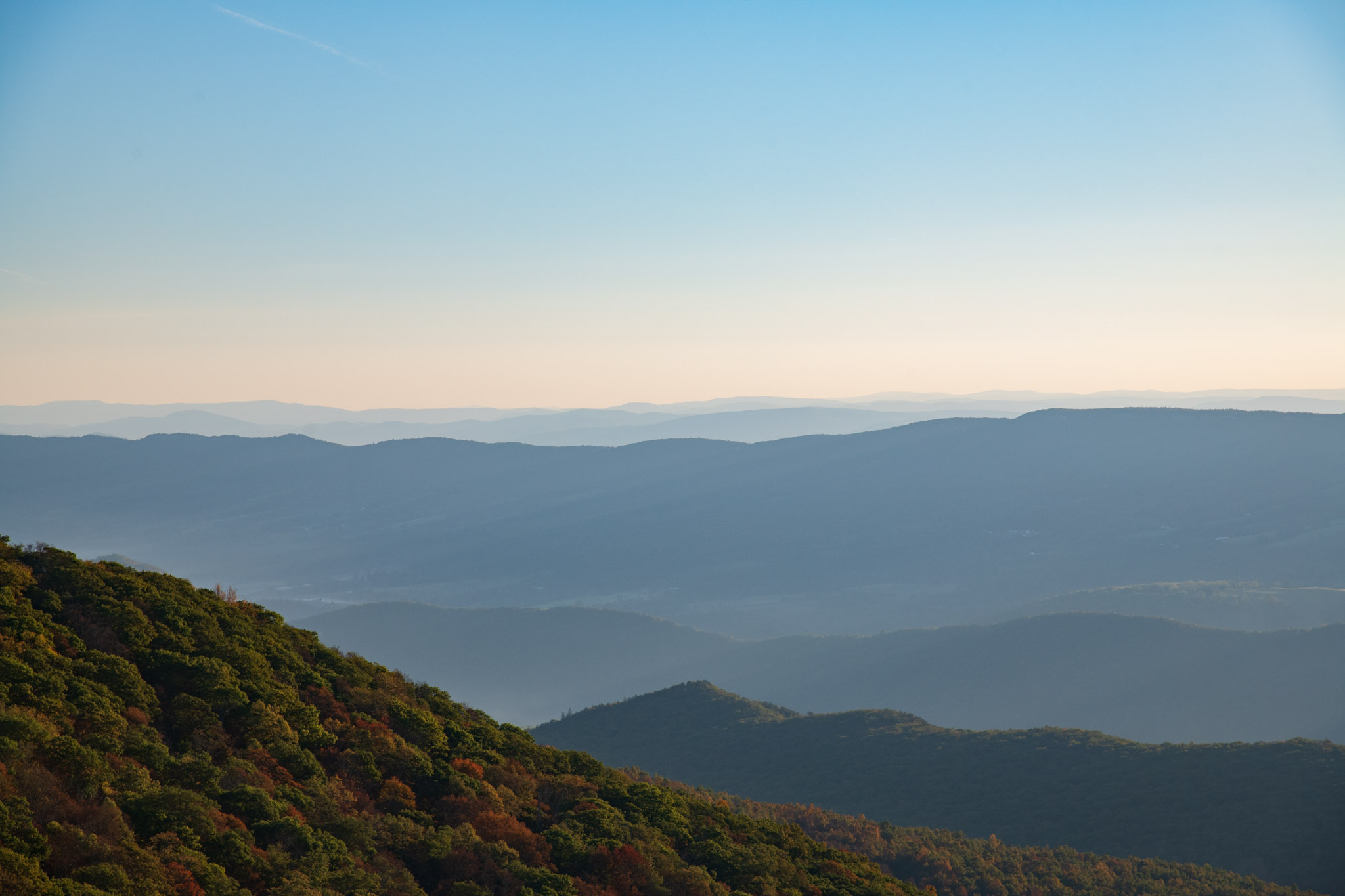
All the leaves were pretty much dead. Seemed like it was either summer leaf color or winter bareness. Still was very pretty. Here is are two only lightly edited pictures (first faces east, second faces west)
-
I saw an all black one that was run over by a bike… which I think sums up a lot of our winters
-
I’m planning to go leaf chasing/hiking to spruce knob wv tomorrow, anyone know how the colors are out there?
-
Finally saw my breath this morning while walking to my 8am classes in Charlottesville!
-
First blue 540 contours over us!
-
Category Five Hurricane Humberto
SnowenOutThere replied to WxWatcher007's topic in Tropical Headquarters
Seems about ready to takeoff