SnowenOutThere
-
Posts
5,623 -
Joined
-
Last visited
Content Type
Profiles
Blogs
Forums
American Weather
Media Demo
Store
Gallery
Everything posted by SnowenOutThere
-
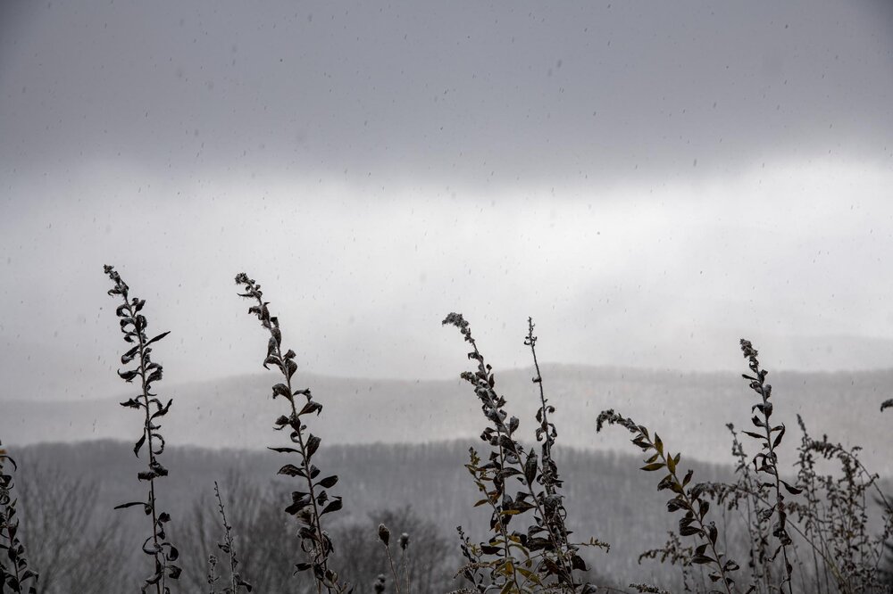
Saw it for a bit in Charlottesville before the clouds ruined my fun
-
I saw that, it seems like models differ on if itll hit either late tonight, tomorrow midday (bad ofc), or tomorrow evening peak
-
I believe that flare would hit Wednesday or Thursday night while the one tonight is seperate
-
And to West Virginia

- 735 replies
-
- 22
-

-

-
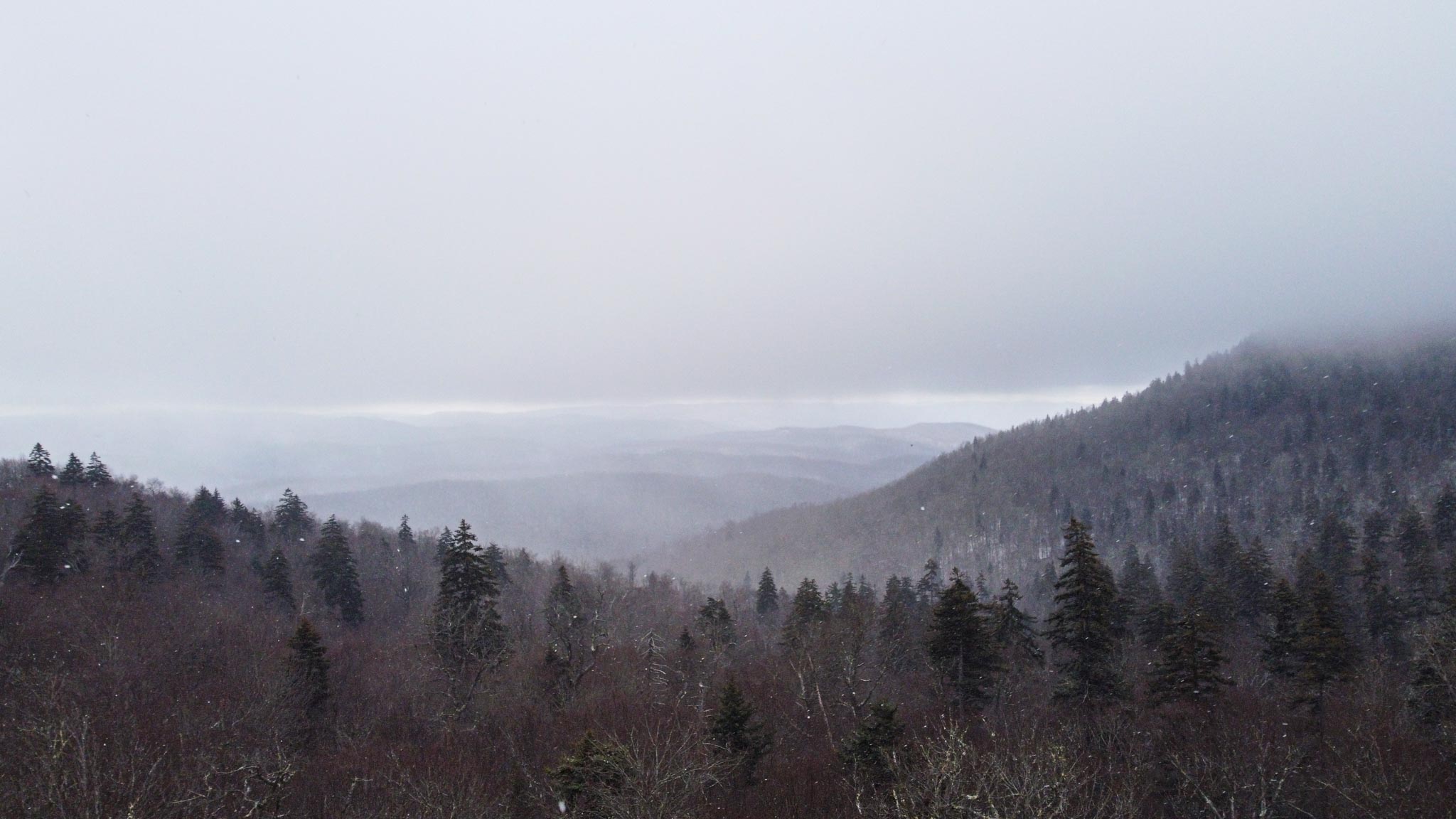
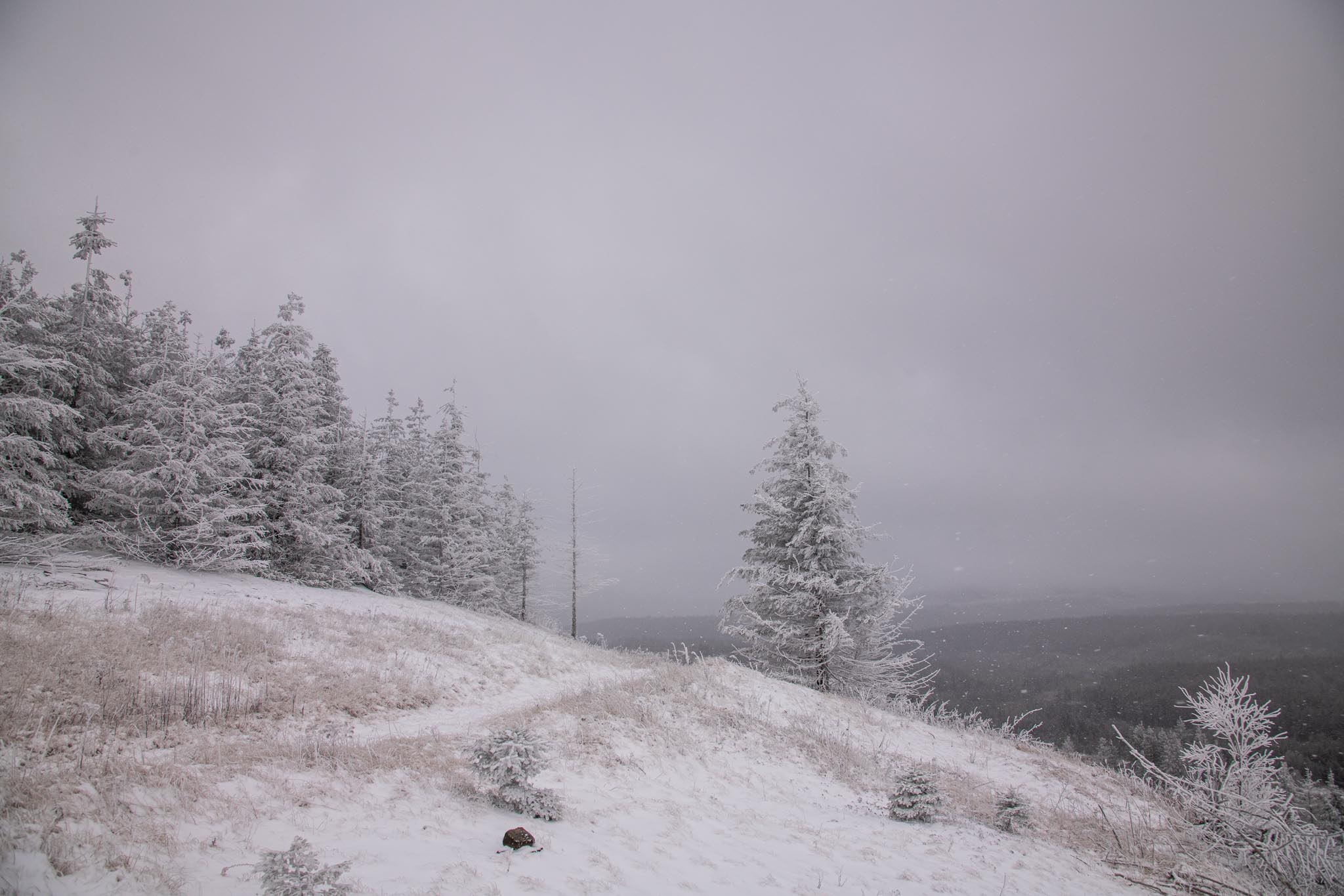
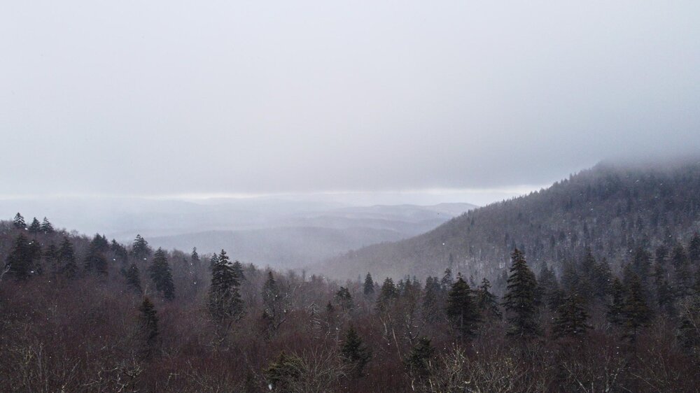
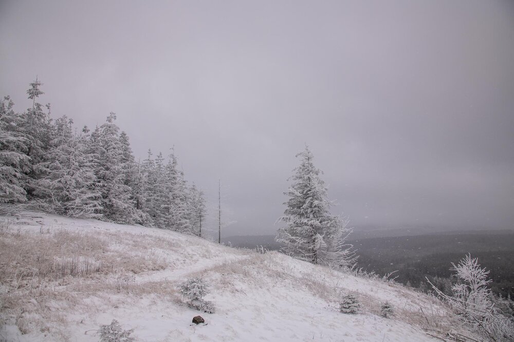
Was quite the adventure! First two hikes I went on were pretty tame with 1-2 inches on the ground (too far north I think) before I headed 10 miles south and got a hike with 3-4 inches on the ground. Couple intense bands punctuated the day as well. Will post some pictures when able
- 735 replies
-
- 11
-
-
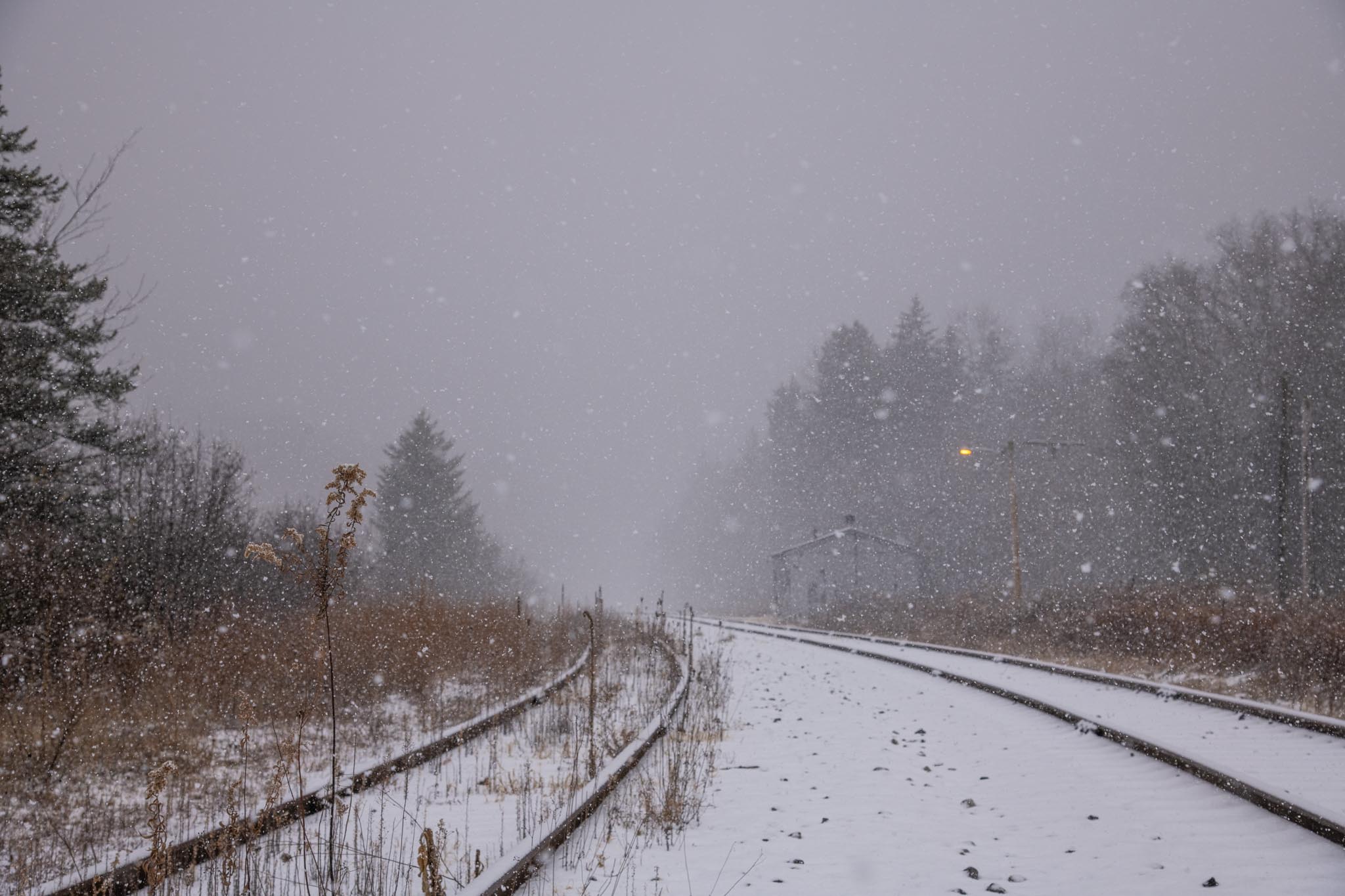
Heading into WV. Snow had started near Monterey Virginia and temps dropped below 30
- 735 replies
-
- 11
-
-
Can’t wait to go hiking out in WV tomorrow! Will probably get to Gaurdineer Knob right around 9am and hike for a while
-
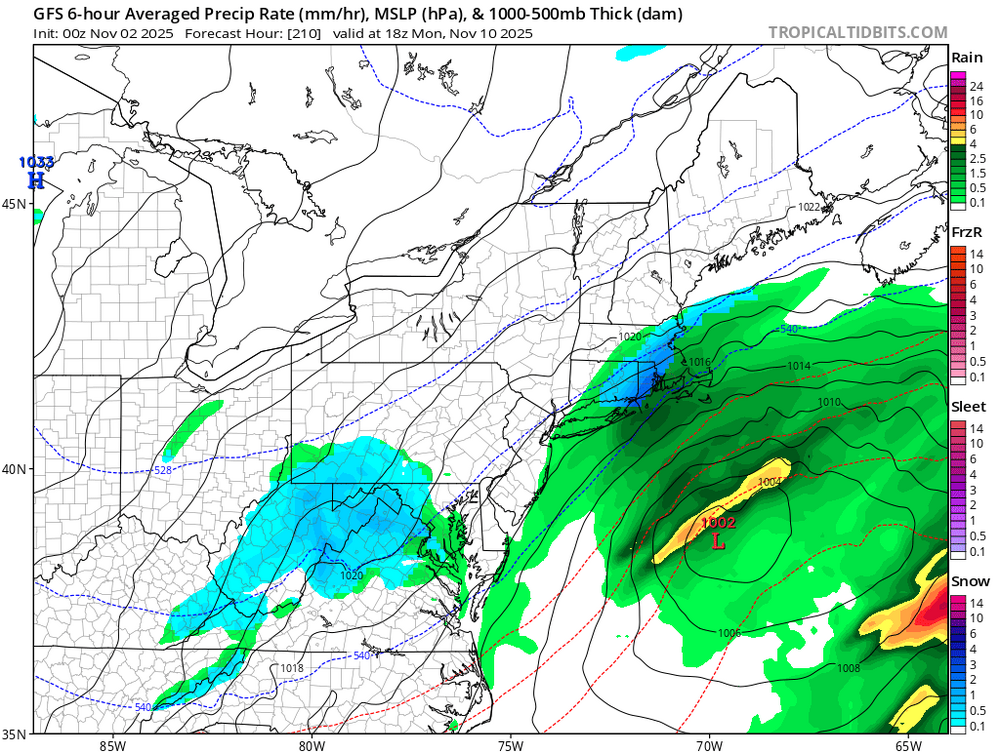
The 12z GFS folded almost completely for how shallow it originally showed the trough. Might be good to keep in mind for later this winter.
-
Latest GFS run stunk pretty bad, worse than 12z for the mountains as it had a less amplified and less deep trough.
-
It'll be interesting to see where the short term models bring this if it doesn't completely fall apart before then. Either way my Monday classes are looking real skippable if WV is getting 2-3 inches OTG and daytime snowfall.
-
Latest GFS does something interesting with the primary costal low as well and honestly gets close to snow from a completely different route
-
Fine, I'll do it myself
-
Also if I did decide to pay for a weather site which one is the consensus pick?
-
Can someone post snow maps for the 6z Euro run? Seems like even UVA might get a dusting from it?
-
To be entirely honest I’m not sure save him fully torching (pun intended) the banner thread what it would be worth banning him over when we have let people stay who add way less value while they bring up climate skepticism whenever they can
-
Don’t worry if last years trends hold true it’ll be congrats Bahamas so theyll lose too
-
Anyways, atmosphere and weather test completed and I think it went pretty well!
-
Crazy to say this about one of our best posters in regards to their meteorological posts
-
On a less pessimistic note than the past couple posts the GFS shows an amazing early season upslope/cold core lapse rate thingy happening on Monday! Gets parts of WV to one foot
-
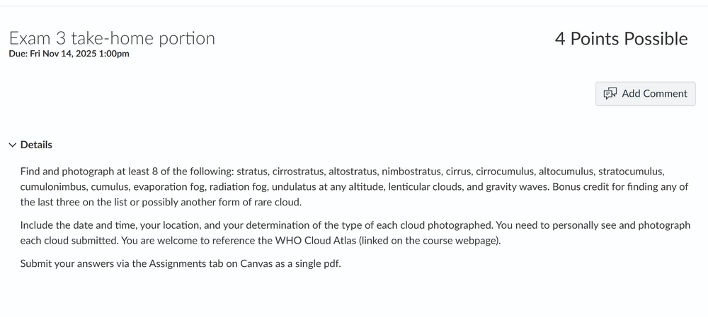
I have my third atmosphere and weather test tomorrow and its all on thermodynamics, saturation vapor pressure, lapse rates, and scew-Ts (I am cooked). So would any met or anyone else who knows what theyre doing check my work on this? @CAPE @psuhoffman @WxUSAF @MN Transplant @high risk
-
European even has not one but two chances for flurries next week! Obviously a long ways away and whatnot but still cool to see.
-
Blue pixels keep showing up around the 10th. Hoping to get some upslope snow
-
Happy Halloween! I have a cloud scavenger hunt for my Atmosphere and Weather course (which is a nice break from the physics of lapse rates, vapor pressure, saturation, and actually learning what a scew-T log P chart means). Would love for some mets @Eskimo Joe @MN Transplant@high risk@WxUSAF to weigh in on when I could find the "rare" clouds (or what soundings to look for on my own). Thanks!
-
Trying to figure out if Shenandoah would have the valley of cloud effect if I went out in 3 hours to the top. Generally it looks like the dew points drop too much though. If anyone wants to weigh in that would be nice.
-
Man I remember that April storm. I was watching weather underground and saw the extended snow totals with us in the 2ft pink zone. What actually happened to cause it to miss?