SnowenOutThere
-
Posts
5,662 -
Joined
-
Last visited
Content Type
Profiles
Blogs
Forums
American Weather
Media Demo
Store
Gallery
Everything posted by SnowenOutThere
-
I just spent the better part of 6 hours hiking that part of shannondoah and got out right as it was getting bad, so trust me you don’t want it. I’m sure some of the roads I used are now underwater
-
Any Mets wanna tell me what hiking the shannondoah tomorrow and Wednesday is gonna be like? I want to take waterfall pictures
-
Cross posting here
- 1,378 replies
-
- 2
-

-
- severe
- thunderstorms
- (and 2 more)
-
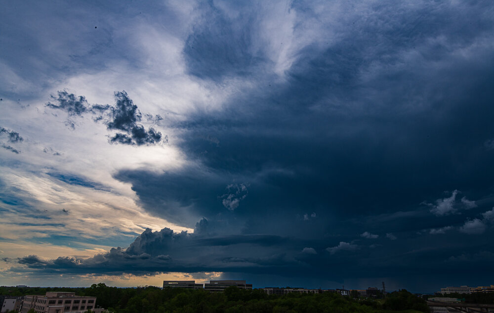
Quickly ran out to the Metro station parking building again as there were some super funky clouds on the cusp of the storms entering. Could see the embedded cell which is hitting Ashburn right now.
-
Got right around .6, not bad and gets the pollen out of the air finally. Excited to be able to go on hikes out west and in the Shannondoah and have the creeks not be dry.
-
I’m just to the east of Dulles airport watching the storm pass literally under 3 miles to the west. Glad the rain will at least get into the ground water from over there.
-
Repost here since it was severe warned with some definite shape.
- 1,378 replies
-
- 4
-
-

-
- severe
- thunderstorms
- (and 2 more)
-
Picture of the Louden storm from around 5 this afternoon. Picture taken at the top of the Herndon Metro parking lot.
- 407 replies
-
- 14
-
-

-
-
Come to think of it that area from Baltimore to Philadelphia always seems to be a hot bed for some of our more impressive severe storms so the bay boundary definitely makes a ton of sense.
-
Mowed outside an hour ago and it was okay for 15 minutes before some breaks in the sun lead to it feeling like a summer morning. At least it definitely feels humid enough outside to rain today…
-
I’m getting February 20th flashbacks now
-
.15 near Reston, hopefully enough to knock out some of the pollen that’s been killing me
-
Wonder if that mcs out in WV can hold itself together for us
-
Warmth down here is fueling some crazy storms up in PA today, if you haven’t checked out their radar I highly recommend.
-
Thanks! My parents feel the same way on that first bit too
-
Its in a super pretty area, and for us NOVA people its in state so the price is... manageable. I agree its hard to justify anything besides in state schools with the tuition. I would've loved to go to a place where it actually snows but sadly they are 2 to 3 times the price. Anyways, If you ever have any questions about it I'll be able to tell you some answers next year! Some of my friends are going to UMD and they keep telling me the food will be better there than at UVA so maybe try that on her.
-
Wanted to give a quick post in the banter thread even though I now rarely post in here. Anyways, as some of the posters here know I joined this forum back when I was in middle school and for a while posted about my various swimming stuff that I've participated in along with some high school stuff. Well, now I am graduating high school! I have committed to UVA (am NOT swimming there because I both don't want to and am nowhere near that fast!) if any posters have gone there any advice would be greatly appreciated. Hopefully I can learn some things to make my posting here a little more informed too, as though I plan to major env sci. and public policy I will hopefully have some time to take some meteorology classes.
- 202 replies
-
- 12
-
-
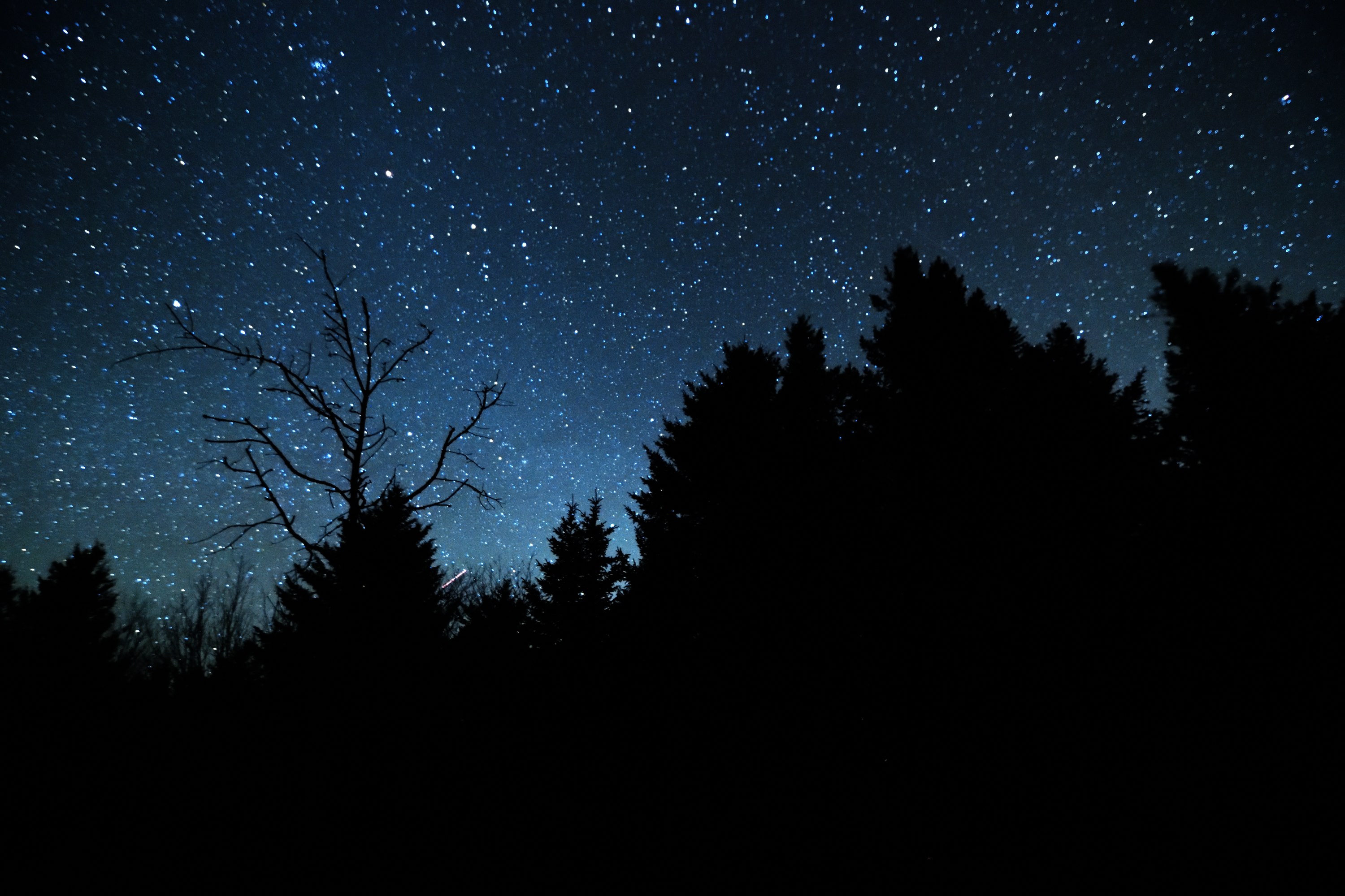
Some polished up pictures from Spruce Knob and the milky way last night. Can't wait for the weather to warm up a bit more and go back so I'm not battling wind and subfreezing temps.

- 581 replies
-
- 17
-
-
Made the journey out tonight (with an assist from a now very tired dad) and it was awesome. Would highly recommend, and there was some snow at the top as a bonus!
- 581 replies
-
- 10
-
-
Tonight seems like it may be the only day that’s still pretty clear, sadly it’s also the day where my car isn’t available though I may be able to get there anyways if it’ll be clear.
-
That’s unfortunate but do you think it would still be at least decent viewing and if not when would a good window be?
-
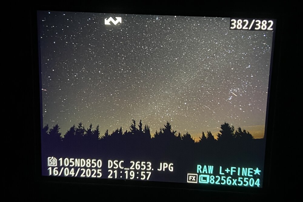
I’m planning on going to spruce knob WV sometime this week for astrophotography could any Mets (or anyone really) weigh in on which night would be the clearest?
-
Honestly the radar's similarities to some recent snowstorms is almost spot on. My backyard rode the edge in each storm this year between the best accumulations to the south and far less to the west and in this storm its the same where I'm at .11 at my home gauge in Reston and .27 at Oakton where I'm at school.
-
Sounds in some ways similar (though far less potential) to last years mini tornado outbreak
-
Congrats Short Pump