SnowenOutThere
-
Posts
5,663 -
Joined
-
Last visited
4 Followers


About SnowenOutThere

- Currently Viewing Forum: Mid Atlantic
Recent Profile Visitors
13,594 profile views


-
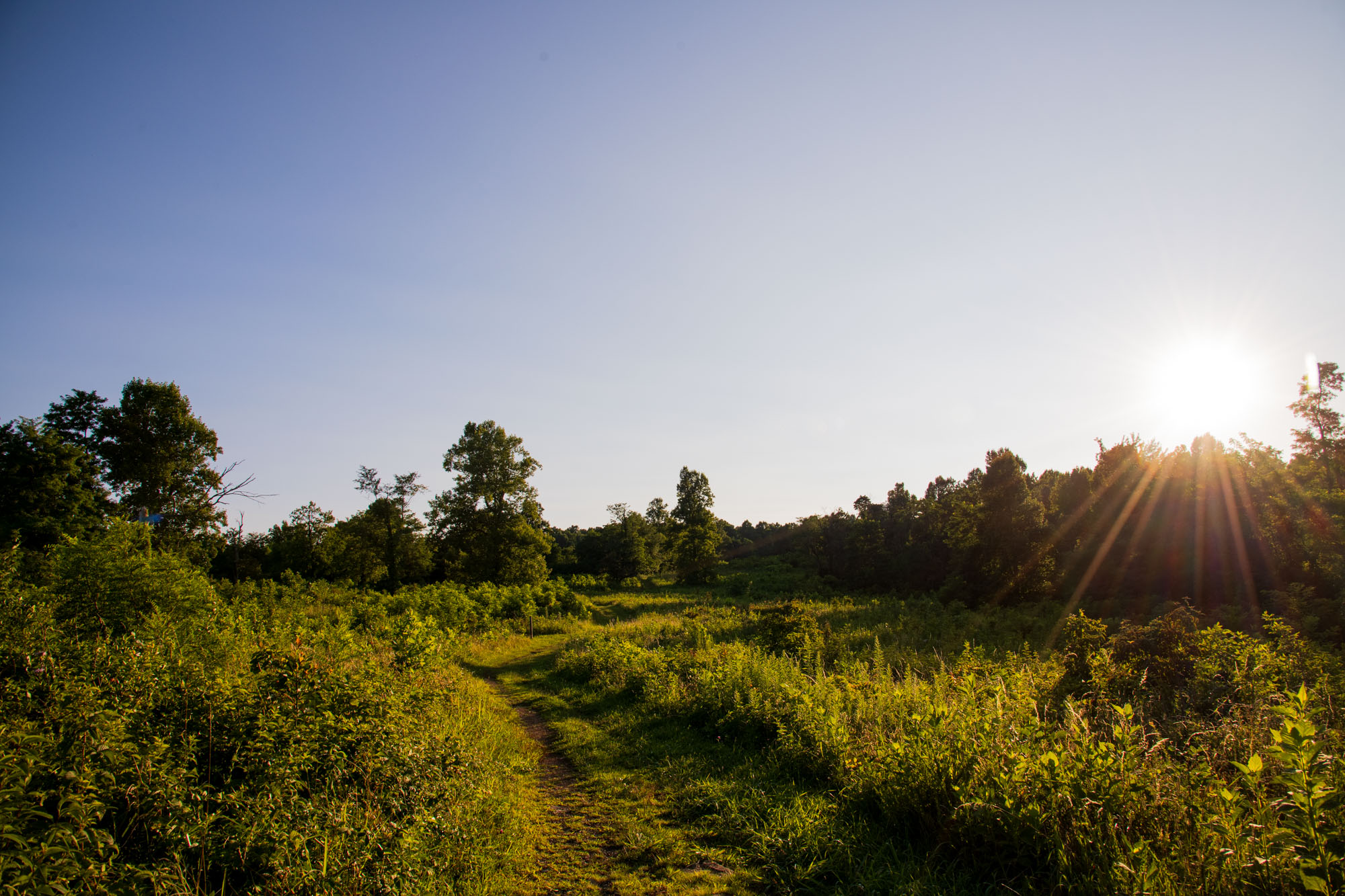
If you need a taste of fall head out to Dolly Sods WV! I went today (I guess yesterday now) and it always amazes me how the Allegheny Front is just a different climate. Drove up from the valley at 82 degrees to the top at 70 degrees. Went on a 12 mile hike and the landscape was beautiful, reminded me of tundra shrubbery I learned about last year in an arctic ecology course. Crossed Red Creek and entered the mud flats for 1 mile which was a bit rough. Otherwise, nearly a perfect day, and would recommend without reservations! (just skip the end of dobbins grade trail and take ravens ridge instead) Driving wasn’t too bad either, 2 hours 35 minutes and the vast majority of it was 4 lane highways (even in WV!). I’ll upload my other pictures later, but here’s one from my phone!

- 11 replies
-
- 14
-

-

-
I'll be joining your ranks tomorrow for a day trip to the Dolly Sods wilderness! I've hiked a bit of Red River in the winter but had to turn back due to the stream crossing. Now I plan to explore the upper marsh/meadow area.
-
I think theres a core issue here with Tor warnings in general. That being, even if there is a TOR, only a very small area of the warning will be actively impacted by the TOR itself. In that regard nearly every TOR warning is an "overwarning" as most of the square mileage of the warning won't be directly affected. For that reason, I think its fine to issue TOR warnings when the radar shows support one may develop as they are meant to be a predictor of a high chance one may occur. If the public fatigued its because they don't understand how warnings work in general. Therefore, the solution isn't to start underwarning but to educate people.
-
Fairfax county is an absolute embarrassment on that map.
-

2026 Mid-Atlantic Severe Storm General Discussion
SnowenOutThere replied to Kmlwx's topic in Mid Atlantic
The Fairfax county split is pretty pronounced today. Hoping the storms near Winchester can rotate in? -
2026 Mid-Atlantic Severe Storm General Discussion
SnowenOutThere replied to Kmlwx's topic in Mid Atlantic
They seem to have a bit of a severe shape to them. Not as extreme as last week when we had better hodographs, but still a good warm sector flow with some organization. The main thing I like seeing is the line of storms swinging into MD starting to fill in a bit more. -
2026 Mid-Atlantic Severe Storm General Discussion
SnowenOutThere replied to Kmlwx's topic in Mid Atlantic
I like that implies we will get upstream storms, so at the very least we should get a nice rainy/thundery evening from whatever remnants can make it our way. Sort of similar to our last setup and getting the MCS from WV. -
I went to backwater falls last January and it was pretty nice. The “trail” is pretty much a straight walkway down to the falls and there’s some pretty nice photography to be done there. I ditched and just did a long exposure of the water/ice in the snow as the lighting was bad when I went. It’ll probably be crowded, there were several families there even in the dead of winter, so that sorta sucked. Worth a small detour, but I personally loved the red river area far more and plan to go back sometime this or next week (and chimney rocks looks sick, but that’s further from deep creek).
-
2026 Mid-Atlantic Severe Storm General Discussion
SnowenOutThere replied to Kmlwx's topic in Mid Atlantic
Can see the clearing happening everywhere around my house on Sat, but ground truth is still cloudy with some haze. That said, think we could be in for a decent severe wx day, we got the parameters for a good squall/MCS so maybe we get lucky and have a nice shelf cloud.- 1,689 replies
-
- 2
-
-
- severe
- thunderstorms
- (and 7 more)
-
You know more than me of course, but I have to think we’re seeing the pattern shift happening. We’ve now had a string of strong lows move by to our north, which if it wasn’t mid summer and the thermal boundary wasn’t up in Canada they would be our synoptic rainfalls instead of convection along the cold front. Now this week looks to have a cutoff low over the northeast that dumps rain too. We still might have some dry periods but it seems, to me at least, the real drought period is over.
-
Man, the silver line extends out to Reston for a reason. You’d get a whole 30 minutes to maybe even an hour of more snow before the flip to rain in our warmer 2016 redux.
-
Took advantage of the excellent weather yesterday to hike sky meadows. Only an hour ride from NOVA and nearly a straight shot on 66 West. Wasn't expecting too much, but was blown away by the views it offered. Highly recommend to anyone wanting to go on a relatively easy escape into nature. Best part of course was the weather. Mid to low 70s in the forest with nice dewpoints too. Also had the moon as nice friend the whole hike!
-
Beautiful morning out. On ffx county parkway where it overpasses 50 could finally see past the blue ridge way to the distant mountains. Otherwise, mid 60s and low humidity means I get to wear a jacket today to coach!
-
Not enough people are talking about the legendary stretch of weather coming up from tomorrow till Saturday. Highs barely past 80 degrees and dewpoints in the low to mid 50s in MID JULY. It’ll be the first look ahead to fall weather wise!
-
2026 Mid-Atlantic Severe Storm General Discussion
SnowenOutThere replied to Kmlwx's topic in Mid Atlantic
Think I'll get to the herndon metro tower as my chase spot. Looks to get a good view as it comes in.- 1,689 replies
-
- 3
-
-
- severe
- thunderstorms
- (and 7 more)