Ephesians2
-
Posts
537 -
Joined
Content Type
Profiles
Blogs
Forums
American Weather
Media Demo
Store
Gallery
Everything posted by Ephesians2
-
Are you thinking ice storm potential in Southwest/Central/Southside VA into RIC? Or mostly sleet?
-

Richmond Metro/Hampton Roads Area Discussion
Ephesians2 replied to RIC Airport's topic in Mid Atlantic
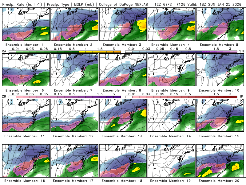
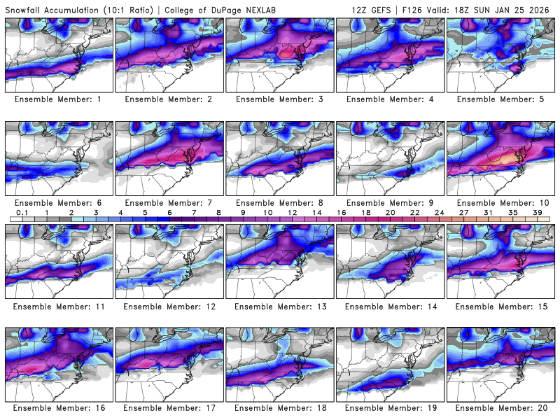
some of the individual members on the EPS were genuinely concerning. Not just mixing, but there were a few pure ice storm solutions. I think everyone in this forum would be content with warning level snow --> a couple inches of sleet --> maybe some snow on the backside -
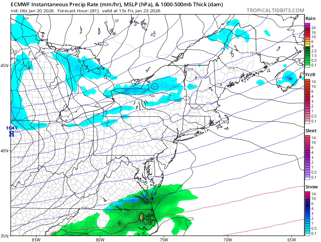
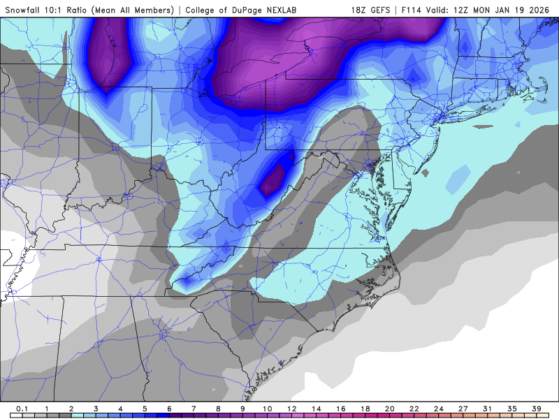
Healthier precip shield at 84...
-
Next window of opportunity?
-
overheard at grocery store: > "8-10 on Friday and 10-20 on Saturday" > "they're calling it the storm of the century" Now, I wonder what AI slop weather page on Facebook came up with that
-
Richmond Metro/Hampton Roads Area Discussion
Ephesians2 replied to RIC Airport's topic in Mid Atlantic
Compromise between GFS and UKMET/CMC would be ideal -
Maybe to an extent, but there are definitely are some misses to the South for most of the region on the individual members. Outliers though
-
Not a great shift on the GEFS.

-
Euro had something similar but further south Seems like a weak wave developing along the boundary from Thursdays front.

-
Let's keep it right where it is ... Although there's something to be said for sleet, in that it keeps snowpack around for a while. I got 4" snow and sleet in Jan 2022, and it stuck around for two weeks. Also the last two runs of the (fantasy range) NAM have shown a weak disturbance bringing some snow to the VA/NC border and north on Friday. There was some support for the idea on the Euro, otherwise I wouldn't be talking about it @BornAgain13

-
Richmond Metro/Hampton Roads Area Discussion
Ephesians2 replied to RIC Airport's topic in Mid Atlantic
Last two runs of the (FANTASY RANGE) NAM have shown a disturbance to our south on Friday. There was some support for the idea on the Euro too.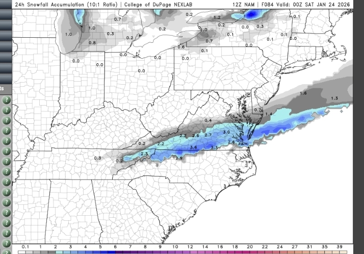
-
also I have 8" on the year and you all have maybe half that, so the likely north trend = reversion to the mean
-
I'd be okay with a sleetfest here in Central VA, as long as we get warning level snow first. Would be great to keep the snowpack around as long as possible.
-
Richmond Metro/Hampton Roads Area Discussion
Ephesians2 replied to RIC Airport's topic in Mid Atlantic
We need this trend to stop soon -
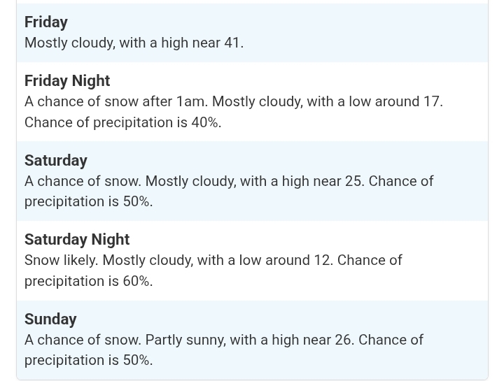
"Snow likely" 5 days out is rare.
-
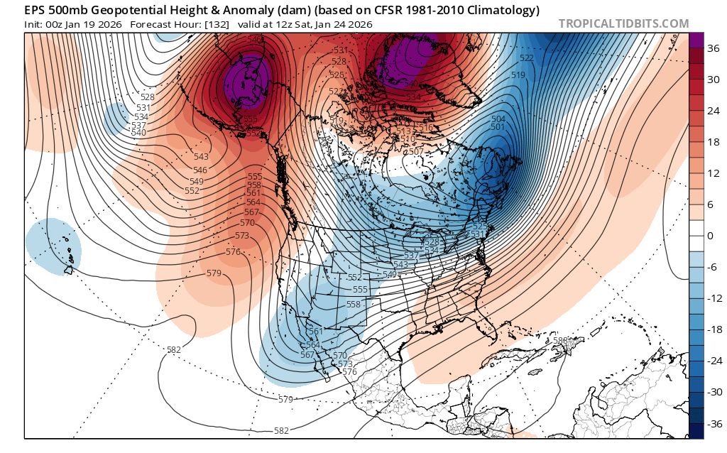
Disclaimer: I'm not the expert at upper level analysis by any means [Edited to remove a sentence that demonstrated that fact] But this doesn't look quite like the "HECS" look that supports a low that strong though its a very good pattern This is -EPO, -NAO, with a neutral looking PNA with the ridge offshore. The -EPO delivers arctic air while the -NAO stops the storm from cutting NW. This looks like it would support, at the upper potential, an overrunning event like Jan 2010 or... Dec 2018 (you all would love that if it had been 100 miles north) with widespread double digits totals, but not the 18-24"+ totals that would be "historic".

-
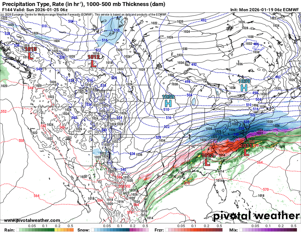
6z Euro at 144
-
-
12.12.2025 T 01.03.2026 T 01.17.2026 0.1 Total 8.2"
-
Getting some Snow TV with this band.

-
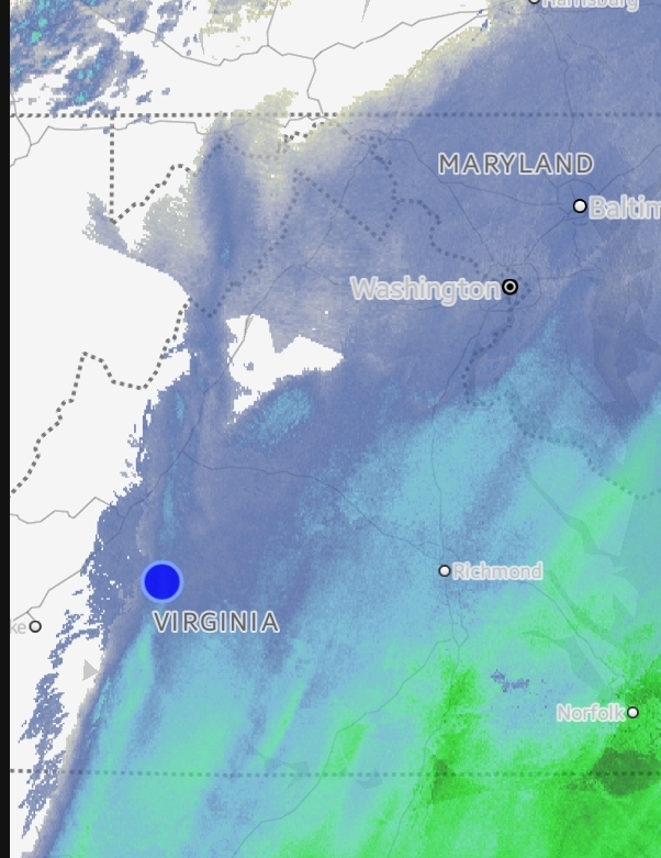
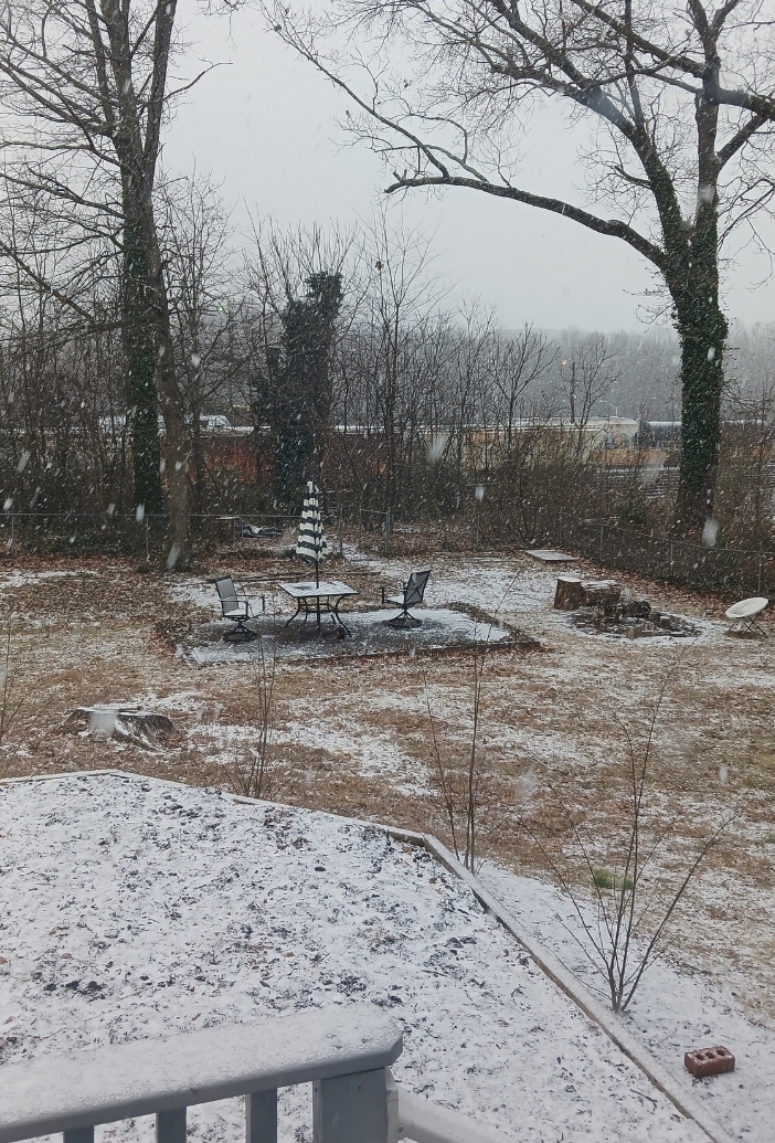
This was unexpected to wake up to

-
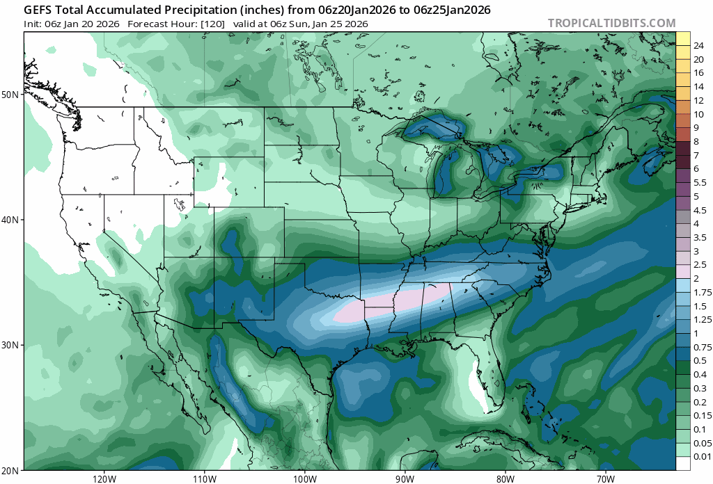
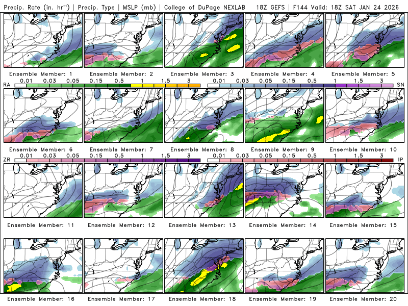
GEFS is northwest of 12z and wetter: (DCA went from 1.2" mean to 2.3") There are also some members more amped than the op:
-
Richmond Metro/Hampton Roads Area Discussion
Ephesians2 replied to RIC Airport's topic in Mid Atlantic
Chance of a light event for Saturday is still alive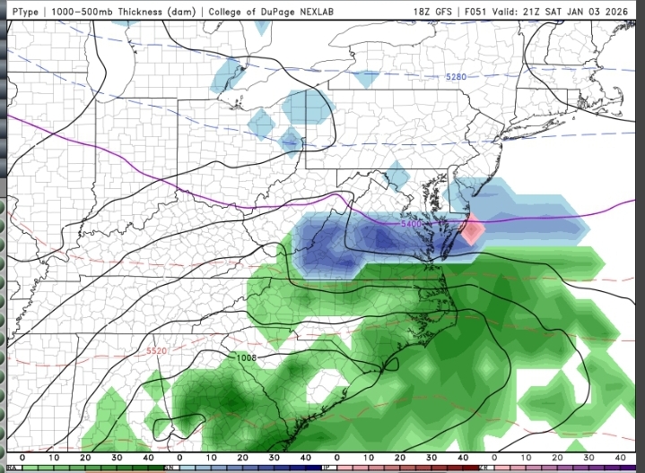
-
It's within striking distance for DC south, we just need temperatures to trend down a few degrees
-
Sorry if this has already been posted here.