

Spanks45
-
Posts
4,366 -
Joined
-
Last visited
Content Type
Profiles
Blogs
Forums
American Weather
Media Demo
Store
Gallery
Everything posted by Spanks45
-
Quite warm out there, 86⁰/69⁰ atm...smokey, haze beginning to move in now
-
Yup dry here of late, in that green stripe....what seems to be the only green stripe in CT. Definitely need some rain or watering in the garden regardless of what happened the first 10 days of the month.
-
51.4⁰ this morning, 3rd morning in a row of temps in the low to mid 50s
-
52.5⁰ this morning, can't we have this all the time?
-
I wish they would have been installed sooner, so I could take advantage of the best solar production months. Unfortunately we ended up needing a new roof first.
-
Just got hooked up today, I fully anticipate clouds and rain until further notice....
-
Windows open, a/c off, 54.1⁰ for the low....
-
Looks like a partial solar eclipse out there right now. One would think just a bunch of low clouds until you take a picture with the sun in the shot....
-
Stein has returned here...0.20" so far here today, missed inches of rain by 5 miles, now everything heavy is to the NW. It probably is alright though, 8.5" in the first 10 days of the month should keep the groundwater levels high for the foreseeable future
-
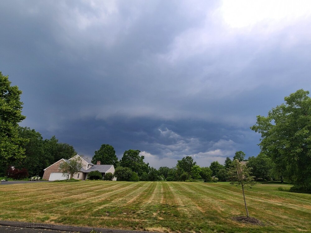
kick the kids out of the pool, right before a lighting strike over the house with the sun out and no rain.....loudest crack of thunder in quite some time too
-
Sort of reminds me of when I was in college and took 4, 3 week courses at the Marine Science Consortium in Wallops Island VA. One of the courses ran from the end of July through early August, our sleeping arrangements were in the old Navy barracks, no A/C. The mosquitoes were the size of birds and my thermometer would not go lower than 85 at night. I never want to ever experience that again, I can imagine it was close to what the gulf states feel like during the summer....They have since renovated those dorms and added A/C....ha
-
Started cutting tomato branches with blight. Ten days, 8.5" of rain is never good for tomatoes, glad to see some dryness the next couple of days. Tons of tomatoes on the plants in desperate need of sun and heat....
-
Some nice sunset pictures from the neighborhood....
-
Looks like the rains have pushed further SW than forecasted....thankfully
-
3.7" since midnight yesterday, 7.54" MTD It can stop raining for a bit now, my tomatoes are going to start to rot...
-
2.19" since midnight, finally a break in the action
-
Just your normal 9+ inches per hour rate....
-
lets not....I was impressed with the 2 am storm that dumped almost an inch in 20 minutes, this one is saying hold my beer
-
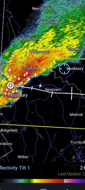
Quite the hook on there...
-
finally a warning with that cell.....
-
not stop thunder to my west.....lets see if that cell makes it here or falls apart like those almost always do
-
Starting to show a bit of a twist to it....I am 20 miles to the east of that
-
Not much here....missed to the north
-
89.8/75...just finished mowing, a roaster out there!


