Spanks45
-
Posts
4,368 -
Joined
-
Last visited
Content Type
Profiles
Blogs
Forums
American Weather
Media Demo
Store
Gallery
Everything posted by Spanks45
-

26th-27th event, coming at us like a wounded duck.
Spanks45 replied to Go Kart Mozart's topic in New England
can something actually go right here, I feel like it has been way too many years.....I mean, anything above 5 inches would rank 2nd biggest since 21/22 season -
26th-27th event, coming at us like a wounded duck.
Spanks45 replied to Go Kart Mozart's topic in New England
It does have that look of a fluff bomb for a few hours, somewhere....hopefully right over our heads (if we are being selfish, lol) -
26th-27th event, coming at us like a wounded duck.
Spanks45 replied to Go Kart Mozart's topic in New England
Watching that band traverse from the NW to SE yesterday, never quite making it here is probably what we will see again....hoping it parks it self just enough in our direction this time. For everyone, hopefully it is as thick as SNE...lol -
lost it years ago....point is we have been waiting years for one of them to fill the ace roll, otherwise we have had a starting 5 that looks like the Rockies....
-
I mean, it feels like with the Euro losing the ace role, someone needs to step up, at some point...the skynets have a great start from time, but then get hit around. So....
-
26th-27th event, coming at us like a wounded duck.
Spanks45 replied to Go Kart Mozart's topic in New England
Icon looked decent for most of SNE...hopefully it has a clue -
26th-27th event, coming at us like a wounded duck.
Spanks45 replied to Go Kart Mozart's topic in New England
Might be similar to what we just saw with regards to yesterday's system, just more overall. -
I think the issue is....while there is plenty of cold air nearby, there is also plenty of warm air nearby. So, at some point the pattern will shuffle and odds are the warm air is coming this way. Doesn't mean it won't snow because of the time of year, but we all know how the past few years have gone....
-
26th-27th event, coming at us like a wounded duck.
Spanks45 replied to Go Kart Mozart's topic in New England
I have to travel to PA on Saturday morning, regardless of what happens it looks like we will have to delay our trip until Sunday -
26th-27th event, coming at us like a wounded duck.
Spanks45 replied to Go Kart Mozart's topic in New England
glad it was the nam, but that was a rough way to start 12z -
White Christmas Miracle? December 23-24th
Spanks45 replied to Baroclinic Zone's topic in New England
Ran to the hardware store yesterday, there wasn't much snow around.....how much did you end up with? -
26th-27th event, coming at us like a wounded duck.
Spanks45 replied to Go Kart Mozart's topic in New England
I'm from the Mid Atlantic region, plus spent 7 years in Delaware, the past 4 years on average around here is what I would average from where I grew up....So I guess I am sort of used to it, but spending the last 10 years up here, it has been rough from that standpoint. I mean, anything above 5" would be the 2nd biggest storm here since the 21/22 season...So maybe we can top that with this one -
Interesting to see once again the models lose the warm up in the extended...Should continue to offer chances into January with that look
-
White Christmas Miracle? December 23-24th
Spanks45 replied to Baroclinic Zone's topic in New England
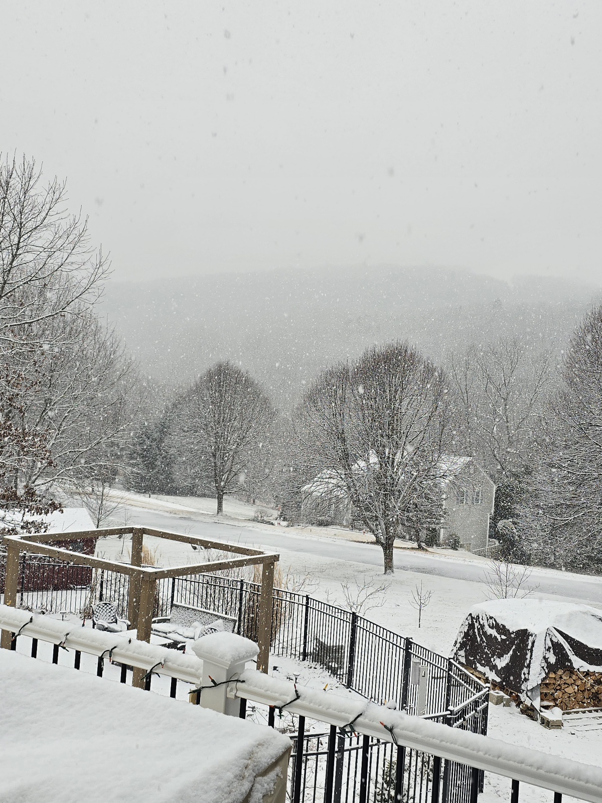
So thats what real snow looks like, congrats to all those that got it.....finished with 1.6" here. We were right around freezing most of the night and already up to 38 so just a coating left over outside of the north facing/protected areas. I doubt we have much left by tomorrow morning. -
The block will push this to the mid atlantic, but I am sure it won't be there to block the next one that will barrel straight through the lakes....just can't win, lol. I guess I can't complain, I pulled off 1.5" this morning that will most likely be gone by tomorrow.
-
White Christmas Miracle? December 23-24th
Spanks45 replied to Baroclinic Zone's topic in New England
1.4" should probably do it....temp has creeped to freezing and the radar looks pretty weak.... -
White Christmas Miracle? December 23-24th
Spanks45 replied to Baroclinic Zone's topic in New England
1" so far, still coming down pretty well....temp 29.8⁰
-
White Christmas Miracle? December 23-24th
Spanks45 replied to Baroclinic Zone's topic in New England
Decent snow growth, moderate at the moment...0.6" so far, temp stuck at 29 here in our valley. Looks wintry out there.. -
Riveting string of storms...Im sure once we get one that has some actual precip with it, it will cut through the lakes and drive the temps up too, definitely feels like the twilight zone, more like groundhog day
-
White Christmas Miracle? December 23-24th
Spanks45 replied to Baroclinic Zone's topic in New England
Maybe it will help out with the 26th as well....wishful thinking? Lets just get a regionwide 2-4 and hope for clouds on Christmas eve to maintain the 'pack' for Christmas -
Yeah, just started to rip here in the valley...been sort meh so far
-
Wind driven rain, 55⁰ and 0.60" in the bucket...wish the ground would thaw and allow the water to soak through, otherwise the yard is going to become a brown glacier, perfect for kids and walking the dog
-
GFS looks fun, if you want to escape any snow past the 23rd/24th "event".....Sheesh, I know it is the OP Post 144 hrs, but seriously that is hideous
-
now what is going around, I feel like there was something being passed around since school started... Sun is finally out, feels fantastic outside, I think I am ready for spring, Lol
-
keeping the "pack" strong for 1 more day....It is odd that it hasn't updated yet, still states mostly sunny...at least throw a clouds to sun for those who just rip and read forecasts, that is why I prefer the NBC10 over the NWS for everyday forecasts.