Spanks45
-
Posts
4,368 -
Joined
-
Last visited
Content Type
Profiles
Blogs
Forums
American Weather
Media Demo
Store
Gallery
Everything posted by Spanks45
-
Yeah, not happy with today's weather....37⁰ with house shaking gusts, going to need the wood stove today at this rate
-
Stratus had 1.95" in it this morning, 1.85" in the Davis.....good soaker and hopefully the start of knocking back the drought 52° currently, feels/smells/sounds like early spring should
-
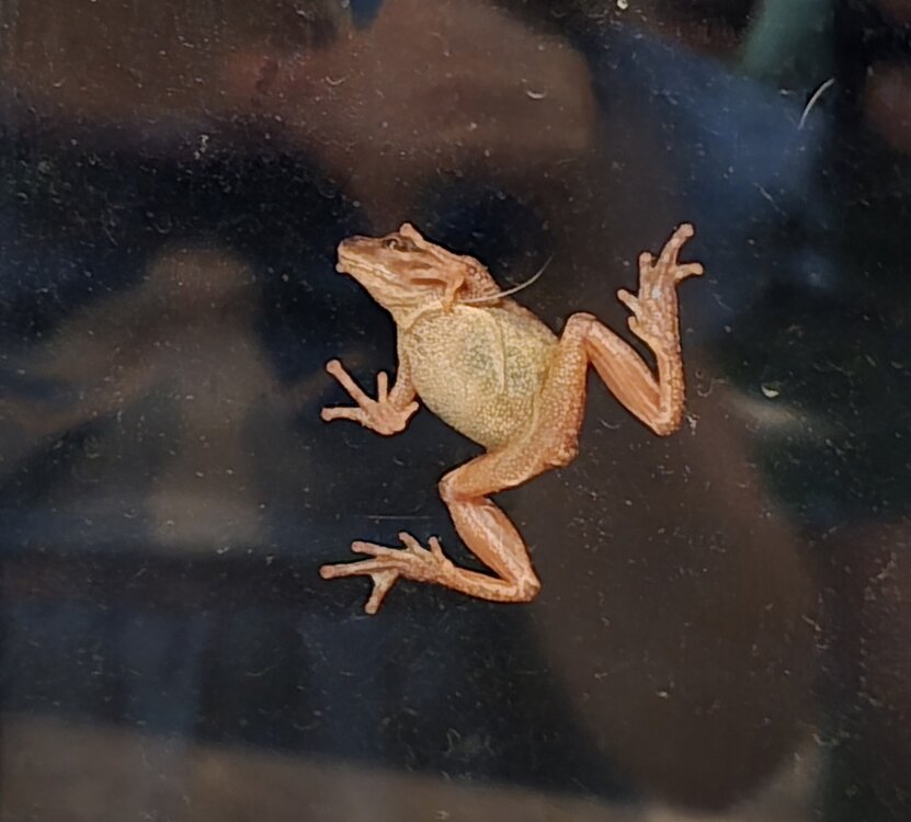
My Davis has 1.08", it runs low during heavier rainfalls. Not sure what the stratus has, will confirm in the morning....despite all of the cold, this guy was hanging out on my window, Spring is here! And I just noticed my kids shirt has Elsa, clearly we have some mixed signals here...lol
-
It really has been simple....if all the models agree, we have something, if there is a model battle, doesn't matter which model it is, if it shows the least snowy potential, it will be right way more times than not. It has been this way for the past 3 years, so why would it be wrong now?
-
Look at my snowfall totals in my signature for March....they are since I have moved to Southbury, not exactly the most exciting snow month here recently, especially when it pretty much melts as soon as the sun comes up. Either we are due or it's the same old garbage, just a different year......
-
Up to 47⁰ here with light winds, kids wanna put tshirts on, lol
-
And finally, not much but at least it is a start...good taste for the first round 46⁰ for the high, low was 21⁰
-
Clouds definitely hung around more than expected today, along with a pretty steady breeze and it was quite chilly...hoping for better tomorrow and definitely Wednesday. One thing is for sure, the kids and dog are dragging mud into the house today...it has begun
-
My garden does not like this comment, neither does my well or my pool water level. They are all connected.....lets keep some rain around at least, otherwise my property becomes the desert southwest pretty quickly
-
Sounds and smells like Spring out there, I am ready... ..
-
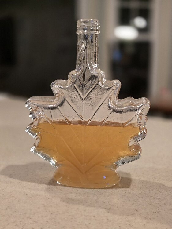
I had tons of sap last year at this time. This year, barely any from even the southern facing trees. The ones in the woods, absolutely nothing...Definitely need some warm temperatures to kick start things. At some point we will get so warm that the trees will start budding and the season will be over..
-
The Nam solution isn't happening, but could be a bunch of light snow, dustings to an inch variety...just enough to cover the sheet ice and make it even more dangerous to traverse
-
I hope it happens....poor Nam gets beaten down every storm and rightfully so, but is always good with mid level warmth...maybe it will finally have its day or not...lol
-
Snowfall aside, it has felt like winter for 3 winter months and I have the most seasonal snowfall of the past 3 winters. If I had no clue what the snowfall averages were and I didn't stare at weather models all day I would think this was a pretty decent year. I would be at average snowfall if I was still living in SE PA. On that note, I wouldnlove to thaw the glacier in my yard, dangerous to even take the dog outside...let alone kids play on it
-
Love how Sussex County Delaware has a similar number as I do....
-
And it will be right with coastal, that far out too....perfectly placed low pressure and no cold air available. Man, winters suck now.
-
If this was 4 or 5 years ago, it would be interesting....but the way things have gone, you can bet the house it won't happen. Doesn't matter the model, if it shows the least snowy outcome, it will be right. Ensembles haven't been really helpful either...this is the 3rd year that just doesn't want to snow around here.
-
Still sitting at 33.1⁰ I swear the trees continue to accumulate despite being above freezing. I was hoping the slushy/icy mess would melt off the walkway and driveway, but unless we get some real spike in temps soon, everything is going to freeze solid.
-
We melt now....32.7 with more heavy rain bands moving in. Unless we get some decent winds, I bet my valley rots between 33-35 most of the time
-
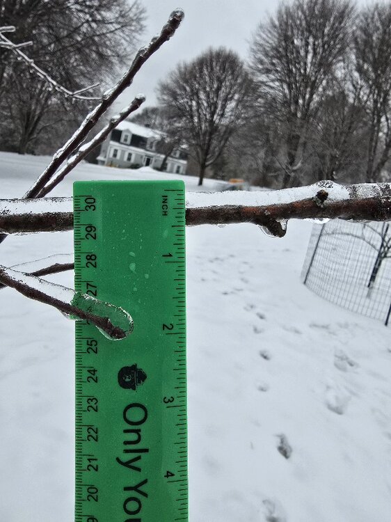
I knew there was some odd rules for that....I recall better ice years back, the sag on the trees is impressive at the moment...otherwise, I have seen worse
-
Temp up to 31.1⁰ now....decent amount of ice on everything. Maybe a 0.25" of accretion? There was a lot of sleet at something which cut down the ice numbers for sure.
-
Temperature has actually dropped a bit over the past hour, back down to 30.4⁰ freezing rain is mixing with sleet. Should be nice looking when the sun comes up....
-
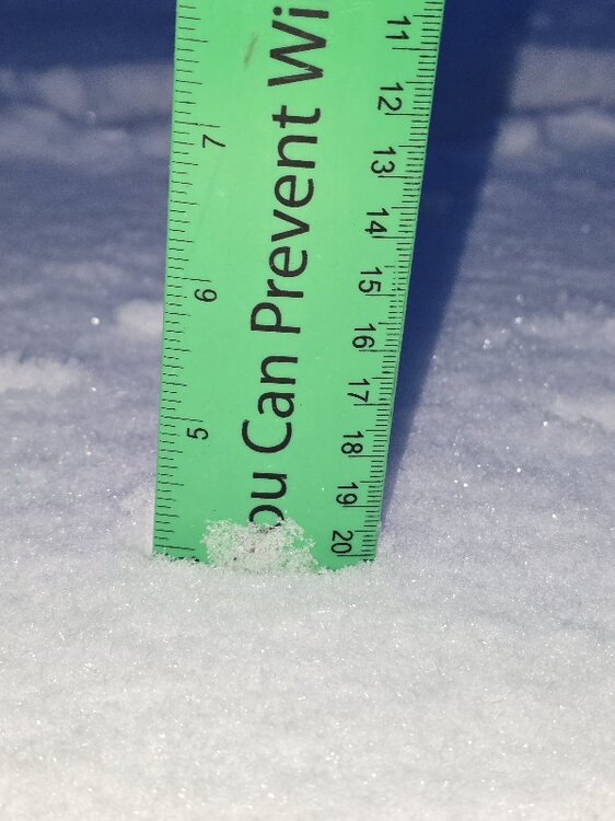
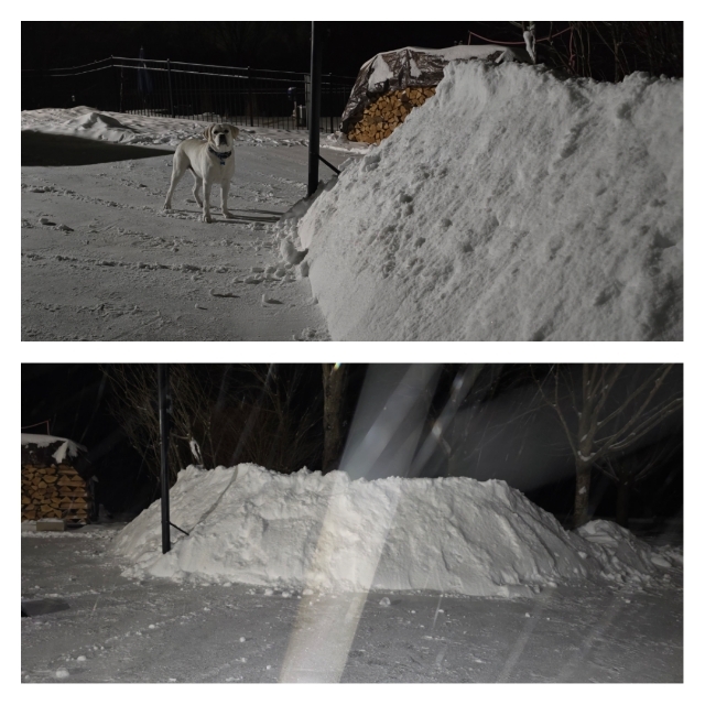
2", now mostly freezing rain....26.8⁰ currently. Did a quick shovel to add to the snow fort for the kids...this thing will be here for a while
-
Getting ready to go and shovel here....sleet now mixing in, will get an official amount shortly
-
Heavier bands moving in, almost an inch down...temp hanging around 25.9⁰ Actually out walking around and the pack is better than expected on the north side of the house...held up well this week. Let's glacier this thing