MN Transplant
-
Posts
17,494 -
Joined
-
Last visited
Content Type
Profiles
Blogs
Forums
American Weather
Media Demo
Store
Gallery
Everything posted by MN Transplant
-
My vote is for August, but I understand the sentiment.
-
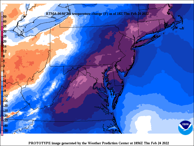
51, 49, 49 at DCA, BWI, and IAD. Even 50 at home. Spring will not be denied.
-
First daffodil today. Some irises have been up since Saturday. Nice to see.
-
Yeah, that is clearly an error. Nice find.
-
Haven't been down to the Jefferson since it was cleaned. Nice!
-
In a truly shocking development, temps are overperforming with a frontal passage. High of 57.4.
-
Feb 24-25, 2022 Ice/Sleet/Rain/Snow (yeah sure) Storm Thread
MN Transplant replied to WinterWxLuvr's topic in Mid Atlantic
Another reminder of how sensitive these borderline icing events are to solar radiation, even on cloudy days. Having a night event is such a huge plus. -
Good stuff, Rodney.
-
My main note on 3/21/18 was that I lost to all three airports (3.7”). 3/6 was very warm ~35 for the snowfall here so I’m not surprised it didn’t collect in DC. 0.9”
-
Feb 24-25, 2022 Ice/Sleet/Rain/Snow (yeah sure) Storm Thread
MN Transplant replied to WinterWxLuvr's topic in Mid Atlantic
Proof!
-
Feb 24-25, 2022 Ice/Sleet/Rain/Snow (yeah sure) Storm Thread
MN Transplant replied to WinterWxLuvr's topic in Mid Atlantic
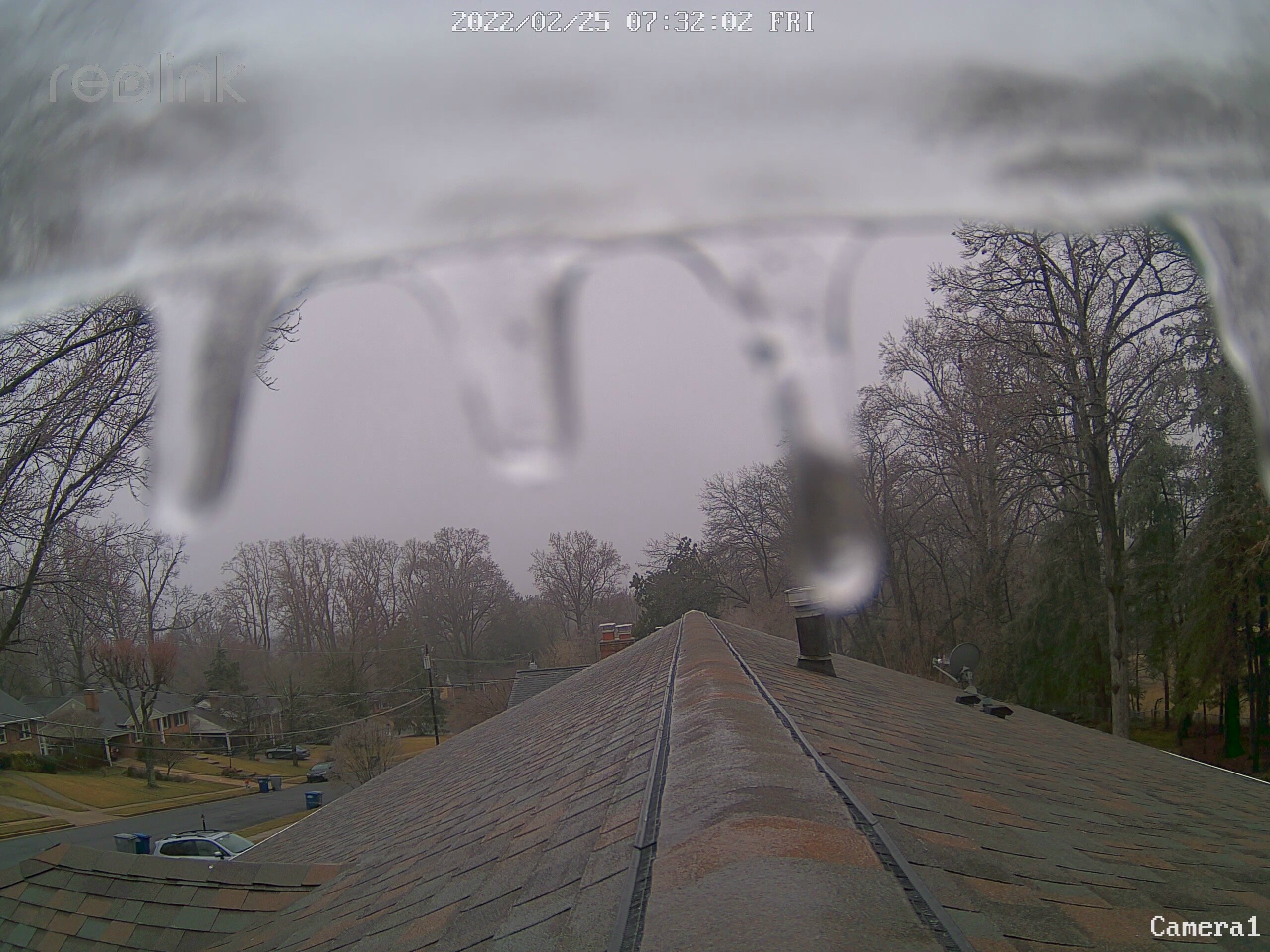
This might be where my extra couple hundred feet helps me out. Decent coating of ice on trees and other elevated surfaces. Lowest temp was 32.4 on my station. -
Feb 24-25, 2022 Ice/Sleet/Rain/Snow (yeah sure) Storm Thread
MN Transplant replied to WinterWxLuvr's topic in Mid Atlantic
This is a nothingburger as far as precip goes, but 33 midday after a 76 the prior day is pretty impressive. -
Feb 24-25, 2022 Ice/Sleet/Rain/Snow (yeah sure) Storm Thread
MN Transplant replied to WinterWxLuvr's topic in Mid Atlantic
0.08” rain, 34.4 -
Feb 24-25, 2022 Ice/Sleet/Rain/Snow (yeah sure) Storm Thread
MN Transplant replied to WinterWxLuvr's topic in Mid Atlantic
PRES HGHT TEMP DWPT RELH MIXR DRCT SKNT THTA THTE THTV hPa m C C % g/kg deg knot K K K ----------------------------------------------------------------------------- 1019.0 93 2.2 -4.8 60 2.64 25 6 273.9 281.3 274.3 1000.0 238 0.4 -6.6 59 2.34 25 9 273.6 280.2 273.9 938.0 746 -4.3 -7.6 78 2.31 45 11 273.8 280.3 274.2 933.0 789 -4.7 -7.7 80 2.31 39 12 273.8 280.4 274.2 929.0 823 -3.5 -12.5 50 1.58 35 13 275.4 280.0 275.6 926.0 848 -2.5 -13.5 43 1.46 28 13 276.7 281.0 276.9 925.0 857 -2.3 -13.3 43 1.49 25 13 276.9 281.4 277.2 921.0 891 -1.9 -12.9 43 1.55 13 13 277.7 282.3 278.0 914.0 952 -1.7 -10.7 50 1.86 352 13 278.5 284.0 278.8 911.0 978 -1.5 -6.5 69 2.59 343 13 279.0 286.4 279.4 908.0 1005 -0.7 -3.6 81 3.24 334 13 280.1 289.3 280.6 905.0 1031 2.0 -1.6 77 3.78 325 13 283.1 293.9 283.8 903.0 1049 2.0 -1.5 78 3.81 323 13 283.3 294.2 283.9 886.0 1202 1.3 -0.9 85 4.05 305 10 284.1 295.8 284.8 876.0 1293 0.9 -0.6 90 4.20 275 8 284.6 296.7 285.4 873.0 1321 0.8 -0.5 91 4.24 264 10 284.8 297.0 285.5 869.0 1358 1.3 0.2 93 4.50 250 13 285.7 298.6 286.5 865.0 1395 1.8 1.0 94 4.78 248 16 286.6 300.3 287.4 860.0 1442 2.8 1.3 90 4.91 245 20 288.1 302.3 289.0 858.0 1461 3.4 -0.6 75 4.29 244 21 288.9 301.5 289.7 856.0 1480 3.6 0.7 81 4.73 243 23 289.3 303.1 290.1 853.0 1508 3.8 -2.2 65 3.83 242 25 289.8 301.1 290.5 852.0 1518 3.8 -0.3 75 4.41 241 26 289.9 302.9 290.7 851.0 1527 3.8 1.4 84 5.00 241 26 290.0 304.6 290.9 850.0 1537 3.8 1.6 86 5.08 240 27 290.1 304.9 291.0 849.0 1547 3.8 1.5 85 5.05 240 28 290.2 304.9 291.1 847.0 1566 4.6 -1.4 65 4.09 240 29 291.2 303.4 292.0 845.0 1585 5.2 -1.8 61 3.98 240 30 292.1 303.9 292.8 844.0 1595 5.2 -0.8 65 4.29 240 30 292.2 304.9 292.9 842.0 1614 5.0 2.3 83 5.39 240 31 292.2 308.0 293.1 838.0 1653 5.0 3.7 91 5.99 241 31 292.6 310.1 293.6 830.0 1731 4.4 4.4 100 6.36 242 32 292.7 311.3 293.9 814.0 1890 3.4 3.0 97 5.87 245 34 293.3 310.5 294.3 811.0 1920 3.6 -0.2 76 4.67 246 34 293.8 307.7 294.6 810.0 1930 3.6 -0.5 75 4.58 246 34 293.9 307.6 294.7 -
Feb 24-25, 2022 Ice/Sleet/Rain/Snow (yeah sure) Storm Thread
MN Transplant replied to WinterWxLuvr's topic in Mid Atlantic
IAD sounding has a thin, but stout, cold layer from 900-950. Will be interesting to see if it is enough to refreeze (sleet). -
Nice 40 degree spread across MD right now.
-
74 here. DCA got the off river bump and flew to 75. Both DCA and IAD within 3 degrees of their record highs.
-
Feb 24-25, 2022 Ice/Sleet/Rain/Snow (yeah sure) Storm Thread
MN Transplant replied to WinterWxLuvr's topic in Mid Atlantic
I would say that it is going to rain, but now it appears that it’ll barely do that in the DC area. -
High on the day 64.6.
-
I’d put Jan at a B+/A- in my book. Problem is that it is bookended by Fs.
-
It is interesting to look back and see just how terrible February has been since 2010, at least down here by DC. Since 2010, my house and DCA: 2011 (0.3", 0.5") 2012 (0.3", 0.3") 2013 (0.6", 0.4") 2014 (17.9", 11.2") 2015 (10.3", 9.8") 2016 (4.4", 3.1") 2017 (T, T) 2018 (1.2", 0.2") 2019 (5.1", 3.7") 2020 (T, T) 2021 (4.4", 2.8") 2022 (0.5", T) Climo is 5" at DCA, meaning that we have exceeded climo fewer times than recording a T over these dozen years. The median is about a half inch!
-
@leesburg 04
-
Feb 24-25, 2022 Ice/Sleet/Rain/Snow (yeah sure) Storm Thread
MN Transplant replied to WinterWxLuvr's topic in Mid Atlantic
Despite the crappy NAM, this was never an event for us. We can simply enjoy our Spring temps over the next two days. -
Temps are all over the place. I’m at 50 and DCA is 44. Mid 50s in Manassas and 30s in some areas between Tysons and IAD.