MN Transplant
-
Posts
17,493 -
Joined
-
Last visited
Content Type
Profiles
Blogs
Forums
American Weather
Media Demo
Store
Gallery
Everything posted by MN Transplant
-
Meanwhile, the HRRR kills off the line prior to 95.
-
2022 Mid-Atlantic Garden, Lawn, and Other Green Stuff Thread
MN Transplant replied to mattie g's topic in Mid Atlantic
August is the worst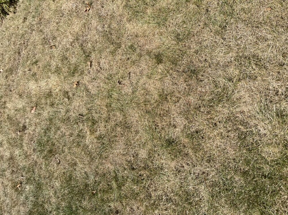
- 137 replies
-
- 2
-

-

-
- maters
- green stuff
- (and 5 more)
-
Rooting for the NAM Nest for tomorrow since the long range models look dry.
-
5 straight 90s at DCA. More to come.
-
Keeps the mosquitoes happy
-
Woo

-
Winning
-
This last hot stretch is clinching a very slightly above normal August and summer. A lack of big heat is the saving grace.
-
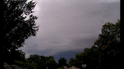
Curious to see whether this works. From the Arlington tornado day last year (7-1-21). Video to Time Lapse to gif.
- 120 replies
-
- 10
-
-
2022 Atlantic Hurricane Season Tracking Thread
MN Transplant replied to WxWatcher007's topic in Mid Atlantic
The last couple of runs of the GFS are aggressive with the wave coming up on the Windwards. -
It is humid again
-
I got 0.07”, so, success?
-
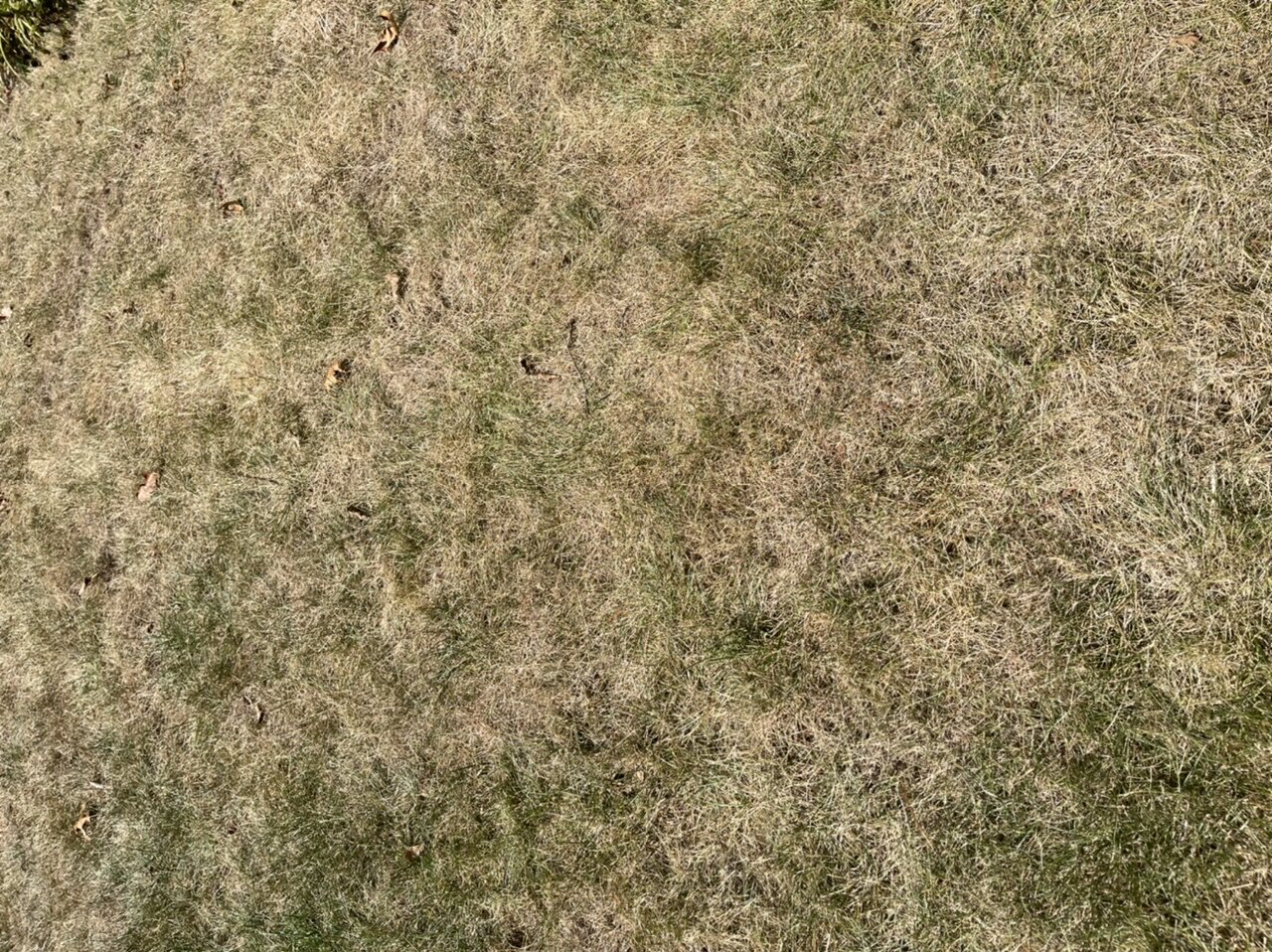
Amazing how things get crispy very quickly. Less than an inch of precip over the last two weeks and the lawn completely gave up.
-
Addendum to the school discussion
-
Keep it in Texas
-
Eastern DC getting smacked around again. Amazing.
-
Any day that stays in the 70s in August is a big win in my book
-
Still too warm in the direct sunlight, but so much nicer than it has been. 81
-
2022 Mid-Atlantic Garden, Lawn, and Other Green Stuff Thread
MN Transplant replied to mattie g's topic in Mid Atlantic
Hostas are deer food only, and you can't convince me otherwise. Plenty of tomatoes, but they are sure slow to ripen. Our fig tree is finally grown enough to really start producing.- 137 replies
-
- 1
-
-
- maters
- green stuff
- (and 5 more)
-
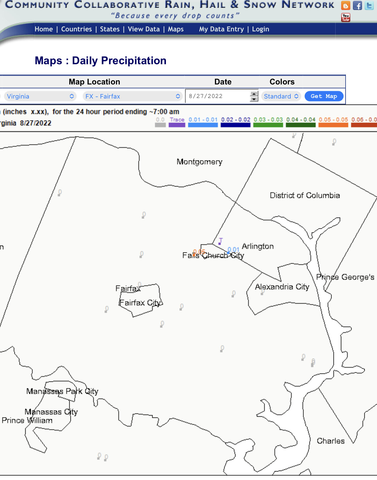
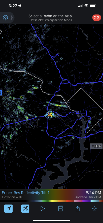
I think that is MRMS data that LWX plots, but don’t hold me to that. https://mrms.nssl.noaa.gov https://www.arcgis.com/apps/mapviewer/index.html?webmap=318de5dd4d784f72bb96ad2cfddce041 I will say that there is a big fat 1.49” over my house and I got 0.51”, so there are still resolution struggles. I really just prefer CoCoRaHS. https://maps.cocorahs.org
-
Today is going to end up within a degree of average at DCA. I want it cooler.
-
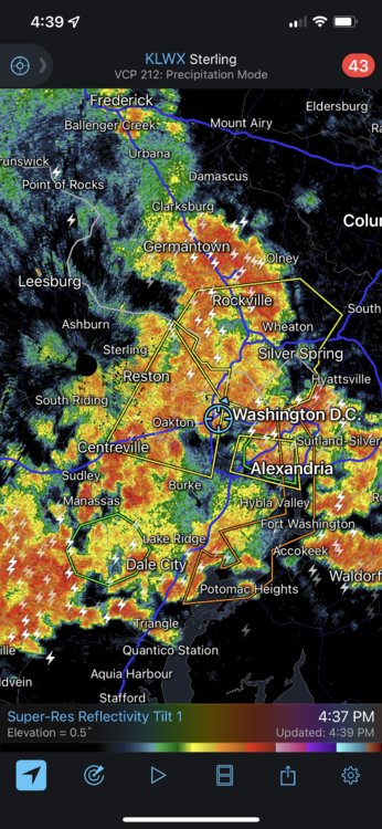
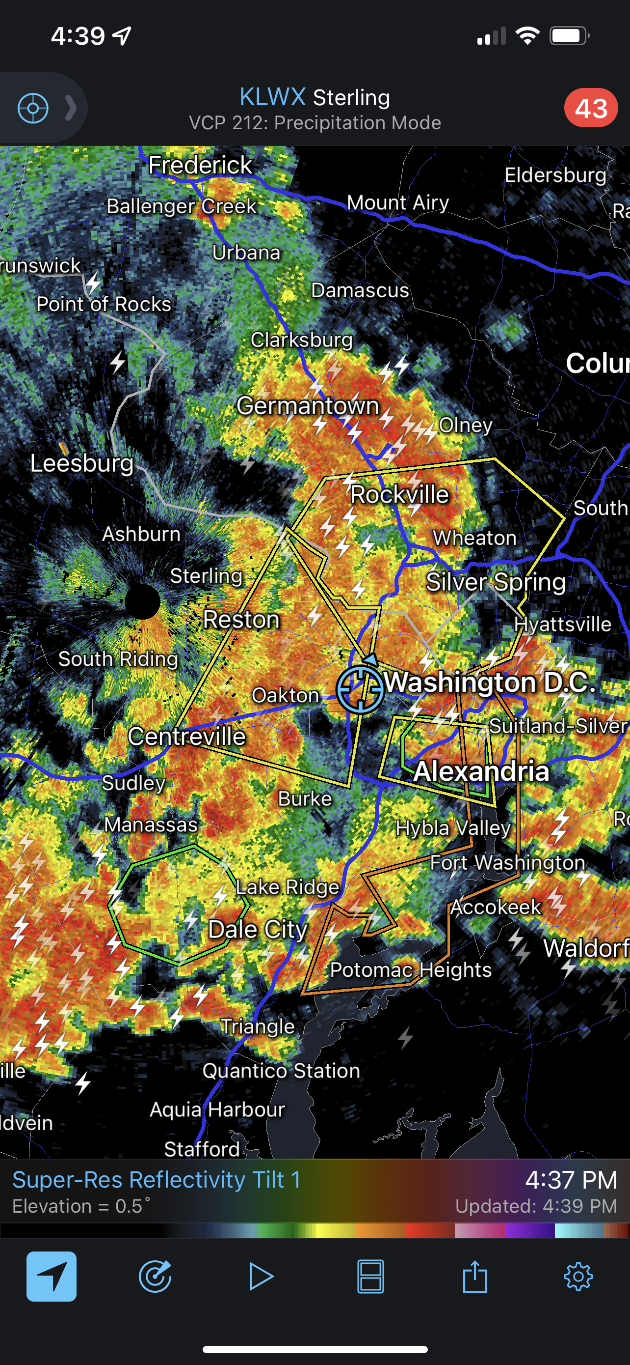
SPC talked this morning about how the second round had more upper air support, but the first round would stabilize us. I sure don’t remember many cases where a new round of convection ran into a trailing stratiform region.
-
We haven’t had a lot of trailing stratoform regions this year.
-
I’m not desperate for rain, but 0.30” from this radar 40 minutes ago feels like a minor letdown.