MN Transplant
-
Posts
17,845 -
Joined
-
Last visited
Content Type
Profiles
Blogs
Forums
American Weather
Media Demo
Store
Gallery
Everything posted by MN Transplant
-
Twins win! Finally.
-
I couldn't really comprehend how this was going to look until the first real concerts. Insane.
-
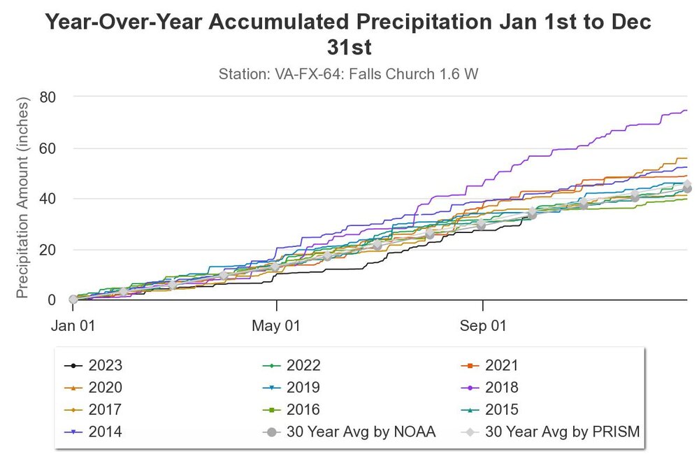
CoCoRaHS just came in with a new visualization tool. The 2nd half of 2018, LOL. https://dex.cocorahs.org/
-
I had to search for the actual press release. Despite the hindcast successes, I am skeptical of a climate model for seasonal forecasts. https://news.ucar.edu/132912/ncar-experimental-prediction-system-calls-super-el-nino-winter
-
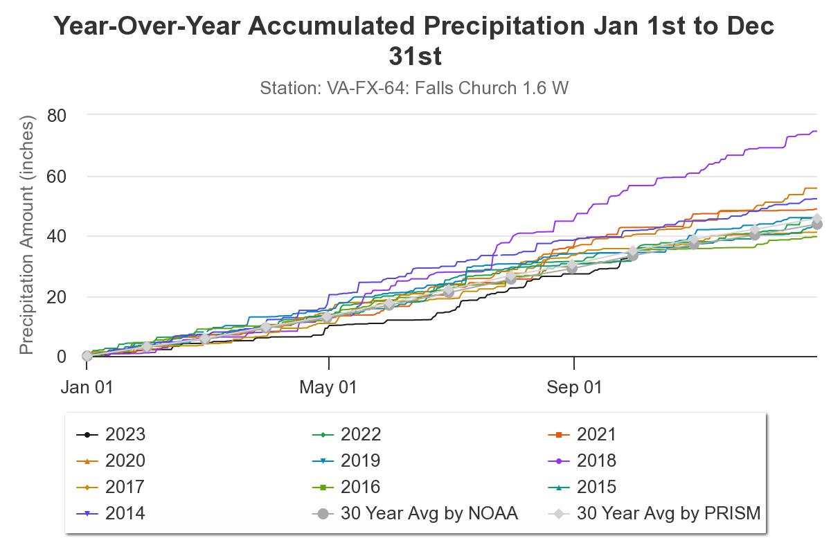
3.33” since it started raining on Friday
-
I do wonder whether they are trying to be more gap-filling or whether they are aimed at denser coverage where there are people.
-
Minnesota sports are a special breed of mediocrity. The Vikings, Wolves, Wild, and Lynx (WNBA) all made the playoffs and had a first round exit in the past year. Hard to imagine the Twins don’t pull the same feat.
-
3.03”. Great stuff.
-
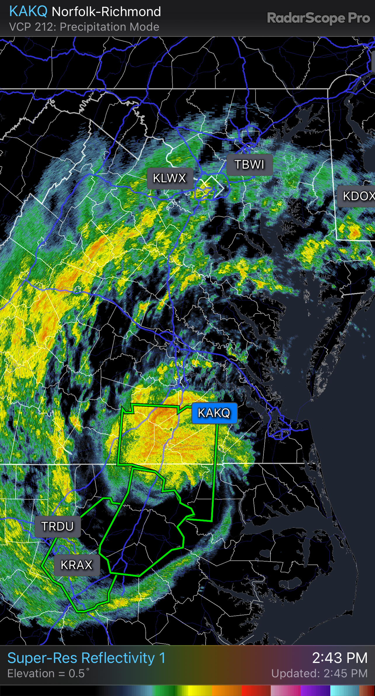
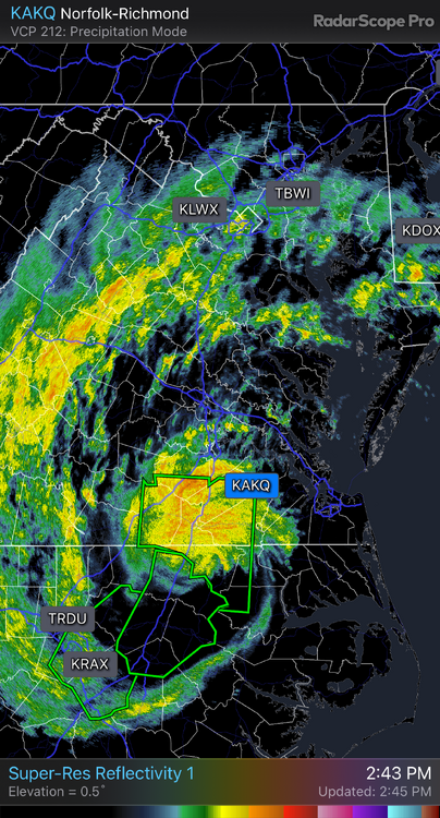
Heaviest rain rate of the day with this band
-
Squally when you get into a band. Over 1.5” now. Excellent soaker.
-
Kids-sized bowling ball
-
Nice steady rain and the treetops are swaying, but not much wind at the surface.
-
On my way back from Colorado. A super quick look at the models shows a difference in max gusts between the meso models (50mph) and globals (40mph).
-
Shouldn’t people be drinking hurricanes?
-
Friction. Saved you 10 pages.
- 193 replies
-
- 12
-

-

-

-
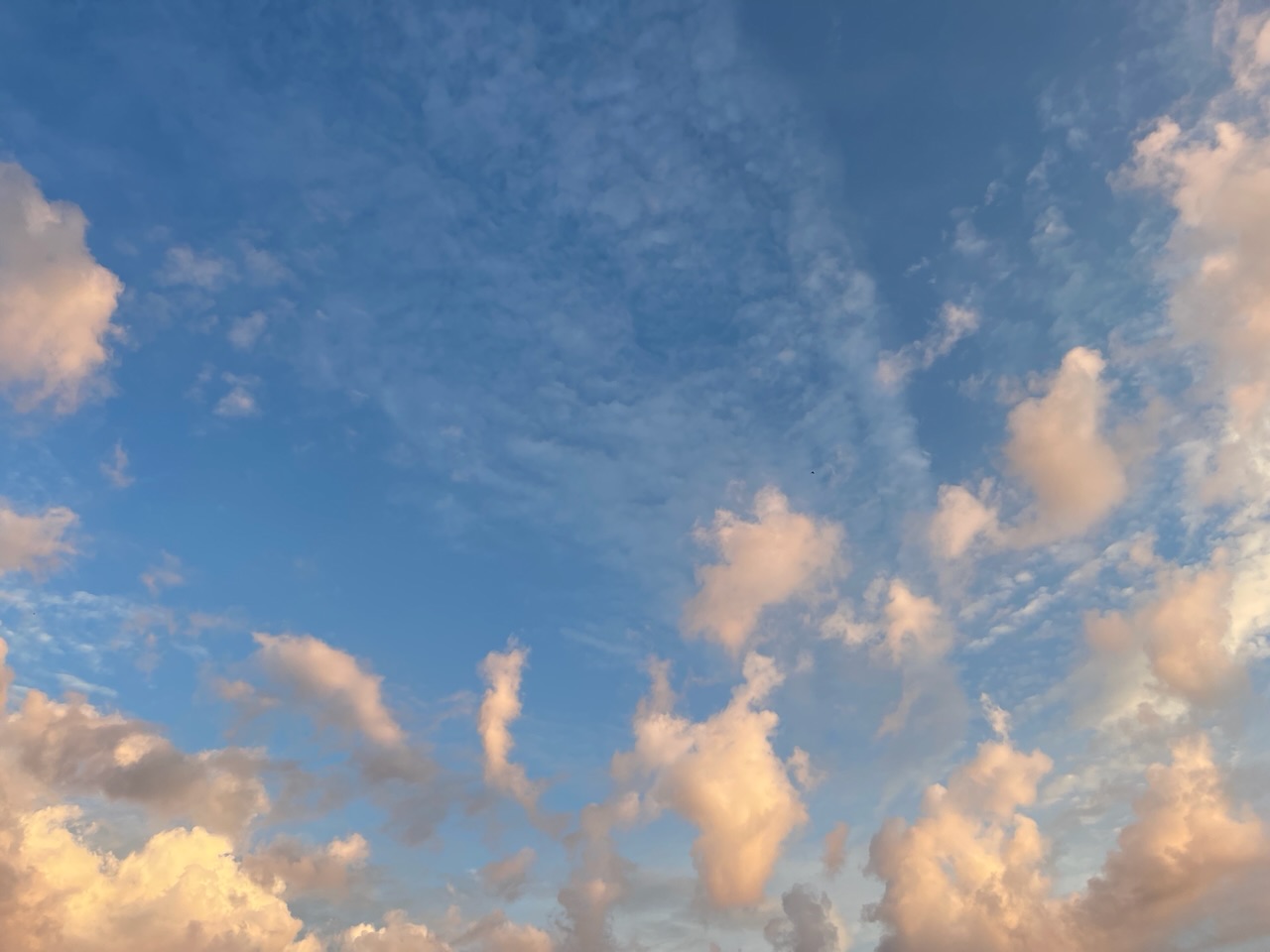
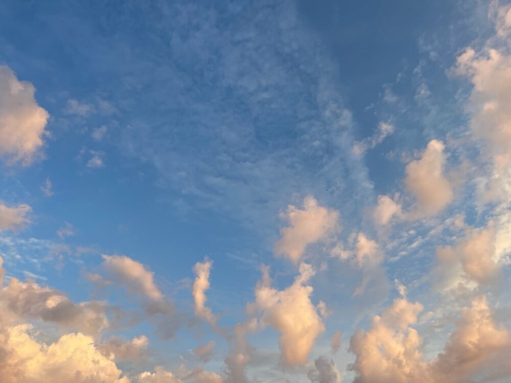
Great sky this morning. Like something AI would come up with.
-
2023 Mid-Atlantic Garden, Lawn, and Other Green Stuff Thread
MN Transplant replied to mattie g's topic in Mid Atlantic
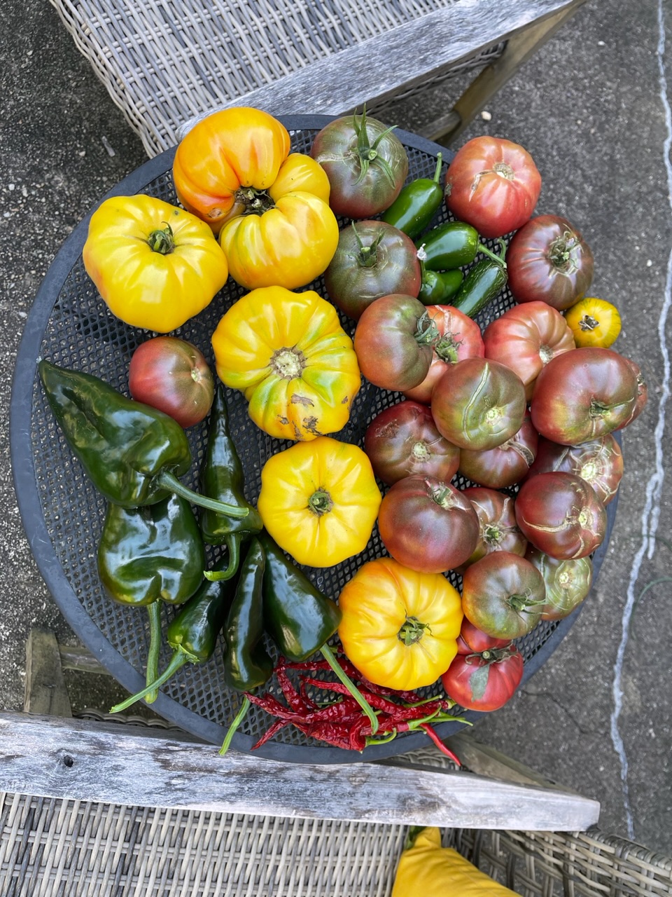
This morning’s harvest
-
So many people are outside this evening. The first perfect Friday night of the season.
-
Good thread https://x.com/climatologist49/status/1702378818693112236?s=46&t=bA1Os5w_10i9PfsurY28aw
-
So, you're saying he's coming back.
-
2023 Mid-Atlantic Severe Wx Thread (General Discussion)
MN Transplant replied to Kmlwx's topic in Mid Atlantic
The averaging period will be important for solar irradiance.- 2,785 replies
-
- 1
-

-
- severe
- thunderstorms
- (and 3 more)
-
Now I’m rooting for the Jets so that the 2nd rounder is as late as possible.
-
I don't know if you saw the first fumble. The RG (who is just awful) started to pull immediately and managed to jab his left arm into Kirk as he was collecting the snap. So, our RG effectively stripped the QB near the red zone in a game we lost by 3. Payback for all the good luck last year.
-
The two teams cited for completely over performing last year were the Giants and Vikes. The Giants got manhandled and the Vikes made a comedy of errors to lose to a subpar Tampa teams. Regression, baby!
-
I know we are (almost) all looking for more rain, but getting rid of the humidity by Thursday is going to feel so good.