MN Transplant
-
Posts
17,845 -
Joined
-
Last visited
Content Type
Profiles
Blogs
Forums
American Weather
Media Demo
Store
Gallery
Everything posted by MN Transplant
-
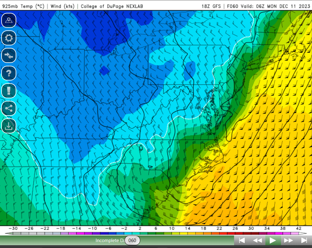
06z NAM 3k and HRRR (now in range) are simply too warm at the surface.
-
The GFS is actually cold enough aloft but the surface temps and dew points are too warm. That's why it is still signaling rain during this panel time.

-
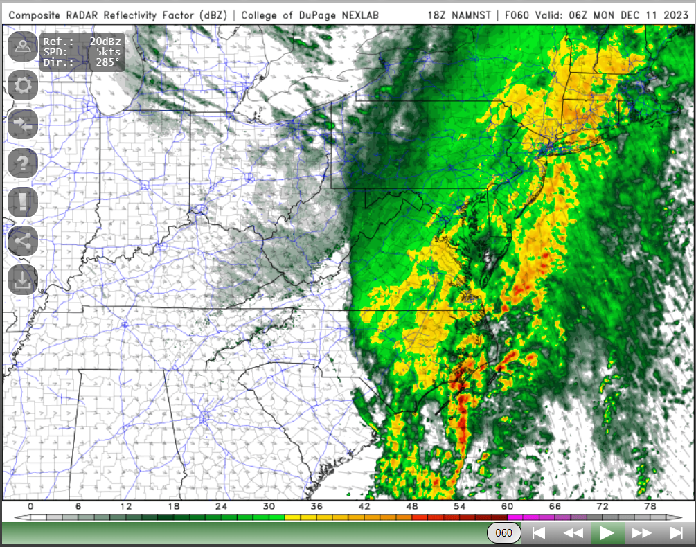
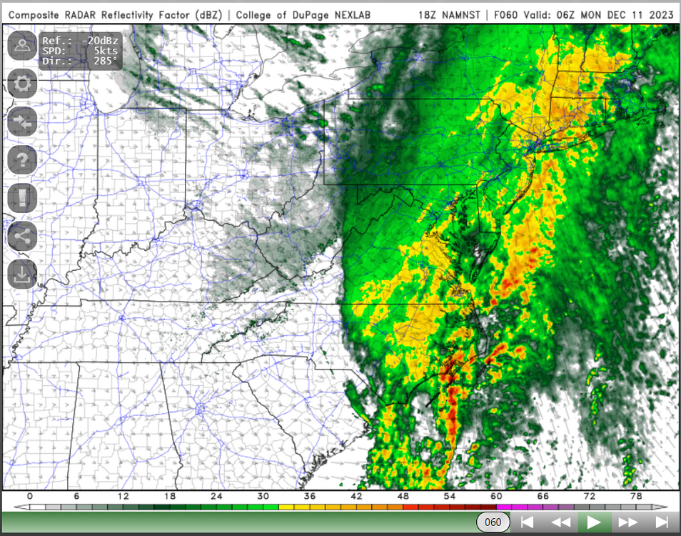
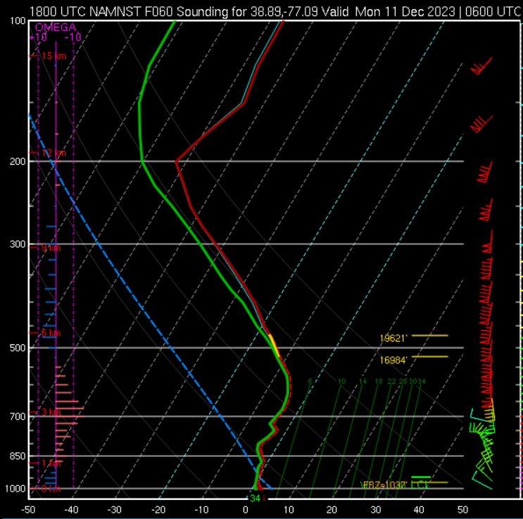
This is the composite sim and sounding as the rain/snow line is hitting 95. Not bad.
-
Iowa State. Utah state has the best download site for the full climate record for stations, but Iowa State's has the fun tools. https://mesonet.agron.iastate.edu/plotting/auto/
-
Flurries in Alexandria
-
Looking like this was intentional. That’s one way to go out!
-
What is the average guess at each site?
-
Wild that we are going to see a Power 5 conference undefeated champion left out of the CFB.
-
0.74". Chipping away at the deficit.
-
I was thinking more about inversions and moisture/aerosols, but your convection idea is also solid. The other thing that the wind does is to prevent the cold-air drainage and microclimates from setting up. So, the difference between IAD and DCA is always going to be muted in CAA scenarios because IAD also will not be able to form their ridiculous cold-pool inversion.
-
I think that is almost a given. A stable boundary layer is going to be much more susceptible to emitted long wave radiation from all of the “stored” urban heat.
-
20.7. That is good for the 3rd coldest day of calendar 2023 and colder than any day in January 2023. DCA 25, IAD 20
-
The sleet bomb?
-
El Niño = Tush Push
-
Yeah, that is really good. Wow.
-
32 on the 5-min obs at DCA. I think that does it.
-
Current temp is my low on the season so far. 28.0
-
The Dobbs thing was fun for a while, but he is clearly a backup QB at best. They’ve desperately missed Kirk the last two games. Sounds like a QB competition over the bye week to determine who gets to play the final 5 games.
-
We got this. Very good chance it happens before midnight. Down to 39 from a high of 43 despite the sun. In the last two hours I’ve dropped from 41.0 to 32.9!
-
I had a 12:09am low at home. Tonight really should be the night at DCA.
-
This board would implode with a late start like 65-66. 0.2" through January 25th. Then an 8-day period of three storms totaling 23" in late Jan/early Feb. Followed by a sloppy 5" storm in late Feb. The Jan 29-30, 1966 storm does look like it was fun, though. 13.8" with highs of 16 and 17 degrees. All stats from DCA.
-
BWI: 14.5" DCA: 11.4" IAD: 18.1" RIC: 8.5" Tiebreaker: SBY: 7.6"
-
Really nice job by the NAM last night with the steady/rising temps. The HRRR was terrible. No freeze yet at DCA.
-
Problem is that a couple of the stations that I checked in downtown DC and Crystal City, Arlington also didn't make it to freezing this morning.
-
2.12”. Fantastic job by the models on QPF.