MN Transplant
-
Posts
17,845 -
Joined
-
Last visited
Content Type
Profiles
Blogs
Forums
American Weather
Media Demo
Store
Gallery
Everything posted by MN Transplant
-
2024 Valentines Day Who the Hell Knows - Comeback Thread
MN Transplant replied to DDweatherman's topic in Mid Atlantic
Doesn’t matter at that point. White rain. -
2024 Valentines Day Who the Hell Knows - Comeback Thread
MN Transplant replied to DDweatherman's topic in Mid Atlantic
The 17z HRRR has it snowing at IAD with a temp/DP of 37/37. -
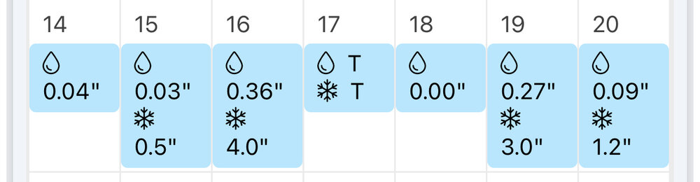
Minneapolis averages 33” year to date. They are sitting on 7”.
-
April 8th Eclipse- Last Easy One To See In My Lifetime
MN Transplant replied to Interstate's topic in Mid Atlantic
That’s me. Syracuse and Louisville, and then drive into the path early in the morning. -
How you gonna ban someone for posting a blank map?
-
The crocus house in our neighborhood is ready to bloom
-
You aren't kidding. Tonight Partly cloudy, with a low around 32. North wind 9 to 13 mph, with gusts as high as 21 mph. Saturday Sunny, with a high near 47. North wind 7 to 9 mph. Saturday Night Clear, with a low around 30. North wind 3 to 6 mph. Sunday Sunny, with a high near 50. North wind 3 to 5 mph. Sunday Night Mostly clear, with a low around 31. Calm wind becoming north around 6 mph after midnight. Monday Sunny, with a high near 47. Monday Night Mostly clear, with a low around 29. Tuesday Sunny, with a high near 45. Tuesday Night Mostly clear, with a low around 28. Wednesday Sunny, with a high near 50. Wednesday Night Partly cloudy, with a low around 32. Thursday Partly sunny, with a high near 55. Thursday Night Mostly cloudy, with a low around 41. Friday Mostly cloudy, with a high near 58.
-
Was made official this week at AMS that NCAR’s MPAS will be the next dynamical core for the Rapid Refresh and Warn-on-Forecast systems. FV3 will continue for the GFS. The new HAFS (HWRF/HMON replacement) for tropical is performing well.
-
Jan/Early Feb Medium/Long Range Discussion Part 3
MN Transplant replied to WinterWxLuvr's topic in Mid Atlantic
Snow cover on the GFS on February 7th via Windy. Woof.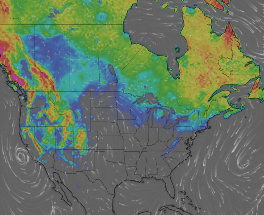
-
Live by the Dan Campbell, die by the Dan Campbell
-
The Annual AMS is in Baltimore this year so I’m walking around downtown right now among sad Ravens fans. If I squint at the purple I get bad Vikings flashbacks.
-
1.51" which brings my total to 12.68" since Dec. 1st. The ground is a bog.
-
HRRR and 3km NAM are plenty wet tonight. 1.25”-2” over a good chunk of us.
-
Rodney, I wonder how many times the top two temperatures for a month have happened on the same date. We had that oddity yesterday with 1/26/50 previously being the high for the month.
-
And my wife flipped the AC on. I hope this is an unbeatable first AC day of the year.
-
This is insane
-
76.8 for my high. Amazing
-
71.0. 73 at DCA.
-
Morning low of 61.3 on Jan 26th. Sure.
-
Current snowpack status
-
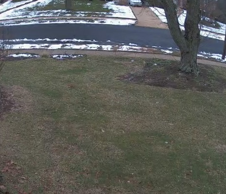
Low of 28. Snowpack is looking ragged in the sunny spots. Today will be rough.
-
The two personal weather stations right near, but across the river from DCA were 22 and 21 for lows. Can I complain about IAD being ridiculously low when my low was 17?
-
I'm still celebrating national "Packers season is over" day.
-
Midnight low. Still, full winter out there.
-
I think this is it