MN Transplant
-
Posts
17,625 -
Joined
-
Last visited
Content Type
Profiles
Blogs
Forums
American Weather
Media Demo
Store
Gallery
Everything posted by MN Transplant
-
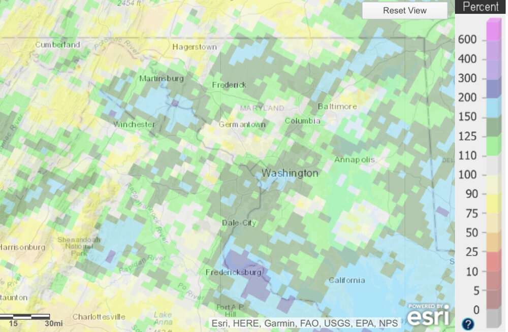
0.04”. And now the inevitable lawn-killing short term drought begins.
-
It is splotchy
-
Usually I’d say don’t text and drive. But this isn’t really driving.
-
The GFS is quite dry with a NW flow for most of the run beyond this weekend. Hopefully we can all score before we get into the real crispy time of year.
-
2021 Mid-Atlantic Severe Weather - General Discussion
MN Transplant replied to Kmlwx's topic in Mid Atlantic
Sometimes it seems to play a huge factor, and other times it doesn’t. I’m sure it is all about the structure of the atmosphere above the surface. My 0.01” suggests that it was a killer this time. -
2021 Mid-Atlantic Severe Weather - General Discussion
MN Transplant replied to Kmlwx's topic in Mid Atlantic
That I66 line got lame in a hurry. Down to 78 with the outflow here. Practically pleasant. -
2021 Mid-Atlantic Severe Weather - General Discussion
MN Transplant replied to Kmlwx's topic in Mid Atlantic
You can have the initial batch if that line further west rides 66. -
Feels like this should be a bigger story (from yesterday, they are making a run again today)
-
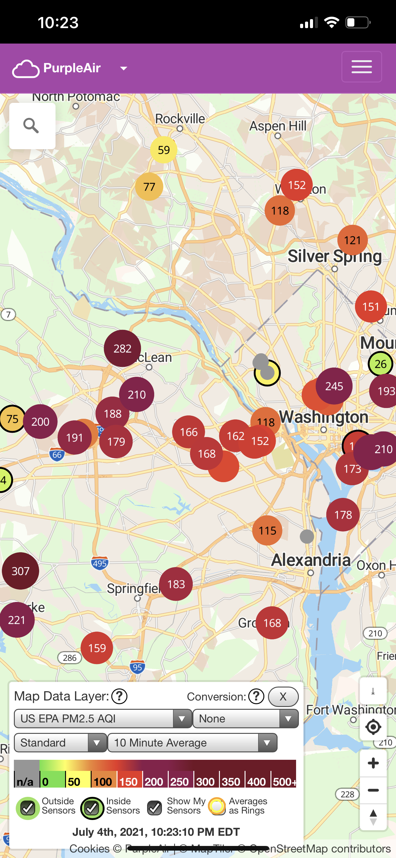
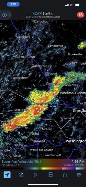
1.01” from today. Matched Elsa’s total in less than 10 minutes.
-
These are wet storms
-
Got 0.18” after midnight. Combine that with an equivalent amount in the evening and I ended up 0.4”. In the end, the dry models were too sharp with the cutoff on the NW side, but the wet models weren’t as good with the track.
-
2021 Mid-Atlantic Severe Weather - General Discussion
MN Transplant replied to Kmlwx's topic in Mid Atlantic
Marginal for today. SPC: ...Eastern States This Afternoon... Water vapor loop shows a shortwave trough over WI, with an associated cold front extending from western NY/PA into western NC/northern GA by this afternoon. Dewpoints in the 60s to lower 70s ahead of the front, combined with pockets of daytime heating and modest midlevel cooling will help to destabilize the airmass, and lead to scattered afternoon storms along the front. Flow aloft will slowly strengthen today, helping to organize a few of the storms into multicell clusters posing a risk of locally damaging wind gusts from eastern NY/PA southward across the Carolinas and north GA. It appears at this time that severe storms will be isolated in nature. -
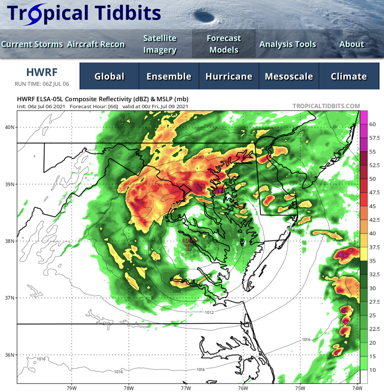
Comically, the latest HRRR throws a band back at DC as Elsa passes by.
-
And the HRRR. Never bought into this one.
-
Wouldn’t be shocked if the 0.04” I got earlier was it for Elsa.
-
More thunder than raindrops here. 0.02” The short range modeling differences are amazing between most of the models and the HWRF. The HRRR expects the NW side of the larger precip shield to slowly disintegrate. We’ll see.
-
18z HRRR is a scrape of 95. There is a northward moving spiral band-like line in the afternoon on Thursday that saves some from a shutout.
-
93.8 with a HI of 111 in my garden. Woof.
-
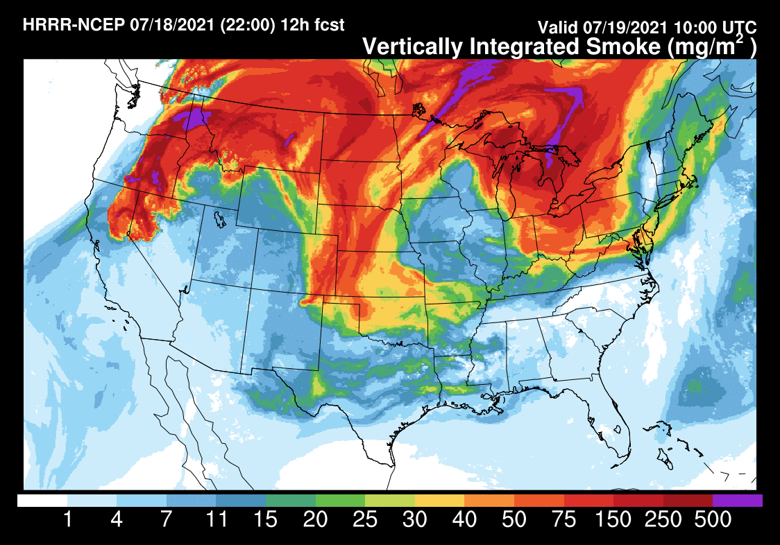
DCA down to 6 miles vis with "haze". Air quality levels are still elevated from the Ohio Valley to the East Coast.
-
2021 Atlantic Hurricane Season Tracking Thread
MN Transplant replied to WxWatcher007's topic in Mid Atlantic
I vote for the 6z HWRF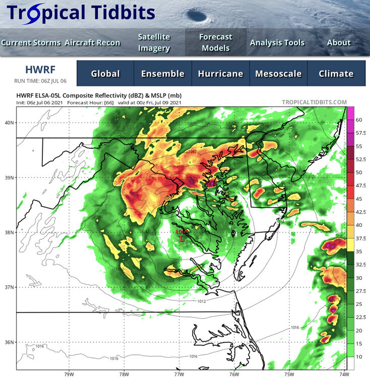
-
Per usual, the worst air quality night of the year.

-
Went to take a sunset picture and got photobombed by one of our neighborhood foxes (bottom right).

- 554 replies
-
- 12
-

-
I think the update looks sharp, and usually people hate change online. This isn’t specific to this site, but the board software overall - too much wasted space on mobile. If I go to a thread, I have to scroll to see any content, even on an iPhone 12 max. The notification drop down is on its own line, as is the thread creator. But the member statistics being up top really doesn’t make any sense given the amount of space it takes up.

-
Spent way too long trying to figure out how to make a time lapse.