PaulyFromPlattsburgh
-
Posts
532 -
Joined
-
Last visited
Content Type
Profiles
Blogs
Forums
American Weather
Media Demo
Store
Gallery
Everything posted by PaulyFromPlattsburgh
-
I am wrong. Read the previous post. I apologize
-
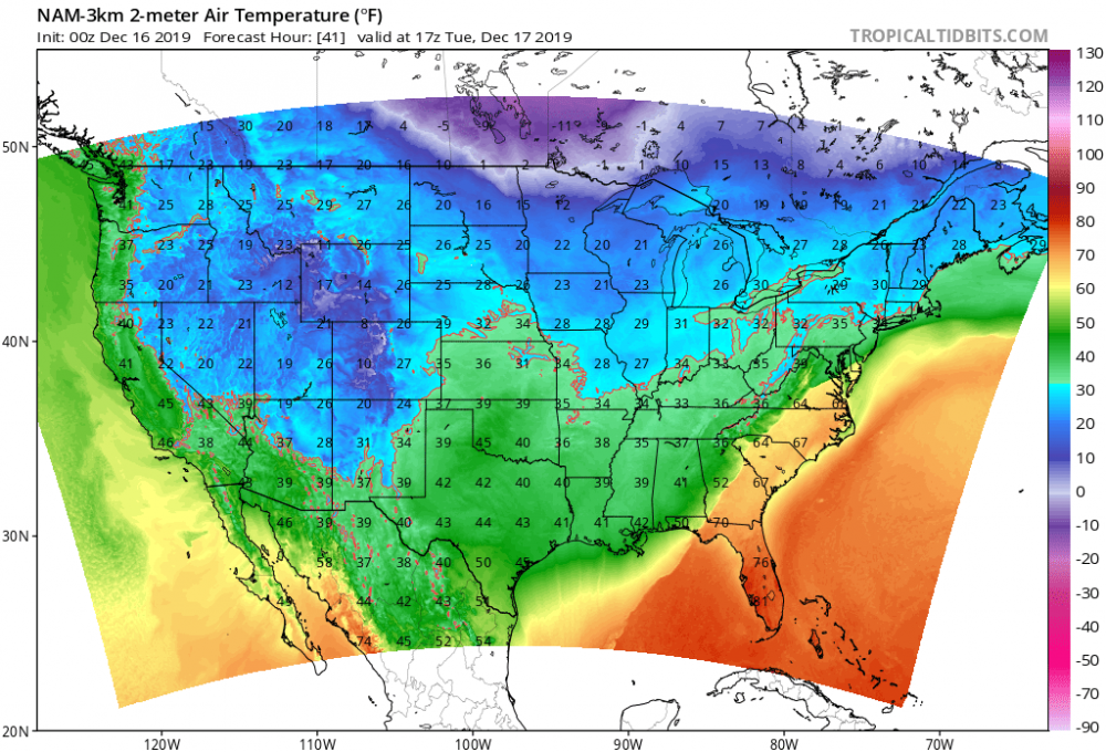
That ice threat is scary with those cold surface temps.
-
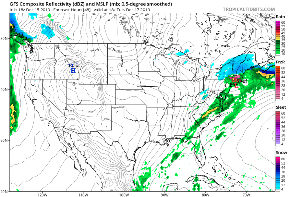
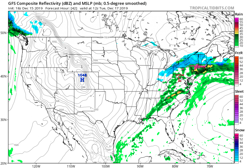
You are right it is 6 hours behind. Here is the correct plot. Goofus is north. Lol

-
Big jump almost 100 miles into NY state , VT, NH with the decent precip. I am a big outlier in this board. I am in New England technically. Northern Adirondacks. Sad location for snow miss out a lot
-
Looks similar to me . Gfs just a tad north and faster

-
Yes you are right. Weathafella trying to say it’s not north compared to the ICON and EURO


-
U are wrong
-
Big jump north on the NAM in line with GFS
-
Euro looks torchy over there and so does the EPS. I wouldn’t call this a good look lol.

-
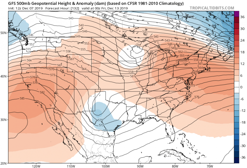
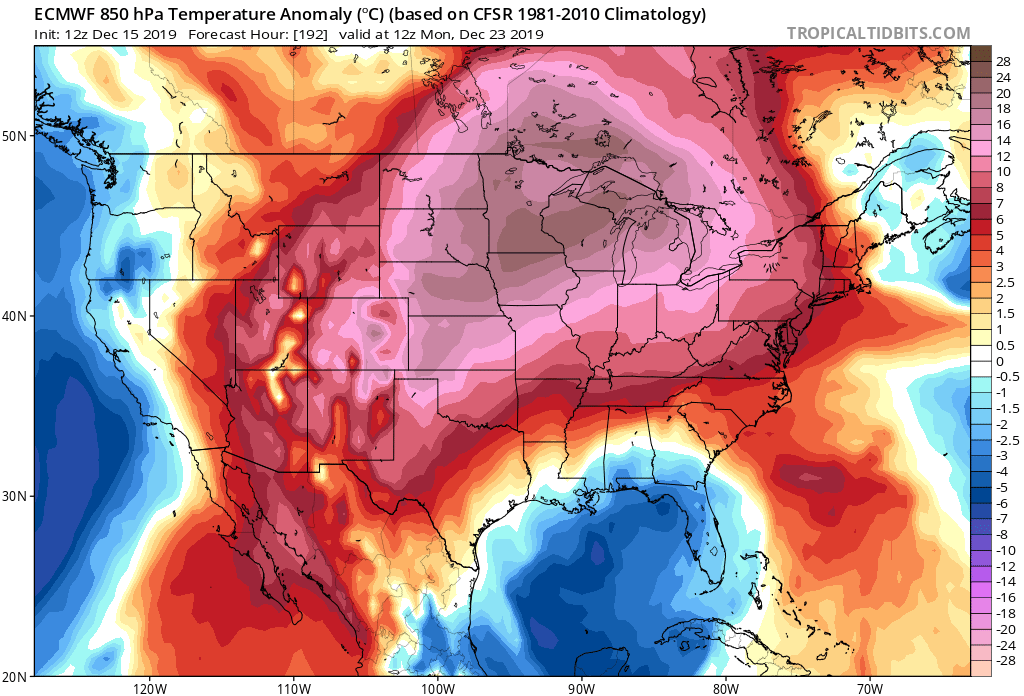
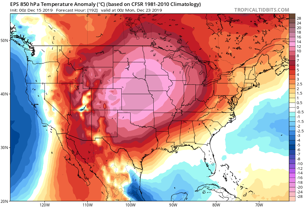
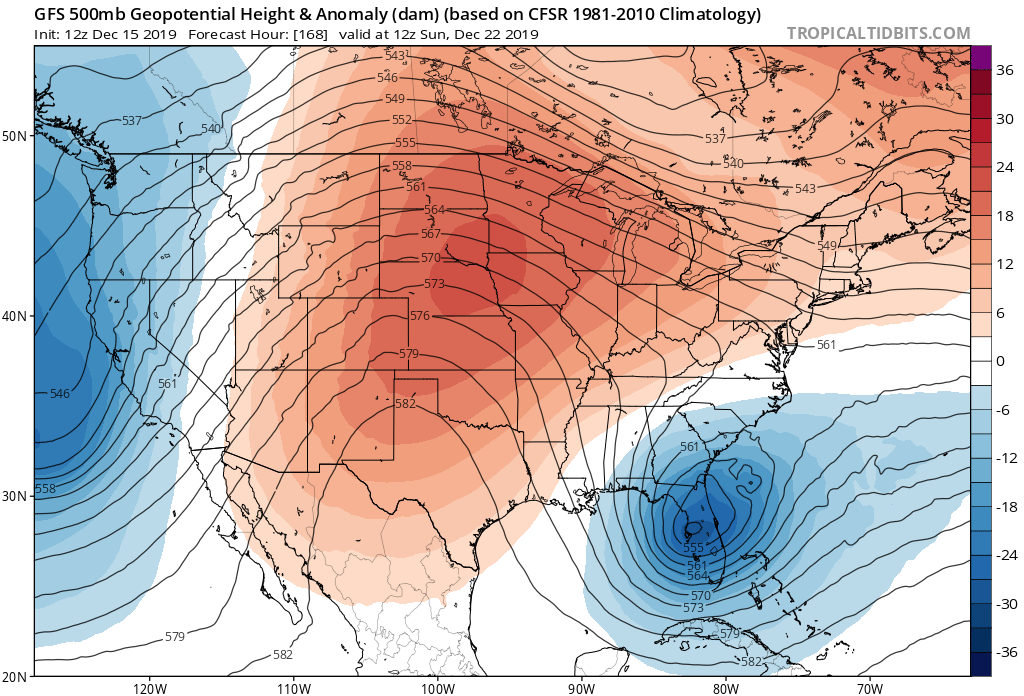
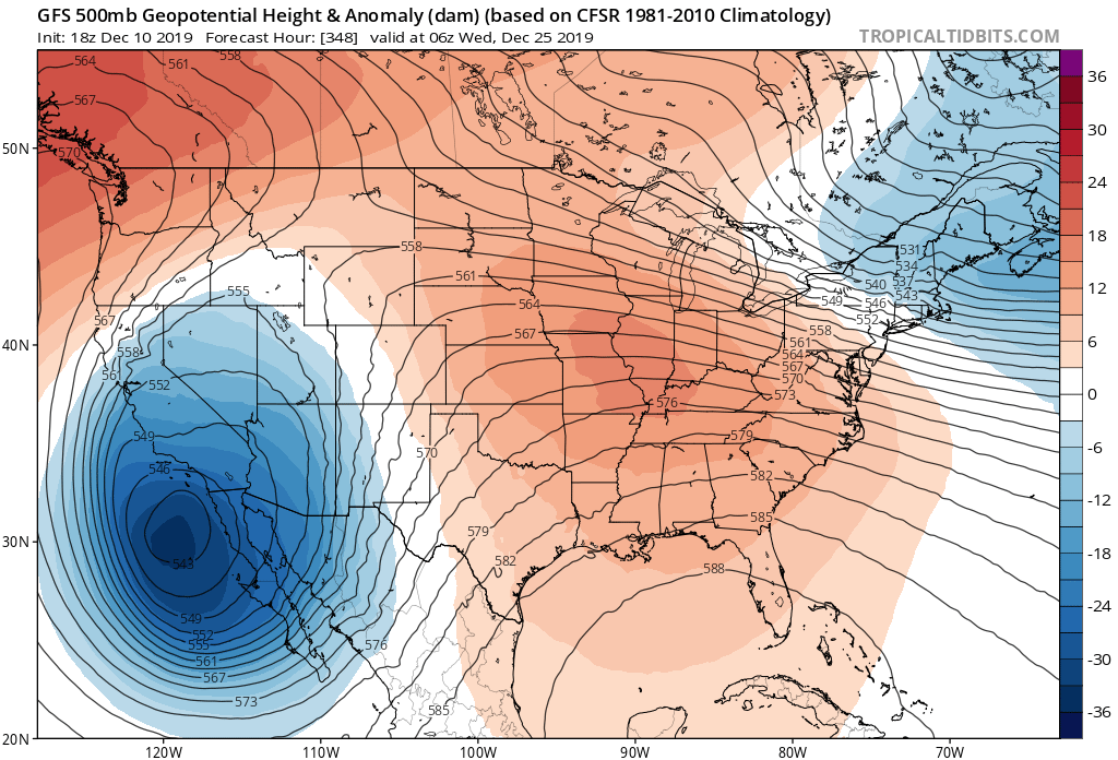
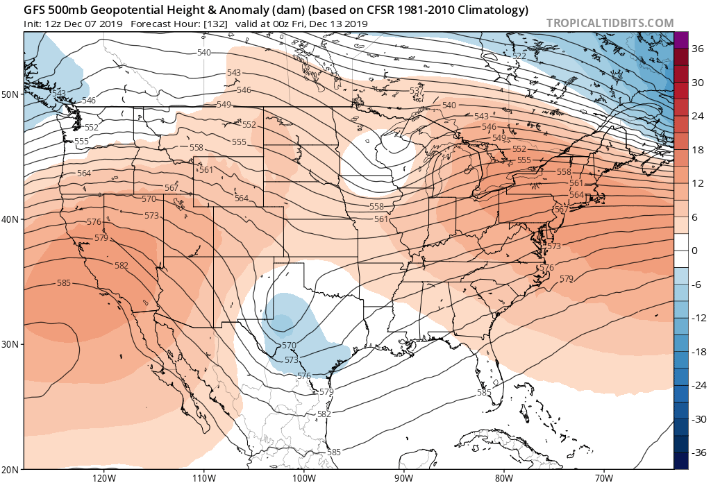
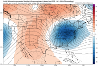
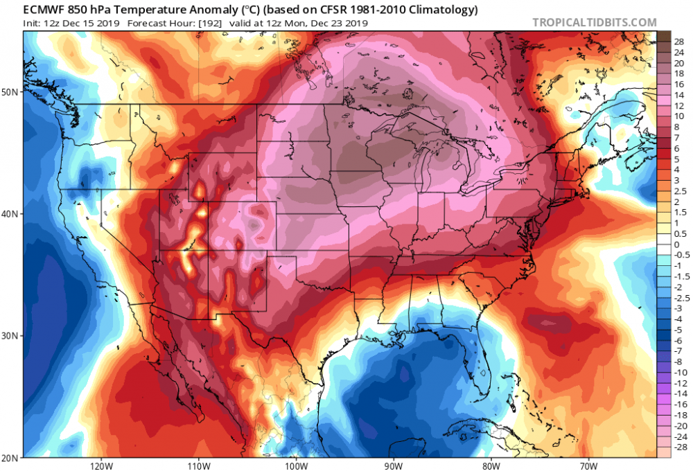
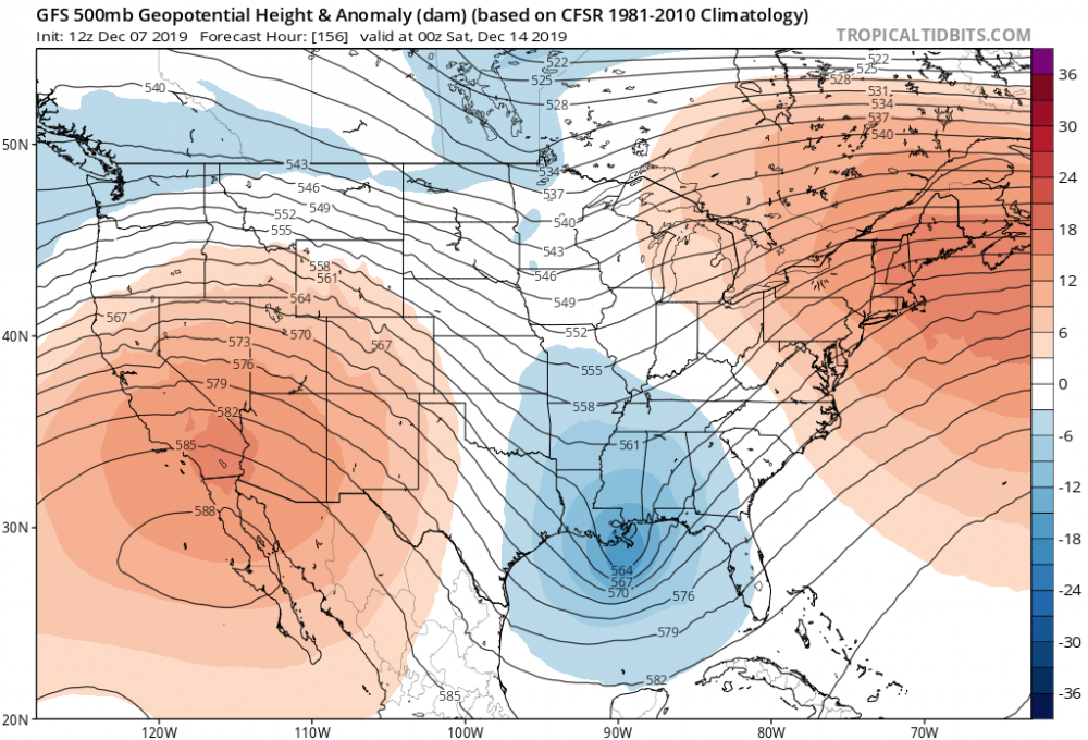
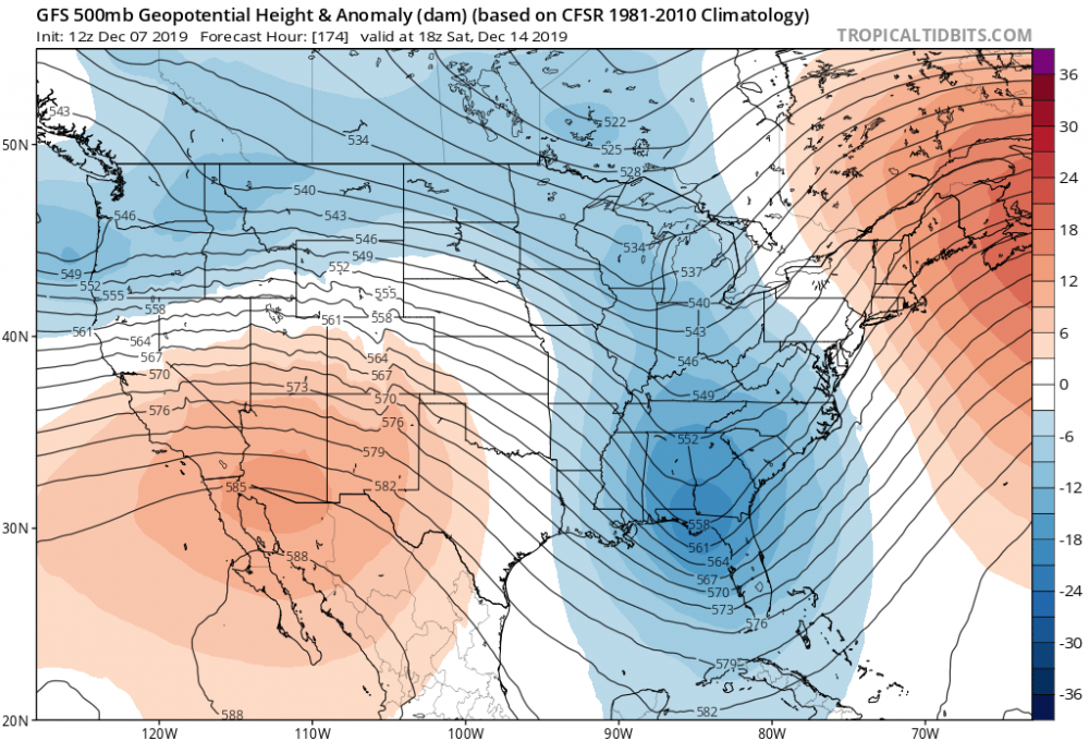
Yup. 500mb pattern not conducive. Trough in the west. Ridge to far east and everything squashed south. Looks like some record warmth for parts of the upper mid west
-
Upstate/Eastern New York
PaulyFromPlattsburgh replied to BuffaloWeather's topic in Upstate New York/Pennsylvania
Not good. We have not had significant snow since the early November storm. It’s a weird location. -
Upstate/Eastern New York
PaulyFromPlattsburgh replied to BuffaloWeather's topic in Upstate New York/Pennsylvania
Euro and GFS take it into Florida
-
Upstate/Eastern New York
PaulyFromPlattsburgh replied to BuffaloWeather's topic in Upstate New York/Pennsylvania
I unfortunately live where that snow hole is with 0 inches in northern New York Lol! -
Upstate/Eastern New York
PaulyFromPlattsburgh replied to BuffaloWeather's topic in Upstate New York/Pennsylvania
wow the nam is north through 33! -
Share maps please
-
Upstate/Eastern New York
PaulyFromPlattsburgh replied to BuffaloWeather's topic in Upstate New York/Pennsylvania
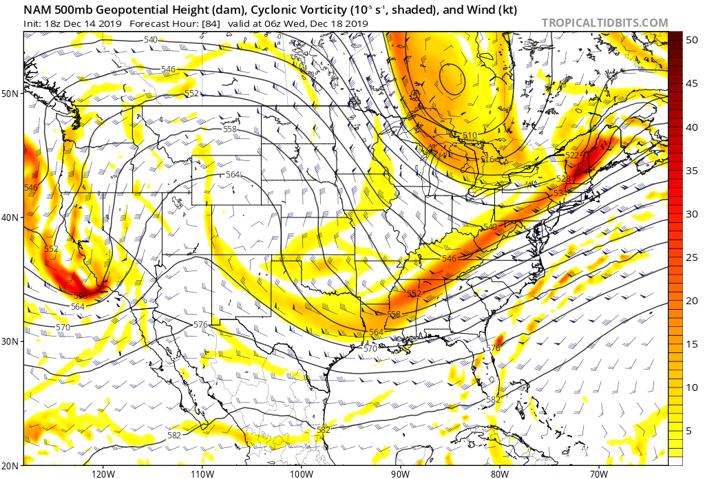
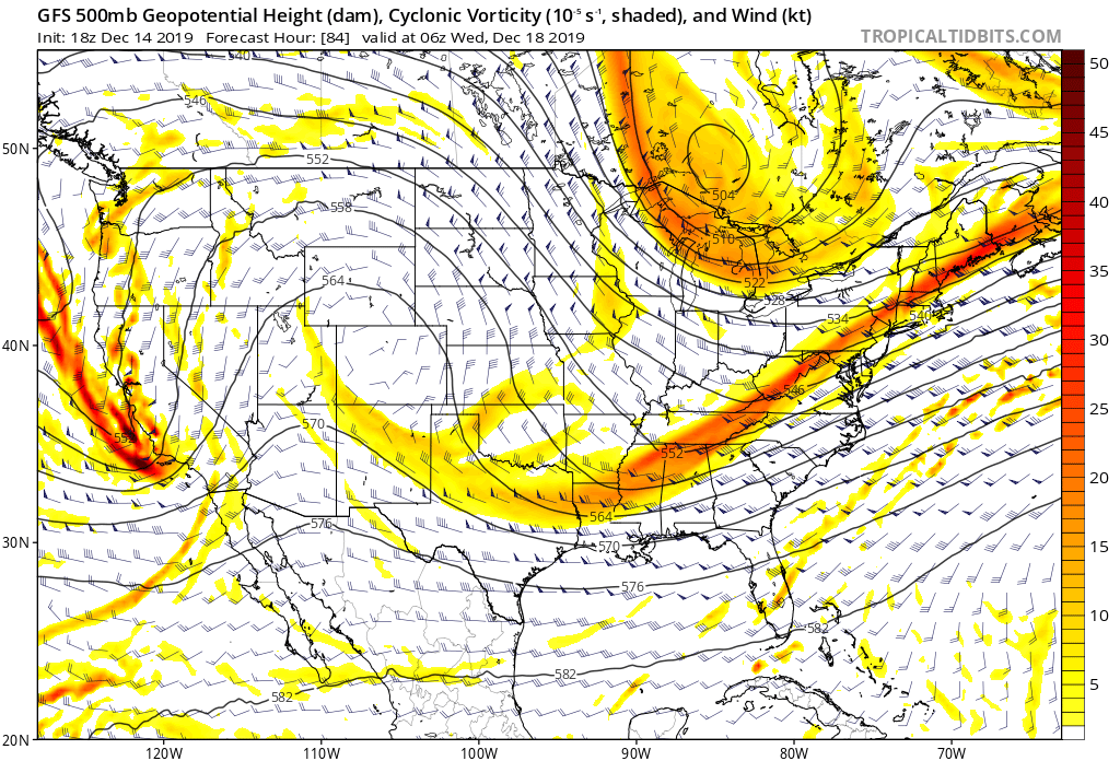
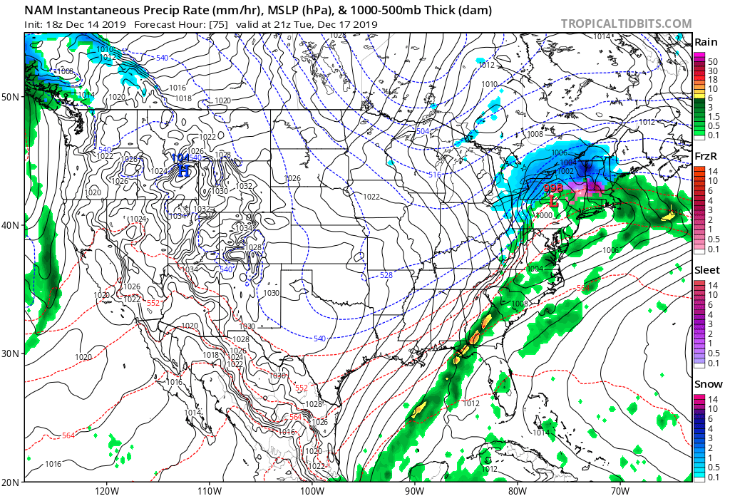
It’s slowly trending stronger and northwest with that short wave. NAM vs GFS same time frame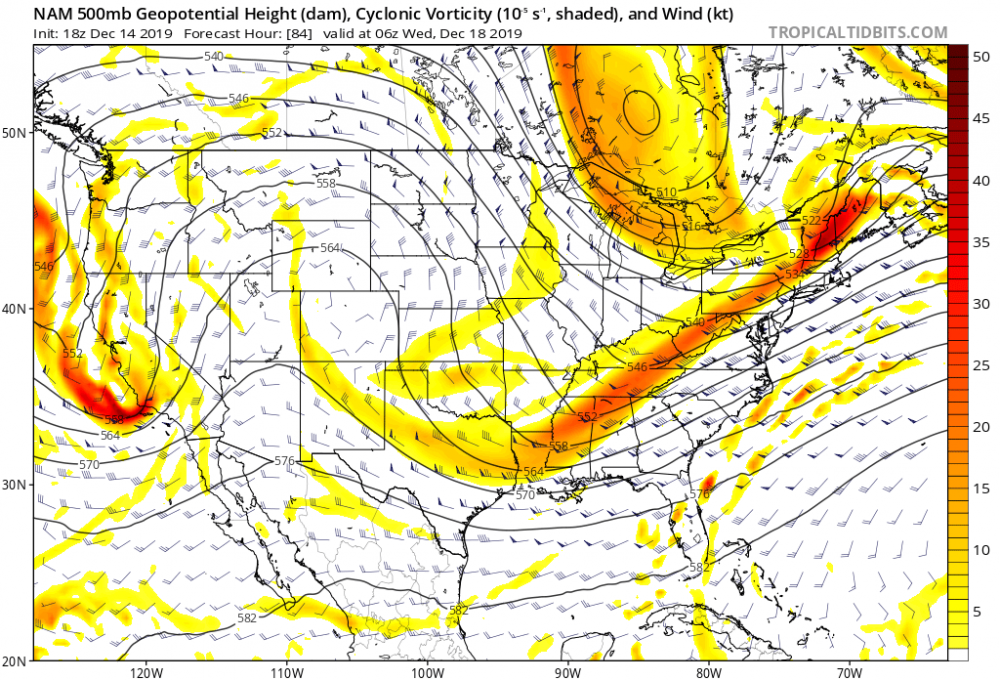

-
Upstate/Eastern New York
PaulyFromPlattsburgh replied to BuffaloWeather's topic in Upstate New York/Pennsylvania
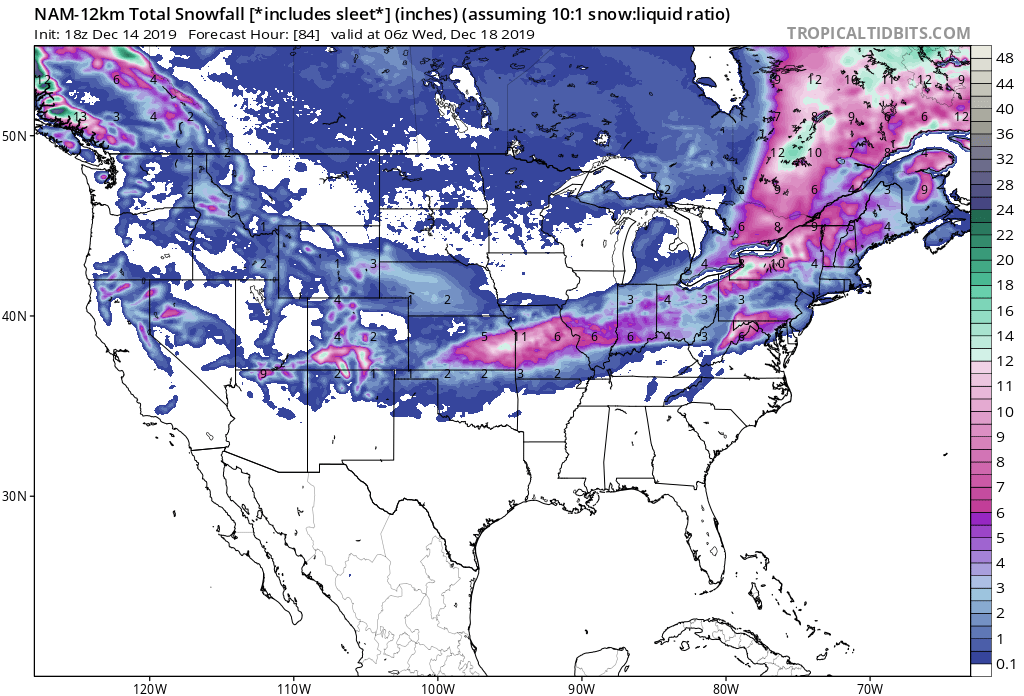
NAM total snowfall including Tuesday
-
Upstate/Eastern New York
PaulyFromPlattsburgh replied to BuffaloWeather's topic in Upstate New York/Pennsylvania
It’s wrong. It was wrong last system. Won’t fool me twice. NAM is onto a north trend with Tuesday system. -
Upstate/Eastern New York
PaulyFromPlattsburgh replied to BuffaloWeather's topic in Upstate New York/Pennsylvania
Long range NAM delivers the goods with the next storm for northern Adirondacks! Booom!!
-
Possible frontal wave snow
PaulyFromPlattsburgh replied to Zelocita Weather's topic in New York City Metro
But still worse than the 10 year average haha -
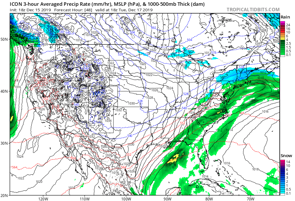
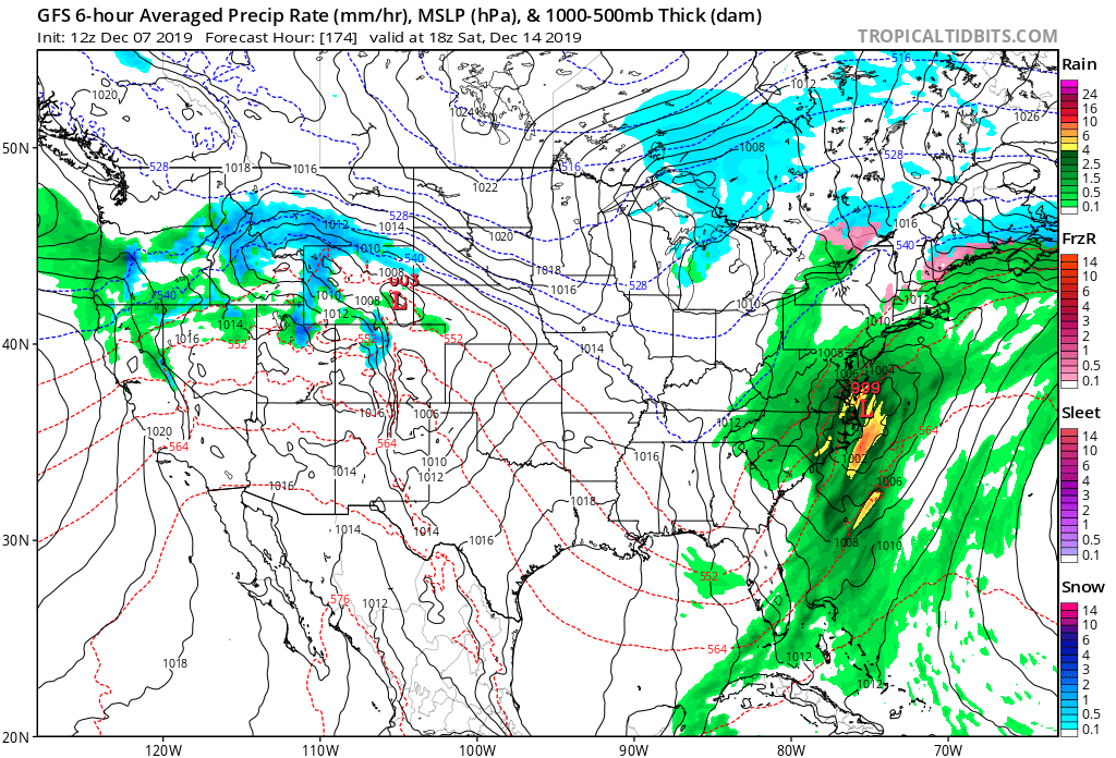
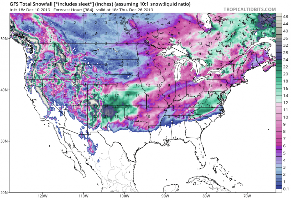
Umm the latest GFS delivers a record snowstorm for Texas at the end of its run. Wow what a bomb

-
You are right. Way different look. Digging much better too. Next system right behind it. Warm verbatim but a good start

-
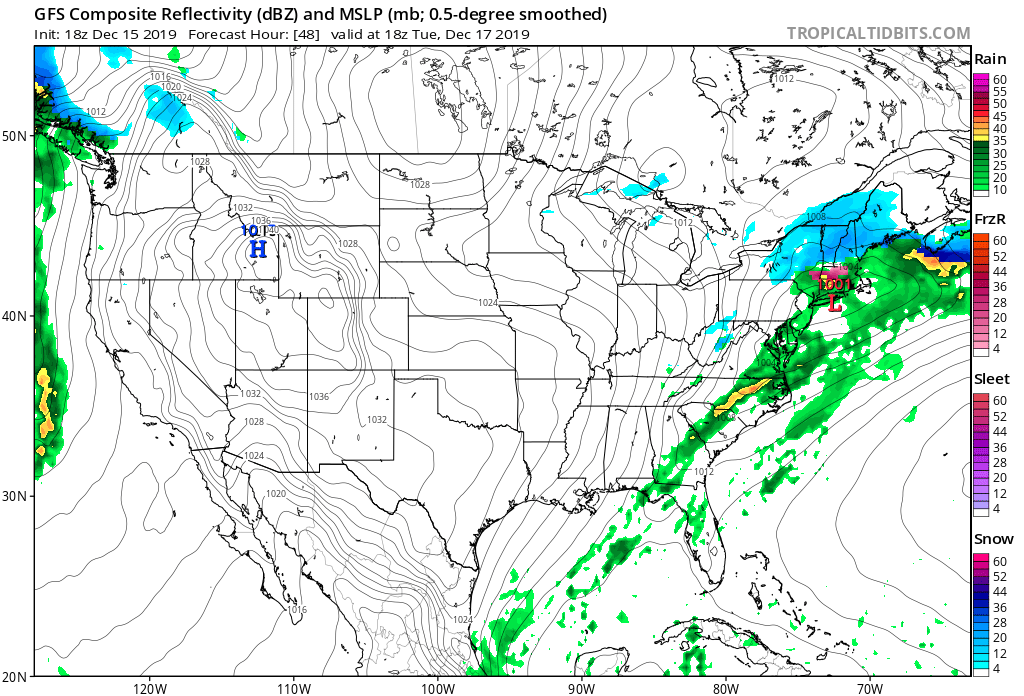
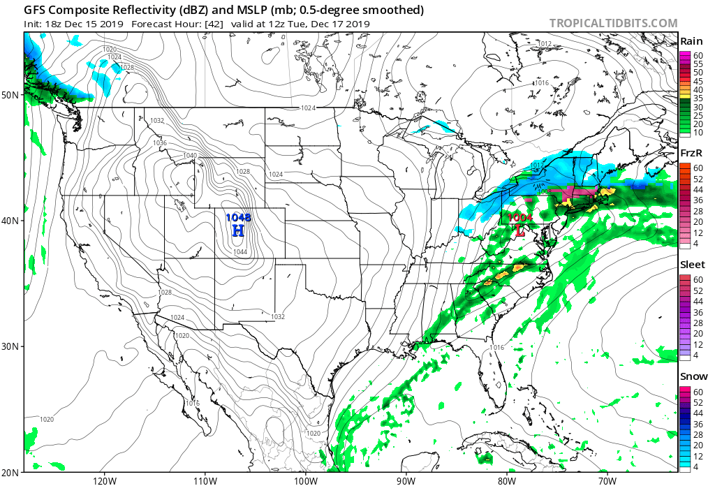
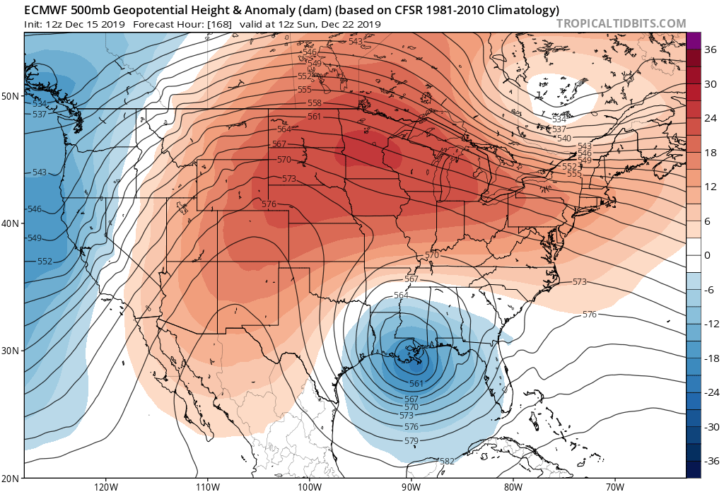
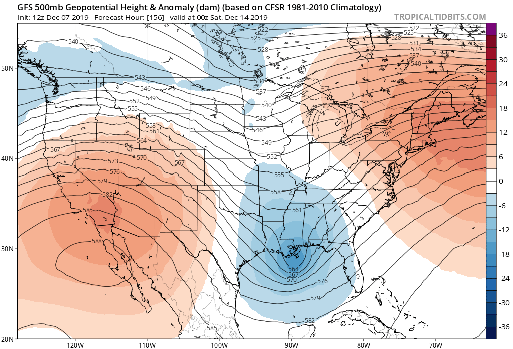
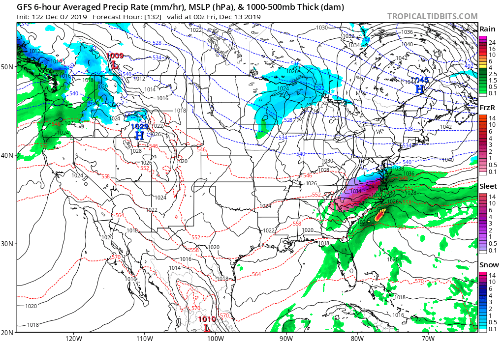
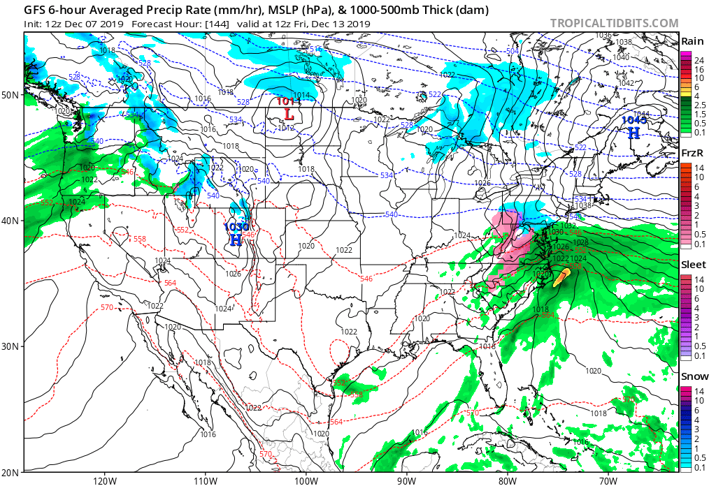
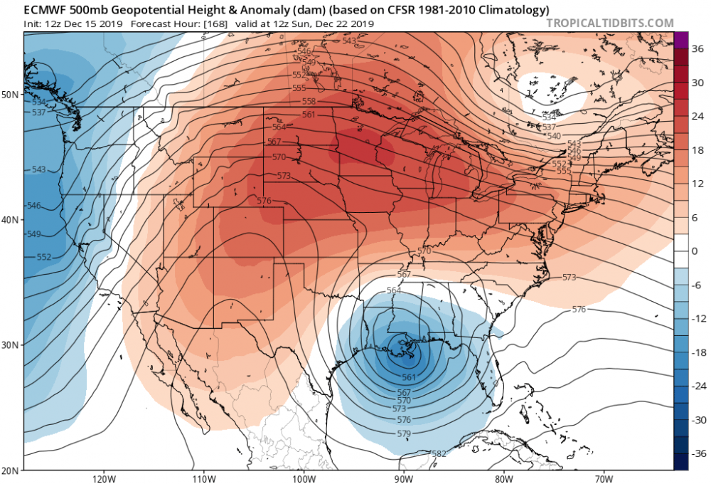
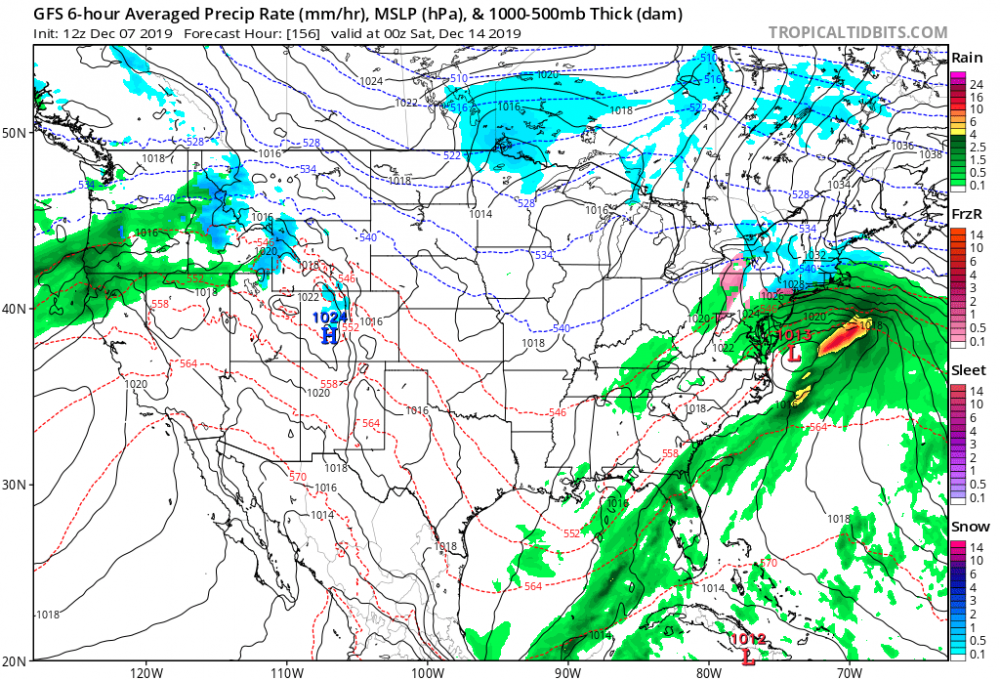
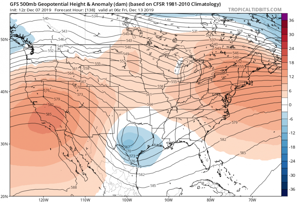
Interesting. Strong high slipping to the east. Weak Upper level low in Texas . Will watch this


-
December 2019 Med/Long Range Disco
PaulyFromPlattsburgh replied to Bob Chill's topic in Mid Atlantic
I have not seen a high that strong in a while. 1045. Upper level low in Texas.