PaulyFromPlattsburgh
-
Posts
532 -
Joined
-
Last visited
Content Type
Profiles
Blogs
Forums
American Weather
Media Demo
Store
Gallery
Everything posted by PaulyFromPlattsburgh
-
Synoptic Snowstorm 2/1-2/4
PaulyFromPlattsburgh replied to BuffaloWeather's topic in Upstate New York/Pennsylvania
Absolutely ripping whiteout. 30 DBZ band. Anyone know what’s causing this surprise band. Usually the Froude values are so high we never cash in on upslope. -
Synoptic Snowstorm 2/1-2/4
PaulyFromPlattsburgh replied to BuffaloWeather's topic in Upstate New York/Pennsylvania
Feels almost like a lake effect experience -
Synoptic Snowstorm 2/1-2/4
PaulyFromPlattsburgh replied to BuffaloWeather's topic in Upstate New York/Pennsylvania
I’m in some kind of upslope band been getting 1-2 inches an hour for the past 3 hours. Close to a foot here already total -
Upstate/Eastern New York
PaulyFromPlattsburgh replied to BuffaloWeather's topic in Upstate New York/Pennsylvania
I would love that haha! -
Upstate/Eastern New York
PaulyFromPlattsburgh replied to BuffaloWeather's topic in Upstate New York/Pennsylvania
Wow nice looks like I’m in a perfect spot. RGEM burries me -
Upstate/Eastern New York
PaulyFromPlattsburgh replied to BuffaloWeather's topic in Upstate New York/Pennsylvania
Plattsburgh? -
Upstate/Eastern New York
PaulyFromPlattsburgh replied to BuffaloWeather's topic in Upstate New York/Pennsylvania
Wow my area looks to score somehow from the redeveloping coastal?!! -
Upstate/Eastern New York
PaulyFromPlattsburgh replied to BuffaloWeather's topic in Upstate New York/Pennsylvania
Sad storm for me. 0.2 inches lol mostly virga. Congrats to the rest. Waiting for the northern Adirondack special -
Mid to Long Term Discussion 2020
PaulyFromPlattsburgh replied to jburns's topic in Southeastern States
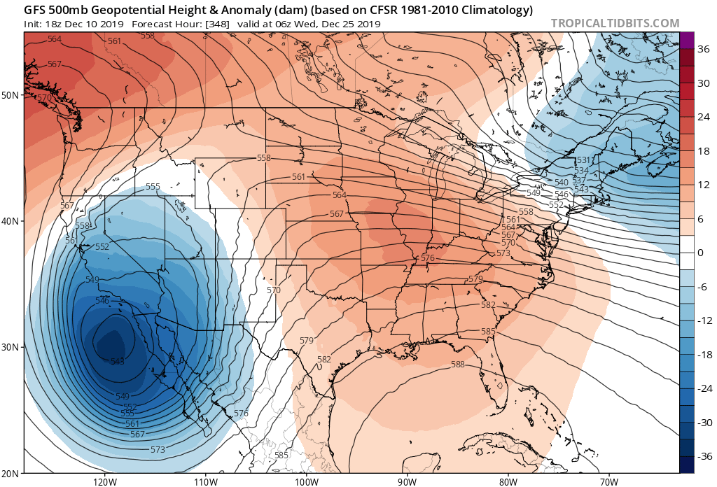
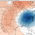
yes negative heights indicate a trough and positive heights indicate a ridge. look at 500mb -
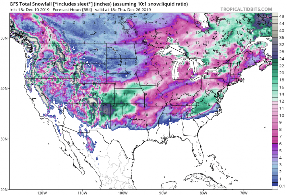
Umm the latest GFS delivers a record snowstorm for Texas at the end of its run. Wow what a bomb