PaulyFromPlattsburgh
-
Posts
532 -
Joined
-
Last visited
Content Type
Profiles
Blogs
Forums
American Weather
Media Demo
Store
Gallery
Everything posted by PaulyFromPlattsburgh
-
Possible Dec 1-3 Winter Storm
PaulyFromPlattsburgh replied to Zelocita Weather's topic in New York City Metro
. -
Possible Dec 1-3 Winter Storm
PaulyFromPlattsburgh replied to Zelocita Weather's topic in New York City Metro
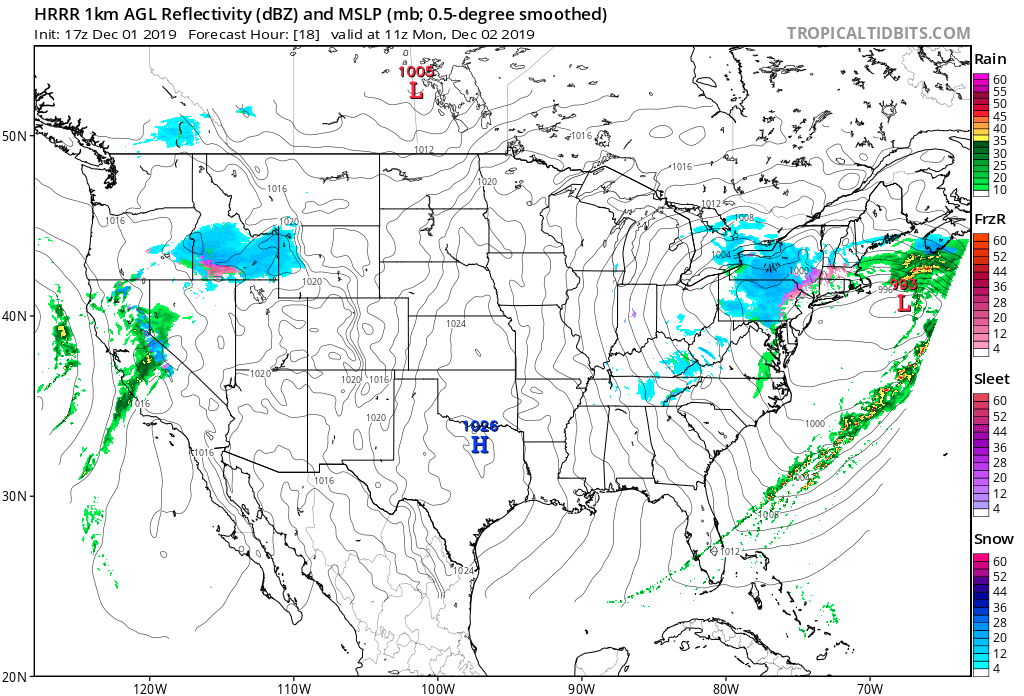
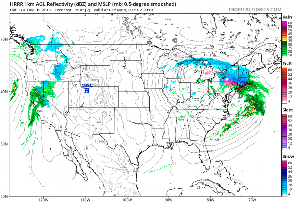
That’s not the pressure. It can’t be. I don’t think those are pressure readings. In fact I believe that said 031 but the line crossing over it makes it look like 931! -
Possible Dec 1-3 Winter Storm
PaulyFromPlattsburgh replied to Zelocita Weather's topic in New York City Metro
Where are u getting these #s lol. Not 931 by any means -
Possible Dec 1-3 Winter Storm
PaulyFromPlattsburgh replied to Zelocita Weather's topic in New York City Metro
Looks like a really late developing Miller B hence why it’s still snowing in albanyin Albany -
Upstate/Eastern New York
PaulyFromPlattsburgh replied to BuffaloWeather's topic in Upstate New York/Pennsylvania
If you look at the radar, there is some snow squalls developing off of lake Champlain going west south of Cornwall. Rare to see! -
Upstate/Eastern New York
PaulyFromPlattsburgh replied to BuffaloWeather's topic in Upstate New York/Pennsylvania
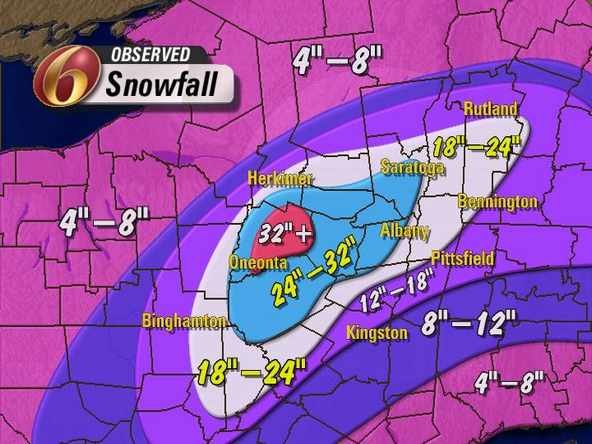
Something similar to the early November event. Had a foot then. That was even a bit too north for me. An inland runner with the 500mb running south of Albany is usually good.SWFE are good here when we get them -
Upstate/Eastern New York
PaulyFromPlattsburgh replied to BuffaloWeather's topic in Upstate New York/Pennsylvania
Snow ended. 1 inch total. These types of setups suck for me. -
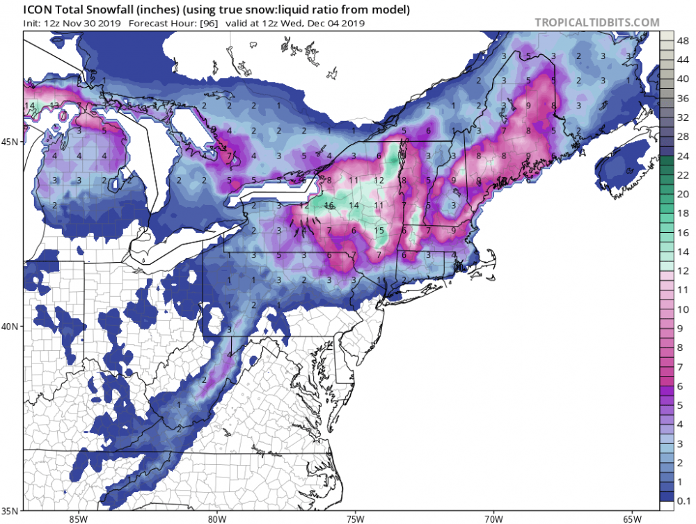
New HRRR looks much better for SNE! Enjoy this one guys. round one
-
EDIT: new HRRR much improved.
-
HRRR if correct is gonna upset many

-
I live Half hour away in plattsburgh. I could smell the smoke
-
Upstate/Eastern New York
PaulyFromPlattsburgh replied to BuffaloWeather's topic in Upstate New York/Pennsylvania
Yeh it’s confused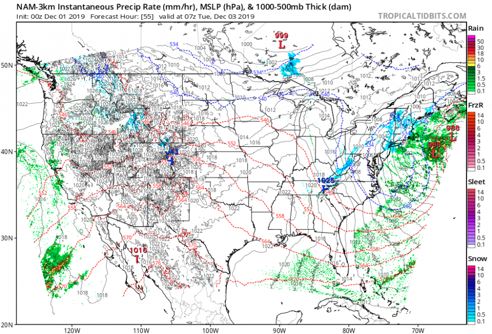
-
Upstate/Eastern New York
PaulyFromPlattsburgh replied to BuffaloWeather's topic in Upstate New York/Pennsylvania
This is not my system unfortunately... I need an inland runner like we got in early November lol. I cashed in with a foot during that one. Can’t win them all. Gonna hope for a quick front end 1-2” before the secondary moisture stays too far south -
Upstate/Eastern New York
PaulyFromPlattsburgh replied to BuffaloWeather's topic in Upstate New York/Pennsylvania
I feel like a lot of the action is now on the back end from the energy between the primary and the redeveloping coastal. A regular coastal storm would bring clear skies to Syracuse! Lol -
Upstate/Eastern New York
PaulyFromPlattsburgh replied to BuffaloWeather's topic in Upstate New York/Pennsylvania
I know it counts some as sleet but wow! Smoked. Where are the buffalo warnings??? At least the eastern part of the area. To let the public know big snow is a possibility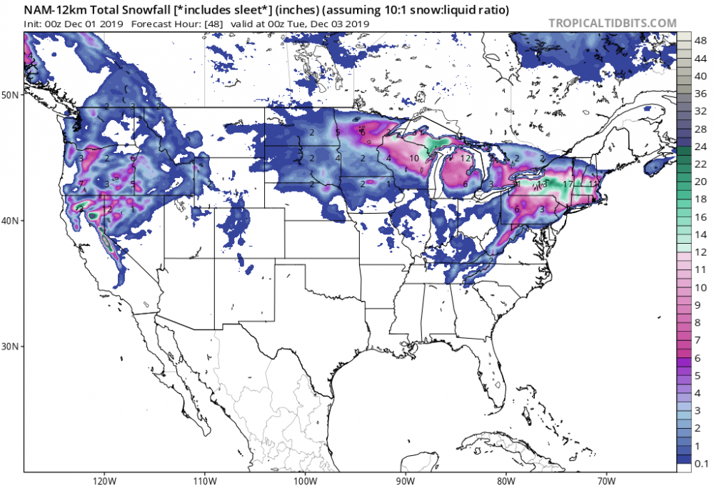
-
No, it’s just teasing us for the 00z
-
Upstate/Eastern New York
PaulyFromPlattsburgh replied to BuffaloWeather's topic in Upstate New York/Pennsylvania
New England board blowing up after that run lol. Everyone discounting the NAM now. Bunch of IcOn haters lol. But if you really look at it’s been leading the way -
Yet it’s ahead of the GFS in accuracy. And the NAM just trended torward the solution it’s been showing for three days. Extending snows into Syracuse and buffalo now even
-
Upstate/Eastern New York
PaulyFromPlattsburgh replied to BuffaloWeather's topic in Upstate New York/Pennsylvania
The 3k is even better really extends precip out torward Buff. They need a warning -
ICON is third in accuracy ahead of the GFS in the past 90 days and seems to have lead the way this whole time as Well.well done. Euro and Uncle are first two in accuracy
-
Upstate/Eastern New York
PaulyFromPlattsburgh replied to BuffaloWeather's topic in Upstate New York/Pennsylvania
NAM destroys syracuse -
Upstate/Eastern New York
PaulyFromPlattsburgh replied to BuffaloWeather's topic in Upstate New York/Pennsylvania
This is such a dynamic low that it will come down to “nowcasting” . -
Upstate/Eastern New York
PaulyFromPlattsburgh replied to BuffaloWeather's topic in Upstate New York/Pennsylvania
ICON “weenie”
-
I really hope it pulls off the coup