ORH_wxman
-
Posts
93,110 -
Joined
-
Last visited
Content Type
Profiles
Blogs
Forums
American Weather
Media Demo
Store
Gallery
Everything posted by ORH_wxman
-
I def wouldn't forecast a monster storm based on that ETA run down in the M.A....maybe for like NNJ still, but that is getting pretty ugly for the rest of the M.A.....relying on just the deformation which it wasn't uncommon for the ETA to be overdone on (the QPF bias back then was even more than now on the ETA...aka NAM). You can actually see how much central and S NJ is dryslotted too. But that run def gave a little more snow to the M.A. than I recalled in the 2011 synopsis...maybe I need to do some more mind exercises. lol.
-
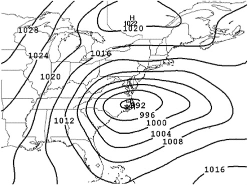
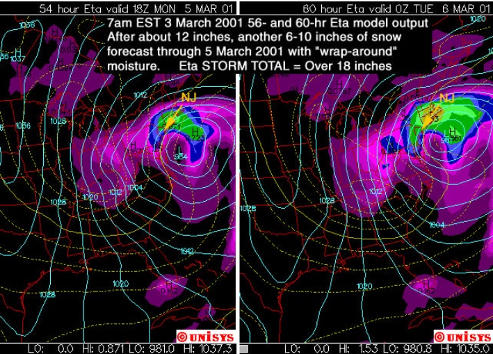
2 more from March 2001...model images....first one is the AVN model and the 2nd one is the ETA model from a Rutgers presentation I believe (hence the focus on NJ)...you can see by the 12z run Saturday morning, the ETA was already crushing SNE...though it was still overdone for the mid-atlantic, but the trend was in full effect by this point (the ETA-X was actually more aggressive in the next panel or two).....you can see how ridiculously far south of AVN is....these are not the same model run...AVN is 12 hours earlier in the cycle, but it's still way south in classic KU position for the M.A.:
-
12/30/00 kind of sucked in ORH too...not because we changed to rain, but because we got blitzed for several hours and then a horrific dryslot that went all the way into S VT, which effectively ended the storm. It never really gave much as it collapsed back east, maybe another inch of currier and ives snow. The forecast for for widespread 10-16" or so...but most were in the 6-10 range...with a few lucky 12" lollis. I thought 10" was unlucky at first but then found out I was actually fortunate to get that much. The first 4-5 hours were pretty fun though...very heavy snow. I'm sure it was a great storm for the greens.
-
Radarman sold his camera to ginxy a few years later.
-
I had to drive back to ORH twice that semester from Cornell...once right before the March 2001 blizzard to see my sister's college recital (she went to Boston Conservatory of music)...experiencing the storm was fun at least (and I felt bad because there was like a crowd of 20 people around me during the reception asking about the storm...at this point the forecast was literally 30-40" for a lot of MA)...and then again in early April around the 10th...there was still about 10-12" of snow on the ground the 2nd time. It was bizarre in that it wasn't the typical "fresh snow pack on April 10th from a big storm on April 7th" type pack you would normally see that late. It was clearly layered snowpack and looked more like mid March than April 10th. It definitely would have been a horror show for golfers ready to get out and start the season.
-
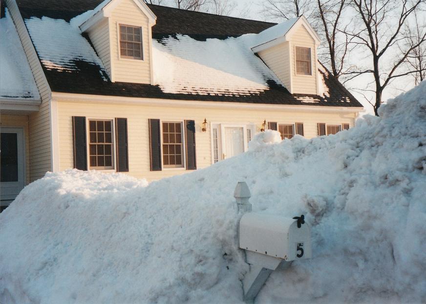
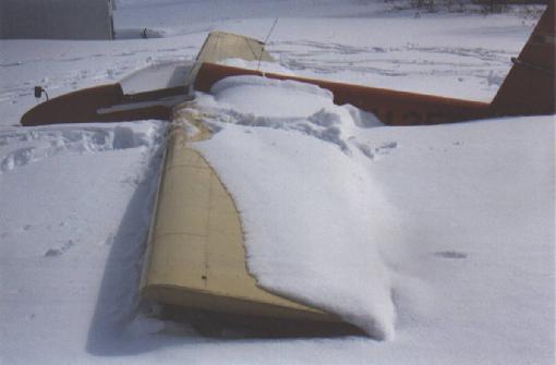
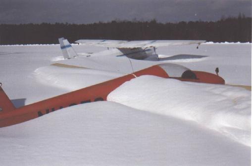
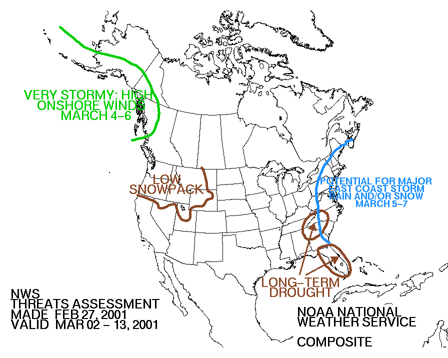
Some old March 2001 stuff...the airplanes are Sterling, MA airport that I remember grabbing online not too long after the storm...and there's a late February map from HPC on the threat:
-
It was def a huge bust by a lot of big name outlets. I think it would be unlikely to happen again because we have better ECMWF data now and it also runs twice a day. Back then, we only got one run of the Euro per day and it was crappy graphics and the one run (12z) didn't even come out until 7-8pm. The Euro was not gung ho on huge mid-atlanitc snows once we got inside of about 72 hours...it was even iffy at 96 hours. When it trended way north into a New England storm at 72 hours...I recall DT on ne.weather saying it was completely over for the M.A....citing the EE rule...the old ETAx (which was the ETA out to 84 ours) had a similar solution. I think way too much weight was probably placed on the GFS (AVN model back then), UKMET, and Canadian around 48-72 hours...and it was probably because there was much better access to that data and it was more timely. Also the AVN had been performing well that winter, so folks didn't have a huge reason to doubt it again....except for the fact that the ECMWF was against it.
-
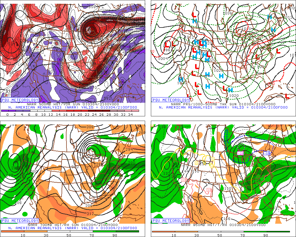
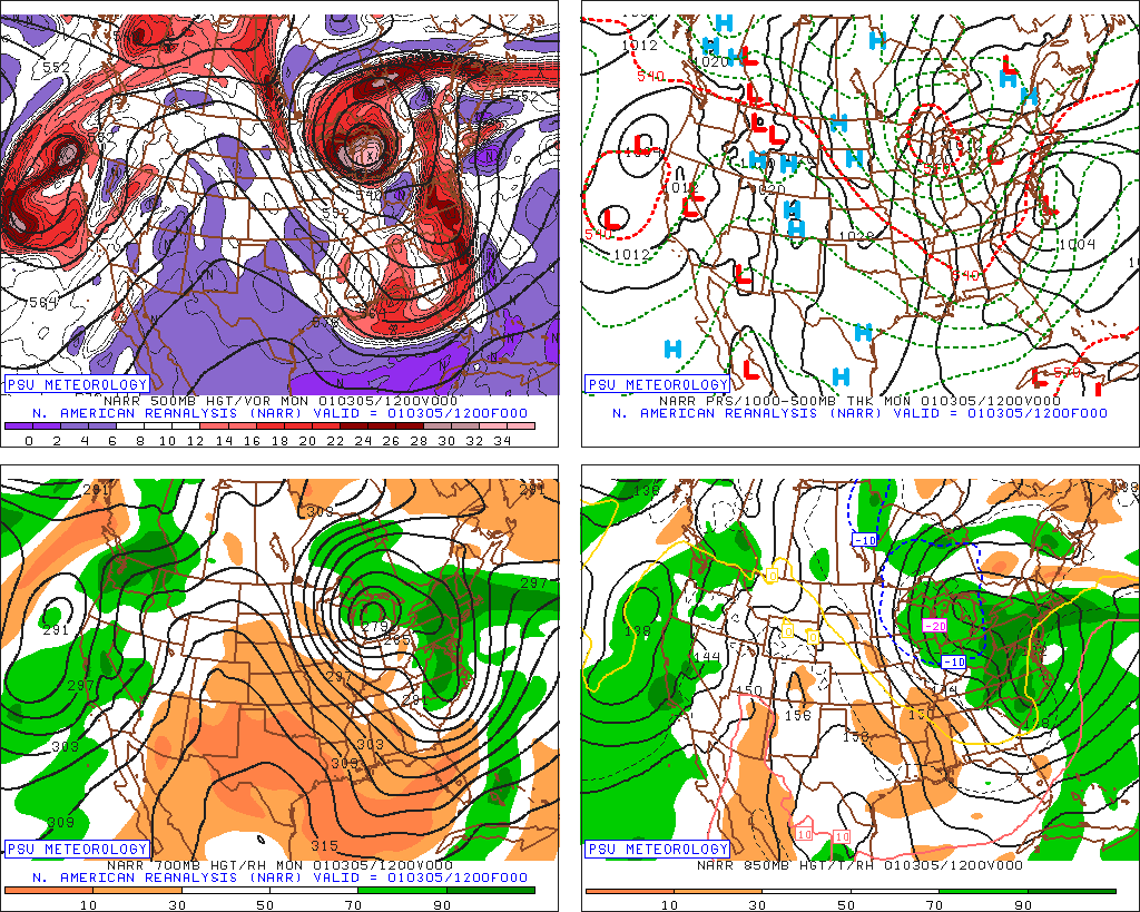
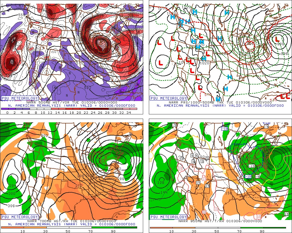
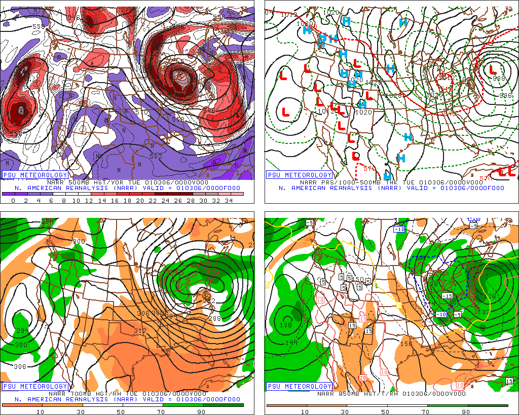
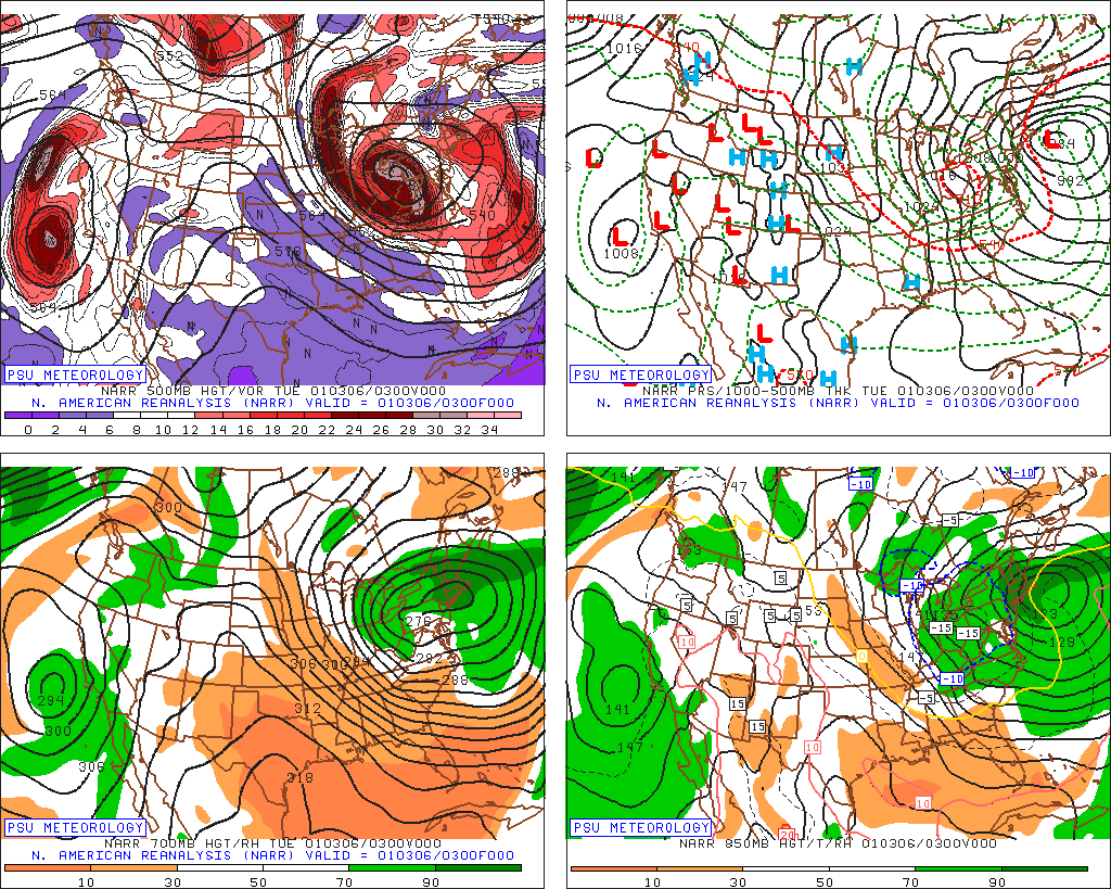
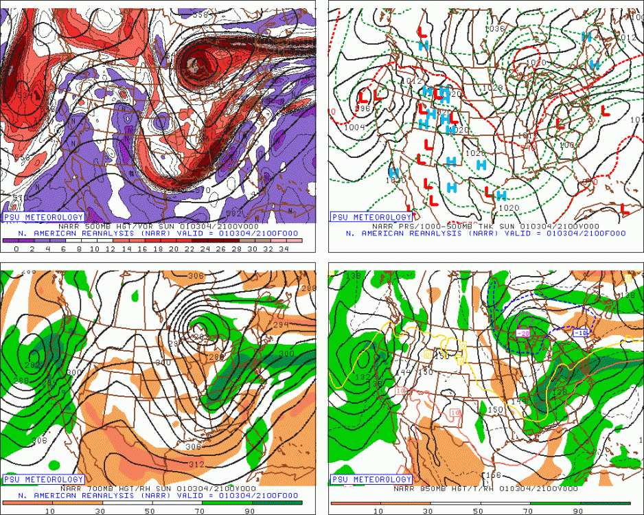
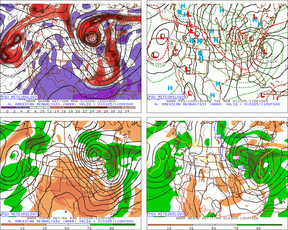
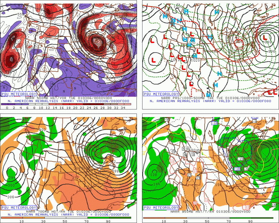
If that initial spoke of energy out to the east of the main 500 low in the lakes hadn't been there, then it would have been a much better storm further south...but the whole baroclinic zone set up along that spoke, so you had to be pretty far north where the spoke was to get max snowfall. The whole thing eventually congeals further south....but again, by the time that happens, the storm is occluding, so the dynamics have weakened somewhat. So your area prob had like 8-12" instead of 18-24. You'll often hear that the storm "didn't phase cleanly" and that's what is really mean by that....that leading piece of energy kind of outran the main 500 low just a little bit. Here's a view of that energy when it's further south still...you can see it's over MS/AL down south...things are looking good....but by the time we get to the next morning, it's starting to outrun the lakes 500 low a little too much and you can see the 850mb front is already over LI (look at the kinks poking east in the isoheights) and the storm isn't really organized yet...finally, the sequence reaches Tuesday evening and that's the plot I showed once already above where the storm is finally starting to really organize well and the 700 low is trying to redevelop, but at this point, it's pretty far north, so you're missing out on the best initial frontogenesis...you still end up getting decent snow eventually as everything congeals south/southeast, but you probably cost yourself at least 10 inches with the missed opportunity early in the storm...that was intense ML fronto snow:
-
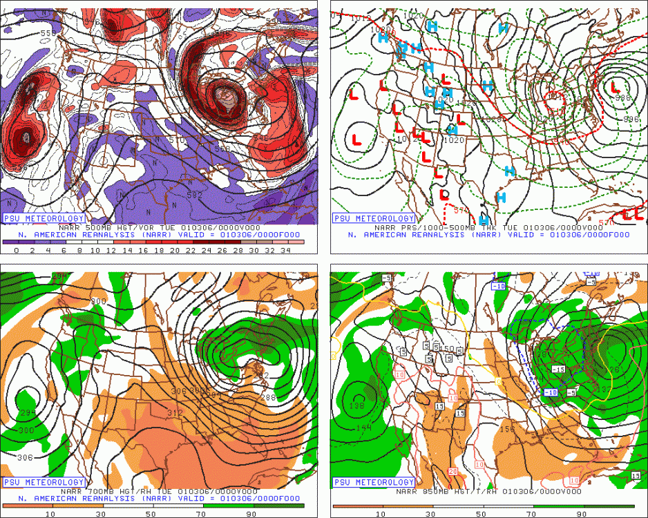
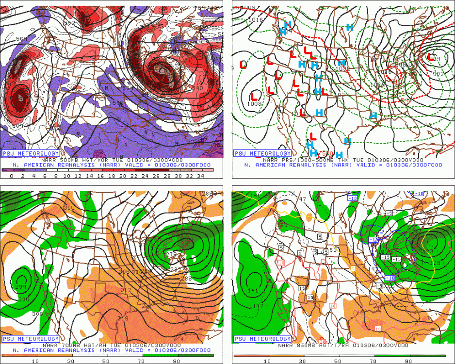
The initial burst on the night of the 5th into the 6th was a little far north on the setup for your area. 700mb low is almost over like POU or SW CT...it does redevelop into the larger circulation further south and southeast later one, but by the time that happens, the best frontogenesis has already occurred and the storm is more occluded. So you got a lot of lighter snows during the 2nd half of the storm...there was one decent deform band, but it was mostly to your east and went over central/E LI as well. During the early part of the storm where the best ML frontogenesis was occurring, you had to be up further N into maybe far N CT, MA, and NH/VT. Here's a couple snapshots of the early part of the storm when the max intensity snowfall was occurring in SNE (mostly MA and maybe far N CT)....you can see the 700mb low is kind of elongated E-W but it's fairly far north which is going to put the best ML fronto north of your area:
-
I don't have model forecasts of that event....but there's a good thread on remembering that storm: https://www.americanwx.com/bb/topic/42533-january-2223rd-2005-blizzard-recap/ That storm did have a quick movement northwest on the models in the final 48 hours. The Cape was always going to get slammed and same with SE MA....but back in ORH was sweating it out a bit, but that final push NW got us in the 2 foot range. It was definitely one of the best "true blizzard" condition storms in the old school sense (meaning temps included)...temps were frigid as I'm sure you remember...even right in Boston. Most of the storm was in the teens....maybe low 20s at the peak there and back here we had hours of the storm around 10F. Huge winds and hours of near white-out conditions. It was definitely a blizzard's blizzard...not a marginal blizzard or just a heavy dump of snow with meh winds...ala Feb 2003 or even January 2011 which had better winds than '03, but still not overly exciting.
-
Relive some February 2015 model runs: http://mp1.met.psu.edu/~fxg1/ARC/20150202/AVNEAST_0z/avneastloop.html http://mp1.met.psu.edu/~fxg1/ARC/20150207/AVNEAST_0z/avneastloop.html http://mp1.met.psu.edu/~fxg1/ARC/20150214/AVNEAST_0z/avneastloop.html
-
I think ginxy over to N Foster RI had like 18 inches in that one...most of it fell in 6 hours. That deathband over E CT and into NW RI I remember. 4" per hour stuff and thundersnow. That was actually one my toughest nowcasts...I was getting bombarded with calls/emails all day about what we might get. I had about 12 inches in ORH as well in that one. We actually had a little predecessor band of snow late afternoon on the 26th...I think most of us got about 1-2 inches from it. That season seemed to have predecessor snows in multiple events (Feb 1-2 was a classic one where the predecessor snows were better than the main event).
-
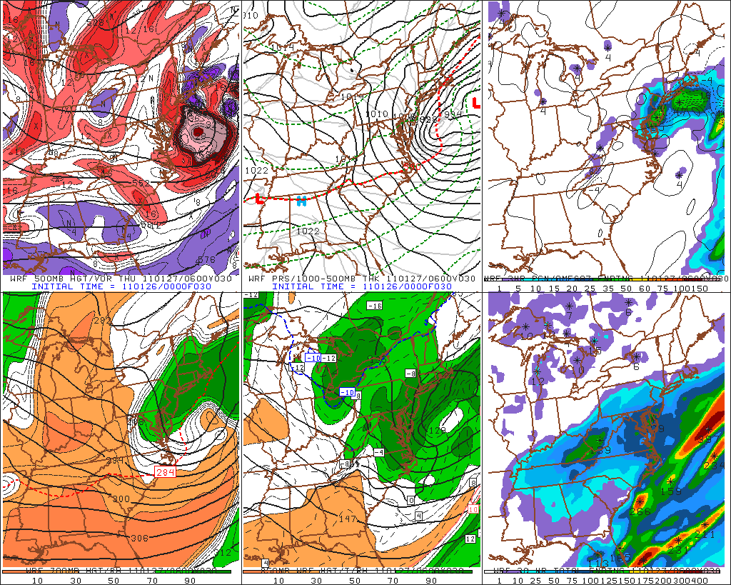
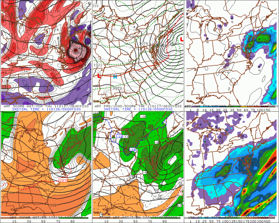
That was a great bust...it had been big on the models about 3-4 days out but then starting trending SE to the point where it looked like just a scraper. Then on January 26th in the morning, we started noticing the RUC and HRRR showing much more robust look at the end of their runs...it looked like we'd get crushed if extrapolated out another 6-10 hours...but it was still easy to be a bit skeptical since those models can often be overamped after 6 hours....but when they didn't back off through the afternoon and the satellite/water vapor and radar loops started supporting them by late afternoon, we were thinking "oh man, this might be real". I remember the 18z NAM jumped like 100 miles northwest that afternoon and I knew we were probably in good shape...that finally a non-nowacast model had made a jump...the 18z GFS followed suite an hour or two later. This had been the NAM run the night before at 00z....almost all the models looked like this. GFS was slightly better, but they were all way SE.
-
No, he was saying you could see how bad the tree damage was from the Oct '87 storm during his April '88 trip. I'm sure it took a couple years for it not to be really noticeable. (though for a tree expert like tamarack, he can probably notice that stuff a decade later)
-
Coldest storm I've ever been in. We had heavy snow and -1F at one point. Think we made it to -3F while the steady snow was still falling.
-
Yeah I remember that storm well...we had about 12-13" in ORH. That system had pretty strong winds. I do remember hearing about the huge snows in central PA. PA had the huge storm in January too of that winter.
-
I'm correcting scooter. That's actually march 8th, 2013. Yes I'm sick.
-
Yeah you got the icing event in 2013 before Christmas...whereas down here we had rain and 63F at the peak of it, though we did get backdoored down to about 30-31 and some ZR. The Christmas snowpack was mostly intact averaging about 3 inches but did have a few holes in it. Too bad, as prior to that event, we had around 16-17 inches on the ground after the clipper-redeveloper on 12/17....prob down to about 12 inches right before the Grinch storm started. 2000 and 2002 were also good down here, that latter giving us 13.5" on Christmas....only 2013 really differs. The bar has been set though for Dec 1995...we never had any thaws basically the entire month...snowpack just kept accumulating. Although the Dec 19-20, 1995 storm was somewhat "disappointing" (about 8.5 inches when 1-2 feet was forecast), it was still within the context of a snowy month that saw the depth reach around 20 inches for Christmas. We also had mood snow for days after the Dec 20 storm as the system just rotted in the Gulf of Maine and Nova Scotia which sent moisture pinwheeling back SW, including some nice snowshowers on Christmas day. A thaw wouldn't hit that season until we reached January 17, 1996. Two days later on the 19th, one of the most horrendous cutters hit....amazing warmth aloft for that time of year with 850 temps around +12. It even produced a line of severe Tstorms in SE MA. Brockton, MA would go from a 46 inch depth on the morning of January 12th to 0.0 on January 19th...mostly thanks to that destructive cutter. We never lost all of our snowpack in ORH, but we had a similar depth on January 13th (we had snow from the 1/12/96 storm while the coast had mostly rain...thus prolonging our depth increases) in the 45" range and probably got beat down to around 8-10 inches of a pure glacier that probably was somewhere around 3 to 1 or 2 to 1 ratio.
-
What did you get in that one? I'd have to imagine you cleared double digits pretty easily. That one had a pretty strong NE to SW gradient in MA due to the late explosion offshore as the storm transitioned from a classic SWFE to a full-blown coastal...areas out in SW MA had probably 2-4" while once you were up in Essex county, they had 12-14"....a lot of it falling late in the storm as the CCB started forming and gave them intense bands early that evening. I had just over 8 inches in ORH. By the time the storm was up at your latitude, it looked like a classic nor' easter on radar with bands rotating from SE to NW as the whole precip shield lifted N and NE. It was a great storm to track meteorologically-speaking. A lot of things going on like the coastal front (posted above) in addition to the rapid transitory features of the system. The storm trended colder too every model cycle inside of 48 hours...initially as we were in the early stages of the 12/19 event, I remember thinking a lot of sleet and ZR would hit us out in ORH for 12/21....never got even close...the non-snow ptype stayed well down in SE MA...BOS a little further north did flip to plain rain on east winds about 5 hours into the event, but then flipped back to heavy snow for a couple hours before ending as the storm deepened offshore. Too bad we had that miserable rainstorm on the 24th to warp our snowpack into a frozen glacier by Christmas morning. Never can seem to escape the Grinch in the past 15 years (except maybe 2010).
-
The southern route opens all the time...it's even opened in some years pre-2000...I guess the fact that some icebreaker decided to do it earlier than other crossings made it some big deal. The CAA this year definitely didn't melt back as much as a lot of recent years.
-
He's prob talking about the southern route. The deeper main channel northern route never opened this year.
-
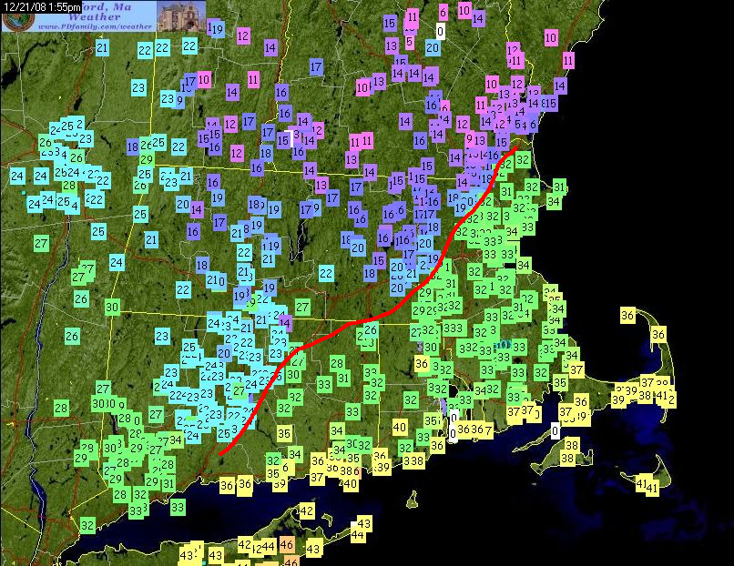
Dec 21, 2008 had a good one too...it was actually more impressive a couple hours before this image, but I didn't save an image for that time:
-
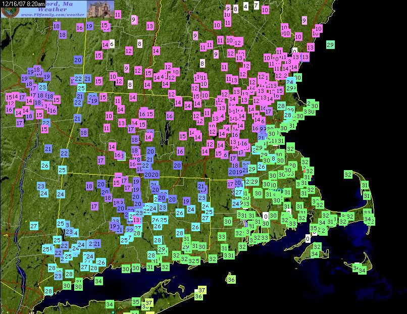
CAD was awesome in that one:
-
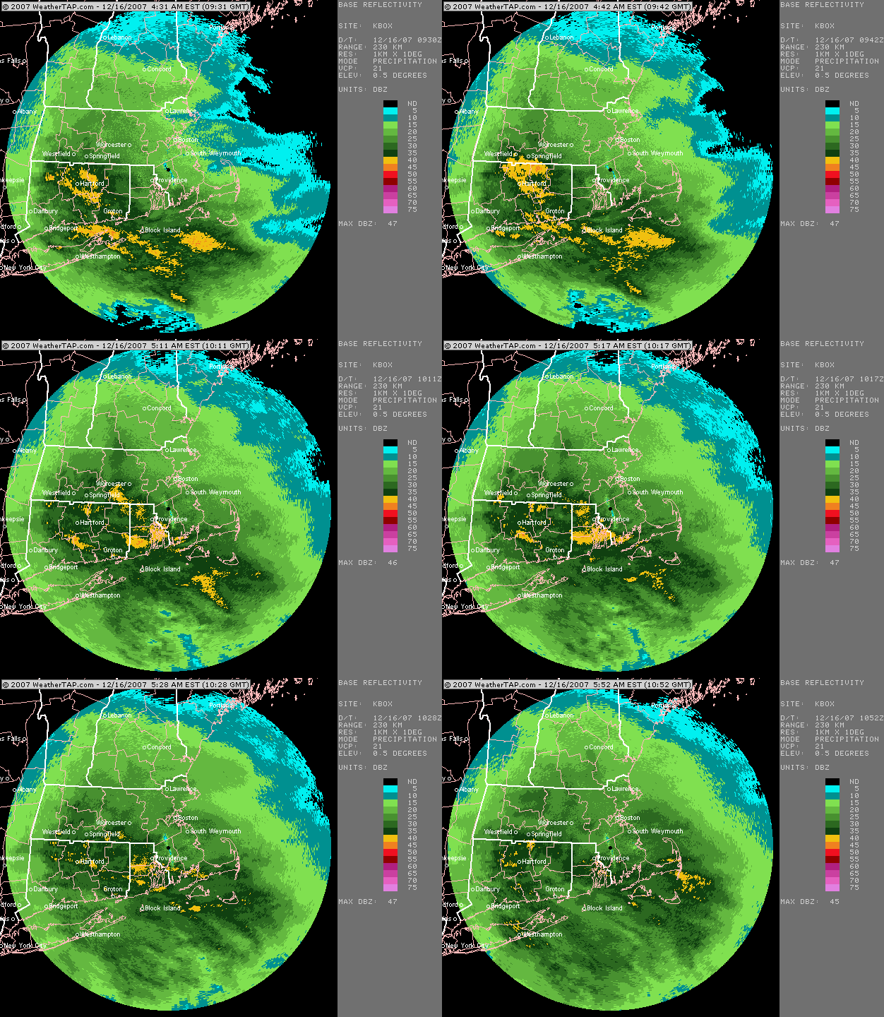
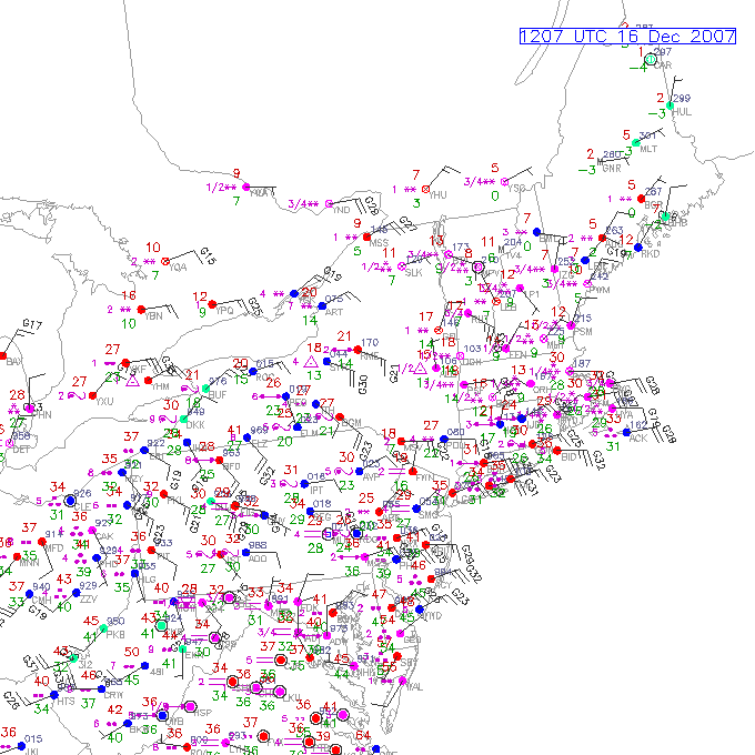
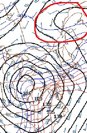
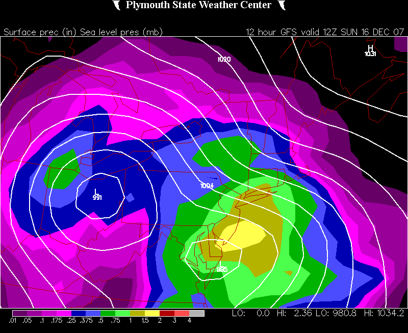
Back in the archives...found a very dumbfounding storm...the days before dualpol, but you can still tell where the line is.
-
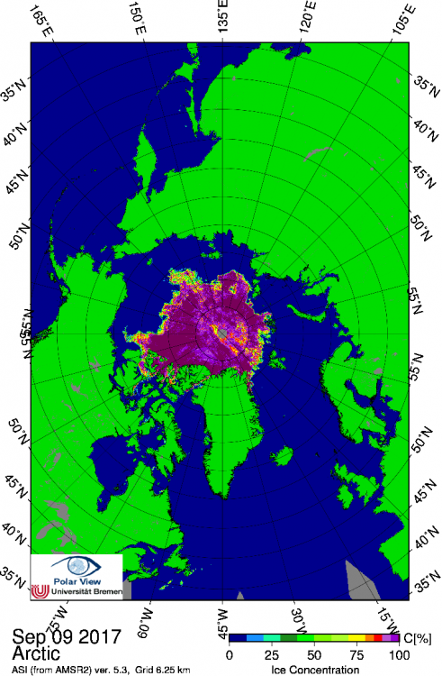
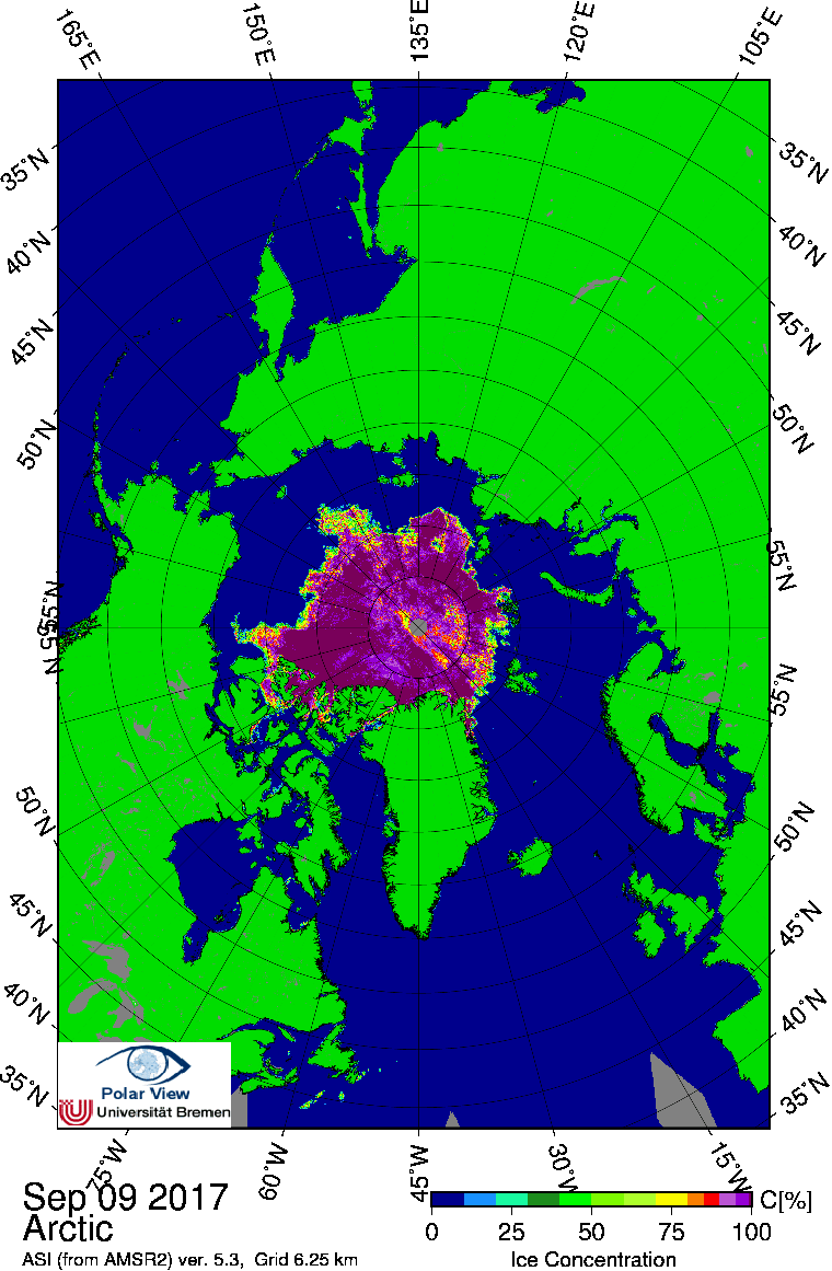
Given the area is more than 400,000 sq km above the min now, I think it is quite safe to call the minimum. My decision to use the post-2007 distribution served well this season for predictions as the area bottomed out at 2.94 million sq km...that was within my range of 2.90-3.30 at the time of this post. The minimum of 2.94 million sqkm ranks 5th lowest behind 2007, 2011, 2016, and 2012. There were some unknown factors going into this season. We had the lowest volume on record at the beginning of the melt season so we weren't sure how it would respond versus previous years. We had some pretty big/strong cyclones this summer, but the key IMHO is we lacked a good pre-conditioning melt pattern...so the cyclones did relatively little damage. The weak pre-conditioning was a bigger factor than the low volume, though the low volume did play a role as evidenced by the summer temperatures were very similar to 2014, yet the ice melted back further than 2014 which finished with an area minimum around 3.50 million sq km and an extent min around 5 million sq km. It is also pretty safe to call the extent minimum. NSIDC extent increased 92k last night, which puts it about 230k above the min. The minimum was 4.61 million sq km. This ranked 8th lowest behind 2012, 2007, 2016, 2015, 2011, 2008, and 2010. Jaxa's minimum was 4.47 million sq km which is consistent with the change in their methodology in 2014 which puts them a bit lower than NSIDC.. That closes the books on the 2017 melt season. Ice pack at min area: