ORH_wxman
-
Posts
93,098 -
Joined
-
Last visited
Content Type
Profiles
Blogs
Forums
American Weather
Media Demo
Store
Gallery
Everything posted by ORH_wxman
-
Guys cut the politics talk...you can go to Ampol or some other political forum, but not here. I've started deleting posts. If you keep posting, then I'll just suspend or 5-post you. I get that people may want to talk about it, but most people prefer to keep politics off the wx side and it's a rule we've long stood by going back several versions of these forums.
-
Yeah we'll see. The weeklies supported a really bad pattern to open December too FWIW. We know how these things can be horrible accuracy sometimes, but it's something to watch.
-
That Euro december map would be hideous....even with the -NAO...there's no cold air for the NAO to hold in. We might see a marginal event or two on that look. Lets hope it's wrong. We don't want the piggy showing up.
-
Wow this thread flew off the rails....time to shut down the political talk
-
Can't wait for the postmortem on the polls this time. Maybe they all donate their money to Selzer?
-
Nice snow growth on the phineas cam. Probably 20 to 1 stuff.
-
This is bringing back memories of the bizarre golf course shutdown well after it was apparent people don't get covid playing golf. I highly doubt this is going to be enforced.
-
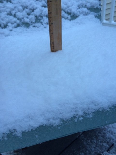
About an inch on winter hill
-
Thank god the heated sidewalks are not on yet at Stowe.....those things make me irrationally angry.
-
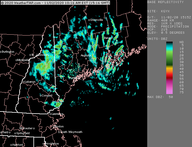
This event is pretty robust considering you are getting the echoes showing up so well in the White Mts....Alex will often report decent upslope when you can barely see the echoes, so this one is deeper in the atmosphere...rather than some of the lower level shallow upslope
-
Def don't measure in the open field with this stuff....you prob want to try and find a fairly sheltered place where some trees are close enough to keep the wind from going crazy, but not so close as to contaminate the snowfall itself. Maybe the north side of your place?
-
Same here. A lot of houses were giving out “baggies” of candy. Basically ziploc bags with 4-5 pieces in each one instead of the usual one or two you’d get at a house. Also, an unusually high number of houses gave out full sized candy bars this year. I think a lot people were feeling bad for the kids with all the crap they’re going through with school.
-
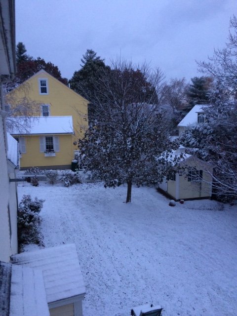
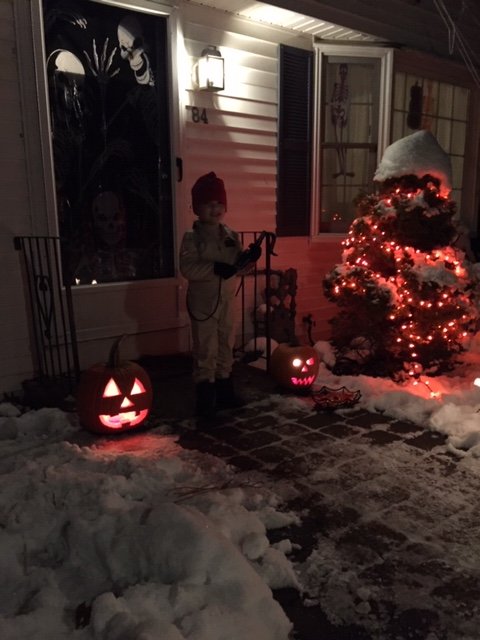
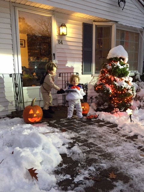
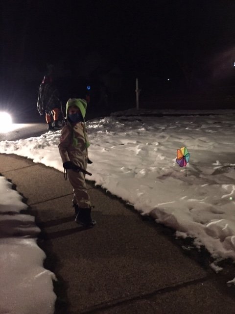
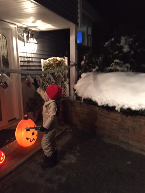
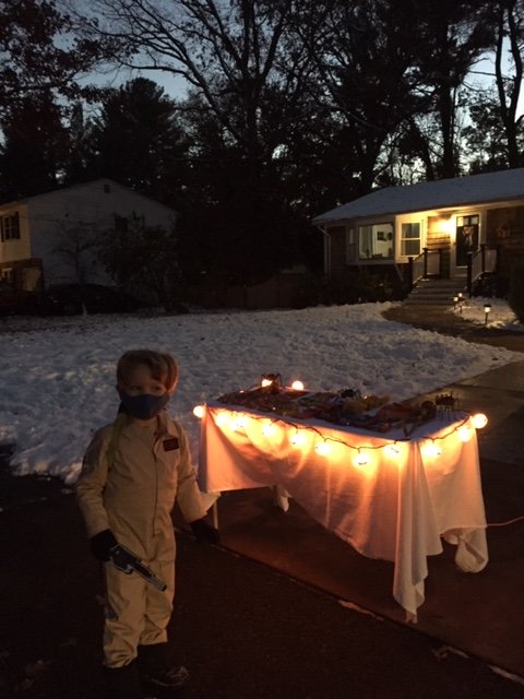
This angle is probably a little easier to tell they are orange...man, what a ridiculous Halloween with the covid safety measures and all the snow.....but all that matters is the kids had a blast. Yep. It was a little different but to all the little ones running around getting their candy at tables set up or through pipes or just tossed into their bags, it was just the same as ever. They got their candy while in costumes and had the added “fun” of snow everywhere.
-
C’mon man...those are orange Halloween lights and the white ones lining the walkway are little ghosts.
-
Yes and his little brother was marshmallow man (he had no idea what was going on though, lol)
-
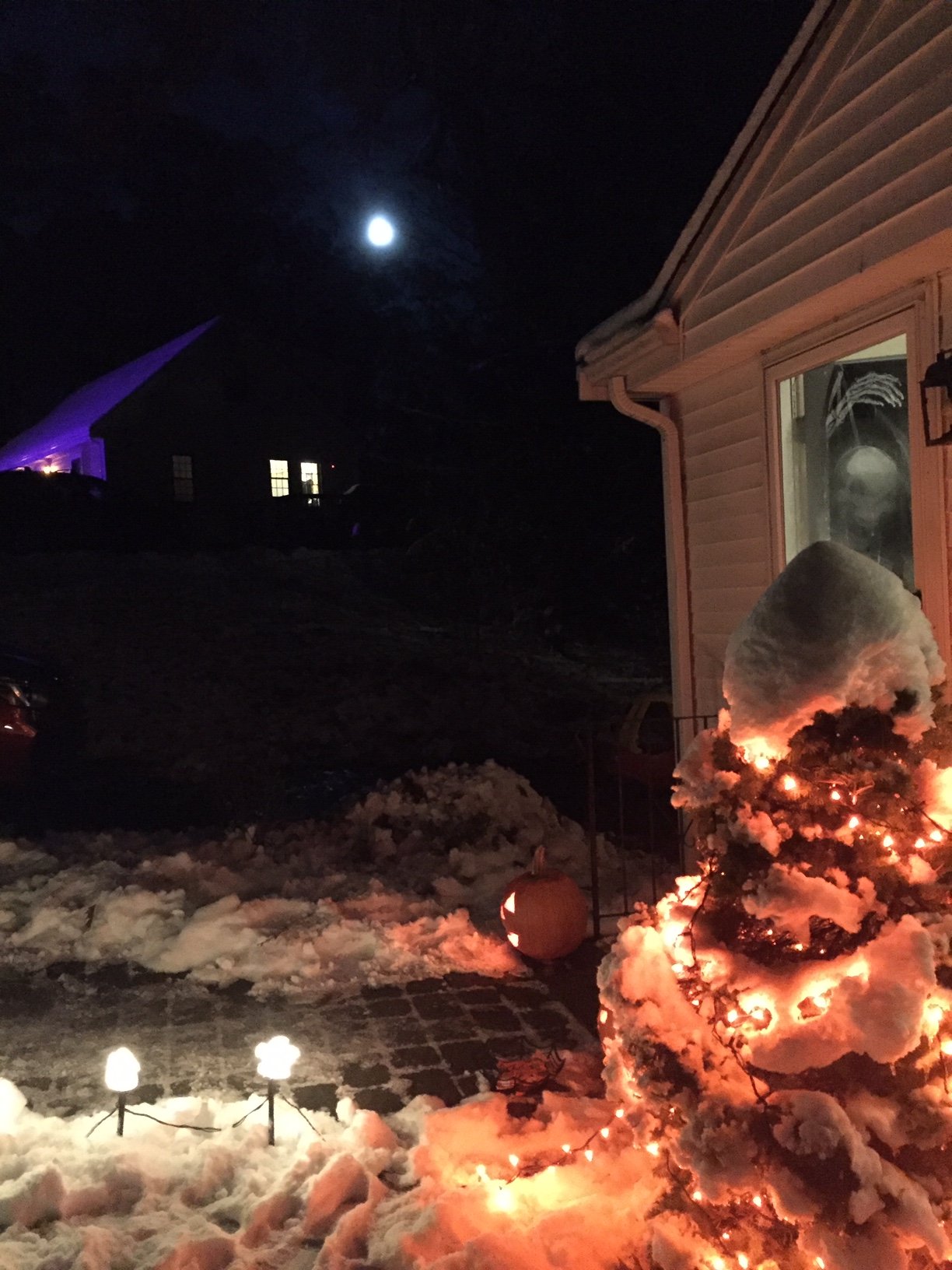
Yeah it’s just a crappy iPhone 6 camera. This one is for you....Halloween Hunter’s Moon with a snowscape. Wish I had a better camera

-
Totally normal Halloween
-
That’s the one I was waiting for. Great shot there. Amazing just how much fell right in Boston proper. Sharp cutoff just southeast of Scooter.
-
Yeah I was thinking how empty it probably is so it is easier. Though I've heard talk that some airlines might go to rapid testing for their passengers...not sure how that would possibly work for like 100 people. If it would require people getting there super early, then t would offset a lot of the current ease of no lines.
-
If we’re going to discuss covid at all in the banter thread, then we are going to keep politics out of it. Let’s not imply political conspiracies for objectively easy-to-track numbers from a whole slew of decentralized sources. Some might complain about media narratives and such, but that is outside the scope of this thread and getting into the political aspect of it...and thus, should be avoided or we will just start deleting stuff.
-
I might have to start subscribing to Ginxy’s Astrology Weather forecasting service...he’s always talking about etreme events at the end of October. Maybe there’s something to it....full moon goon?
-
Happened in 2011. Though up in Princeton we had a semi-white Thanksgiving from the day before when a front-ended gave a couple inches. Xmas, New Years and Vday were all totally bare.
-
I said to myself on Halloween 2011 when there was still about a foot of snow OTG....”there’s a good chance I’ll never see another white Halloween unless I move into the mountains or Alaska”. Even ORH with their 6.2” got 9% of their seasonal snowfall. Doesn’t beat the 26% they got in 2011 (from two events). Let hope the ensuing winter is better.
-
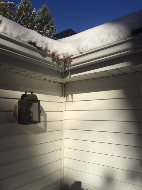
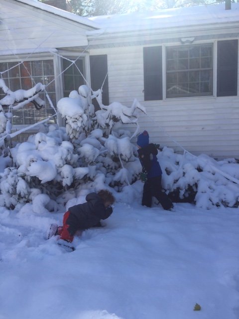
Typical Halloween Saturday...icicles hanging off the gutters and boys playing in the snow
-
Could make a run at 70 in spots later next week. Quite the flip from this weekend and even early in the week with that brutal cold shot on Monday/Tuesday.