ORH_wxman
-
Posts
93,098 -
Joined
-
Last visited
Content Type
Profiles
Blogs
Forums
American Weather
Media Demo
Store
Gallery
Everything posted by ORH_wxman
-
That had to be a drift. We didn’t even have 55” in March 2001 in ORH county though some places did get close. I definitely believe 45” though. I mean some places did get 60”+ in those 2 weeks. But you’d probably need like 100” over the same period to reach a 55” depth.
-
LOL you missed my posts a few posts up....I had just mentioned that one when you brought up coastal and I going into Midatlantic threads. I had said that one was one of my favorites... https://www.americanwx.com/bb/topic/53695-fall-banter-and-general-discussion/?do=findComment&comment=5657569
-
One of my favorite events was the event a few days before snowmageddon (I think that’s what you guys called 2/5-6/10)....the event I’m thinking of I think was 1/30/10...and you all were fighting with southern VA and NC weenies. It was like a classic SWFE (overrunning event) except displaced 200 miles south and I was thinking “those NC weenies are gonna feel just like mid-Atlantic weenies during overrunning events....classic trend north in the final 24-48 hours” and I went in there posting about how MD and DC would get smoked while they’d prob mix with sleet and rain down in NC. It was like forecasting for SNE the previous 2 winters where NYC weenies kept getting duped...except MD was SNE this time and NC/S VA was NYC. Turned out perfect too, I think I recall you and Marcus getting like 7-8” of fluff when the models were barely giving you an inch 36 hours earlier.
-
There is no doubt we have a sickness for this stuff.... Yeah, before Alex moved up there a few years ago we had nobody right in the whites. Now with Phin we have two....and since Phin is also in a real weenie spot but for somewhat different reasons than Alex, it’s really fun to scrutinize the differences and then wait for their obs in the winter. This stuff is straight out of heaven for hardcore snow weenies....analyzing topo maps. And a big yes to Maine...we really need some posters in the Bethel-Rangeley corridor. Maybe in another 5-10 years I’ll contribute by getting a place there, LOL.
-
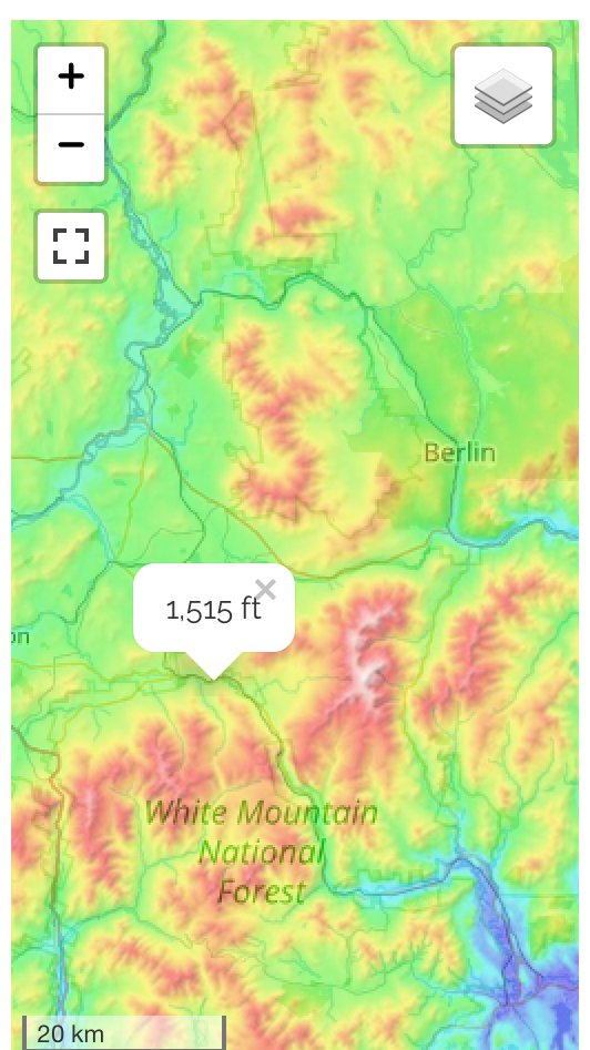
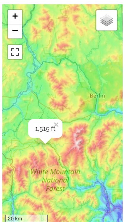
I zoomed out a little and put roughly Phin’s and Alex’s locations.... First one is Phin...you can def see he’s in a really good synoptic spot. Those north, northeast, and easterly winds are gonna upslope and also funnel into his area....he’s def getting upslope too but not as good as Alex. Now here is roughly where Alex is (correct me Alex if I screwed it up but I thought you were slightly west of Bretton Woods...def prime upslope spot...you have funneling like powderfreak said plus great spot for blocked flow. There’s definitely potential to struggle a bit on bb easterly or ENE flow events though but they look fine on N and NE winds....just maybe less funneling than Phin gets.
-
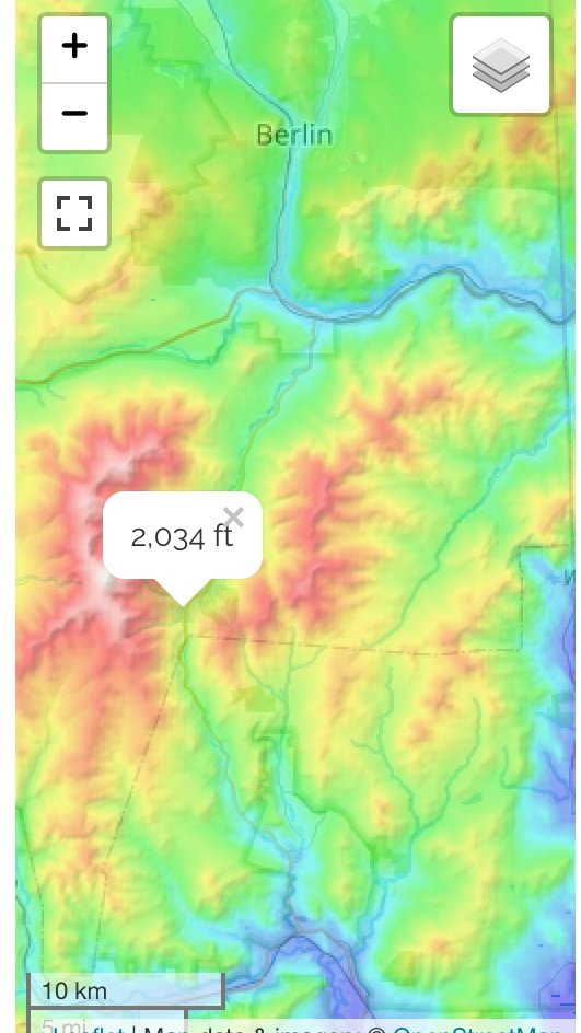
Fwiw here is look at the topography around Pinkham....you can see how those 5000-6000 foot presidentials probably block a lot of upslope from them. But they actually look pretty nice on a N or NE wind. ...or even southerly or SSE winds. They may get some downslope on due easterly flow if the forcing is mostly lowlevel orographic driven....but if it’s deeper layer then they might get some downstream drift since it’s not like they are 10-20 miles west of Wildcat.

-
I think Pinkham doesn’t quite get the upslope that the north side of the presidentials get....they probably need really unblocked flow....but I don’t think they are shadowed much by wildcat in synoptic events since they are so close to it and the flow doesn’t get as blocked in low levels for synoptic events as it does in upslope events. I’d think they are easily a net winner on orographics in most synoptic events. Maybe at the tail end on NW/NNW winds they could struggle as you mention...that’s typically when the moisture is more low level and the flow could start getting blocked some by MWN/Adams/Madison. That April 2011 measurement looks just plain bad.
-
Yeah your 120 number is pretty close, if just a bit low....if you are 1700 feet, I'd prob put you 130"ish though based on the old West Wardsboro coop. They were 117" and at 1400 feet plus had the 1980s as like 1/3rd of their period of record and didn't "take advantage" of the 2010s as they stopped reporting at the beginning of the decade. I don't think there is anywhere at 1000 feet up near Lancaster, NH that gets what you get at 1700 feet. My guess is he prob gets like 100"....maybe a little more. He's a little bit outside the death triangle but still not a great orographic spot.
-
Pinkham Notch used to be pristine but they have degraded just a tad over time. They started missing some big storms in the 1990s and 2000s IIRC...I haven't looked super recently, but perhaps they are missing some storms still. They are still a good coop, but if you miss even one moderate storm, that's a black mark. Their mean snowfall from the 1930s to like 1980 was 167"....but it's been about 125-130" since then which kind of doesn't jibe with the rest of the region. They shouldn't have declined like 40" per year when much of the region has actually gone up or is at least comparable. It tells me they had a change in reporting. It could be something as innocuous as going to strictly once per day reporting which will deflate snowfall totals...plus if they are missing the occasional snowstorm like they did on 2/1/08 or 12/30/00 (they missed both of these I remember), then that is going to deflate annual averages further.
-
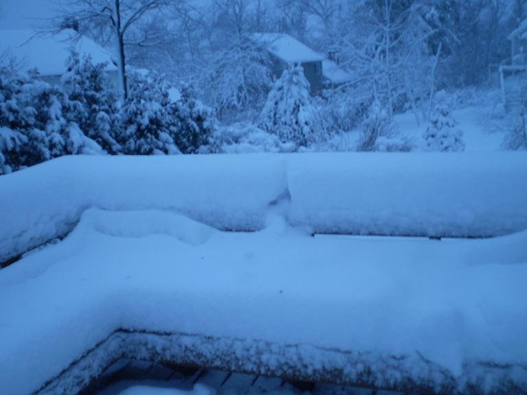
This was 2/24/10 in ORH
-
Once you got south of Phin and Alex's area, a lot of the snow was from the first wave on 2/24. I actually had about a foot of paste from that on winter hill in ORH...then round 2 was like 3 inches of 37F rain, lol.
-
If it’s snow on top of deep snow, that’s pretty normal. Happened down here in huge snow pack winters like 2011 and 2015. Though I’d nitpick and say it looks like depth got up to 61.5” so that’s a 25.5” increase in a 47” fall...that last 2.5” on 3/2 was probably putrid with the disc of the sun showing and a rotted out airmass...I remember it just circulating like a spring wheel-o-rhea with no cold left at all. Its when you get like 24” of LES fluff on bare ground and it’s 8” a couple days later is when it’s “fake”...and then vaporizes in 2 days when the temps reach 40-45F.
-
It was a pretty good storm over interior SNE. About 6-10" west of 128/I-95 but there was a big dryslot which prevented much higher totals. Areas a bit closer to NYC in southwest CT got over a foot and also NW CT/far Western MA where they avoided the dryslot for longer.
-
You had 12/30/00 PTSD in the 1/12/11 thread....you got convinced you were screwed. Here's where it starts, but the real melt happens a couple pages later.
-
I think he's about 1500 feet.
-
Final daily minimum NSIDC extent has likely been reached....and it was 3.71 million sq km on 9/13. This is the second lowest minimum behind 2012's 3.34 million sq km. Minimum area may or may not have been reached. Current minimum is 2.59 million sq km on 9/15. This is the 3rd lowest behind 2012 (2.23) and 2016 (2.46). I will update if we slip any further, though we're unlikely to change the ranking as it's very late in the season for large moves. The predictions this year based on SIA at the end of June proved to be very accurate and both were off by less than 100k.
-
Yeah...I just actually looked, and it seems you can get pretty good hydraulic plows for even between 1-2k new....cheaper if used. I might splurge on a heavy duty version though if I was up there, lol.
-
If I was spending almost every day up there in the winter, I'd just find a heavy duty hydraulic plow for 3k or something and slap it onto the front of a truck....I might even buy an old used pickup just for the plow stuff. Guess he can see how the first winter goes....then decide, lol.
-
A lot of guys will plow for a seasonal rate and not "by the storm" and that might be cheaper too....I've had a lot of clients over the years that were plow guys/companies. They will often charge a seasonal rate but then might charge extra over a certain amount of snow. That's when I often had to do forensic reporting for them....someone would claim to the plow guy they got 75" of snow instead of 110" and the contract stated anything over 80" would have extra charges....so they'd try and claim they didn't go over 80", LOL.
-
Yeah that's tough if you leave it be too....you end up with a slab of ice like 3-6 inches thick if you just let is pack down. Turns into a glacier. If you start spending full winters there in the future, you might as well invest in getting a plow yourself....you can probably get a good one for a snowy climate like that put on your truck/SUV for about 3k. Prob would pay for itself within 2 winters, lol.
-
Yeah, when I was on winter hill, I'd get the most almost every year between us 3 with a an exception or two.....but now it's a neck and neck race every year with them. I think Ray averages the most out of us climo-wise, but it's not by a lot...maybe by 2-4 inches or so.
-
That's a good price for a driveway that long....whats the threshold for plowing though? If it's like 2 inches, then you might have a lot of plow bills.....lol.
-
I forget where you are....pretty close to Mt. Snow or Stratton, right? Snowfall is pretty variable around there so I'd need to know which town and which side of that town. Like the western side of Wardsboro above 1300-1400 feet is probably 120-130 while eastern side lower down is maybe 90-100. Similar results in Jamaica and Dover. The West Wardsboro coop averaged 117" when they were in commission from 1978-2011 and they were at 1400 feet. A lot of dogshit years in the 1980s too, so their longterm average is probably a bit higher in the 125-130 range would be my guess.
-
Yeah when we were first discussing who got more snow, I was thinking to myself that it's probably going to be a situation where Alex probably does a bit better on NW upslope and Phin does better in synoptic storms....which force wins out? Is the uplsope advantage Alex has enough to outweigh the synoptic advantage Phin has? Looking at the Randolph site daily snow history, they clearly get upslope too, but I think Alex's spot origraphically looks a bit better. But Randolph looks to do better on coastal storms. Either way, that's why some of us were excited to see another person up in that area....we can actually do a comparison now. Only sick weenies like us would find that exciting....lol.
-
That was the retro-storm that rained on most of New England and gave NYC like 20" of snow (though the first phase of it was a huge wet snowstorm for interior SNE up to NNE)....but up there the snow never really changed over....those easterly and even southeasterly flow events seem to absolutely dump on Randolph....I've noticed a lot of marginal storms there where they get like 2-3" of QPF and 30" of snow while 10-20 miles away probably didn't get much. That was probably an example of the terrain upsloping enough from the east to keep it a wet snow bomb. Several mountain areas that do well on easterly flow stayed snow on that one across NNE.