-
Posts
93,092 -
Joined
-
Last visited
Content Type
Profiles
Blogs
Forums
American Weather
Media Demo
Store
Gallery
Everything posted by ORH_wxman
-
Yeah keep it dry and then let’s get 25 inches of qpf from Nov-Mar to even it out.
-
For “snow depth” to equal a trace (or more), it needs to be observed on the ground at observation time....but to record “daily snowfall” as a trace, all you need is literally a flake of snow (or sleet/graupel) to fall out of the sky and it technically gets recorded as a trace.
-
ULL (but not quite closed off...very deep cold trough likely with windex type graupel/snow). I was outside in it. Late afternoon/early evening on 9/30/92. It was still light out. It started as just a few drops of rain and then quickly we were like “is that hail?”....and it went nuts and all of the sudden flakes mixed in and it went nearly to all flakes for a good 10 min or so. Never got below mid/upper 30s I don’t think but man, that was crazy. Little did I know what would happen a few months later in Dec ‘92. I guess “snow in September” doesn’t cancel winter....
-
Nitpick but I have ORH at 11. Might be you just missed one of the ASOS blackout years (Oct 2000 and 2002 both had snow) 1993, 2000, 2002, 2003, 2005, 2008, 2009, 2010, 2011, 2015, 2016
-
Yeah I'd have to think at minimum he will see those graupel squalls that change to snowflakes after several minutes of good intensity on some cold CAA cyclonic flow airmass that would coat things up.....but he's likely to get something more real in October there.
-
I've posted this pic before....but even down here, this was Thanksgiving 2018. It hadn't snowed for days at this point (that thin layer on top of the older layer was about 3 days old....the thicker older layer was over a week old), but it stuck around like it does in mid-winter and Thanksgiving itself was the coldest November day on record at ORH (and likely many other stationsin New England)....you just don't normally see the snow stick around like that in November. Most November snow melts within a day or two down in SNE or even most NNE lowlands....Randolph, NH at 1500 ft is obviously different.
-
I actually misspoke here....October did in fact have the opposite trend, but they were actually on a negative decadal trend before the 2010s....the 2010s simply brought it back to a flat trend.
-
I was looking at ORH the other day and they haven't broken a record low in September since 1990 (though 10/1/92 did get one....and BOS actually set a record low in September 2013)....30 years. Only December has gone longer (31 years)....I was kind of surprised about December but somehow we didn't break a record low there recently...I was sure we did during 2017, but all those 1933 and 1917 lows blocked them. We saw a ton of record low maxes in December that year, but no actual record low minimums. Compare that to November where we've broken 5 record lows just since 2018. November had been one of the fastest warming months on ORH data through the late 2000s, but now they have been beaten back down so hard with 6 of the last 8 being below normal including two of the top 10 coldest Novembers on record....to the point where November is now just warming at 0.1F per decade. Always weird to see stuff like that. October did the opposite....it had barely been warming on the data through like 2010, but then we just got obliterated with October torches in the 2010s so now it is warming much faster now on the means.
-
Some pretty good cold shots showing up on guidance over the next 10 days....prob 3 legit frost/freeze opportunities (more frost rather than freeze on the first one for NNE) between now and 9/21. I don't feel like we've seen this type of continuous frost threat pattern in September in a while.
-
-
You might be thinking of 3/3/94. Massive interior storm. We got about 13-14” in ORH with big wind. Lot of rain for the big cities after some front end snow....though I believe BOS had decent snow (8”+) with some rain/sleet at the height. But the true jackpot was back into interior PA and central NY where 2 feet fell.
-
Mar '56 to your generation was what Dec '92 was to mine (or maybe Mar '93 for those who got shafted in '92)...."The Big one that broke the snow drought" for each generation of kid snow weenies.
-
The Syzygy storm was 1/2/87
-
The bolded....it's emotional forecasting.
-
It was mostly the early 1950s....at least over SNE....1955-1956 seemed to break the bad stretch.
-
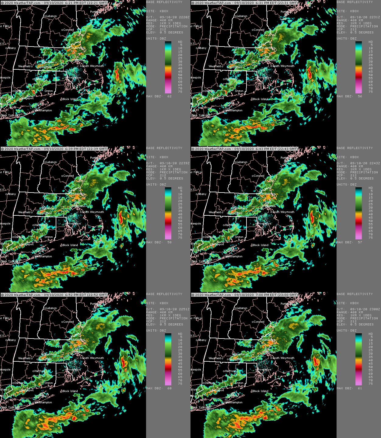
Doesn't look like it's coming down very hard....high visibility. It appears the best lift is this evening though, so we'll see if they pick it up later today/tonight.
-
The 2010s are pretty unique for their warmth, though amazingly, the 1950s (not listed above) were the next warmest for ORH (at the current site)....they had an average October temp of 51.1F....the 1960s (also not listed above) were not far behind putting up an average of 50.9F...half a degree warmer than the 2000s. The 1940s may have challenged 2010s in some spots. ORH has an average temp of 52.6F for October in the 1940s....though 8 of those years were at the old site, which makes the direct comparison a little harder. The older site averaged 51.7F vs 51.15F at the airport site during the 15 overlap Octobers between 1948 and 1962. So even if you subtracted 5 or 6 tenths from those 8 years, you'd still have a warmer average than the 2010s. But we'll never know for sure. Logan airport did not match their 2010s warmth in the 1940s, however....but it was 2nd warmest at 55.6F.
-
Temps matter too...there are mid and upper 20s in WY where that snow was falling....you can easily get that to stick even if it's pretty light. It's different if you have 33-34F and SN- with a warm ground. 27F will make that very top sfc of the ground frozen pretty quickly.
-
Warm ground only matters when the precip is really light...... or after the snow stops falling, it can start melting from underneath. I've seen that when we get snow in November and it's only like 25F out the next day but there's still some melting from the bottom with upper layer soil temps still in the 40s. The surface of the ground itself will usually come in line with the ambient air temp pretty quickly, so immediate accumulations aren't too hard.
-
Very cold winter in New England as well but SNE missed the Feb 79 storm...whiffed to the south. They had some rainers in January where NNE got snow/sleet so the winter was largely a bust here.
-
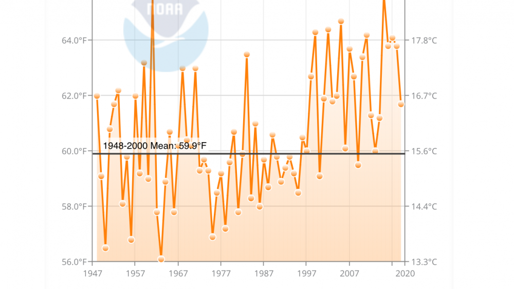
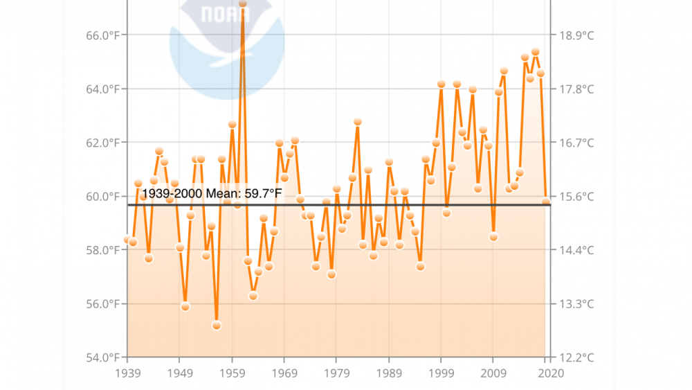
This is ORH. Definitely a little warmer in the past than CON but clearly still pulling teeth to go below avg in September these days. It’s actually amazing how consistently chilly the 1980s and first half 1990s were in September. Kind of fits my childhood memories at least CON is probably losing their ability to radiate too in addition to just straight AGW. Im not all that aware of how any developments or land use near the airport has gone over the past couple decades.
-
-
1930s were pretty terrible here too though there were a couple blockbusters mixed in (like ‘33-‘34). Some of our warmest winter months are in the 1930s. The early 1950s were horrific too.
-
You can include the first 3 winters of the 1990s in the bad period of the 1980s....and also 1978-1979/1979-1980. 78-79 was probably decent in NNE but it was utter trash in SNE. Rain/cold/whiff/rain/cold pattern. For ORH, there were 3 above average winters (1981-1982, 1983-1984, and 1986-1987) for snowfall and two near-average winters (1987-1988 and 1982-1983) in the 14 year period. But the clunkers were pretty bad. The freeze/thaw cycles were e bad in 1984-1985 and 1985-1986. Add onto that 4 consecutive garbage winters from 1988-89 through 1991-92 (you could argue 1989-90 wasn’t THAT bad), it’s not a fond set of memories.
-
The only White Thanksgivings I can think of for Buzzards Bay Area would be 1987 and 1989. It’s exceptionally difficult down there. Kind of weird that they had two so close together and probably nothing 20 years either side of that. There may have been snow OTG in 2002 not too far away but I think right down at buzzards bay they were too warm. But I’d have to double check that one. Edit: scratch 1987....just hit me that that one was Veterans Day. Not near Thanksgiving.


