

ORH_wxman
-
Posts
93,092 -
Joined
-
Last visited
Content Type
Profiles
Blogs
Forums
American Weather
Media Demo
Store
Gallery
Everything posted by ORH_wxman
-
December 5-6, 2020 Storm Observations and Nowcast
ORH_wxman replied to Baroclinic Zone's topic in New England
R/S line is hanging out just outside of BOS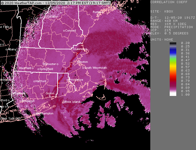
-
December 5-6, 2020 Storm Observations and Nowcast
ORH_wxman replied to Baroclinic Zone's topic in New England
There’s a feedback there too in addition to what you said. The harder it snows, the closer to 32F the lowest layer gets from latent cooling...and when the intensity slackens a bit it goes back to like 33-34F. -
December 5-6, 2020 Storm Observations and Nowcast
ORH_wxman replied to Baroclinic Zone's topic in New England
Ha, you got me, it was windy. -
December 5-6, 2020 Storm Observations and Nowcast
ORH_wxman replied to Baroclinic Zone's topic in New England
-
December 5-6, 2020 Storm Observations and Nowcast
ORH_wxman replied to Baroclinic Zone's topic in New England
Go north on 495 -
December 5-6, 2020 Storm Observations and Nowcast
ORH_wxman replied to Baroclinic Zone's topic in New England
Snow line should be getting inside 128 now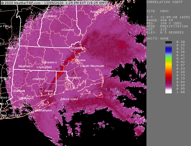
-
December 5-6, 2020 Storm Observations and Nowcast
ORH_wxman replied to Baroclinic Zone's topic in New England
Yeah too bad this one will be more like an Antione Walker in the end rather than those guys....nothing wrong with that. Solid system but if this were a few ticks colder, it would be up there with those others easily. It had all the ingredients...that radar says it all. Just needed a non-disgusting airmass. -
December 5-6, 2020 Storm Observations and Nowcast
ORH_wxman replied to Baroclinic Zone's topic in New England
He would have had an epic meltdown about QPF if he was still there. -
December 5-6, 2020 Storm Observations and Nowcast
ORH_wxman replied to Baroclinic Zone's topic in New England
This radar definitely has a bit of 12/9/05 to it and a little bit of 1/12/11 to it.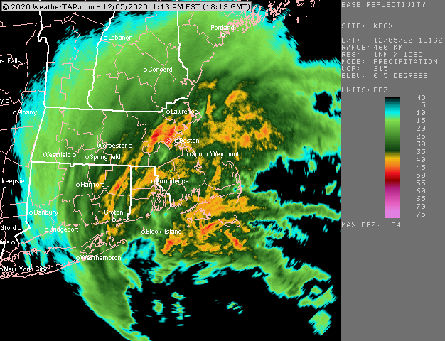
-
December 5-6, 2020 Storm Observations and Nowcast
ORH_wxman replied to Baroclinic Zone's topic in New England
Londonderry will do great later on. Decent chance they end up under a death band. -
December 5-6, 2020 Storm Observations and Nowcast
ORH_wxman replied to Baroclinic Zone's topic in New England
Metrowest is looking really good for this afternoon/evening and into SE NH/S ME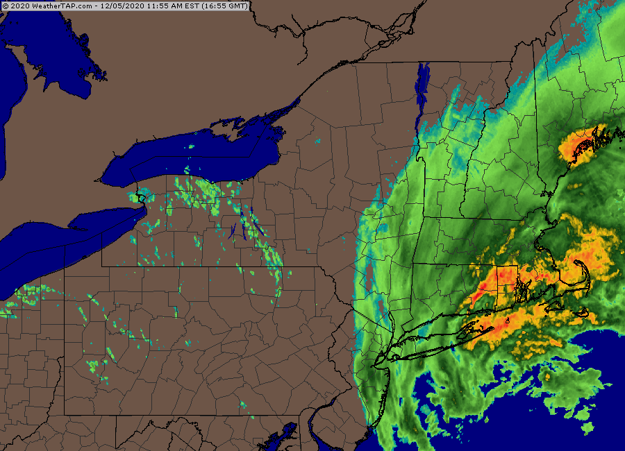
-
December 5-6, 2020 Storm Observations and Nowcast
ORH_wxman replied to Baroclinic Zone's topic in New England
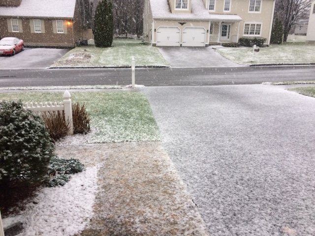
Caked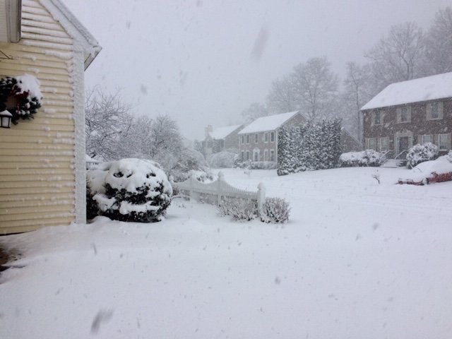
-
December 5-6, 2020 Storm Observations and Nowcast
ORH_wxman replied to Baroclinic Zone's topic in New England
Absolutely ripping (sorry didn’t realize the 2nd one was a ginxy cell phone pic)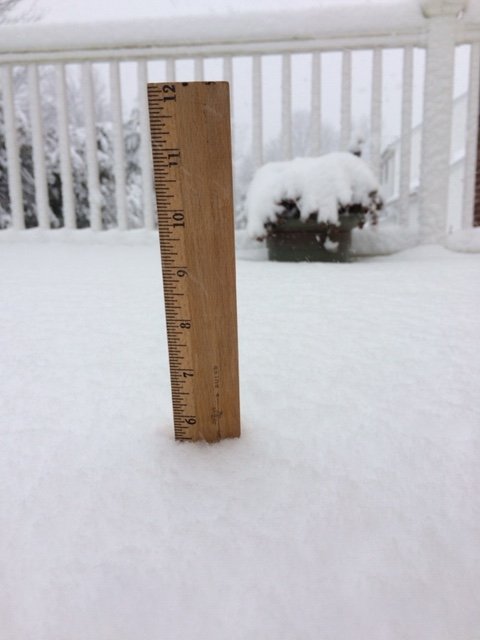
-
December 5-6, 2020 Storm Observations and Nowcast
ORH_wxman replied to Baroclinic Zone's topic in New England
Metrowest is going to get a lot. Big power problems are in store.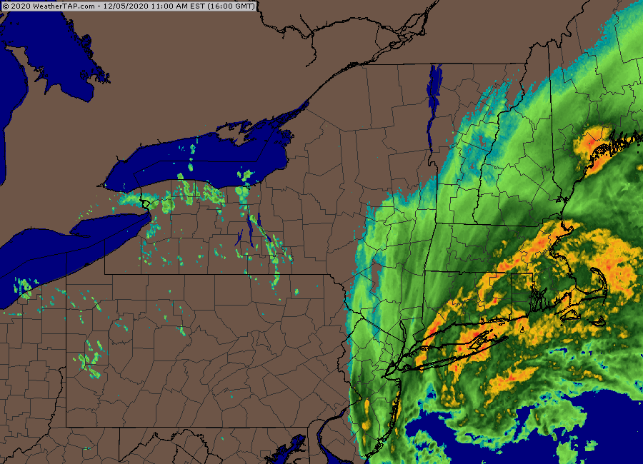
-
December 5-6, 2020 Storm Observations and Nowcast
ORH_wxman replied to Baroclinic Zone's topic in New England
-
December 5-6, 2020 Storm Observations and Nowcast
ORH_wxman replied to Baroclinic Zone's topic in New England
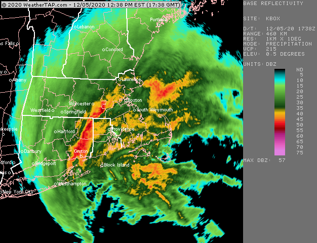
Fighting midlevel temps there but it should go back to snow soon. You can see the CC collapsing back SE in the last couple frames. Meanwhile, getting blitzed in ORH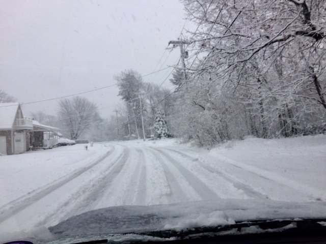
-
December 5-6, 2020 Storm Observations and Nowcast
ORH_wxman replied to Baroclinic Zone's topic in New England
Check out the stuff streaming into LI and banking up into the deformation/fronto zone in your mesonalysis. That gonna be sick over CT for the next few hours...that’s when it’s time to start adding it up...like 11am-3pm there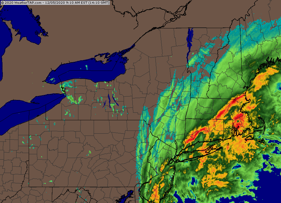
-
December 5-6, 2020 Storm Observations and Nowcast
ORH_wxman replied to Baroclinic Zone's topic in New England
WaWa webcam is pretty fun right now https://www.wachusett.com/The-Mountain/Media-Center/Web-Cams.aspx -
December 5-6, 2020 Storm Observations and Nowcast
ORH_wxman replied to Baroclinic Zone's topic in New England
Northern ORH up through like Princeton is definitely the “Westminster” of the general BOS region. -
December 5-6, 2020 Storm Observations and Nowcast
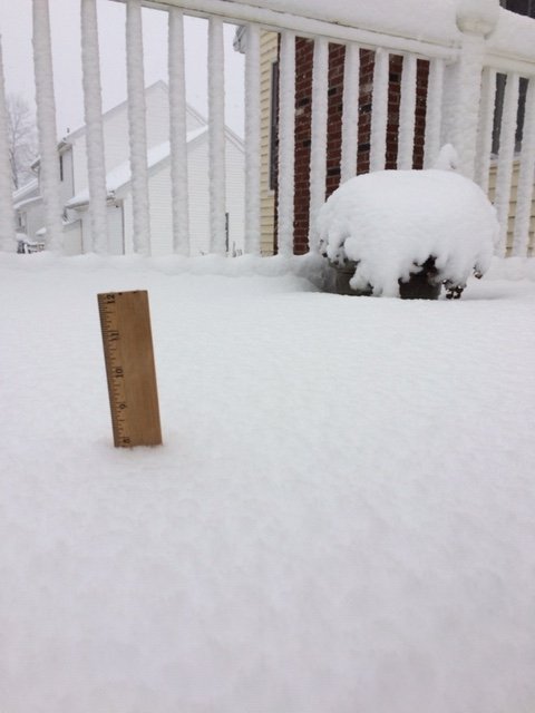
ORH_wxman replied to Baroclinic Zone's topic in New England
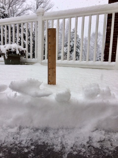
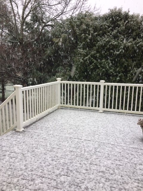
First inch down on winter hill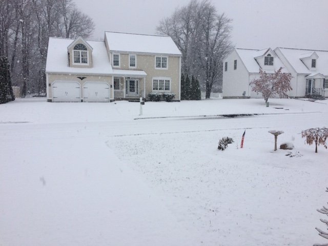
-
December 5-6, 2020 Storm Observations and Nowcast
ORH_wxman replied to Baroclinic Zone's topic in New England
Intensity dependent. You can see when Kevin flipped back to rain it was lighter echoes going over him. Same with you now. The frocimg should become extremely intense soon so I’d expect the radar to light up quite a bit in the next hour or so. You see this pretty well on the OXK radar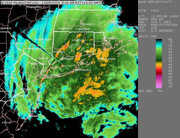
-
December 5-6, 2020 Storm Observations and Nowcast
ORH_wxman replied to Baroclinic Zone's topic in New England
All snow on NW side of town at 900+ feet. Should be all snow there shortly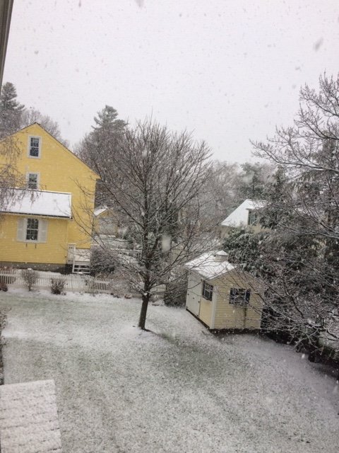
-
December 5-6, 2020 Storm Observations and Nowcast
ORH_wxman replied to Baroclinic Zone's topic in New England
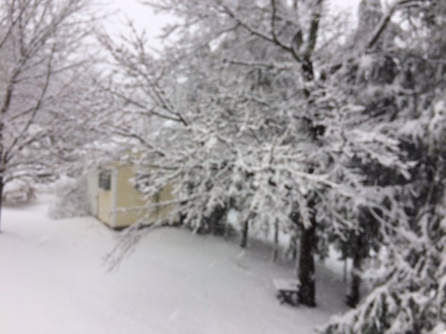
An ORH obliterator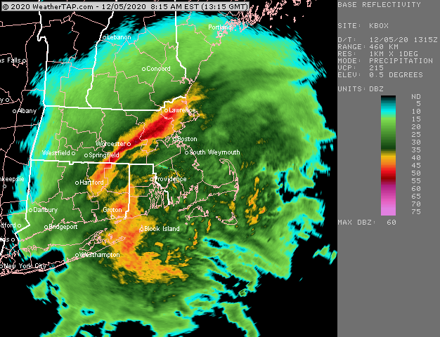
-
December 5-6, 2020 Storm Observations and Nowcast
ORH_wxman replied to Baroclinic Zone's topic in New England
-
December 5-6, 2020 Storm Observations and Nowcast
ORH_wxman replied to Baroclinic Zone's topic in New England
Yeah prob a lot of 20+ amounts with even about 3C colder.


