ORH_wxman
-
Posts
93,099 -
Joined
-
Last visited
Content Type
Profiles
Blogs
Forums
American Weather
Media Demo
Store
Gallery
Everything posted by ORH_wxman
-
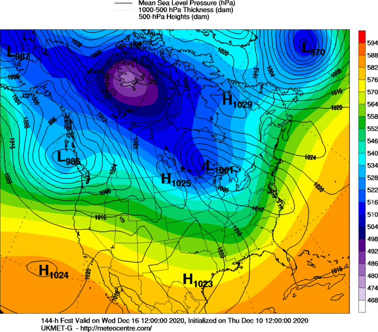
Yeah less likely to have this go full zonked out west....still possible, but less likely with the NAO the way it is and the 50/50 low. This is still 6 days out though, so we're going to see some big changes run to run.
-
Ukie looks like a late developer based on 144.
-
GFS at 132 looks quite classic for Miller B.
-
Dr No is more like waking from the post-lunch coma with a ripping hangover. You're reading the stingy Eurowx snow maps with a pot of coffee in front of you.
-
When that's not doing it, you can break out the secret stash and fire up the JMA.
-
The PV just kind of sits there in the same spot and spins for days on end....good environment to just keep cooling down with almost no solar insolation now up there.
-

-
You basically get a ridge bridge now at about D5-7. That is a good thing..... The -NAO going forward is nice too...especially since the N PAC isn't that good once we're about D8+....the NAO can really help put a system or two underneath us on that scenario.
-
It's actually always been there but the models were breaking it down really quickly N of AK before it could really exert much influence. I am always skeptical when guidance breaks down blocks very quickly....it happens sometimes in reality, but more often they do it too quickly. In this case, it was really bad though, they not only did it too quickly, they failed to see it strengthen.
-
I was actually thinking that this morning when I took my boys outside to the car to drop them off at daycare....it was like 31F out and not that cold but the pack was this frozen mass and that combo had me thinking "this kind of feels like March 20th or something when it's not that cold, but still cold enough to refreeze the paste that we got in some event on St. Patty's day"
-
The good part of about this threat is that it has multi-guidance ensemble support. It's not just showing up on one model and kind of meh on the others. There's never any guarantees at 6-6.5 days out, but if you had to pick what you want to see at this time frame, then that is pretty darn solid. You have the larger scale pieces in palce like Scott outlined on his map and you have some antecedent cold and a good shortwave. About all you can ask for. Sure, it could go to crap, but we'll roll the dice all day long on that setup and we'll hit more than we miss. It's like being in a 3-1 count in baseball. You have the advantage at that point even though you could still pop out to shortstop.
-
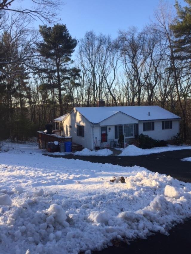
Yeah man, look at this crap....you can just tell by looking at it in the pic that it's like 4 to 1 slime (that has been refrozen for days now).

-
That is pretty darn classic. Hopefully it sticks.
-
Yeah places like ORH and northward will prob keep full cover. The 495 belt (esp down this way) will prob try and keep a little bit. But hopefully the pack retention doesn't matter anyway and by the time we get to Sunday, we're tracking a a major storm, lol.
-
You'll prob keep at least some of the pack in the non-torch spots where the afternoon sun doesn't hit it. But regardless, there's a good chance we reload next week. I think we're going to hit on one of these threats over the next 10-12 days.
-
That’s definitely been a theme on today’s guidance...started trending toward that a day or two ago but it seems like today the models are really bullish on it. EPS has it too....though the EPS doesn’t have as much western CONUS ridging as the GEFS which would be nice to see. I remember you posting about Mar 2001 back on the ne.weather newsgroup. I think you had like a dozen mid-Atlantic posters ready to kill you in that thread, lol. I didn’t post yet back then but that’s when I really started following the online weather community.
-
It did put down that much from like Ray’s current location over to ORH and the northern Berkshires...but yeah, surprising it wasn’t further south with the 20+ amounts. It was just a bit disorganized. You can see how the phase is a little bit sloppy where the sfc low gets pretty Far East and then has to be yanked all the way back west. It kept the WCB and CCB from really getting in sync properly. Again, still a pretty big storm even for CT (12-18 except in a few spots far SW and far SE) but it definitely could have been considerably bigger.
-
You sure it wasn’t Jan 6-7, 2002? ALB got destroyed by that mesoband in an otherwise shit winter. In don't recall anything special about ALB in 2/5/01. The huge band was mostly east of them from western MA, N central MA into NH.
-
Feb 5, 2001 miller b.
-
Ha he told that story at the conferences a few times. Always epic. He’s like “one minute it’s like 2 mile vis with sleet or rain mixed in and then we pop outside and it’s 200 yard vis with CGs hitting all around us”
-
Yeah it was an awesome storm but I let internal expectations get out of hand. Nowadays regardless of what the models show, is never feel screwed by getting 25 inches. I was still pretty new with modeling though being 19 years old at the time. But it was really hard not to believe the 3-4 foot totals....even the old NGM was like 3.3 inches of qpf, lol. It was like pulling teeth to get that model to spit out more than an inch or inch and a quarter in any other big winter storm.
-
Everything phased kind of later and more disjointed than originally modeled. The more disjointed is what cost New England from getting widespread 3+ feet. The later and further north phase/development is what screwed further south (like mid-Atlantic) from getting snow at all.
-
March ‘01 might have been the only time I’ll be “disappointed” with like 2 feet of snow. It felt like we left about 12-18” on the table in that one. The modeling was so ridiculous.
-
I’ve heard some Mets over the years calling those big ocean retrojobs as Miller Cs since they don’t fit the definition of either an A or a B as per Miller’s original 1946 paper. It was probably closer to an A though since it’s origins were way down in the subtropics around Florida.
-
I don’t think feb 25-26, 2010 is a miller B. That was this huge retrojob. The storm center was like down in the Bahamas the day before.