ORH_wxman
-
Posts
93,099 -
Joined
-
Last visited
Content Type
Profiles
Blogs
Forums
American Weather
Media Demo
Store
Gallery
Everything posted by ORH_wxman
-
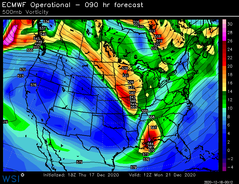
The grinch storm definitely took a turn for the worse last night. Hopefully it goes back the other direction today on guidance. Need to drop that energy into the southwest US so the whole thing goes positive tilt and that would help a lot. Either that or we need to really deepen the 12/22 system offshore and slow it down.
-
I’m sure when this goes through some reanalysis and scrutiny, we’re going to find insane ML fronto numbers along with super deep DGZ column. We had a beast arctic high up there and this was slamming up right into it with extreme negative tilt aloft. So my guess is the models prob undersold the ML fronto...even though it was already really impressive on guidance. The super deep DGZ always helps too because you aren’t needing to be very precise with where the lift is to get the cross-hair sig.
-
18z euro looks like it would produce
-
Yes I would think so.
-
Yeah this was a really weird storm. It was extremely well predicted in the medium range like a week-plus out but then it was kind of a short term disaster with model guidance inside of 24-48h.
-
I’ve become addicted to our Ariens snowblower. It just destroys huge snowbanks and drifts...or in your case, 30-something inches of snow on the level.
-
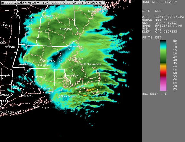
I’m looking around at totals and this was a massive snowstorm even if you totally eliminated that obscene fronto band. Like BOS to ORH to HFD/BDL down to NYC and back across a chunk of PA got double digits. But all those 13” and 16” totals all of the sudden look paltry when there’s 33” and 38” and 44” on the same map.
-
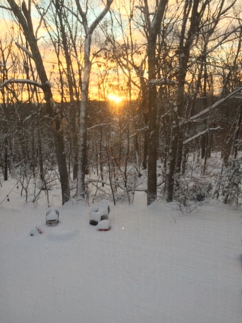
Nice sunset. Unfortunately I had to take the pic through the screen before the sun went behind the ridge but still a nice sight.
-
Getting a quick sunset now as the flurries have ended. What a site. Im guessing about 14” is our final when I check it out officially. Funny how 14 inches sounds so paltry when it’s an incredibly good storm in mid December. But when a mesoband is giving people 40 inches, anything else feels insignificant. Lol But what a great storm. Had some amazing rates last night and the snow has some meat to it. It’s not 20 to 1 blower. Prob like 12 to 1 or something.
-
That wave we're interested in is the one down in Georgia at 84h. This run wouldn't get it done but that is the shortwave we need to watch if it can phase with the one diving through the N plains.
-
No way PVD did....they had a paltry 7.3 at 1pm.
-
LOL....good choice. I think they got about 30 inches in this storm.
-
It's the opposite of the 12/5 event....I think all of our lift down here has been lower level stuff since about 4-5am, but we've kept nice dendrites mostly. Helps when it's like -8C to -10C in the 850-925 layer with all that easterly flow supplying tons of salt nuclei.
-
Yeah I've been waiting for that Grinch storm to start getting muted...based on the longer wave features. There's some risk of a cutter there, but we've been seeing a transient 50/50 feature and a -NAO that could try and put the squeeze on that trough a bit. The Grinch storm basically fails this run, but it doesn't result in a snow event for us....at least yet. More like a quick FROPA and then a weak wave along the front Xmas Eve night that doesn't do much...maybe give us a little bit of light snow. At least we're not ripping 55F+ dewpoints into New England like on some other runs.
-
Only time I've ever seen anything like that was Tahoe...was in a storm there where it dumped like 70-75 inches in 2.5 days, and the peak of it was probably 10" per hour type stuff. I guess December 23, 1997 was pretty close in ORH with 6-7" per hour.
-
We got an Ariens 2 years ago and the best part about it how easily it chews up heavy snow banks. I love the thing. The snow banks were easily 3+ feet in front of my driveway and it made fairly quick work of them today.
-
They also got 2+ feet in Dec last year....and 20+ in Jan 2011
-
Euro made a huge jump toward a system on 12/21-22.....gonna go wide right, but close call.
-
Nice....similar to here for totals...I had ~13.5 about an hour ago but you have more QPF in the pack. Snow starting to pick up again in these weenie bands congealing over central MA.
-
What are you up to there?
-
Low level goodies with a cold 850-900mb layer....like -8C or -9C....plenty cold with that flow off ocean.
-
This stuff for the past couple hours rotating through has been fluffy currier and ives type snow.
-
You had the liquid equivalent. At least it is a man pack now. Might survive a grinch storm.
-
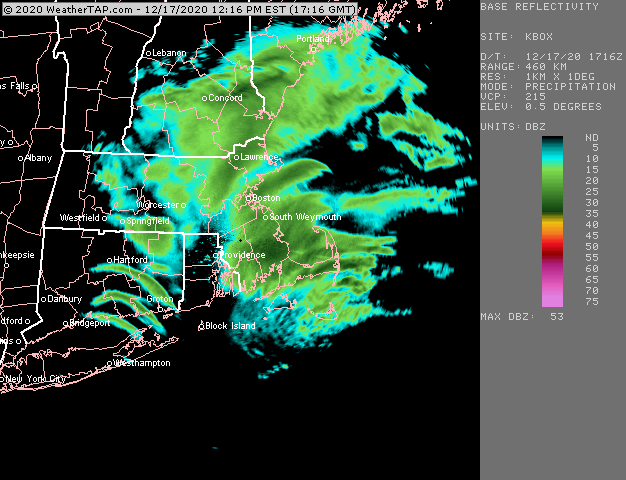
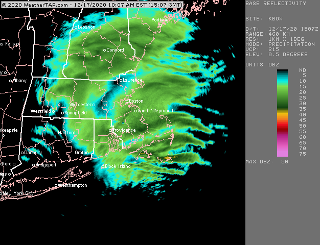
Yeah that is a nice band over ORH county now
-
ORH had less than my current place in Holliston. Winter hill is just now around 10". Have 13"+ in Holliston. Looks like radar is filling in though so maybe another inch or two out in areas that were in the sucker hole