

ORH_wxman
-
Posts
93,099 -
Joined
-
Last visited
Content Type
Profiles
Blogs
Forums
American Weather
Media Demo
Store
Gallery
Everything posted by ORH_wxman
-
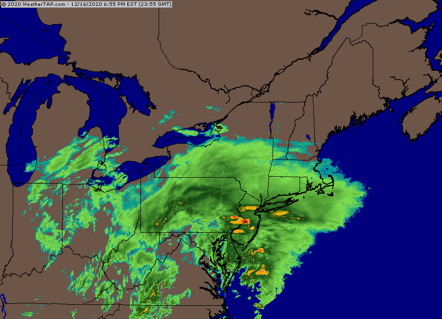
Radar in NJ and S of LI should fill in as the low get cranking a bit and you get the low level inflow
-
Building nicely
-
Active mid December with multiple event potential
ORH_wxman replied to Typhoon Tip's topic in New England
It’s true in this case. Terrain tends to be most important when midlevel forcing is weak. Events where you just see a steady firehose of moisture. Terrain can enhance or reduce intensity but they don’t cause midlevel death bands. -
Active mid December with multiple event potential
ORH_wxman replied to Typhoon Tip's topic in New England
Jerry’s RPM fetish. Final run for all of SNE pre-snow (SW CT started snowing shortly after 21z)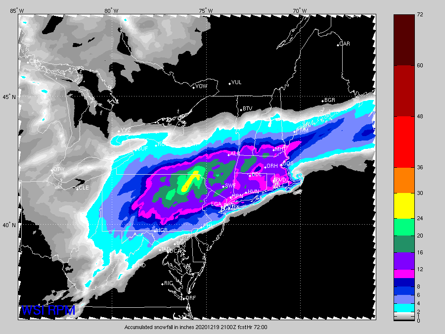
-
Look at all those S+ obs over PA into N NJ. You love to see it...
-
You won't get less than 8 there.
-
Current radar looking pretty good...I like the WCB look there
-
No that "rule" has been around for like 2-3 years now. (except first order sites still can clear)
-
That's been the most important trend over the past 24h....the WCB maintaining some strength and starting to link up with the CCB where they are in phase more....before, they were almost totally disjointed and separated.
-
Active mid December with multiple event potential
ORH_wxman replied to Typhoon Tip's topic in New England
Def closer to 12z Euro now on the banding part....maybe still a smidge N but at least the gap has rapidly closed. -
Active mid December with multiple event potential
ORH_wxman replied to Typhoon Tip's topic in New England
NAM gone wild with CCB over SNE early tomorrow AM. -
Active mid December with multiple event potential
ORH_wxman replied to Typhoon Tip's topic in New England
Not the right setup for an ORH jackpot....but it will be a solid hit regardless. Prob 12-15ish. Can't rule out a bit higher if a few lucky bands happen. -
Active mid December with multiple event potential
ORH_wxman replied to Typhoon Tip's topic in New England
Yeah I can see that. Someone is gonna get 2 feet...best chance is prob west in Catskills but there is an unignorable chance it creeps into N litchfield county and parts of adjacent W MA. -
Active mid December with multiple event potential
ORH_wxman replied to Typhoon Tip's topic in New England
Cranberry Bog joking aside....there's prob gonna be a secondary jack a bit north of them like near Blue Hill I feel like...maybe back to Foxborough. That typical interior SE MA zone where they will get slammed with lower level CCB stuff tomorrow and get some CF enhancement -
Active mid December with multiple event potential
ORH_wxman replied to Typhoon Tip's topic in New England
Definite chance of a secondary smaller jackpot zone down there. Agreed.
-
Active mid December with multiple event potential
ORH_wxman replied to Typhoon Tip's topic in New England
Yeah you aren't jackpotting....i agree on that. But you're not going to get 7 inches of sand either I don't think. You're gonna get CCB action tomorrow. -
Active mid December with multiple event potential
ORH_wxman replied to Typhoon Tip's topic in New England
Jackpot for New England might actually be in Litchfield county and adjacent SW MA....combo of big WCB hit before it fizzles and also getting clipped by the ML goodies. -
Active mid December with multiple event potential
ORH_wxman replied to Typhoon Tip's topic in New England
Lol, my drawing is a rough approximation....could easily tickle that SE 5 or 10 miles. -
Active mid December with multiple event potential
ORH_wxman replied to Typhoon Tip's topic in New England
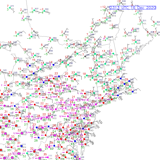
Yeah you can see where the H7 WF is below in red....I put in the likely spot of the ML goodies based off that in the blue area....prob near the 600mb WF in this system.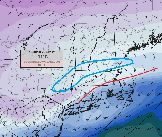
-
Active mid December with multiple event potential
ORH_wxman replied to Typhoon Tip's topic in New England
He's actually in a really good spot on the Euro for ML banding....His area up to like MHT and then back WSW to near your hood. -
Active mid December with multiple event potential
ORH_wxman replied to Typhoon Tip's topic in New England
You look like you're gonna get some really good snow growth for a time in the ML goodies. -
Active mid December with multiple event potential
ORH_wxman replied to Typhoon Tip's topic in New England

-
Active mid December with multiple event potential
ORH_wxman replied to Typhoon Tip's topic in New England
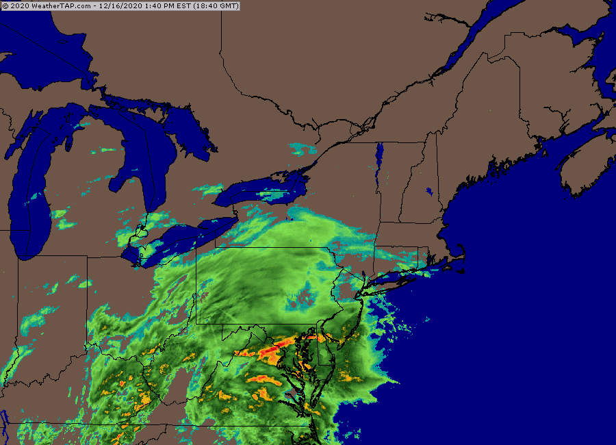
Waited until the final run before the storm. That's a good look though in all seriousness....good CCB action tomorrow AM...really cranking for your hood too. -
Active mid December with multiple event potential
ORH_wxman replied to Typhoon Tip's topic in New England
The problem with the algorithm is that even if the max lift is below the DGZ, it is still saturated above that up to like -10 or -11C....that's not even close to being sleet. You're gonna get seeder-feeder easily. If the air went dry above the -5C layer, then maybe it could be sleet....but even then, we are SNE and stick out into the ocean, so we have a lot of salt nuclei available and ice crystals can form with salt nuclei at much warmer temps. -
Active mid December with multiple event potential
ORH_wxman replied to Typhoon Tip's topic in New England
Yeah I don't think it would do a ton back as far west asbyou are, but it could add enhancement in the form of extra frictional convergence in eastern areas tomorrow AM....just something to watch.


