

ORH_wxman
-
Posts
93,099 -
Joined
-
Last visited
Content Type
Profiles
Blogs
Forums
American Weather
Media Demo
Store
Gallery
Everything posted by ORH_wxman
-
It’s going to prove it this time!!
-
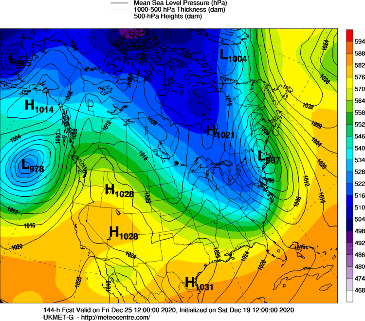
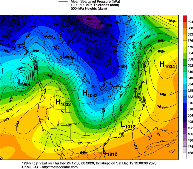
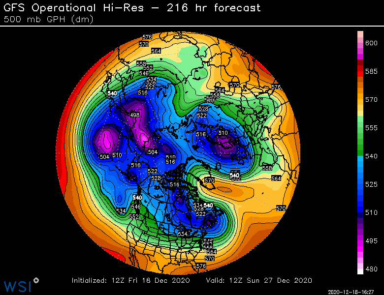
GFS is definitely a shorter torch. Still pretty bad but at least the front is already through by 12z Xmas. Ggem is horrific. Ukie is actually getting closer to pretty interesting. It’s pretty positively tilted for longer before going negative and then develops a wave along the front...another few miles and its snow Xmas morning for a lot of New England ...prob already good enough for snow in M VT that run
-
Damn...NAM trying to eliminate the grinch....buries the energy SW and northern stream about to run ahead of it
-
Shift the Ukie east like 100 miles and we’re in business.
-
You can believe the statistical anomaly exists and still think it is random. The two are not mutually exclusive. You would expect statistical anomalies in a random distribution of n = 100 or 150. I’m open to the possibility that it is not random and there is a legit meteorological explanation, but I haven’t seen it yet.
-
Yes, especially in December and January. Cutters are definitely reduced in frequency in February. There is definitely a historical spike around 12/23-12/25 in temps but I am not at all convinced it is anything other than statistical anomaly. If the distribution of cutters was truly random in December, you would still expect several outliers based on 100+ years of data. It would probably take over 1000 years to weed them out. I haven’t seen an actual meteorological explanation of why we would expect the 12/23-12/25 anomaly to continue.
-
We’re actually kind of due for a snow melting grinch if you think about it. We haven’t had a true grinch since 2013? I guess you could count like 80F on xmas eve/Xmas in 2015 but it wasn’t melting anything. Same with the torching cutter a few days before Xmas 2018...wasn’t melting anything for most people.
-
I think NOAA hired the ecmwf.int graphics guys to design their radar.
-
18z gfs actually had a little bit of CAD in front of the cutter as it kind of built the high northward toward Nova Scotia out ahead of the cutter. That wouldn’t be an all out disaster. Still hoping for much better though.
-
We can always root for the JMA
-
Colder dewpoints in the northern Bahamas than here.
-
I hate it on Xmas day....I'll deal with a quick FROPA on Xmas eve....but give me the refrozen glacier for Xmas day. EPS must still have a lot of faster members as the front is through by 12z in the mean...hopefully that means subsequent runs come in weaker/faster.
-
That one at least had a high retreating in Nova Scotia rather than one sitting over Bermuda.
-
Yeah I think it was 12/17/00....it produced major wind damage.
-
Yep...as a small one. Good Euro run today....temps near 60F and POURING rain on Xmas morning.
-
There's always a chance some sort of sfc CAD sets up, but we'll need some sort of confluence to develop for that...even if kind of weak. Right now, there is nothing...it literally wants to rip the low into Hudson Bay....that's about the worst possible setup. : But we'll see if things change on guidance over the next 36 hours....I think the 3 best ways to avoid a disaster cutter are 1. Make the system more progressive and whiff on a phase which turns it into kind of a quick dryish FROPA on Xmas eve...still mild but not 12 hours of tropical dewpoitns and heavy rains. It would be through quite quickly. 2. Have the 12/21-22 system deepen and phase more with the arctic jet/PV lobe and that would create more of a pseudo block and probably promote more confluence in Quebec....which in turn, would produce CAD even if the system tried to cut west....you'd drastically reduce the warmth. 3. Bury the energy coming onshore in the southwest so that the whole thing turns completely flat....you'd end up with an overrunning situation or nothing at all
-
LOL...can you say "wave break event"?
-
There could be a bit of weenie snow Sunday evening/night with that leading shortwave swinging through. I doubt any real accumulation but a coating wouldn’t be shocking.
-
I wonder if the PNS is wrong....they might have erroneously thought the report was 12.7" just for 12/17 so they added the 0.4 from 12/16 when the report submitted was a storm total.
-
What's up with Logan airport's snowfall total in CLI not matching the PNS? ...Suffolk County... Charlestown 13.4 426 PM 12/17 General Public Chelsea 13.3 258 PM 12/17 Trained Spotter Dorchester 13.2 240 PM 12/17 Ham Radio Logan AP 13.1 700 PM 12/17 Logan Airport CLI has 0.4" on 12/16 and 12.3" on 12/17 for a total of 12.7"
-
Yeah if that is the case, then I'd start being suspicious of deliberately bad totals from him....which is really not cool. Nothing worse than someone deliberately passing off unreliable data.
-
You forgot 2002. But yeah, snow on actual Xmas is pretty rare. Though 2012 technically pulled it off too but it wasn't a "storm". We had about an inch Xmas morning....it was actually a very pretty currier and ives type snow too. For me personally, I can handle a cutter if there is still cover on Xmas morning....but I really don't want the cutter to be happening on Xmas day itself...that is just....gross.
-
He could be totally innocuous in his measuring but just have a bad siting where the snow board location is prone to drifting or blowoff from roof or something like that which causes consistently higher measurements.
-
There's plenty of time to flatten out the Xmas eve/Xmas system. Even if it just turns into kind of a dry FROPA where a low goes NW of us but it is not a phased stemwinder....in that case, you'd just get a fairly mild Xmas eve but no 55-60F downpours and then FROPA happens that night.
-
Yep the LR continues to look good. EPS are hitting 12/28 and 12/31 as potential dates to watch. We just gotta find a way to minimize the grinch storm. Luckily with this type of pattern, 6 days is a lot of time to change things.


