

ORH_wxman
-
Posts
93,099 -
Joined
-
Last visited
Content Type
Profiles
Blogs
Forums
American Weather
Media Demo
Store
Gallery
Everything posted by ORH_wxman
-
Euro still has FROPA around 18z on Xmas...would be nice to move that up 6 hours. GFS is more like 06z-09z but it's probably wrong....it has support from the NAM, lol.
-
Looked similar to 12z. No trend.
-
These small events are nice when they are falling on top of a robust pack. Kind of useless when it’s bare ground.
-
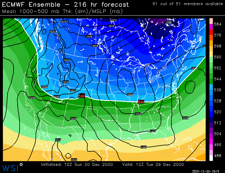
EPS is interested in 12/29
-
Fatties falling here. Starting to coat things up.
-
Rap dumps an inch or so for central/western areas in the next 4-6 hours.
-
Euro still bad for the grinch storm but it sped things up a lot...by about 12 hours from late Xmas night for FROPA on last night’s run to 18z Xmas day on today’s run. Let’s speed that up another 12 hours and we’re looking better.
-
Actually looking at it in more detail on pivotal instead of the 1996 meteocentre graphics, it’s still pretty awful. More like 18z FROPA.
-
It’s in between the GFS and the horrific scenarios. It’s still bad but at least the front is through early Xmas morning so we’d avoid downpours and 60F temps during the day. It would actually get colder throughout the day.
-
Ukie tries to get front through 12z. Would be better if a little faster but at least it’s not as hideous as the GGEM/Euro.
-
Yeah probably. We may need to just embrace mudslides and flooding with 60F dews on Xmas. Came close to pulling off a really good Xmas season but grinch found a way at the last second.
-
GGEM is still absolutely hideous.
-
The torch was much shorter...even down here it’s like maybe 8-10 hours of 50+ and maybe 12-14 of 40+...way more manageable than basically twice those numbers on the euro and earlier GFS runs. Problem is we need other guidance to cave that direction.
-
Early guidance really speeding up the system. Icon has front through by 12z Xmas morning and GFS is now about 06z Xmas morning.
-
Cant rule out NYD itself either. Kind of a signal then too.
-
Maybe 12/29-30. Been on and off guidance for a few days now. EPS were kind of meh last night after liking it previously but other guidance more bullish.
-
Yeah you need the northern stream to move way out ahead to get a frontal system to develop far enough east for us. That’s why we wanted the energy to bury southwest or at least lag big time. We haven’t gotten that. The better hope now is to keep the entire thing faster (ala keep trending like 06 GFS) which swings the whole thing through in like 12-18 hours. I suppose we can’t rule out a sudden change back to trying to bury the energy, but I’m skeptical given we couldn’t get that to occur during last night’s runs.
-
Hope for the trend of speeding this up like GFS and it would survive. Otherwise it’s toast. Too bad we couldn’t bury the energy in the SW. It got pretty close but no cigar.
-
On the flip side, the 06z GFS prob has its “best” run yet. Some weak CAD out ahead of it and the front is through by Xmas morning. Prob really only hideous for 12-15 hours. Maybe less in the CAD areas. Wouldn’t be enough to wipe out the pack in most areas.
-
Can’t seem to quite bury the energy in the southwest. 00z runs were no help. Euro might have its worst solution yet where the front doesn’t come through until Xmas night. We get like 40 hours of tropical dews starting Xmas eve.
-
18z Euro was trying again to bury the energy early on but just couldn’t quite get it to cut off. It’s still a possibility but admittedly we’re going to need to start seeing a few more models do it tonight and tomorrow at 12z or I think we’re screwed.
-
Lol. I’m guessing you prob avg 10” more per season than them.
-
Yeah I do agree there is at least some background support for a whiff on the monster phase. It is nice that a few models are showing it or even hinting at that potential change in the outlook. (Already noted the NAM and Ukie earlier this morning) Even the EPS are dragging the southern stream a little more this run vs 00z.
-
Yeah it nearly buried it this run but didn’t quite do it and it still managed a phase. I’m hoping it actually gets trapped in the southwest eventually on the next few runs.
-
Worst case scenario in Euro for grinch storm. 60F and downpours on Xmas. Slow moving too so that would be a total pack wipeout. Hopefully it’s wrong.


