


ORH_wxman
-
Posts
93,110 -
Joined
-
Last visited
Content Type
Profiles
Blogs
Forums
American Weather
Media Demo
Store
Gallery
Everything posted by ORH_wxman
-
Active mid December with multiple event potential
ORH_wxman replied to Typhoon Tip's topic in New England
Ukie finally more north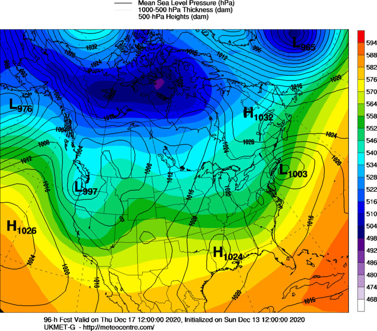
-
Active mid December with multiple event potential
ORH_wxman replied to Typhoon Tip's topic in New England
NAM upper air was significantly more amplified at the same hour so I doubt it would have moved the same. -
Active mid December with multiple event potential
ORH_wxman replied to Typhoon Tip's topic in New England
Yeah 00z tonight or 06z once it goes out far enough. -
Active mid December with multiple event potential
ORH_wxman replied to Typhoon Tip's topic in New England
NAM doing NAM things at 84h. Damn that is zonked. -
Active mid December with multiple event potential
ORH_wxman replied to Typhoon Tip's topic in New England
It’s def NW of 00z. Esp at 102 hours near the BM. -
Active mid December with multiple event potential
ORH_wxman replied to Typhoon Tip's topic in New England
Maybe an inch or two on the NAM for Monday in most of SNE. Possibly a little higher down near south coast if they can accumulate efficiently. I’m still pretty skeptical about that threat for much more than a C-1” but not impossible to pick up more if some pretty nice fronto can get going for 3-4 hours. -
Active mid December with multiple event potential
ORH_wxman replied to Typhoon Tip's topic in New England
Uncertainty on GEFS disproportionately to the north side. Id be surprised if it didn’t come north. -
Active mid December with multiple event potential
ORH_wxman replied to Typhoon Tip's topic in New England
102h on EPS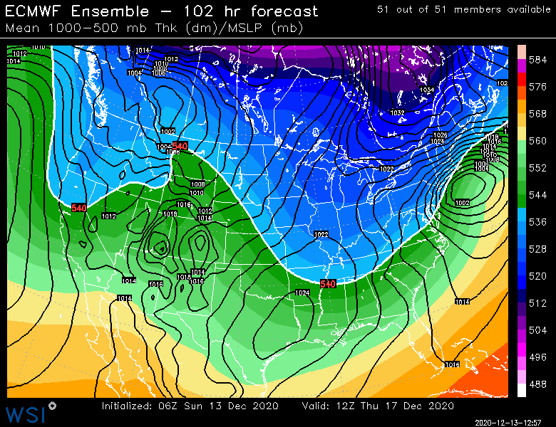
-
Active mid December with multiple event potential
ORH_wxman replied to Typhoon Tip's topic in New England
06z EPS are maybe a shade more amped than 00z through 96h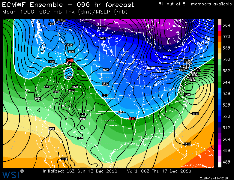
-
Active mid December with multiple event potential
ORH_wxman replied to Typhoon Tip's topic in New England
Euro was an outlier last storm, it is not this time. The GFS suite is now the outlier (except the new parallel which is quite amped). -
Active mid December with multiple event potential
ORH_wxman replied to Typhoon Tip's topic in New England
06z only goes out to 90 hours. But it looks like 00z at that point, maybe a hair slower as Chris mentioned many posts back. The 06z EPS is coming now out and we’ll be able to see the storm as those go out to 144. -
Active mid December with multiple event potential
ORH_wxman replied to Typhoon Tip's topic in New England
Pony express that sucker right to BOX. -
Active mid December with multiple event potential
ORH_wxman replied to Typhoon Tip's topic in New England
Amazing how different the GFS and GEFS are from the other guidance. Don’t want to totally toss guidance out at 4-4.5 days out, but it’s hard to think they are right. -
Active mid December with multiple event potential
ORH_wxman replied to Typhoon Tip's topic in New England
NAO on cpc calf is like -1 for the event. It’s not your massive -3 SD block from 2010 or 2011 but it’s definitely a -NAO. The 50/50 low is exceptionally strong so that sort of make the block “act” stronger than it really is on a temporary basis. It’s not creating a traffic jam slowing the flow down to a crawl though. The 50/50 low is still moving and the storm steadily moves out instead of rotting for 36 hours. -
Active mid December with multiple event potential
ORH_wxman replied to Typhoon Tip's topic in New England
00z icon is crazy amped. Getting big banding into dendrite land. Ukie running late..it was pretty flat at 12z and was hoping to see if it trended north at all at 00z, but I’m not waiting up for it any longer. Euro can wait 4+ days out. -
Active mid December with multiple event potential
ORH_wxman replied to Typhoon Tip's topic in New England
Seemed like the mean position of the trough was getting kicked east a lot faster on the 00z run. -
Active mid December with multiple event potential
ORH_wxman replied to Typhoon Tip's topic in New England
There is the required GFS choke job if we’re going to get a big storm. It seems to puke on itself in almost every one. Usually a lot closer to the event than this though. -
Active mid December with multiple event potential
ORH_wxman replied to Typhoon Tip's topic in New England
That is an UGLY GFS suite tonight. But we’ll see if it’s supported or not by other guidance. GGEM so far says no....84h NAM (if you want to count that) didn’t support it either. -
Active mid December with multiple event potential
ORH_wxman replied to Typhoon Tip's topic in New England
Ray smoking cirrus this run. Lol This thing got kicked east so fast compared to the prior runs. -
Active mid December with multiple event potential
ORH_wxman replied to Typhoon Tip's topic in New England
I don’t think Monday makes a big difference. Regardless, this is a philly special this run. -
Active mid December with multiple event potential
ORH_wxman replied to Typhoon Tip's topic in New England
This run won’t be as amped as 18z. Can already tell by 78h. -
Active mid December with multiple event potential
ORH_wxman replied to Typhoon Tip's topic in New England
Yep. Not a single run from them I’ve seen that wanted to bring that sucker northwest. Ukie too. -
Active mid December with multiple event potential
ORH_wxman replied to Typhoon Tip's topic in New England
RGEM still not biting on Monday. -
Active mid December with multiple event potential
ORH_wxman replied to Typhoon Tip's topic in New England
If I was at PSU in UNV and over to IPT I’d be feeling pretty good. -
Active mid December with multiple event potential
ORH_wxman replied to Typhoon Tip's topic in New England
12z Reggie wasn’t on board either. Kind of skeptical of that threat but who knows. Sometimes a sneaky band on northern edge could produce a couple inches.


