ORH_wxman
-
Posts
93,092 -
Joined
-
Last visited
Content Type
Profiles
Blogs
Forums
American Weather
Media Demo
Store
Gallery
Everything posted by ORH_wxman
-
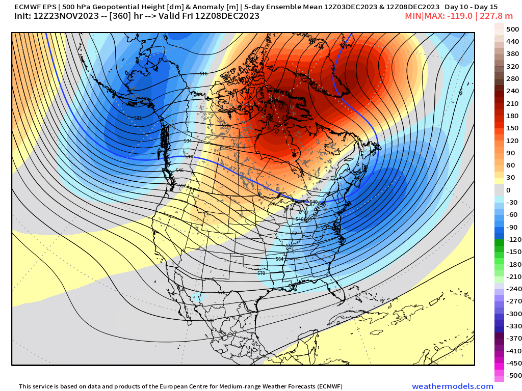
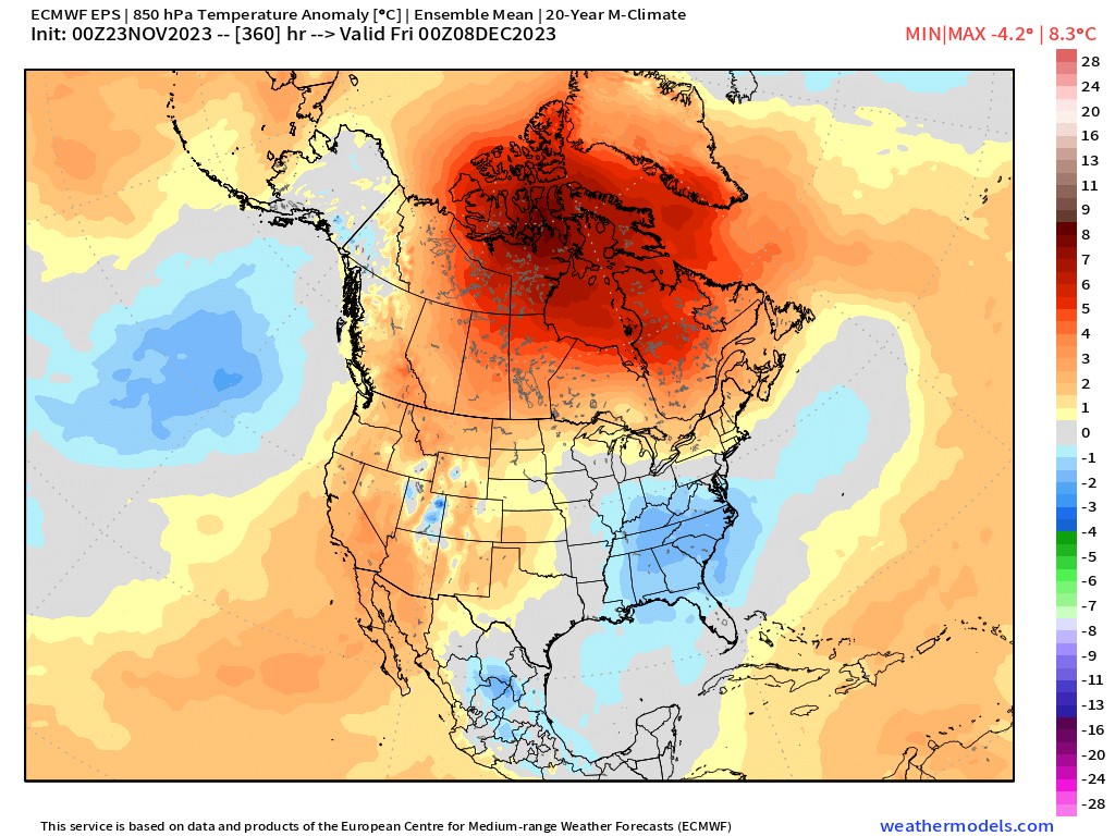
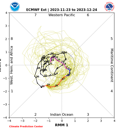
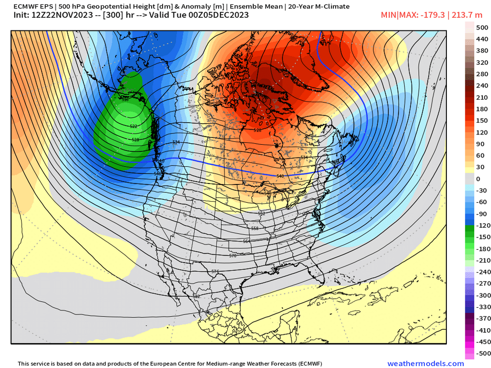
Pacific looked more hostile the first few days of December on yesterday's and last night's runs than we saw on Tuesday/Wednesday....but as you said, it doesn't last very long. The NAO blocking is still showing up, which is probably the most important variable for a positive outlook later in the winter. Weeklies have been quite weenie-ish beyond mid-month too and you can see one of the reasons why on the MJO/RMM plots....we emerge into weak/COD phase 8 around mid-month. Note that the phase 4/5 stuff has mostly disappeared....fewer and fewer members show significant waves into that region now.
-
Doesn’t really look like a SWFE pattern either…but some of the airmasses could be a bit marginal in that pattern given the +EPO so I could see interior and elevations being favored. But the coast definitely has a shot anytime you have blocking like that
-
Right. A few days ago it looked like a big cycle through 4/5 which would probably torch us for a week or two but now it goes back into the COD after phase 3 and it looks like it might try to re-emerge in 8 by mid-December….if that happens, maybe we cheat our way out of the big torch. We’ll see. Guidance hasn’t been very consistent this cold season. But like you said, the corrections as we get closer have mostly been colder (same thing happened earlier this month when a 1-2 week torch turned into like 3 days)…it’s the opposite of recent seasons.
-
This big model guidance shift occurred at a time when the Nino went through a period of more rapid strengthening…wonder if that was just a coincidence or related. Also noticed that the MJO forecasts all started shifting into the COD instead of propagating through phases 4/5.
-
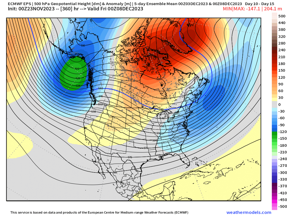
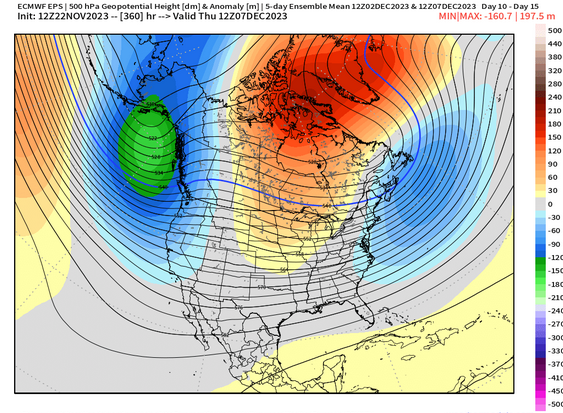
Yeah here’s the 5 day mean EPS Dec 3-8…even some western ridging popping

-
NAO block changes the whole equation. Still gotta make sure it evolves like guidance says, but if it does, then there’s basically no warmup for the Dec 5-15 period.
-
Natural variability can still trump CC on smaller time spans. Even seasonal chunks like 3 months. 2014-15 wasn’t the coldest DJF up here but it was indeed the coldest JFM on record going back to the late 1800s. So it can happen…it’s just harder than it would’ve been decades ago. I remember thinking Feb 1934 would never be broken up here…then it happened in 2015.
-
I think Chuck is mostly correct that extra tropical SSTs are vastly overrated in terms of their effect on the hemispheric pattern. They are more of a result. They can maybe have some feedback all else equal, but they aren’t primary drivers.
-
We had snow the day before Tday in 1996. Got a white Tday out of it. Maybe there were lingering snow showers and squalls up north.
-
Yeah it was good to see the -NAO not only showing up again, but the pattern got even colder than the 12z run. I think we’d all roll the dice with that look….still a lot of bust potential given this pattern just started showing up, but it’s certainly a positive trend

-
We may have to revive that one. Even if it’s only a handful of people.
-
Awesome. Got all of SNE on there now. The 1” line is prob a little further SE in reality but most people prob didn’t measure until morning. I had around an inch about 1am (about halfway between your 0.1” and the light blue line) but by the time I woke up at 6 it was prob down to a couple tenths. I wouldn’t bother changing it for this event though.
-
The western trough isn’t nearly as deep as last December 10-20th. Also the NAO block is further north. Doesn’t guarantee anything but both of those aspects were part of the reason last December failed to give us a prolific event. You always want to see blocking showing up early since it often repeats itself later in winter. I’ll want to see this on multiple model runs though before believing it.
-
Wasn’t he just trolling the winter crew on Twitter a week ago about a blowtorch/snowless December? This type of discourse is what keeps me from doing wx Twitter.
-
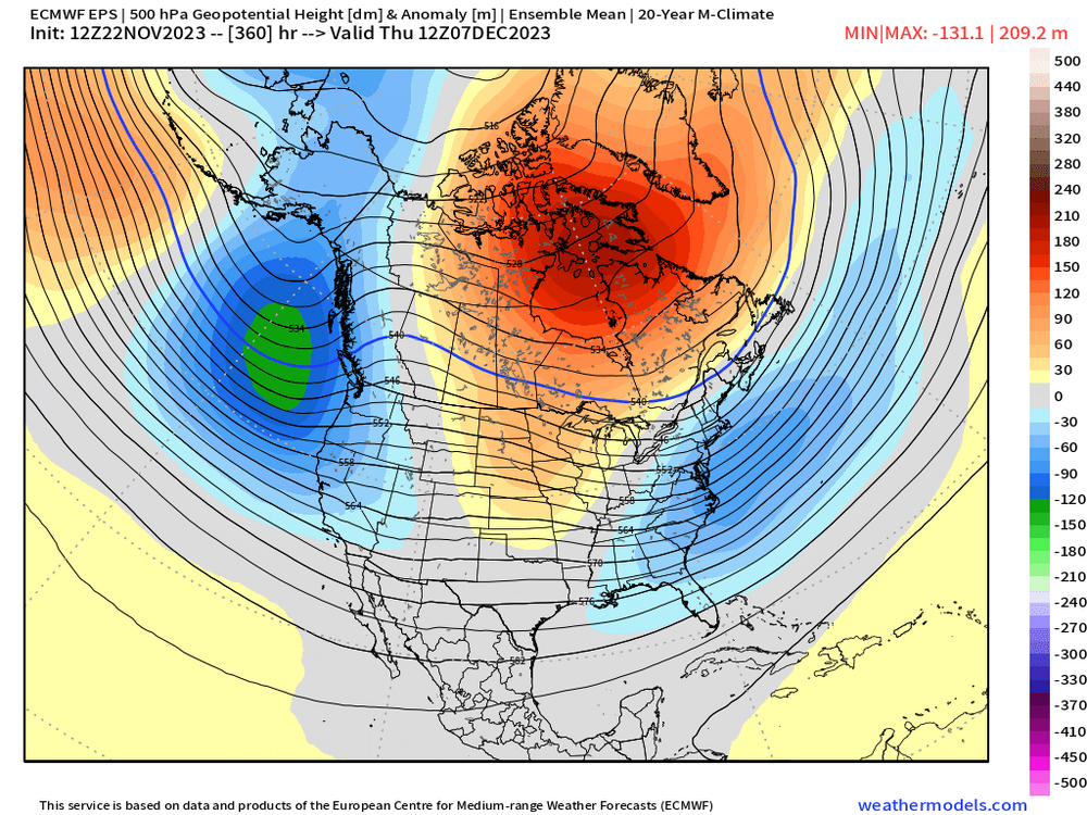
Lot more -NAO showing up in early December than previous runs on both GEFS and EPS....I'd want to see this sustained for a few runs, because it was a notably continuity break

-
Maybe we can pin the PV in SE Canada for a bit. Been a while since we had that type of luck…it’s actually how we stayed cold in mid-Dec 1995 when the rest of the country went torch before PAC reloaded.
-
You want it out near the Aleutians. But even though that pattern isn’t cold, it’s likely serviceable for interior threats.
-
Goes right to the end of the run
-
EPS gone wild with -NAO on 12z run
-
There are some signs that he may come early but then we try and go more wintry as we go into that week leading up to Christmas. Things can obviously change though. I’m not even convinced though that we are going to be snowless during the “relaxation” because it may get kind of blocky up in central Canada which can help us in New England.
-
Yeah that seems pretty fair…1965-66 was technically just under 2.0 (but rounded up to nearest tenth)…so you can see why that one is just strong.
-
There’s a difference between one super Nino monthly value and one super Nino trimonthly value….one requires 3 months to average over 2.0 and the other just requires one month. I’ve never seen any strength classification done with ONI that didn’t just use the peak trimonthly value.
-
If one ONI trimonthly reaches 2.1C, then it will be classified as super. It seems 2.0C is still technically strong since 1965-66 is classified as strong with a max ONI value of 2.0. But in order to get one ONI trimonthly exceeding 2.0, we’re gonna need these current values to sustain all the way through January. I think that’s going to be quite difficult.
-
Measured almost 3” on winter hill to his south so I’m guessing he prob had between 3-4” there before compaction.
-
Prob still snowing by Pleasant Mt on Moose Pond where I go every summer.