

ORH_wxman
-
Posts
93,099 -
Joined
-
Last visited
Content Type
Profiles
Blogs
Forums
American Weather
Media Demo
Store
Gallery
Everything posted by ORH_wxman
-
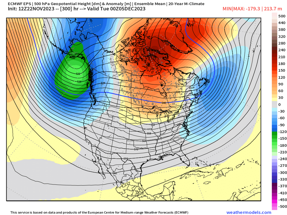
EPS gone wild with -NAO on 12z run
-
There are some signs that he may come early but then we try and go more wintry as we go into that week leading up to Christmas. Things can obviously change though. I’m not even convinced though that we are going to be snowless during the “relaxation” because it may get kind of blocky up in central Canada which can help us in New England.
-
Yeah that seems pretty fair…1965-66 was technically just under 2.0 (but rounded up to nearest tenth)…so you can see why that one is just strong.
-
There’s a difference between one super Nino monthly value and one super Nino trimonthly value….one requires 3 months to average over 2.0 and the other just requires one month. I’ve never seen any strength classification done with ONI that didn’t just use the peak trimonthly value.
-
If one ONI trimonthly reaches 2.1C, then it will be classified as super. It seems 2.0C is still technically strong since 1965-66 is classified as strong with a max ONI value of 2.0. But in order to get one ONI trimonthly exceeding 2.0, we’re gonna need these current values to sustain all the way through January. I think that’s going to be quite difficult.
-
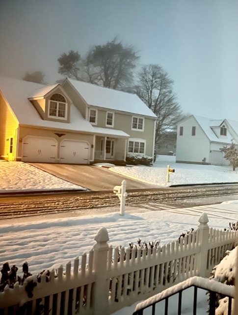
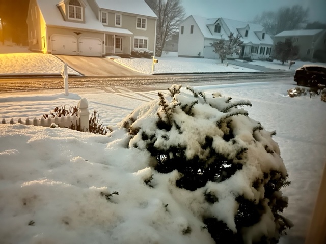
Measured almost 3” on winter hill to his south so I’m guessing he prob had between 3-4” there before compaction.
-
Prob still snowing by Pleasant Mt on Moose Pond where I go every summer.
-
The mid-level CAD capital of New England.
-
Winter hill in ORH
-
They had between like half inch and an inch there before it flipped. Saw pics.
-
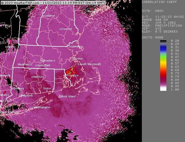
Can see the snow line pretty easily
-
Snowing to your NW in Holliston. Though it’s quite wet here and only just beginning to stick to the grass/mulch. Temp is finally ticking under 34F though now…so maybe we can make a run at measurable in the next hour.
-
34F and steady light snow.
-
Yeah he was going to block out some time this evening to track this one closely.
-
Just make sure that little bit of dry air doesn’t get down into the SGZ.
-
Weeklies shifted noticeably colder for the week before Xmas
-
We encourage new threads. Start an obs thread. I think quite a few over the interior will at least start as frozen even if it doesn’t last long for most of us.
-
Warm sector to dendrite!
-
Seems like euro suite has a much weaker MJO wave than the GFS suite. Might be something to watch in how long/intense the thaw is…though their current progged patterns for 12/5ish are pretty similar.
-
Is that blizzard24 with a new handle?
-
Yeah it’s not that warm between now and Tday…some 38F rain/drizzle after the paste isn’t going to melt much if they end up picking up 3-4”.
-
You’d think after this many seasons in New England, he’d learn to understand CAD and not forecast like he’s still on Long Island. Amazing there’s no improvement.
-
Sleet wouldn’t surprise me to start where you are. Maybe some brief flakeage.
-
Looks about average-ish for Tday. Maybe slightly below avg esp over interior NW high terrain where weak low level CAA will be ongoing.
-
First week and last week are nice. Middle two weeks are meh…though some southern stream action may still produce a threat even if it’s not all that cold (see Dec 23, 1997 as an example)


