midatlanticweather
-
Posts
4,888 -
Joined
-
Last visited
Content Type
Profiles
Blogs
Forums
American Weather
Media Demo
Store
Gallery
Everything posted by midatlanticweather
-
Thankful for the power back.
-
Power was immediately knocked out. Winds are howling.
-
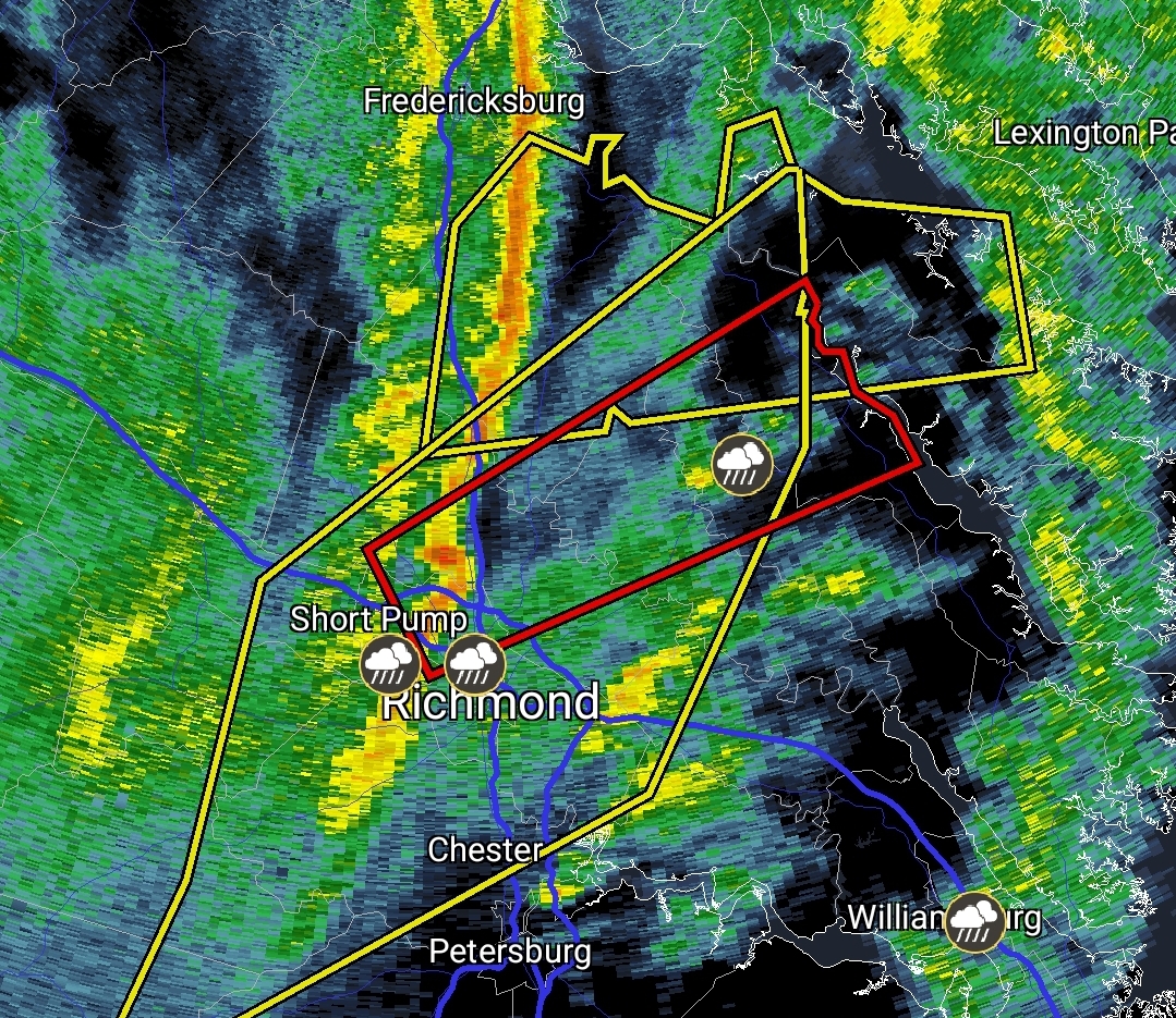
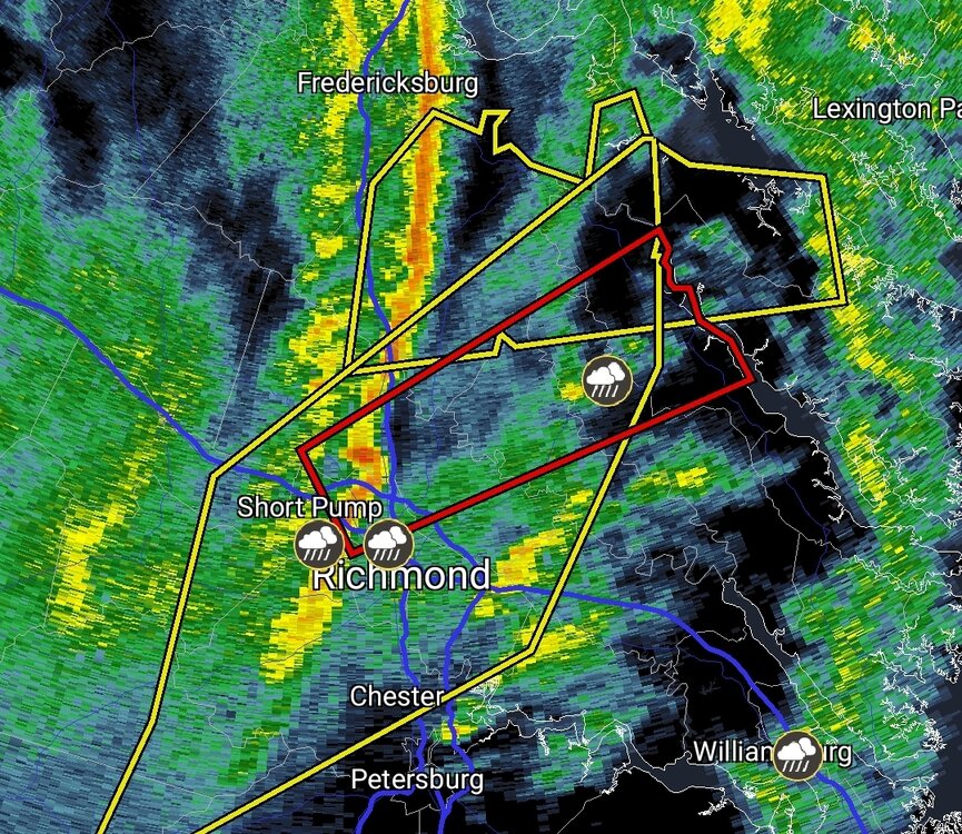
Wild seeing tornado warning for Richmond area
-
How we doing on the wind threat? Models tend to overdue winds a bit, but the NAM and HRRR were quite impressive.
-

February Medium/Long Range Thread
midatlanticweather replied to stormtracker's topic in Mid Atlantic
Consistently sucks -
February Medium/Long Range Thread
midatlanticweather replied to stormtracker's topic in Mid Atlantic
A car that old will probably change the local climate and turn it too warm to snow due to CO2 emissions -
February Medium/Long Range Thread
midatlanticweather replied to stormtracker's topic in Mid Atlantic
Ya. Doesn’t look great -
February Medium/Long Range Thread
midatlanticweather replied to stormtracker's topic in Mid Atlantic
Fringed in the 2 foot potential. -
February Medium/Long Range Thread
midatlanticweather replied to stormtracker's topic in Mid Atlantic
We cannot afford any downward trends. We have got to HOLD on Euro or improve.. GFS and other models bounce a lot. Euro needs to lock. -
February Medium/Long Range Thread
midatlanticweather replied to stormtracker's topic in Mid Atlantic
Especially for you all
-
February Medium/Long Range Thread
midatlanticweather replied to stormtracker's topic in Mid Atlantic
Serious snow loving from the models this Valentine’s Day -
February Medium/Long Range Thread
midatlanticweather replied to stormtracker's topic in Mid Atlantic
Dr no has been pretty good on location of heavy snow. This far off I would expect it to waffle a lot though. -
Icy snowballs can be made now! And they hurt
-
February Medium/Long Range Thread
midatlanticweather replied to stormtracker's topic in Mid Atlantic
AI is so resource-intensive! Need some more hamsters on wheels in the basement. -
February Medium/Long Range Thread
midatlanticweather replied to stormtracker's topic in Mid Atlantic
@Heisy Cool! AI will keep getting better. -
February Medium/Long Range Thread
midatlanticweather replied to stormtracker's topic in Mid Atlantic
You deserve an award for your humility. Just don't accept it -
Surprised to have picked up half inch more! 3.2 total
-
2.7 inches here! We could JUST make it to 3 with the little stuff left.
-
Just a bit over 2 inches on deck and cars.. Pavement has an inch. Snowing steady but lightly.
-
That was a step in our direction. Southern folks are not happy. If NAM is right.. what stops the steps?
-
February Medium/Long Range Thread
midatlanticweather replied to stormtracker's topic in Mid Atlantic
This looks ... good! -
Property taxes are obnoxious! BUT - take it to banter! LOL! Add absolute obnoxious HOAs to that cost!
-
February 11-12; 12-13: Are they real??
midatlanticweather replied to stormtracker's topic in Mid Atlantic
-
February 11-12; 12-13: Are they real??
midatlanticweather replied to stormtracker's topic in Mid Atlantic
Stubborn as a mule! Central VA still gets the main goods -
February 11-12; 12-13: Are they real??
midatlanticweather replied to stormtracker's topic in Mid Atlantic
My thoughts (and they mean nothing as they are guesses) Tuesday into Wednesday comes a bit north on precip amounts. Thursday ends up a rainier system than mixing out this way. Think the GFS is a bit cold. I would take what it shows and be happy!