Coach B
-
Posts
289 -
Joined
-
Last visited
Content Type
Profiles
Blogs
Forums
American Weather
Media Demo
Store
Gallery
Everything posted by Coach B
-
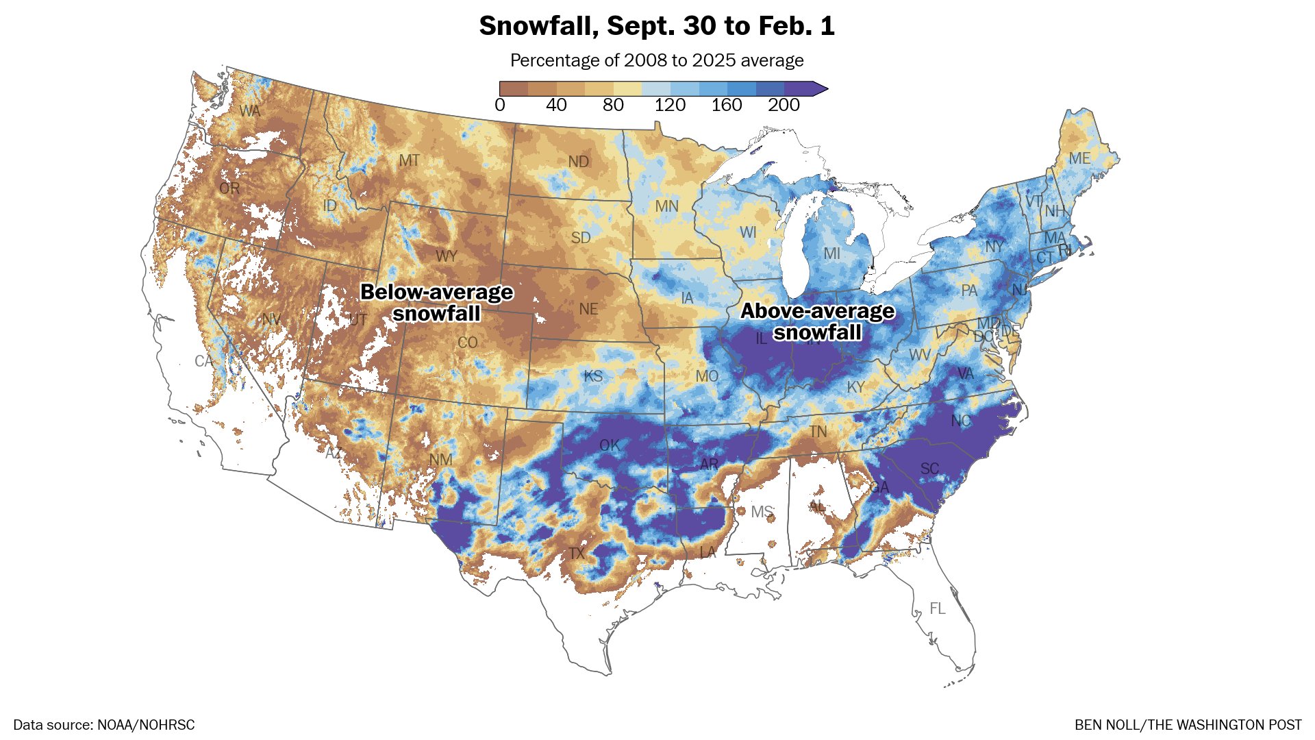
While there is certainly time left, many of us missed a golden opportunity to have a banger of a season. Places in all direction are well above normal.

-
We were WAY above normal Dec 23rd - 28th, then again Jan 5th - 10th. The rest of the period was mostly normalish until the bottom dropped out January 24th.
-
I like the positive thinking. Although I'm fearing 2014 flashbacks.
-
Here in Marshall county I've got about 1/2" of snow and over 1/4" of sleet.
- 618 replies
-
- 2
-

-
- observations
- obs thread
- (and 1 more)
-
Correct! We needed it last year with the great Gulf Coast snowstorm. We were sitting pretty 5-7 days out just waiting for the northwest correction, but instead it trended south all the way to the Gulf.
-
The UKIE has rain all the way to the southwest corner of Pennsylvania Sunday night.
-
The NBM....and the actual forecast from the NWS always seem to lag model changes by quite a bit.
-
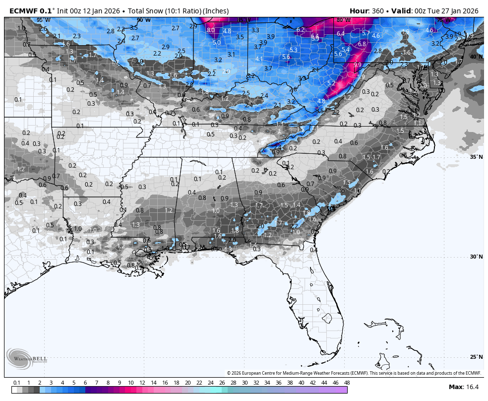
This map from Pivotal must include sleet and ice unlike the WxBell maps. It's significantly higher, and probably more realistic given the likelihood of significant sleet accums on the southern end of the snow band.
-
I generally like those guys so I watched the latest video for his thoughts. He definitely believes it'll be well north. Heaviest snow north of the Ohio River and ice in Kentucky. Thinks the high is weakening and getting the banana look that will encourage the storm to cut. Used the late January 2009 storm as an example. Just said it was gut feeling and what climatological normally happens. Also, admitted he could be wrong and that he really want the snow.
-
It's not the only one. The UKMet and GFS AI are both far north solutions as well.
-
No, it blows through here. However, that particular run lays down a ridiculous amount of sleet and snow northwest of us before it gets here. That leads to the craziest cold over that area. It does stall for a bit. That's probably what you are seeing. Way to far out to know for sure.
-
18-19 had only .2" officially at Nashville at this point. Ended the year with .5" total. Least snow I've seen in my 50+ years in middle TN. I'd still rank 2014 as the worst overall. The wasted cold and record totals just to our north combined with two deep south winter storms was an epic fail.
-
35" for Indy, 40" at Columbus, and 50" at Pittsburgh. Lol
-
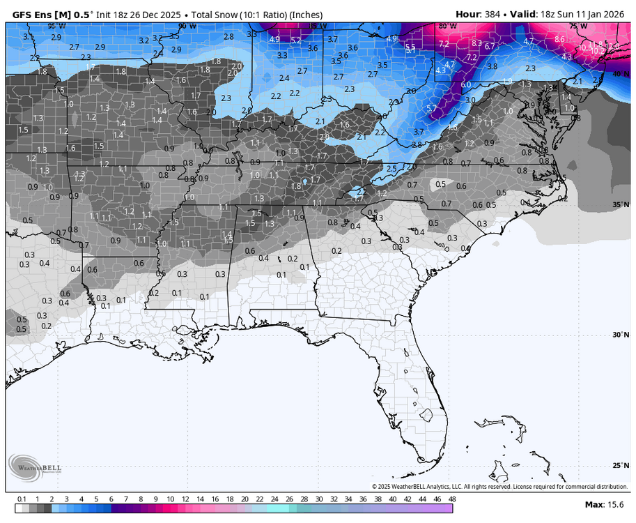
Outside of the mountains this would be a painful look for our cold snap if it verifies:

-
Signal faded overnight back to the west:
-
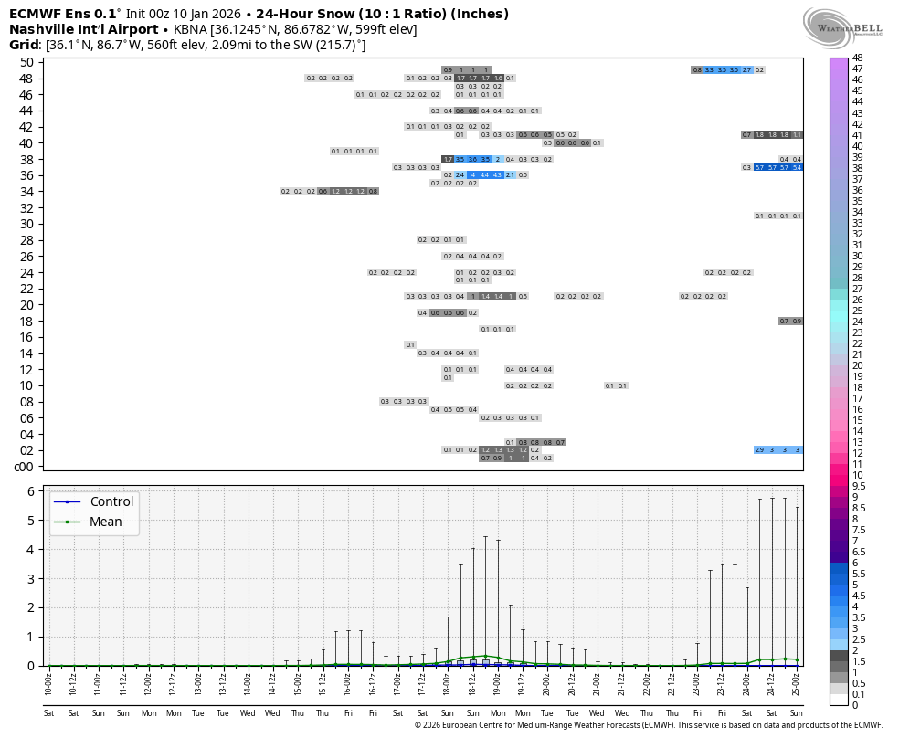
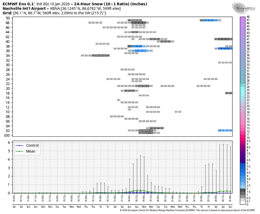
Obviously none of us put a lot of stock in the individual ensemble snow panels.....but they sure are fun to look at when they start lighting up. P17 gives me the same 9.3" as p28 but in three separate events. Think that answers the above question for me. I'll take multiple events.
-
Finally getting a bit of a signal on the 18Z GEFS:
-
Just rain here in Marshall county. Lots of snow/sleet reports around Nashville.
-
December 2025 Short/Medium Range Forecast Thread
Coach B replied to John1122's topic in Tennessee Valley
It will be interesting to see how it plays out. I've always felt 95-96 was somewhat unique in that whenever it got cold it actually seemed to snow. Jan and Feb that winter were below normal, but only like -2 or -3 here in middle TN. Yet every cold shot seemed to bring snow. On the other hand I've heard the dreaded 13/14 winter brought up by BAM weather in the last couple of days. That winter featured at least 7 different significantly cold shots with barely an inch of snow total in Nashville. January was -7 for the month with only .4 of snow, February was -4 with only .1 of snow. Meanwhile just north of us they were setting yearly snowfall records. That's probably why BAM(based in Indy) would like to see a repeat of that. I think east TN scored a couple of times that winter so some of you may not react as negatively when its mentioned. -
I had just under an inch this morning in southern middle TN. Some of the fluffiest snow I've seen. 2.8" total for the combined event.
-
I ended up with exactly 2" on the board here in southern middle TN. Kind of a last minute save overnight. Good luck with the flow snow tonight for those on the Plateau and in NE TN!
-
In the last two hours I've picked up exactly 1.5 inches. Was coming down really hard there for awhile.
-
Nothing here. There was one mping report north of Jackson a little while ago. Probably some flakes reaching the ground in the slightly heavier returns passing thru Humphreys and Hickman county.
-
Are we going to swing and miss like 2014 or hit it out of the park like 85?