DownpourDave
-
Posts
1,353 -
Joined
-
Last visited
Content Type
Profiles
Blogs
Forums
American Weather
Media Demo
Store
Gallery
Everything posted by DownpourDave
-
Blowvember - and not named for wind potential
DownpourDave replied to Go Kart Mozart's topic in New England
Driving to the airport at 3 am this morning….. at times driving was very hazardous less than 100 feet visibility in front of me at times… so yes it was very thick -
Blowvember - and not named for wind potential
DownpourDave replied to Go Kart Mozart's topic in New England
Seems like such an outlier from just the 12z run. Initialization error? Seems odd -
Do you consider post-season upgrades? Unlikely event Oscar gets upgraded to cat 3 months later
-
With a 70knot wind…. They missed the center
-
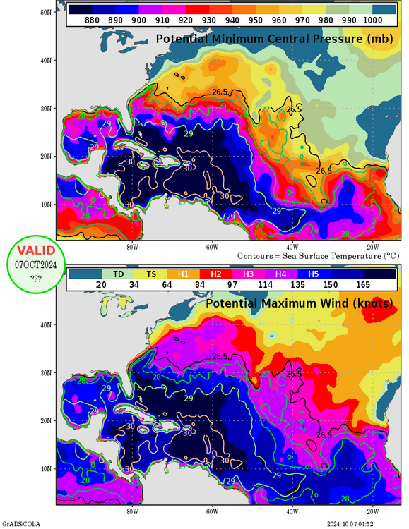
MPI for where Milton is, is around 890-900mb.
-
Source?
-
I’ll await for confirmation from NWS. They will send out a climate report soon.
-
Do you have a link to that?
-
It didn’t unless there is something I am missing.
-
It is only just hitting 100, possible but not likely. Guessing it maxes at 101
-
It probably already is, multiple different data points support cat 5. Awaiting for NHC confirmation
-
High rainfall rate, it could be an error but perhaps not “The SFMR performance is highly reliable at hurricane-force wind speeds, but accuracy is found to degrade at weaker wind speeds, particularly in heavy precipitation. Specifically, a significant overestimation of surface wind speeds is found in these conditions, suggesting inaccurate accounting for the impact of rain on the measured microwave brightness temperature.” https://journals.ametsoc.org/view/journals/atot/31/11/jtech-d-14-00028_1.xml
-
I heard Solomons or near there got a waterspout but yet to see and photos or videos of it. Kind of surprising considering there should be plenty of people down there.
-
Would you be able to share the video? Looks pretty bad from the still shot.
-
Final Guess if counts: 26:13:6
-
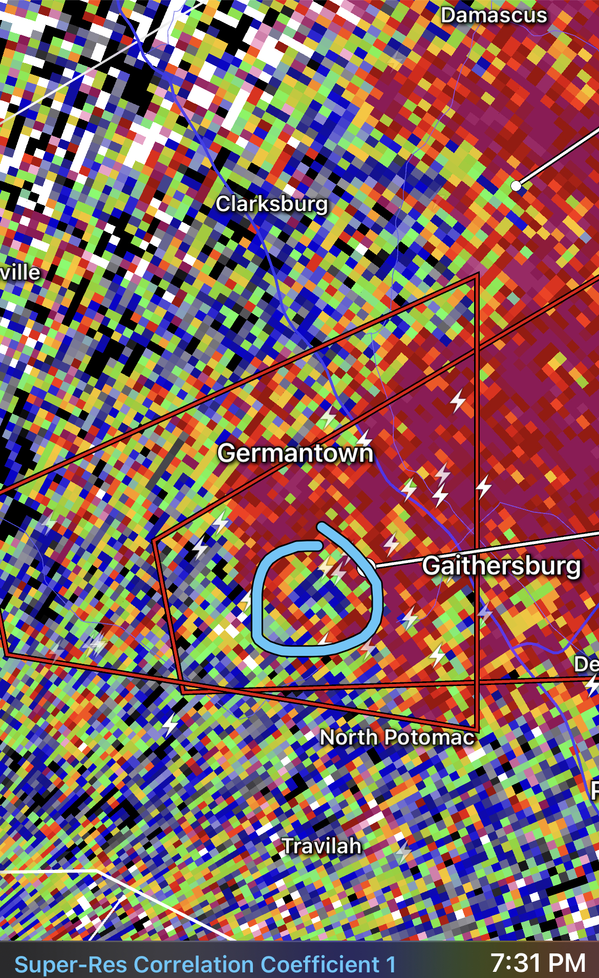
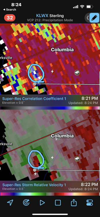
Tornado looks to be south of Columbia proper so assuming you’re in Columbia proper, you should be fine.
-
Stay Safe!
- 1,696 replies
-
- 1
-

-
- severe
- thunderstorms
- (and 5 more)
-
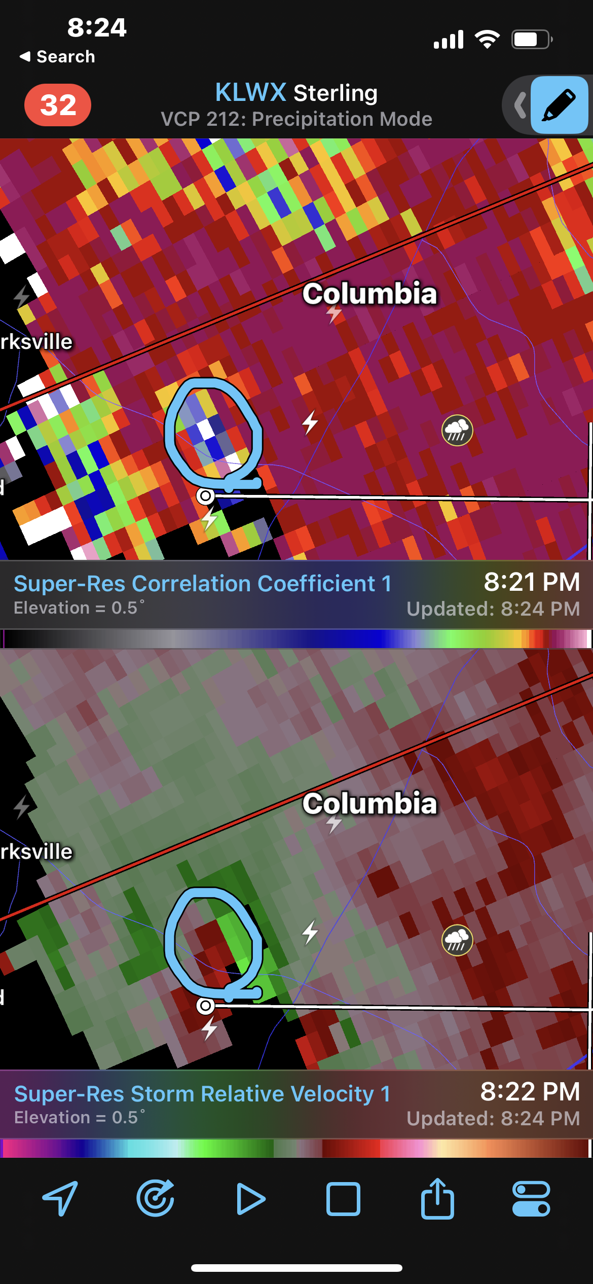
Once again, radar confirmed ✅
-
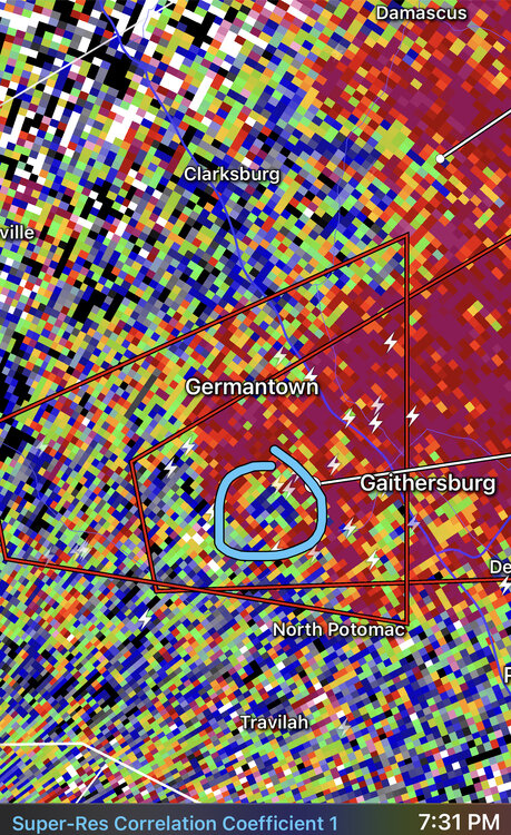
Tornado should be just passing Gaithersburg now. CC drop lining up quite well with couplet and strong gate to gate shear.

- 1,696 replies
-
- 1
-

-
- severe
- thunderstorms
- (and 5 more)
-
I saw it was also confirmed by weather spotters.
-
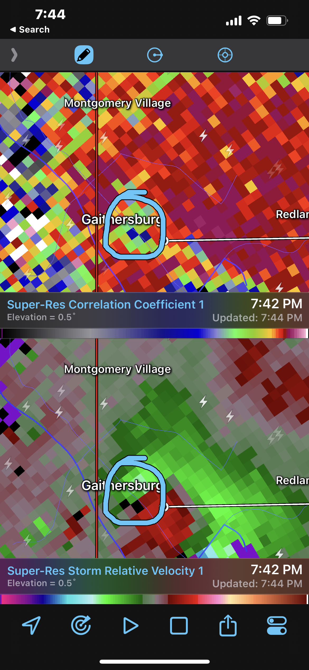
Radar confirmed tornado. CC drop evident.
- 1,696 replies
-
- 2
-
-
- severe
- thunderstorms
- (and 5 more)
-
I suspect there will be a few storm surveys tomorrow. We will see.
-
28/15/7
-
22/14/5