

Paleocene
-
Posts
1,989 -
Joined
-
Last visited
Content Type
Profiles
Blogs
Forums
American Weather
Media Demo
Store
Gallery
Everything posted by Paleocene
-
Gonna be 10 miles north of MDT on sunday, with plans to be snowed in. I take
-
NAM has hated this thing since it came into NAM crazy range
-
That was my thought. Heavy snow would slow down what I'm scared about: Stafford throwing to Nakua and Kupp
-
Anybody got that good national blend thingy?
-
Regardless of how you feel about the Eagles, if you like watching football, looks like a decent chance for a snow game for the 3pm sunday divisional playoff against the LA Rams. Or Philly will be on the I-95 rain/mix line and it will be a disgusting mess for everyone there, ha. If you, like me, want them to win: snow game advantage Saquon?
-
Solid coating on cold surfaces even here in the core of the urban inferno
-
Going to Harrisburg for the weekend to see family. MDT jack, calling it.
-
-
edit; ninja'd
-

January Medium/Long Range: A snowy January ahead?
Paleocene replied to mappy's topic in Mid Atlantic
Ah yes the ol' 2-footer in Jacksonville NC, though apparently it has happened https://www.weather.gov/mhx/Mar011980EventReview -
Flurries- here in Riverdale in PGC
-
I'm honestly not sure I remember a period of this much sustained snow cover in my time on the urban heat island (since 2010). Maybe 2013-2014 or 2014-2015?
-
January Medium/Long Range: A snowy January ahead?
Paleocene replied to mappy's topic in Mid Atlantic
Everyone ignored bob and psu's posts that nothing will be resolved until within 96-72 hours. -
They're taken inside engines of Airbus a320s
-
I think the ravens could pull this one off
-
I am skeptical that we will overperform but man, looking at my radar app and thinking I'll wake up with a fresh inch tomorrow is hard to reconcile. #radarweenie
-
Yep this was a highlight on Sunday AM as we moved from sun to cloud cover. Ominous!
-
GOOFUS. Broadly consistent with the morning regional models. RGEM was less kind but that's because Canada doesn't understand the south anyone in this forum from norfolk/hampton roads? They'll get a decent storm out of this!
-
Looks like decent alignment between NAM and HRRR. Most falls in the late night/early AM hours. Stay up late to watch the flurries
-
New 12z NAM QPF. Brings in the 0.15" contour to the Southern MD counties @dailylurker and 3k qpf (still snowing on lower eastern shore here)
-
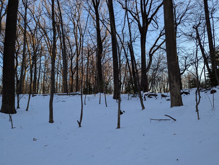
A cool thing I've noticed here in the suburbs the last two days. It's cold and the snow is sticking around, which is super rare. When one walks around in the woods, the snow now has odds and ends that fall from trees on top of the snow. Twigs, leaves, etc. Reminds me of my childhood in colder climate PA. Deep winter
-
3K NAM. Congrats Memphis/Nashville.
-
NAM
-
Damn, every time I look at a model for this thing, I wish that NS vort got phased in and nuked us. So close
-
January Medium/Long Range: A snowy January ahead?
Paleocene replied to mappy's topic in Mid Atlantic
I was a kid in Central PA for 1996 and I remember absolutely insane snow piles on the streets. They seemed like mountains, as I was 8 at the time. 2003 was similar, as was 2010.


