
BooneWX
-
Posts
1,320 -
Joined
-
Last visited
Content Type
Profiles
Blogs
Forums
American Weather
Media Demo
Store
Gallery
Posts posted by BooneWX
-
-
1 minute ago, ILMRoss said:
I say this completely in good nature and from a place of levity. But typically, as someone with the username "ILMRoss", when a different user named "BooneWX" tells me not to cliff dive, it's time to cliff dive. Haha
Luckily for you, the name doesn’t fit my location anymore.
-
I mean. There’s a reason why GSP didn’t cliff dive like this thread.
-
 2
2
-
 1
1
-
 2
2
-
-
Yea I may have to hop off the main thread. It’s getting muddied with conversations that should be in the sanitarium. If it cuts west, this is still a major storm for the foothills and mountains. With that being said, send your generators down the mountain please

-
6
-
-
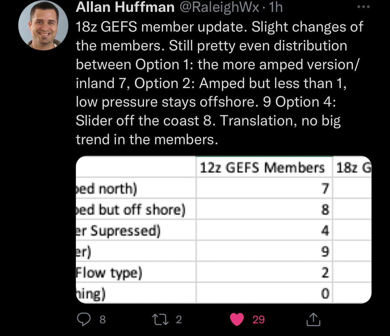
 Edit: Allan is a great follow if you don’t follow him already
-
1
-
-
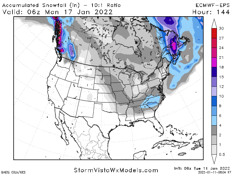
Anybody have the GEFS map?
-
2 minutes ago, ILMRoss said:
I'd like to interrupt the pity party by noting that the 18z GEFS appears colder, stronger with the CAD, further south with our ULL, and with more separation with our northern stream "kicker" compared with the 12z GEFS. Ok, carry on.
Yep. Important to not come and go with the deterministic runs 4+ days out.
-
4 minutes ago, wxduncan said:
I think Hickory NC is a good spot to be in right now. I just hope NW trends don't start because we get burned to many times here in the Lee Side. But the best to everyone I hope it's a good 4 inches at least for the whole state.
We’ve earned one. We get shafted every single storm that doesn’t come from this direction.
-
2
-
-
Carbon copy of Dec 2018
-
I’ll take another Dec 2018 and shut up for 3 more years
-
1
-
1
-
1
-
-
I think I need to sit down
-
1
-
-
Just now, burgertime said:
6z EPS again goes towards the GFS. Not the monster GFS is but a nice low track with an I-85 special. RDU east across much of the state is 4+. Not so far east with that 4+ as the 00z. Sorry @ILMRoss
A result almost everyone on this board would be content with
-
1
-
-
Euro a bit more amped at 114 and 120
-
You’d also typically expect more moisture north and west of that low with that track but let’s see upcoming runs.
-
1
-
-
Charlotte folks are going to love that run
-
Evolution of the GFS is a LOT closer to the Euro.
-
This is a remarkable turnaround to be tracking threats just 2 weeks after tracking tee times.
-
6
-
 1
1
-
-
59 minutes ago, Brick Tamland said:
I'm not sure if it's just harder to get a pattern that historically produces snow here in the past, if those patterns just don't produce snow like they used to, or the historically great patterns show up on the medium to long range on the models but then change and never happen down the road. Maybe it's all three. Former local met Greg Fishel said the air off the ocean makes it harder for my area to get snow compared to further west in NC. I wonder if the warming of the oceans is making that more and more of a factor in limiting snow here.
I feel like global warming in general is definitely already making an impact locally. To me, it’s almost as if “normal” climo has shifted 1-2 states north already. As in - DC and the upper mid Atlantic gets wintry bouts at a pace we used to be accustomed to and likewise here that many in say the midlands of SC or Georgia (no offense to you guys, I just mean it quite literally) had been accustomed to prior.
-
3
-
1
-
-
To me, these were always the more magical snow events that came with living in the mountains. Not necessarily northwest flow, but a system the rest of the SE couldn’t cash in on. Enjoy it fellas!
-
2
-
-
1 hour ago, calculus1 said:
Yep, the leeside minimum rears its ugly head once again. Ugh. Can we not get a traditional gulf storm system?
It’s been a tough stretch since 2018 with the exception of the Super Bowl Sunday mini-paste bomb we saw last year. I’m staying optimistic for now but it definitely stinks to know we’re likely getting sandwiched between white ground locations twice in one week.
-
1
-
-
2 hours ago, buckeyefan1 said:
18z gfs keeps with the trend
")


Pain.
-
1
-
 1
1
-
-
Lets see if it’ll dig a little bit. Still some time.
-
Just now, wncsnow said:
It does but it has to be a true miller A gulf powerhouse. So close yet so far away for us. Snowless winter still possible, long range doesn't give me much hope.
I was just about to say. I’d kill for a legit Miller A right about now. Pain is seeing snow the west and east but nothing here. The Dec 2018 and Feb 2014 storm truly were magical for the foothills. I’m not close to being ready to throw in the towel yet. Climo will eventually be in our favor - the quick hitters are rarely our storms but that’s ok.
-
16 minutes ago, calculus1 said:
Finally changed over to a good rain/snow mix here in Hickory. More snow than rain at this moment, but it fluctuates, and it is very wet. Regardless, it's pretty to watch the flakes fall.
Switched back to rain here in Burke. Downsloping is a brutal beast.
-
2
-
-
Downsloping never takes a storm off.
-
1
-
2021-2022 Fall/Winter Mountains Thread
in Southeastern States
Posted
What an absolute THUMPING of snow on the front end, ice in the middle followed by more thumping.